Floods
S


Cloud Precipitation

Heavy rains in New York area produce flash floods

Flash floods in New York
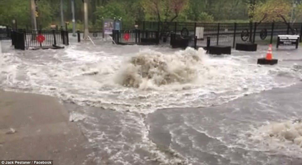
© Jack Pestaner / FacebookWater has also been seen accumulating at subway stations of City Hall, Borough Hall in Brooklyn, and the World Trade Center. The effects of the rain on the Hudson-Bergen Light Rail Station in Jersey City is seen above.
Heavy rains brought flash floods that are likely to hamper the afternoon commute home in the New York metropolitan area on Friday.

Transit officials are reporting delays caused by flooding while those traveling by air may have to wait up to four hours at any of the three local airports.

The heavy rain prompted officials to shut down the main Seventh Avenue entrance to Penn Station in midtown Manhattan.

Water has also been seen accumulating at subway stations of City Hall, Borough Hall in Brooklyn, and the World Trade Center.

New Jersey has also been hit hard by flash floods.

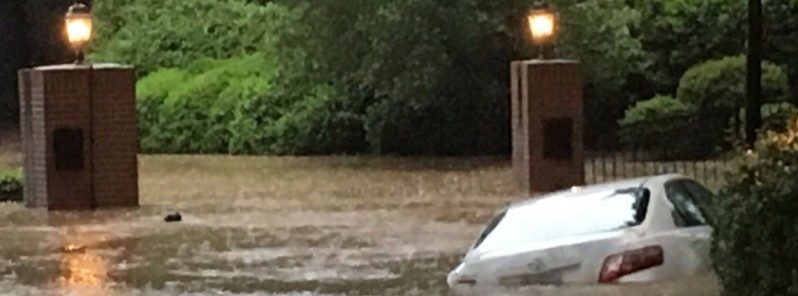
Cars driving along some parts of Route 440 in Jersey City were completely submerged.

Police in Hoboken are urging motorists not to drive unless it's an emergency.

Social media users posted images showing cars almost entirely covered by a few feet of water.

Forecasters are predicting more precipitation as the evening progresses on Friday.

Thunderstorms and showers are possible later Friday and into Saturday.
Cloud Precipitation

National Guard deployed to combat Arkansas flooding following at least 9 levee breaches

Arkansas flooding
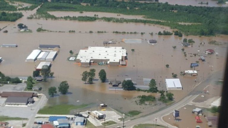
© Arkansas Gov. Asa HutchinsonThis aerial image shows the severe flooding that has overwhelmed parts of Pocahontas, Arkansas.
Arkansas Gov. Asa Hutchinson has deployed additional resources to combat the extreme flooding in northern parts of the state as many communities remain underwater.

A dangerous flooding situation in northeastern Arkansas worsened on Wednesday morning when a levee failed along the Black River near the town of Pocahontas.

Following the breach, the National Weather Service office in Memphis, Tennessee, immediately issued a flash flooding emergency and urged residents to seek higher ground immediately due to life-threatening flooding.

Water rescues were occurring just south of Pocahontas in the community of Shannon, according to the NWS.

Evacuation orders were issued on Monday for eastern Pocahontas, which included 150 homes, dozens of businesses and an assisted living facility, according to the Arkansas Democrat-Gazette. Water had begun to spill over the top of the levee on Tuesday, and officials warned of an imminent levee breach.

At least 50 homes have either been destroyed or have sustained major damage due to the flooding, the Arkansas Democrat-Gazette reported.

Gauge data shows the river crested at a record level of 28.95 feet at 8:30 p.m. local time Tuesday, but it is forecast to remain above the major flood stage of 25 feet through early Saturday morning.


Bizarro Earth

Major flooding in Missouri kills at least 5; More rain expected

Missouri flooding
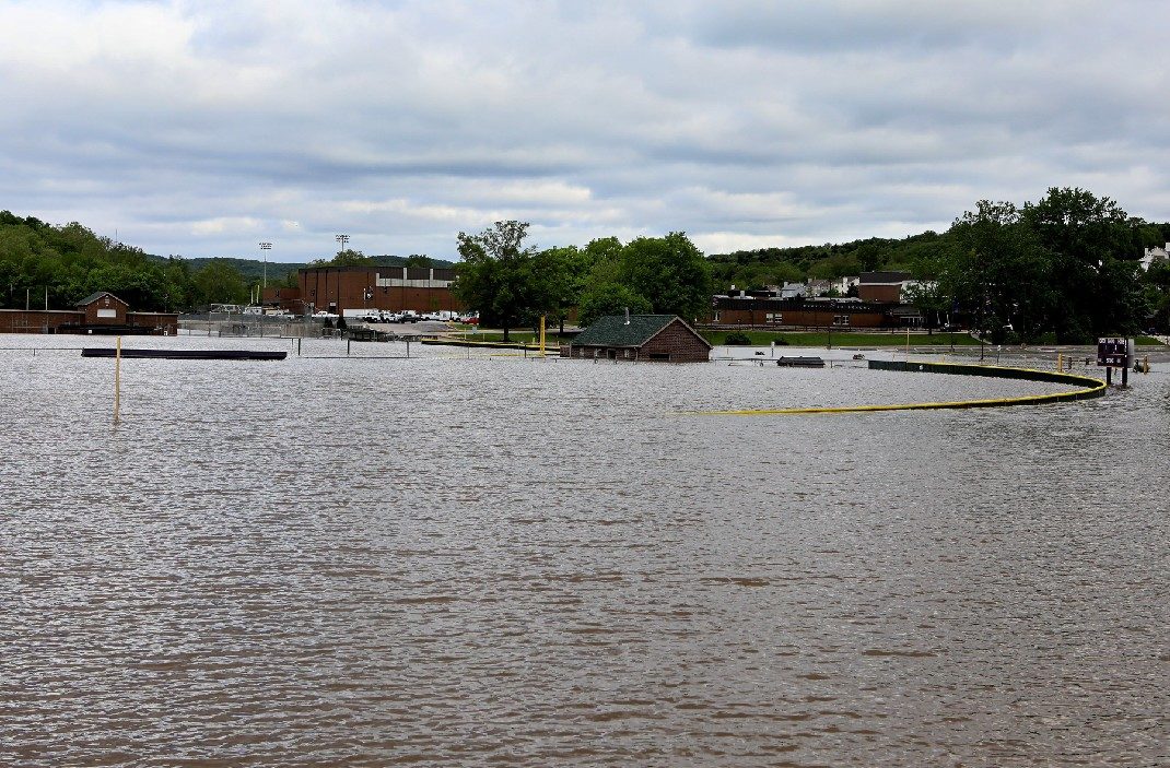
Floods across the U.S. Midwest that have killed at least five people shut major roadways in the St. Louis area on Wednesday, while residents of vulnerable areas piled sandbags to avert destruction as rivers were expected to crest.

The flooding was caused by a storm that parked over the region last weekend and dumped almost 12 inches (30 cm)of rain, the National Weather Service said.

A faster-moving storm was expected to drop up to 5 inches (13 cm) more rain on Wednesday on already saturated parts of central and southern Missouri, southern Illinois, northern Arkansas, central Indiana and Oklahoma.

"Today adds insult to injury," said NWS meteorologist Bob Oravec. "When you see rivers flooding and it's still pouring, it can zap the spirit. This is additional bad news."


Bizarro Earth

U.S. Mid-South Rice: Floods sink 100,000 acre crop

rice field flooded
Approximately 100,000 planted acres of Arkansas rice have been lost to flooding, says Dr. Jarrod Hardke, the state's rice Extension agronomist. Powerful storms moved through Arkansas last weekend. The high winds and heavy rain were blamed for seven deaths and Gov. Asa Hutchinson declared a state of emergency.

Some of the higher 24-hour rainfall totals reported by the National Weather Service included 10.59 inches at Rogers, 10.12 at Elm Springs, 9.1 inches at Farmington, and 8.5 inches at Savoy, 7.85 inches at Guy and 7.82 inches at Georgetown.

"There is major flooding along Current and Little Black rivers in western Clay County and thousands of acres of rice and corn will be impacted," said Stewart Runsick, Extension staff chair for Clay County at Corning, Ark. "I am sure replanting will be necessary in many fields. We had the best stand of corn that I had seen in many years."

In several counties, the rain and flooding eroded or destroyed levees, washing out rice fields.

Cloud Precipitation

At least 10 people die in flash floods in Java, Indonesia

Magelang floods, Indonesia, April to May 2017.
© BNPBMagelang floods, Indonesia, April to May 2017.
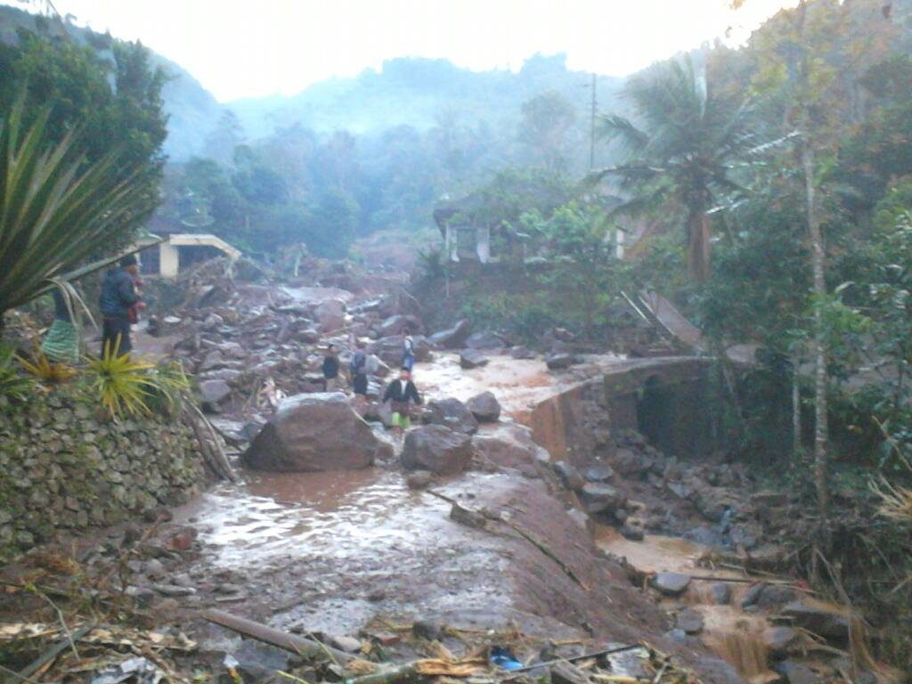
At least 10 people have died in flash floods in Magelang Regency in Central Java province, Indonesia.

The floods struck on 29 April after a period of heavy rain, according to Indonesia's national disaster management agency BNPB. Flooding affected several hamlets near the villages of Sambungrejo and Citrosono, both in Grabag Sub-district.


Cloud Precipitation

Extreme amounts of rain hit Dominican Republic

dominican republic flooding
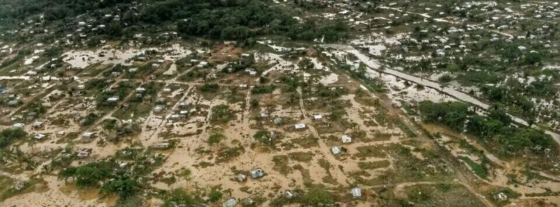
More than 17 000 people were forced to evacuate after dangerous weather system dumped extreme amounts of rain on the Dominican Republic over the past couple of days. Within 24 hours, some regions saw up to 400 mm (15.7 inches) of rain, causing rivers to overflow. This is the same weather system that dumped heavy rain on Jamaica and southern Haiti this week, claiming at least 6 lives.

According to ONAMET, country's meteorological office, a weather station in the southern city of Barahona recorded 396 mm (15.6 inches) of rain within just 24 hours on April 23. Overall, this region received most of the rain over the past 7 days, more than 900 mm (35.4 inches).

Bizarro Earth

'Last of the Season' Tropical Cyclone Frances forms near Australia

cyclone frances
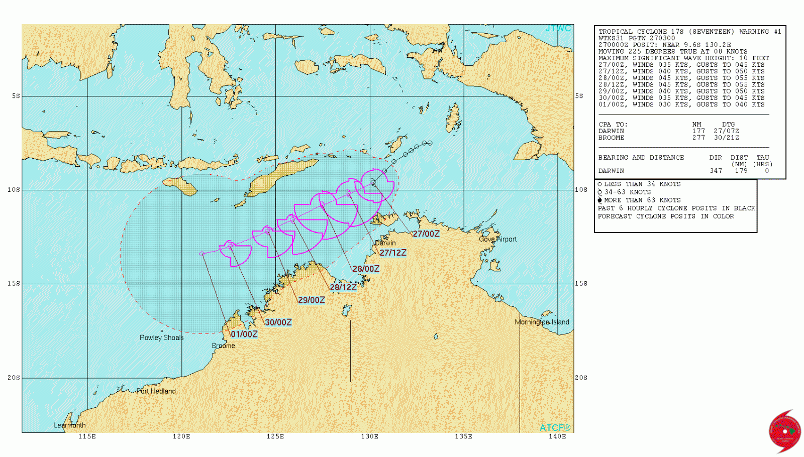
© UW-CIMSSTropical Cyclone "Frances" on April 27, 2017.

Tropical Cyclone 17S (Frances) formed near the coast of Northern Territory, Australia on April 27, 2017, as the 7th named storm of the 2016/17 Australian region cyclone season.
Frances is moving southwest and is expected to somewhat intensify over the next 24 hours, but is not expected to make landfall. The season officially ends on April 30.

As of 15:00 UTC on April 27, 2017, the center of Tropical Cyclone "Frances" was located approximately 324.1 km (201 miles) west-northwest of Darwin, Australia, and has tracked southeastward at 20 km/h (12.4 mph). Its maximum sustained winds at 12:00 UTC were 83 km/h (52 mph), according to the JTWC.

Cloud Precipitation

Dangerous flooding engulfs eastern North Carolina

north carolina flooding
Intense rainfall led to flooding in parts of the Carolinas this week. North Carolina Gov. Roy Cooper said the rain was "like we haven't seen since Hurricane Matthew."

Road closures and water rescues were reported in eastern portions of the state on Tuesday. Raleigh recorded 4.51 inches of rain on Monday alone, making it the wettest April day in the city's history.

In Elkin, North Carolina, the Yadkin River approached moderate flood stage after rising from nearly 5 feet to 20 feet from Sunday night into Monday. Moderate to major flooding will persist along area rivers into next week in some locations.

Cloud Precipitation

Floods displace 17,000 after 15 inches of rain in 24 hours in the Dominican Republic

Floods in Manoguayabo, Santo Domingo, April 2017.
© Fuerza Aérea de República DominicanaFloods in Manoguayabo, Santo Domingo, April 2017.
Flooding has caused major problems in at least 5 provinces in the Dominican Republic after staggering amounts of rainfall over the last few days.

According to the country's meteorological office (ONAMET), almost 400 mm of rain fell in 24 hours in Barahona between 22 and 23 April, 2017. Further heavy rain has fallen since, mostly in southern areas of the country.

In their latest report of 25 April, the Emergency Operations Centre (Centro de Operaciones de Emergencias - COE) says that flooding has affected several areas in Santo Domingo, San Cristóbal, Monte Plata, Sánchez Ramírez, Duarte and Barahona provinces. Several rivers have overflowed, including the Ozama, Yuna, Cevicos, Manoguayabo and Haina.

As many as 3,429 homes have been damaged or affected by the flooding, with around 9 houses completely destroyed. Emergency services and military have rescued 153 people.


Arrow Down

The 'March to Silence' - Shots fired at building housing leading climate skeptic scientists

NSSTC
© Image via Google Maps Street ViewNational Space Science and Technology Center (NSSTC) building.
A total of seven shots were fired into our National Space Science and Technology Center (NSSTC) building here at UAH over the weekend.

All bullets hit the 4th floor, which is where John Christy's office is (my office is in another part of the building).

Given that this was Earth Day weekend, with a March for Science passing right past our building on Saturday afternoon, I think this is more than coincidence. When some people cannot argue facts, they resort to violence to get their way. It doesn't matter that we don't "deny global warming"; the fact we disagree with its seriousness and the level of human involvement in warming is enough to send some radicals into a tizzy.

Our street is fairly quiet, so I doubt the shots were fired during Saturday's march here. It was probably late night Saturday or Sunday for the shooter to have a chance of being unnoticed.

Maybe the "March For Science" should have been called the "March To Silence".

Campus and city police say they believe the shots were fired from a passing car, based upon the angle of entry into one of the offices. Shell casings were recovered outside. The closest distance a passing car would have been is 70 yards away.

This is a developing story. I have no other details.