Floods
S


Tornado1

Hurricane Maria: Flooding continues across Puerto Rico, San Juan begins cleanup

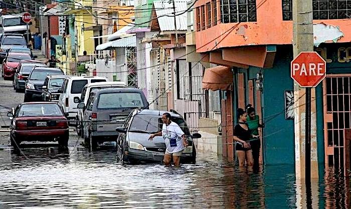
flooded street
© CARL JUSTE CJUSTE@MIAMIHERALD.COMResidents deal with navigating high water throughout San Juan as Hurricane Maria left many streets flooded and blocked by fallen power lines, trees, and debris while Puerto Rico tries to recover from the Category 4 storm on Thursday.
Left to fend for themselves a day after Hurricane Maria ravaged Puerto Rico and forced them into a primitive existence, San Juaneros took to the streets Thursday to do what they say Caribbean people do best: Inventar. Figure it out.

No electricity? A mustachioed man in a white undershirt played traffic cop at a Santurce intersection. No ambulances? A daughter borrowed her brother's SUV to race her frail mother from the La Perla neighborhood to a hospital. No debris removal? A physician and two neighbors borrowed garden tools to clear main Condado thoroughfares on their own.

With the enormity of Maria's destruction still unknown even to the overwhelmed Puerto Rican government, the capital's storm-dazed residents ventured outside Thursday, clogging roadways while trying to bring some semblance of order to their bruised city.

Their task was so massive some just wandered the streets, gawking.
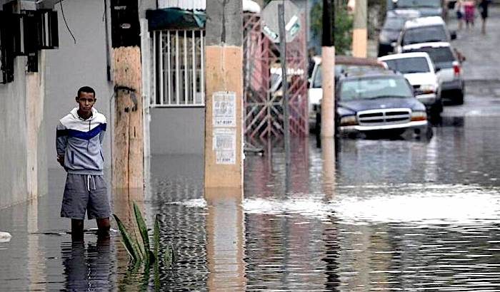
San Juan street
© CARL JUSTE CJUSTE@MIAMIHERALD.COMA man waits in knee-high water for a neighbor to open a door as residents throughout San Juan deal with Hurricane Maria’s aftermath leaving on Thursday.

Comment: Meanwhile officials are rushing to evacuate tens of thousands of people from their homes in western Puerto Rico after Hurricane Maria inflicted structural damage on a dam and unleashed "extremely dangerous" flash floods.

Some 70,000 residents in the municipalities of Isabela and Quebradillas were being evacuated by bus after a crack appeared in the nearly 90-year old Guajataca dam.

"It's a structural failure. I don't have any more details," Governor Ricardo Rossello said from the capital, San Juan. "We're trying to evacuate as many people as possible."

"This is an EXTREMELY DANGEROUS SITUATION. Buses are currently evacuating people from the area as quickly as they can," the US National Weather Service tweeted on Friday .

In a later message, the NWS tweeted: "All Areas surrounding the Guajataca River should evacuate NOW. Their lives are in DANGER! Please SHARE!"

More than 15in (nearly 40cm) of rain has fallen on the mountains surrounding the Guajataca dam, swelling the reservoir behind the nearly 90-year-old dam, which holds back a manmade lake covering about two square miles (five square kilometres).


Bizarro Earth

Major disaster: Hurricane Maria ravages Puerto Rico, leaving entire island without power (Updates, Photos)

Hurricane Maria Puerto Rico
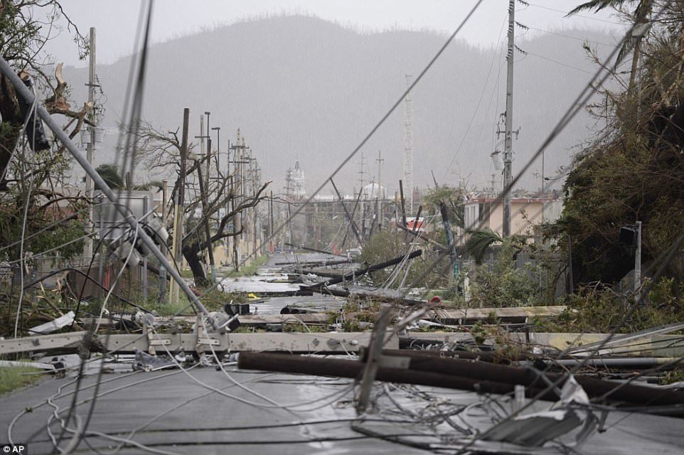
Rosselló also said that at least one person was killed in the storm on the island when a board was ripped from a house it had been nailed to and hit a man. He said that the number of deaths could increase in the next few days. Pictured above are downed power lines and poles on Wednesday on the island
The eye of Hurricane Maria exited Puerto Rico on Wednesday afternoon, but only after carving a vicious path that toppled trees, sheared roofs, engorged rivers and obliterated the electric grid - cutting off power for the entire island of 3.5 million people.

By 2 p.m., the weakened storm had moved into open water but the danger was far from over.

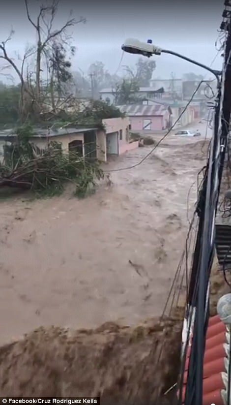
The top winds were still clocking in at 115 miles per hour - still a major life-threatening Category 3 storm - and punishing rain was expected to drench Puerto Rico through the rest of the day. The U.S. National Weather Service was predicting up to 18 inches of rain through Friday, with "life-threatening flash floods and mudslides." News footage showed the muddy Guayama River overflowing and rushing in a brown torrent down streets .

"The truth is the danger continues," Gov. Ricardo Rosselló told the island's largest newspaper, El Nuevo Día. "It's going to keep raining hard. Flood zones are at critical levels. We're still going to have a full day of rain."

Comment:
Update: (Sept. 22)

Puerto Rico battled dangerous floods Friday after Hurricane Maria ravaged the island, as rescuers raced against time to reach residents trapped in their homes.The death toll has climbed to 33, including 15 in Dominica, three in Haiti and two in Guadeloupe. Although the southeast coast suffered the worst damage, no part of the island escaped the storm's wrath. Of the 27 river gauges on the island, 13 of them are in flood. The National Weather Service reported rainfall of between five and 7 inches an hour.

Maria has already torn through several Caribbean islands, claiming the highest toll on Dominica, which has a population of around 72,000 and has been largely cut off from the outside world.
Puerto Rico Hurricane Maria
President Donald Trump said the US territory had been 'absolutely obliterated' by the devastating storm
puerto rico hurrican maria
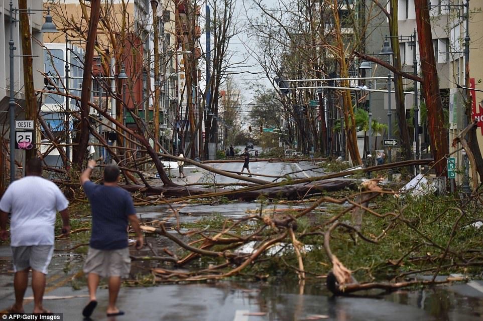
Cars have been forced to navigate the island by any means possible, as many roads have been partially or fully blocked by floodwaters and fallen trees. Picturned here, a car navigates the capital of San Jua
puerto rico hurrican maria
Work has already begun to try and restore a sense of normality after the storm, but officials have warned it could be 'months and months and months' before the country completely recovers
puerto rico hurricane maria
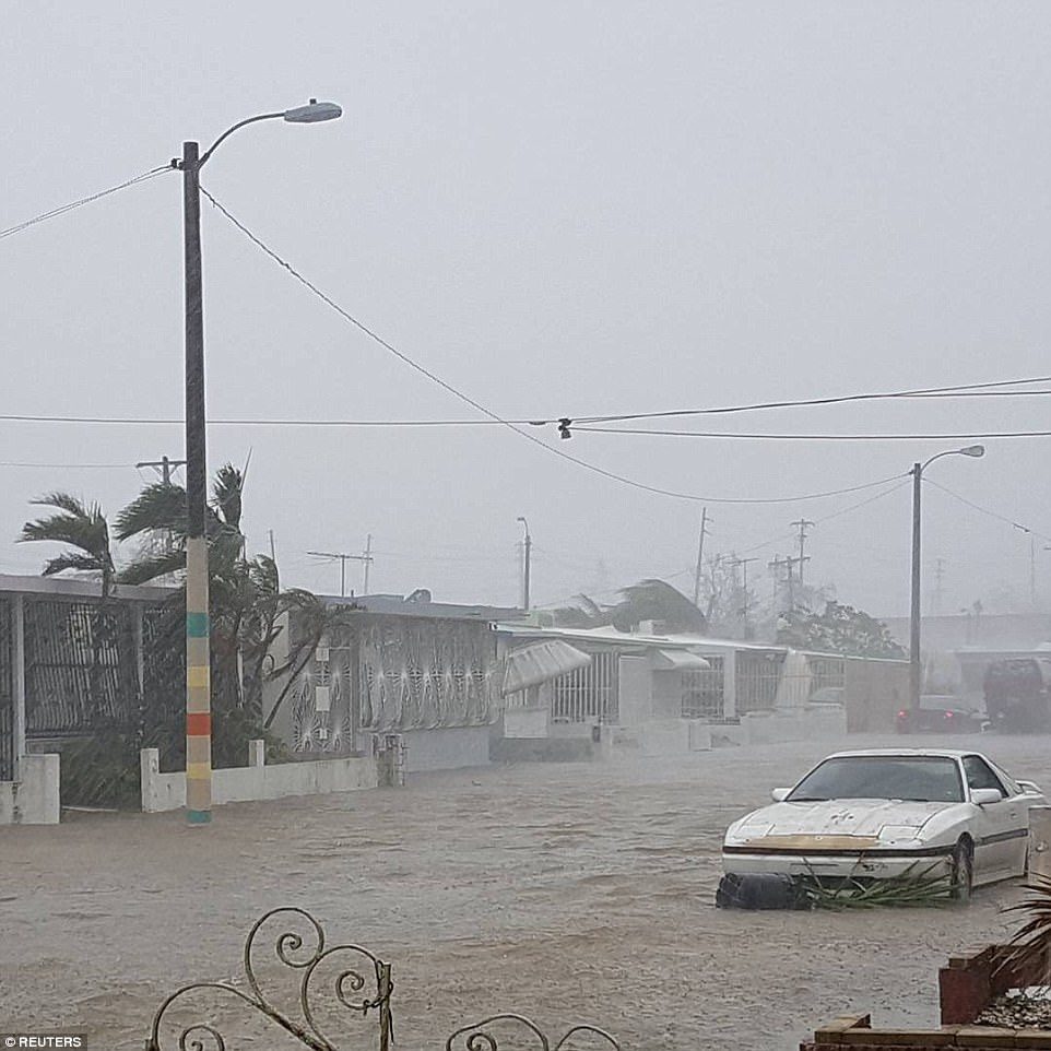
Massive flooding in the town of Guayama
puerto rico hurricane maria
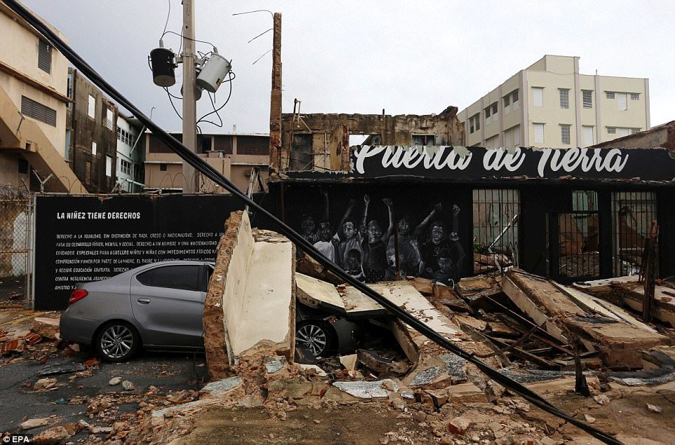
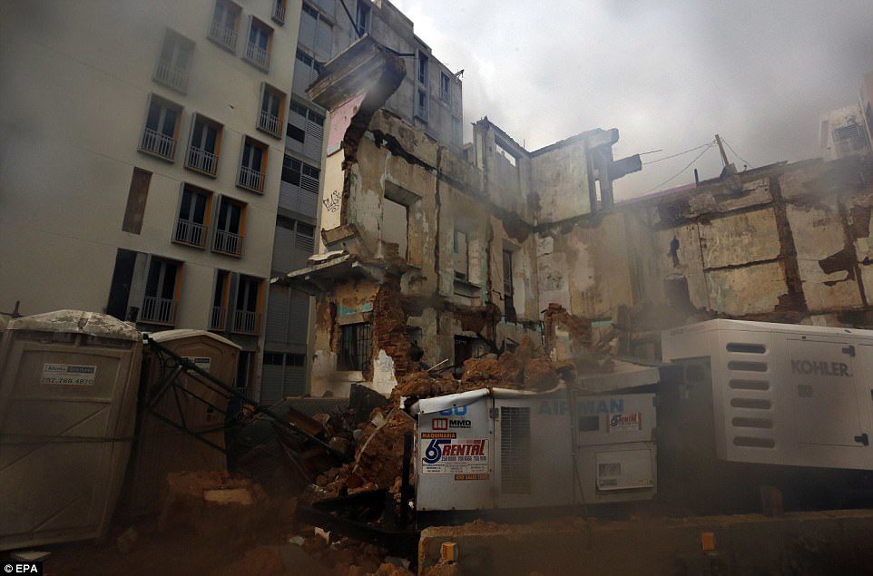
A view of the facade of a building that was damaged by strong winds and heavy rain during the passing of Hurricane Maria in San Juan, Puerto Rico on Wednesday
More photos can be found here.


Cloud Precipitation

12 dead, 92 missing as flooding hits eastern Congo following torrential rain

floods
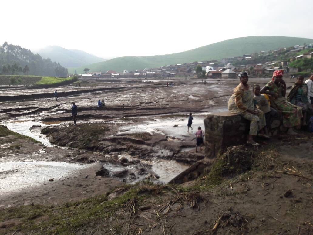
At least 12 people died and 92 were missing after heavy rains caused flooding in two villages in eastern Democratic Republic of Congo, an official said Wednesday.

"The provisional toll after torrential rain hit the villages of Bihambwe and Matanda in Masisi Territory is 12 dead, 18 injured and 92 missing," said Julien Paluku, governor of Nord Kivu province, where the villages are located.

The rain started on Tuesday, causing a river to flood, local residents told AFP.

"The rain began in the afternoon, forcing those coming back from the fields to take shelter in homes near the river. The flooding caught them by surprise," said Joseph Ndabita, a resident of Bihambwe.

He told AFP he had counted "10 bodies and (seen) others being swept away by the strong current towards the river."

Cloud Precipitation

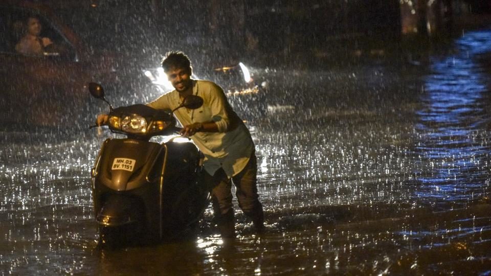
Heavy rains batter Mumbai again, second highest deluge recorded in September

Mumbai floods
© Kunal Patil/ Hindustan TimesA man pushes his bike through a waterlogged street in Mumbai on Tuesday evening.


Between Tuesday and Wednesday mornings, Mumbai received 303.7 mm, the second highest after the 318.2mm recorded on September 12, 1981


Near-record rainfall left vast areas of Mumbai under water on Wednesday, affecting suburban train services and flights and forcing authorities to shut down educational institutions for a day in the country's financial capital.

As many as 183 passengers had a narrow escape when a SpiceJet flight overshot a wet runway while landing at the Mumbai airport and got stuck in mud on Tuesday night, officials said. The passengers were safely evacuated but more than 50 flights had to be diverted as a result of the accident.

The latest flooding comes less than a month after the city of 20 million people was pummelled by unusually high rainfall that killed many and brought the metropolis to its knees for at least two days.


Between 8.30am Tuesday and 8.30am Wednesday, the Santacruz weather station, representative of Mumbai and its suburbs, recorded 303.7mm, and Colaba, representative of south Mumbai, recorded 210mm rain, the highest for south Mumbai this monsoon.

The city was just 14.5mm short of the all-time high 24-hour September rainfall of 318.2mm recorded on September 12, 1981. The last days' rainfall was also the highest in a decade since the September 4, 2012 when the city received 185.3mm rain.

Mumbai's average rainfall for September is 312.3mm, which was surpassed over the past 24 hours.

Met officials said the city has recorded 536.4mm in September. The total rainfall this season is at 2879.5mm as against the annual average of 2258mm.
Cloud Precipitation

Hurricane Jose inundates Mid-Atlantic and New England beaches with coastal flooding

Hurricane jose new jersey

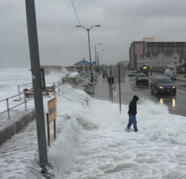
Jose has been unleashing coastal flooding, beach erosion, gusty winds and rain to the mid-Atlantic and New England coasts.

Although Jose is not making landfall, hurricanes do not need to make landfall to cause significant adverse effects such as coastal flooding.

"After Tuesday night, conditions will be improving. The high tide tonight might be the worst, but after things will improve," David Dombek, AccuWeather senior meteorologist, said.

Cloud Precipitation

Flooding in Niger leaves at least 54 dead, 200,000 displaced and 11,000 homes destroyed

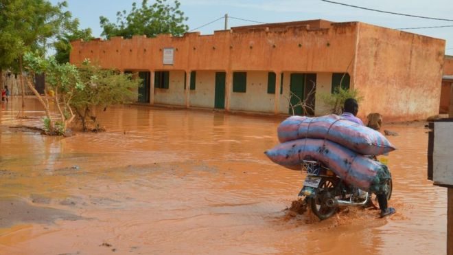
Floods in Niamey, Niger
© AFPNiger's capital, Niamey has seen heavy rains since June
Flooding unleashed by three months of torrential rain in Niger has killed at least 54 people and left nearly 200 000 displaced, the UN said on Friday.

The UN Office for the Coordination of Humanitarian Affairs (OCHA) said most of the deaths took place in the capital Niamey and that more than 11 000 homes were destroyed.

Niamey has been hardest hit along with Dosso in the south, Tillaberi in the west and the central-southern areas of Maradi and Zinder as Niger struggles once more with flooding which claimed more than 50 lives last year.

The recovery from the disastrous rains promises to be long.

Food production will also take a hit, with the flooding killing some 16 000 cattle and about 12 000 hectares of crops being ruined, the UN said.

With its 17 million population in a country three quarters of which comprises desert, Niger regularly is beset by food shortages caused by drought as well as severe flooding.

Comment: "This year's rain is just extraordinary," Katiellou Lawan Gaptia, head of meteorology at Niger's Met Office said. "In Niamey alone, the season's rainfall has increased by 84 percent since 2010."


Attention

Severe flash flooding as dam under construction unexpectedly bursts in Laos (VIDEO)

flash floods after Laos dam burst
© YouTube/Xov Xwm_Lom Zem (screen capture)
A destructive flash flood occurred when a dam under construction unexpectedly burst open sent people in its wake running for their lives in the Laos province of Xieng Khouang.

Video of the Sept. 11 disaster shows the raging waters growing more widespread as workers run for higher ground while some unsuccessfully attempt to drive vehicles out of harm's way.

An unidentified woman screams in a panic, presumably instructing them to leave the vehicles and get to safety:


Cloud Precipitation

Typhoon Talim causes flooding and landslides in Japan; Oita sees 7 inches of rain in 5 hours

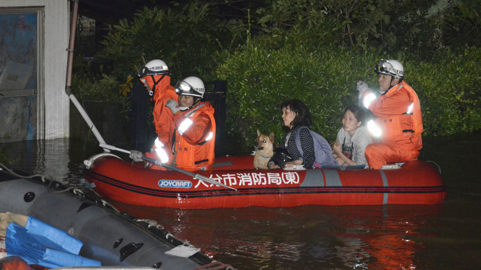
Residents are evacuated from their home in Oita, Japan after heavy rainfall
Typhoon Talim made landfall over the western coast of Kagoshima prefecture, Kyushu island, Japan, on 17 September with winds of up to 162km per hour. It then continued moving over eastern Kyushu, eastern Shikoku, western and northern Honshu, weakening. Talim reached the northern island of Hokkaido by early (local time) Monday 18 September.

High levels of rainfall have been reported across several areas. According to Japan Meteorological Agency (JMA) figures, 179 mm of rain fell in 5 hours in Oita, Oita prefecture, on Sunday, 17 September. As Talim moves north, JMA warnings are in place for potential landslides and flooding in parts of Hokkaido and Tohoku.

Damage

FDMA says that 1 house was completely destroyed in Kagawa. Around 250 houses have suffered some damage. As many as 113 homes have been flooded in Okayama, 25 in Kagawa and 37 in Ehime.

Strong winds and heavy rain conspired to cause major disruption to public transport. Train services, including the Bullet trains, and dozens of flights have been cancelled.


Attention

Florida's Withlacoochee River flooding forces evacuation

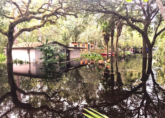
withlacoochee
© unknown
Major flooding is threatening residents along the Withlacoochee River, emergency officials reported Sunday.

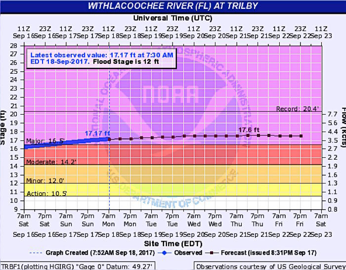
At 12:30 p.m., the river reached 16.8 feet at a gauge near U.S. 301, nearly five feet above its flood stage, elevating the flood status to "major." Waters are still rising, and National Weather Service forecasters predict major flooding to last at least through Friday.

Some 1,900 properties could flood, according to Hernando County spokeswoman Virginia Singer.

A voluntary evacuation order is in effect for endangered residents. Officials urged those in low-lying areas who see flood waters to leave now.

The Enrichment Center at 800 John Gary Grubbs Blvd. in Brooksville is operating as a shelter for evacuees.
river chart
© waterweather.gov

Cloud Precipitation

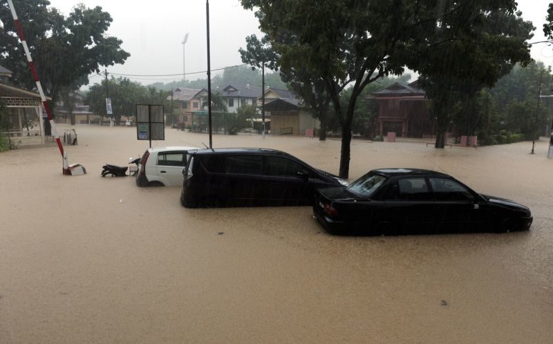
Huge floods hit Penang, Malaysia

Picture shows the flood situation at Jalan P. Ramlee, George Town September 15, 2017.
© BernamaPicture shows the flood situation at Jalan P. Ramlee, George Town September 15, 2017.
Traffic on the Penang island came to a standstill amid massive floods after a downpour throughout the night.

The Penang Island City Council (MBPP) said on its Facebook page that as of 9.30am, the water levels in the river had exceeded the dangerous level.

The Star Online reported that all main routes to the city's central business district were cut off by flood waters since 6am today, with levels reaching from knee-deep to chest-high.

Flood waters in the Jalan P. Ramlee area were reportedly up to 1.5m deep.