Snow has been falling over some of Scotland's highest mountains with temperatures forecast to drop below -10C in the most exposed areas.
The Cairngorms were among upland areas to see a dusting on Tuesday.
Mountain Weather Information Service (MWIS) said Arctic air was affecting the hills, especially in the Highlands, and there had been significant wind chill.
BBC Weather said snow on mountain tops in June was not that unusual, and usually happened every three to five years on average.
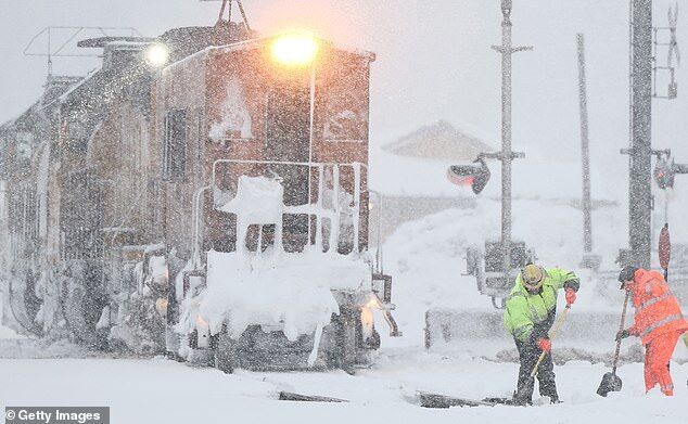
It has been a winter wonderland for some and a morning of chaos for others as snowfall continued in parts of the country on Tuesday.
TimesLIVE Premium on Monday reported snowfall had hit parts of the Northern Cape for the first time in about 40 years as a powerful weather system sweeps across South Africa.
The cold weather was preceded by deadly storms along much of the Cape coast, with people missing, according to rescue officials.
The SA Weather Service (SAWS) issued a disruptive snow warning for Tuesday across high-lying parts of the Western Cape, Eastern Cape and KwaZulu-Natal.
Video clips and images emerged on social media on Tuesday showing homes and roads covered in a blanket of white. Others showed citizens braving the freezing weather to pose outside and take pictures in the snow.
29 hikers had to be rescued after becoming stranded on the Zugspitze.
A rescue operation was launched on Saturday, June 1, to evacuate dozens of hikers who found themselves stranded on Germany's highest mountain, the Zugspitze, due to treacherous weather conditions.
According to the Bavarian Mountain Rescue Service, 29 hikers attempted to scale the 2,962-meter (9,718-foot) peak despite heavy snowfall and poor visibility. At around 2,500 meters (8,202 feet), the hikers could not continue their ascent due to the accumulation of fresh snow, which reached depths of up to 2 meters (6.6 feet) in some areas.
The Mountain Rescue Service, in collaboration with staff from the Zugspitze mountain railway company, mobilized to locate and extract the stranded hikers. The rescue efforts were further complicated by the freezing temperatures, which caused partial icing of the cable car equipment, rendering it inoperable at times.
Delhi recorded an all-time high temperature of 52.9 degrees Celsius (127.22 Fahrenheit) on Wednesday as extreme heat conditions gripped the north and western parts of India, causing students to faint in schools and drinking water taps to dry up.
A heat wave alert has been in place for large parts of India since last week but on Wednesday the temperature in Mungeshpur, a densely packed corner of Delhi, crossed the 50 C mark, the weather office said.
The Indian capital has had temperatures of over 45 C in previous years but never gone as high as 52.9 C.
Streets in Mungeshpur in northwest Delhi were deserted and most shops were shut as people stayed indoors to avoid the searing heat, while residents handed out free cold drinks in Narela after temperatures went up to 49.9 C on Tuesday.
Comment: India's Met. Department has since admitted that there was an error at the measuring station. Link
It gets even better though, because that 52.9C (127.2F) doing the AGW rag rounds was from a faulty sensor. Temperatures in the area were actually around 47C (116.6F), according to the Indian Meteorological Department, some 6C lower than reported.
That near 53C posted in New Delhi suburbs, in Mungeshpur to be specific, was an error officially acknowledged by the IMD:
As severe weather continued Thursday through the Great Plains, residents of a southwest Texas town reported a dramatic temperature drop on Wednesday and hail so deep they had to deploy snow plows to clear the streets.
The temperature in Marathon, Texas, fell more than 50 degrees on Wednesday afternoon as thermometers tumbled from around 105 degrees to the mid-50s in about an hour, Brian Curran, a meteorologist for the National Weather Service Midland, Texas, told ABC News.
Curran attributed the wild decline in temperature to the severe hail storm that hit Marathon.
"It was like an air conditioner," Curran said.
Brad Wilson, chief of the Marathon Fire Department, told ABC News that it was as if conditions turned from summer to winter in an hour.
"There was about two feet of hail on our main street right in the center of town. It looked like snow," Wilson said. "We went out there with a tape measure last night before the road crews came and plowed the roads."
While plains across the nation sizzle in the summer heat, a cool escape is brewing in the hills. Himachal Pradesh's beloved Manali just threw a snowball of joy amidst the scorching season, welcoming tourists with open arms.
On Thursday, the heavens decided to gift Manali with a fresh coat of snow, turning Rohtang into a winter wonderland. Tourists, both locals and adventurers from afar, couldn't resist the call of the frosty peaks.
Videos capturing the snowfall and rain circulated on social media.
According to the weather reports, Manali got a good soaking with 10 mm of rain, followed by Keylong, Kalpa, Shimla, Bhuntar, and Sainj. The mercury decided to take a chill pill, dropping a couple of degrees in the mid and higher hills.
Some of Alaska's clear, icy blue waterways are turning a startling rust orange - so intense it's visible from Earth's orbit.
"The stained rivers are so big we can see them from space,"says University of California (UC) Davis environmental toxicologist Brett Poulin. "These have to be stained a lot to pick them up from space."
After first noticing the problem in 2018 from river banks and fly-overs, National Park Service ecologist Jon O'Donnell, Poulin and their colleagues used satelliteimagery and public reports to identify over 75 remote streams recently tainted this unusual orange color, across almost 1,000 kilometers (1,610 miles) of Alaska's Brooks Range.
Comment: Volcanic activity in and around Alaska may be increasing, and, in turn, it's possible that so is geothermal activity - as also seems to be the case elsewhere on the planet:
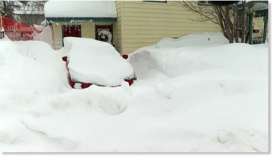
Here in the Georgetown Lake area they are dealing with about a foot of snow, the really wet and heavy kind that's accumulating on all the branches, causing limbs to break and fall on powerlines. It's led to power outages, here and all over the state.
"Well, I think it's a little crazy, I just came back up from the south where it was nice and warm. I was hoping for spring, but apparently it's not coming today," said Georgetown Lake resident Joe Thomas.
Much of southwest Montana was hit with steady morning snowfall. NorthWestern Energy had crews responding to isolated power outages from Missoula to Bozeman.
"The heavy, wet snow is creating conditions for tree limbs to break or bend into power lines," said Jo Dee Black of NorthWestern Energy.
Climate Specialist Rick Thoman said it hasn’t been a typical El Niño winter. Instead, there’s been what he calls a lot of “yo-yo weather.”
A strong parade of storms has been making its way through the northern Pacific Ocean, and the location of the jet stream has produced colder storms for Unalaska and the Aleutian region this spring. That's according to Rick Thoman, a climate specialist at the International Arctic Research Center with the University of Alaska Fairbanks.
"Over the last six weeks, say, the Aleutians have been on the north side of the prevailing storm track, and so on the cold side of the storms," Thoman said. "If the jet stream was say 500 miles farther north, it would still be stormy, but it wouldn't be nearly as cold."
Cold air from above the North Slope brought another round of wintery weather to Western Alaska, the Eastern Aleutians, Kodiak Island and into Southcentral Alaska as well, according to Thoman.
"That was basically a blob of cold air that came down from the high Arctic from north of the North Slope, and it moved southwest through the Bering Strait down through the eastern Bering Sea, and is now actually moving into the western Gulf of Alaska," he said.
The spring chill was unprecedented in the history of meteorological observations in the country
The first 10 days of May were the coldest the European part of Russia has witnessed in the history of meteorological observations there, the scientific director of Russia's Hydrometeorological Center, Roman Vilfand, has said.
The European part of Russia was a "funnel" attracting cold air masses from the Arctic Ocean during the beginning of the month, Vilfand told TASS on Monday.
"Two centers with different signs - an anticyclone to the west of Moscow and a cyclone to the east of Moscow - created conditions for the retraction and advection of the cold air masses of the Arctic Ocean," he explained.
Comment: Are cold temperatures in Russia how a new cold war appears like?
The fact is, that to do anything in the world worth doing, we must not stand back shivering and thinking of the cold and danger, but jump in and scramble through as well as we can.
- Robert Cushing
”
Recent Comments
The Facebook owner has announced the move after Washington claimed Russian outlets are espionage offshoots. Could it be Suckerberg is projecting...
Comment: India's Met. Department has since admitted that there was an error at the measuring station. Link