Extreme Temperatures
S


Snowflake

Best of the Web: Day 2 of the summer snowstorm in the European Alps - at least 30 inches of snow thus far

Obertauern saw 60cm of snow.
© @UnwetterFreaks XObertauern saw 60cm of snow.
More images are coming from European ski resorts in the northeastern Alps as the low-pressure system is moving across the European Alps. While so far only about 50-75 centimeters (20-30 inches) have fallen so far, the brunt of the snowstorm is yet to come. The next 24 hours are expected to be quite dramatic as 200mm of precipitation is forecast in some regions and 400mm over the next 48 hours.

It is expected that this will come down as snow above 1,000 meters (3,280 feet). Massive snow breakage, avalanches, and mudslides are to be expected in those regions. Remote mountain villages could be cut off for several days from the outside world and basic infrastructure, such as transportation, power, etc., is also under threat. Lower areas are anticipated to be at risk of flashfloods. Local authorities are expecting a century flood for regions in Eastern Europe.


Snowflake

Day 1 of the summer snowstorm in the European Alps

Germany’s Zugspitze saw 30 cm of snow.
© Zugspitze InstagramGermany’s Zugspitze saw 30 cm of snow.
The cold front from the Arctic has hit Germany, and temperatures have dropped from summery 25-30°C (77-86°F) to chilly winter temperatures. As the low is moving north, carrying moisture it gathered over the Mediterranean Sea, and hits the cold front, summer snowfall is being unleashed on parts of the European Alps. Between 5-35 centimeters (2-13 inches) of snow have fallen, and the snowline is dropping to as low as 800 meters (2,625 feet) in some areas of Germany.

The brunt of the snowstorm is supposed to come on Saturday, so stay tuned for more images over the next few days.

According to Copernicus, the European Space Agency, an unusual weather system over Scandinavia is accompanied by cold Arctic air, and moving south across Europe, bringing strong winds, a sharp drop in temperatures, and early snow in the Alps.


Snowflake

Early snowfall in the Czech Republic

mmmmmmmm
On the morning of Thursday, September 12, the first snow of the autumn-winter season arrived in the Czech Republic.

The snow covered Velký Javor, the highest peak in the Šumava National Park, which stands at 1,300 meters above sea level.

Overnight, temperatures at Velký Javor dropped to around +2°C, allowing light snowfall to occur in areas above 1,300 meters. The snowfall, however, was light, with no more than one centimeter settling on the ground.

Meteorologists predict that today's snow will melt quickly, but additional snowfall is expected on Friday, Saturday, and Sunday.

This snowfall comes earlier than in 2023, when the first snow was delayed until October 8 due to an unusually warm autumn. The year before, the first snow arrived on September 18.

A video of today's snowfall:


Snowflake

Arctic air brings early snow to Scotland's mountain tops

Mountain ranger Ruari Macdonald in snow at CairnGorm Mountain ski centre near Aviemore on Wednesday
© PETER JOLLY/NORTHPIXMountain ranger Ruari Macdonald in snow at CairnGorm Mountain ski centre near Aviemore on Wednesday
Some of Scotland's highest mountains have had the first autumn dusting of snow.

The Cairngorms, Glen Coe and Lochaber have been among upland areas to see wintry showers.

Strong north-westerly winds have brought colder air from the Arctic across the UK.

BBC Weather said snow over Scottish mountains was not uncommon in September during the transition into the colder winter months.

Nights are expected to feel chilly and rural areas could have ground frost.

BBC Weather said by Friday and into the weekend, there would be another change in wind direction to a south-westerly.

It added that this wind direction tended to bring in more seasonally average temperatures - around 16 to 20C for mid-September.

Snowflake

Are we in for a big winter? Heavy rain and snow in the Pyrenees and Alps - up to 27.5 inches of early snowfall recorded

Passo Stelvio
Passo Stelvio on September 9, 2024.
The recent heavy snowfall and rainfall in Europe represents a significant boost for the snow industry and mountain tourism in Europe. The intense Isolated High Level Depression, which has crossed Western Europe, has resulted in considerable snow accumulations for this time of the year.

Recent weather events in the mountainous regions of Europe, especially in the Alps, seem to anticipate a winter of heavy snowfall. The heavy precipitation and heavy snowfall forecast for the coming months is excellent news for both the winter sports industry and the accumulation of water reserves.

According to data provided by Meteo France, the Alps have recorded accumulations of between 10 and 70 cm of snow on their highest peaks and the Pic du Midi in the French Pyrenees has been dyed white. The "premature" arrival of snow is particularly noticeable in the French and Italian regions, notably the Mercantour and Haute-Maurienne valleys in France as well as the Italian Alps and the Apennines, from the Ligurian coast to Reggio Calabria, where up to 20 cm of snow has been recorded on the highest peaks.


Snowflake

Zululanders feel the chill as snow blankets Drakensberg, South Africa

Snow covers Sani Pass as Zululanders get cold, wet Monday
JUST as many Zululanders thought spring was firmly in their sights, winter returned with a chill today (Monday).

With Brackenham dropping to as low as 12.4 degrees Celsius, Richards Bay CBD 17 and eSikhaleni a more mild, yet still cold 17.8 degrees, the mercury failed to rise above 11 degrees in eShowe, while Hluhluwe reached 15 and Mtubatuba 14.

The cold temperatures brought rain across much of the Zululand region.

Elsewhere in KwaZulu-Natal, snow not only capped the Drakensberg mountain range, it covered Sani Pass in a thick white blanket, as seen in a video shared across social media platforms.


Snowflake

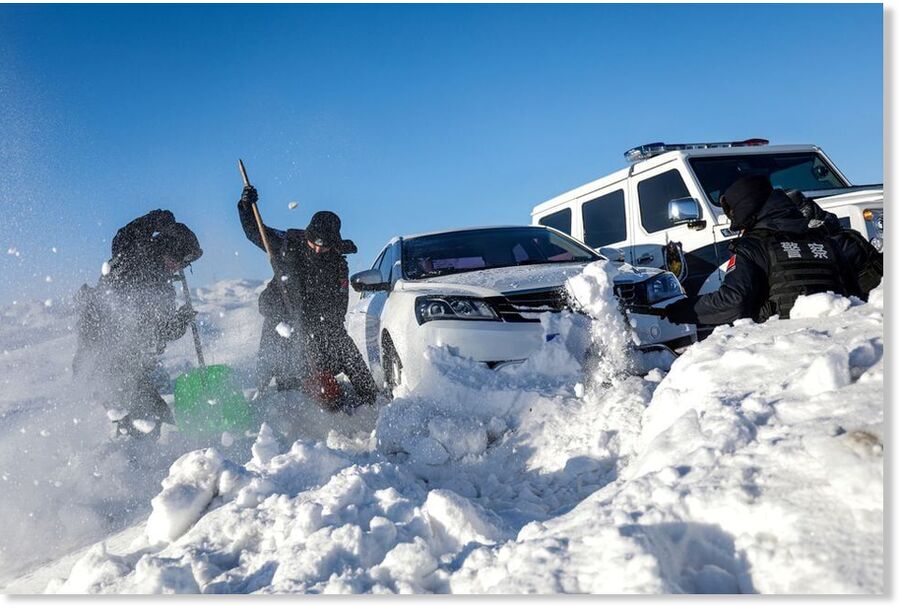
Early snow covers Too-Ashu mountain pass in Kyrgyzstan

nnnnn
Snow has fallen on the Too-Ashu pass in Zhaiyl district of Chuy region on September 2, drivers told Turmush.

Meanwhile, the road service workers said snow melted quickly.

This was the second snowfall this summer-autumn season. The first snow fell on the night of August 27-28, the employees said.

There was no threat to cars and now there is no any threat for vehicles, according to them.

No road accidents occurred on the pass despite the weather conditions, the regional police reported.


Arrow Down

Climate Science goes full-bore witchcraft: Your beefsteak makes bridges fall like Tinker-Toys

Climate Propaganda
© NYT
The Modern West is regressing to 8th Century occult science

Today the supposed "newspaper of record" for the most powerful nation on Earth is effectively telling people that the steak they eat, the car they drive and the heater they use could cause bridges to collapse "'like Tinkertoys". But you'll have to join the dots yourself, because they never do. No one asks the experts: How many Tofu-burgers does it take to save Brooklyn Bridge? How many bus trips will we need to save the Golden Gate?

The worlds leading journalists never ask the obvious questions. They just leave a trail of breadcrumbs: Man makes CO2, CO2 causes Spooky weather and Spooky weather eats bridges. So good people drive EV's!

Each breadcrumb looks like bread, like it might be real, but no one sees the whole loaf and before you know it, everyone is lost in the woods, installing solar panels to save their bridges.

Two days ago the breadcrumbs said "good people go without air conditioners".

Things are so bad the New York Times tells us that on a 95 degree day in summer, one bridge in Manhattan got stuck open "for hours". (The tragedy). Another time a railway bridge in Iowa got washed away and some pavement buckled in Maine.

The truth is that US bridges are a miracle. There are, seriously, more than 600,000 bridges across the country and yet this was all the catastrophe they could find in the leading paragraph. We're supposed to believe that we're in a bridge crisis, and that "extreme" heat, floods and "snap weather changes" are new, and worse, and we're causing it.

Snowflake

Unusual snowfall for Table Mountain, South Africa

NNNNN
Table Mountain reported its first dusting of snow in four years on the morning of Wednesday, August 28. Snow is an unusual occurrence on Table Mountain and it was last spotted on August 29, 2020.

Footage of white snow covered Table Mountain quickly went viral across social media platforms TikTok, X and Instagram.

On Instagram, Table Mountain Cableway said: "It's official! It's snowing on Table Mountain! The mountain is covered in a beautiful layer of snow, turning our stunning landscape into a winter wonderland!

"But that's not all! Table Mountain is in the running for Africa's Leading Tourist Attraction in the World Travel Awards 2024! Your vote can help us bring home this prestigious title and showcase the magic of our iconic landmark to the world."


Snowflake

August snow at higher elevations in Montana

Fresh snowfall is seen on the summit of Big Mountain at Whitefish Mountain Resort on Wednesday, Aug. 28, 2024
We're not out of August yet, but Mother Nature isn't letting that stop her from giving us a preview of wintry conditions.

Several higher-elevation areas of Montana currently have a dusting (or more) of snow, thanks to a cold front that cruised through on Tuesday night into Wednesday.

Glacier National Park reports that part of Going-to-the-Sun Road has been closed due to wintry weather.

The road is closed between Avalanche Creek and Jackson Glacier Outlook due to snow and icy conditions.

There is no word at this point on how long the famed road will be closed.