Earthquakes
The United States Geological Survey says the temblor struck Tuesday night about 9 miles southwest of Georgetown.
USGS says the epicenter was less than a mile underground.
Bear Lake County Sheriff's dispatcher Gene Perkins says no reports of damage or injuries were reported. He says he felt his chair "move just a hair" as he was sitting at home at the time of the quake.
Wednesday, January 26, 2011 at 15:42:29 UTC
Wednesday, January 26, 2011 at 10:42:29 PM at epicenter
Time of Earthquake in other Time Zones
Location
2.120°N, 96.741°E
Depth
26.8 km (16.7 miles)
Region
SIMEULUE, INDONESIA
Distances
234 km (145 miles) WNW (282°) from Sibolga, Sumatra, Indonesia
267 km (166 miles) SW (233°) from Medan, Sumatra, Indonesia
407 km (253 miles) SSE (157°) from Banda Aceh, Sumatra, Indonesia
562 km (349 miles) W (259°) from KUALA LUMPUR, Malaysia
Monday, January 24, 2011 at 02:45:29 UTC
Monday, January 24, 2011 at 07:45:29 AM at epicenter
Time of Earthquake in other Time Zones
Location
38.437°N, 72.749°E
Depth
89.6 km (55.7 miles)
Region
TAJIKISTAN
Distances
95 km (60 miles) SW of Karakul, Tajikistan
150 km (90 miles) NE of Khorugh, Tajikistan
150 km (95 miles) SSW of Sary-Tash, Kyrgyzstan
350 km (215 miles) E of DUSHANBE, Tajikistan
Sunday, January 23, 2011 at 12:16:47 UTC
Sunday, January 23, 2011 at 05:16:47 AM at epicenter
Time of Earthquake in other Time Zones
Location:
34.872°N, 112.058°W
Depth:
5 km (3.1 miles) set by location program
Region:
ARIZONA
Distances:
25 km (15 miles) W of Sedona, Arizona
50 km (30 miles) SW of Flagstaff, Arizona
55 km (35 miles) NE of Prescott, Arizona
160 km (100 miles) N of PHOENIX, Arizona
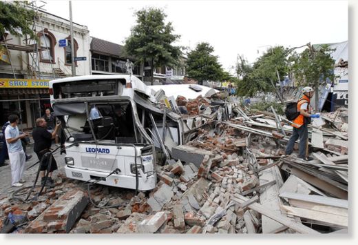
The 5.1 scale aftershock hit at 6.03am today and was centred 10km south-west of Christchurch at a depth of 10km.
There were few immediate reports of damage but Mr Stuart, who lives in the Cashmere Hills, said "the whole house was shaking on its foundations.
"The whole house just shakes like a dog with a bone. The whole house just shakes, rattles and rolls."
He said this morning's aftershock lasted about 15 seconds.
"I've had enough of them, I am sick and tired of them."
He said he was noticing more damage in his house all the time.
"It is amazing... the violence and how bad a house can shake. It's the noise and everything shakes and rattles and you wonder what sort of force causes this."
Saturday, January 22, 2011 at 17:29:25 UTC
Saturday, January 22, 2011 at 09:29:25 AM at epicenter
Location:
38.527°N, 118.407°W
Depth:
5.8 km (3.6 miles)
Region:
NEVADA
Distances:
19 km (12 miles) E (89°) from Hawthorne, NV
20 km (12 miles) W (277°) from Luning, NV
24 km (15 miles) SSW (203°) from Midway, NV
266 km (166 miles) E (90°) from Sacramento, CA
Tuesday, January 18, 2011 at 20:23:17 UTC
Wednesday, January 19, 2011 at 01:23:17 AM at epicenter
Time of Earthquake in other Time Zones
Location:
28.827°N, 63.974°E
Depth:
10 km (6.2 miles) set by location program
Region:
SOUTHWESTERN PAKISTAN
Distances:
45 km (25 miles) W of Dalbandin, Pakistan
255 km (160 miles) W of Kalat, Pakistan
310 km (195 miles) ESE of Zahedan, Iran
1020 km (640 miles) WSW of ISLAMABAD, Pakistan
(Corrects 2nd paragraph to show that 500 people were killed and to show more than one tsunami struck)
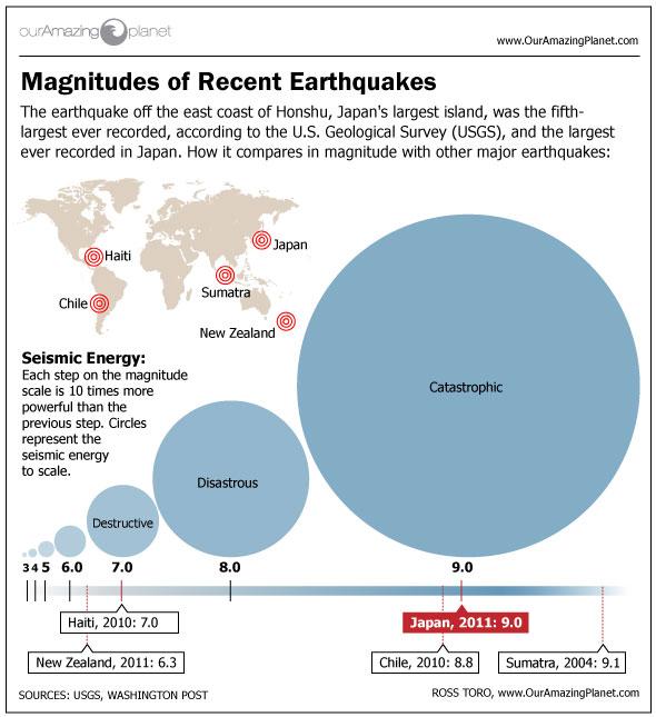
A devastating earthquake in Chile last year may have set off a swarm of smaller quakes as far away as California, U.S. researchers reported on Friday.
They found evidence that the magnitude 8.8 quake in Chile, which killed 500 people and set off tsunamis that devastated coastal cities last February, set off a chain of events 10,000 km (6,200 miles) away.
The largest earthquakes this evening - one with a magnitude of 3.7 and the other with a magnitude of 3.9 - shook an area seven miles west of Prunedale at 7:54 p.m. and 8 p.m., respectively.
Since Wednesday morning, that area of the hills bordering Monterey and San Benito counties has experienced 27 earthquakes following the magnitude 4.5 quake that punctuated the day's seismic activity.
That tremor struck near Fremont Peak State Park at 12:51 a.m., according to the USGS, and had a depth of 1.8 miles. The epicenter was located 10 miles east-southeast of Prunedale and 45 miles south-southeast of San Jose.
Most of the aftershocks had a magnitude between 1.1 and 2.9, but four of the 27 measured 3.0 or larger.
Thursday, January 13, 2011 at 16:16:41 UTC
Friday, January 14, 2011 at 03:16:41 AM at epicenter
Time of Earthquake in other Time Zones
Location:
20.589°S, 168.548°E
Depth:
7.2 km (4.5 miles)
Region:
LOYALTY ISLANDS
Distances:
125 km (80 miles) NNE of Tadine, Loyalty Islands, New Caledonia
135 km (85 miles) SSW of Isangel, Tanna, Vanuatu
285 km (180 miles) NE of NOUMEA, New Caledonia
1755 km (1090 miles) ENE of BRISBANE, Queensland, Australia
Comment: These are relatively shallow earthquakes. Perhaps they have to do with the Army Depot in Hawthorne that drills frequently in the area for geothermal energy. See page 2 of this link for the map of the rather impressive US Military Geothermal Resource locations across the US.