Earthquakes
S


Attention

Magnitude 4.7 earthquake rocks Sedona, Flagstaff areas

Image
A pretty big earthquake shook Yavapai and Coconino counties late Sunday night.

The event occurred at 10:57 p.m. about seven miles north of Sedona near Munds Park, according to the Arizona Geological Survey in Tuscon.

"The location is quite close to the Oak Creek fault zone, a down-to-the-east normal fault with 700 feet of vertical displacement in the past 10 million years or so," said Phil Pearthree, chief of Environmental Geology at the Arizona Geological Survey.

"We think this fault has been active in the past 2 million years, but don't know how recently it has ruptured in a large earthquake," Pearthree said.

More than 1,000 people reported to the U.S. Geological Survey that they felt the earthquake.

Marjorie Tuttle told CBS 5 News that she hasn't felt an earthquake since she lived in San Francisco 17 years ago.

"We were rocking and rolling tonight about 11 p.m. when we felt [it] here in Munds Park," she said. "This is the first time I have felt one here!"

Attention

Magnitude 4.2 earthquake jolts Zamboanga del Norte, Philippines

Image
© Philstar.comThere was no immediate report of destruction in the areas near the earthquake occurrence.
A magnitude 4.2 earthquake struck Zamboanga del Norte offshore on Tuesday noon, according to the Philippine Institute of Volcanology and Seismology (Phivolcs).

Engineer Allan Rommel Labayog, Phivolcs area officer, said the tremor was detected about 12:25 p.m. with its epicenter located some 42 kilometers deep and 26 kilometers southwest of Siocon town, Zamboanga del Norte.

The earthquake was tectonic in origin.

Labayog said the tremor was felt in this city with intensity 2. There was no immediate report of destruction in the areas near the earthquake occurrence.

The Phivolcs said residents in Siocon need not to be alarmed since the earthquake occurrence was deep and was not strong enough to generate a tsunami.

Attention

2 earthquakes recorded in Dolakha, Nepal

Image
© Google/NSCEpicentres of the tremors were in Dolakha District.
Two light earthquakes of local magnitude 4.8 and 4.2 were recorded in Dolakha of Central Nepal on Monday afternoon.

According to the National Seismological Centre, the fresh earthquakes were recorded at 13:18 and 13:21 pm respectively.

The epicentre of the tremors were closer to a location east of Kathmandu, northeast of Jiri Near Sunkhani and neighbouring the second one closer to Tamakoshi river, in Dolakha district.

The tremor originated from location with coordinates 27.71° N 86.15° E and 27.71° N 86.10° E, according to the NSC.

The last individual earthquake, and not aftershock of the April 25 earthquake, was recorded in Sindhupalchok district on September 29.

Attention

Magnitude 6 earthquake recorded off central Chile: USGS

Image
A magnitude 6.0 earthquake struck in the Pacific off the coast of central Chile on Monday, the U.S. Geological Survey said.

Chile's emergency office said no immediate damage was reported and no tsunami was expected.

The USGS said the quake was centered 32 miles (51.5 km)southwest of Coquimbo and struck at a depth of 21.7 miles (35 km). The region has been hit by a string of aftershocks following an 8.3 magnitude quake on Sept 16.

Attention

Earthquake Amatignak Island, Alaska magnitude 5.7

alaskan earthquake OCT 2015
© USGS2015-10-05 17:35:55
51.903°N 179.300°W
depth=89.1 km (55.3 mi)
Seismotectonics of Alaska

The Aleutian arc extends approximately 3,000 km from the Gulf of Alaska in the east to the Kamchatka Peninsula in the west. It marks the region where the Pacific plate subducts into the mantle beneath the North America plate. This subduction is responsible for the generation of the Aleutian Islands and the deep offshore Aleutian Trench.

The curvature of the arc results in a westward transition of relative plate motion from trench-normal (i.e., compressional) in the east to trench-parallel (i.e., translational) in the west, accompanied by westward variations in seismic activity, volcanism, and overriding plate composition. The Aleutian arc is generally divided into three regions: the western, central, and eastern Aleutians. Relative to a fixed North America plate, the Pacific plate is moving northwest at a rate that increases from roughly 60 mm/yr at the arc's eastern edge to 76 mm/yr near its western terminus. The eastern Aleutian arc extends from the Alaskan Peninsula in the east to the Fox Islands in the west. Motion along this section of the arc is characterized by arc-perpendicular convergence and Pacific plate subduction beneath thick continental lithosphere. This region exhibits intense volcanic activity and has a history of megathrust earthquakes.

Attention

Another earthquake recorded south of Fiji: 5.1 magnitude

Image
A 5.1 magnitude earthquake was recorded in the south of Fiji this morning.

The earthquake at 6:16am struck at a depth of 536 kilometres.

It was 372.55 kilometres south southwest of Ono-i-Lau and 665.17 kilometres south southeast of Suva.

The Mineral Resources Department said it was a moderate size earthquake with deep depth source location, a characteristic of non-threatening event particularly to the region.

Meanwhile, at 7:58am yesterday, a 5.8 magnitude earthquake was recorded 677 kilometres south southwest of Suva and 607 kilometres southwest of Nukuni village on Ono-i-Lau.

The earthquake was at a depth of 10 kilometres and was of no threat to the region.

Attention

Chile shaken by two earthquakes of magnitudes 6.0 and 6.1

Image
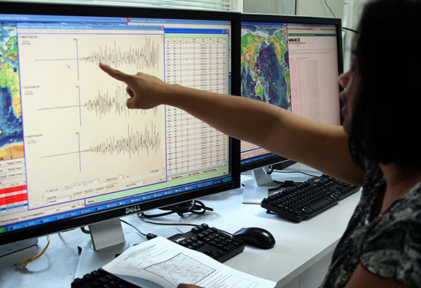
Two earthquakes, magnitude 6.0 and 6.1, hit northern and southern Chile today, but caused no known injuries or significant damage, the government's National Emergency Office (ONEMI) said.

A series of smaller quakes also shook parts of the South American country today.

The 6.1-magnitude quake occurred at 3:03 am (0603 GMT) 10 kilometers (6 miles) northwest of the town of Lebu, in southern Chile, at a depth of 20 kilometers.

The second quake occurred at 3:26 am 17 kilometers southeast of the northern town of Tongoy, at a depth of 33 kilometers.

Chile last month was hit by an 8.3 magnitude earthquake and tsunami that left 15 dead and over 16,000 homeless.
Attention

4.6 temblor strikes Costa Rica; strong shaking reported in Central Valley (updated)

Image
Update 1: RSN has downgraded the magnitude of the quake to 4.6 on the Richter scale, and has also updated the epicenter as being 14 km east of Quepos. Strong shaking was reported in the San Jose metro area and Central Valley, Quepos, Cartago, Aserri, Manuel Antonio, and Grecia. Original breaking report follows.

October 1st, 2015 (ICR News) An earthquake that is initially being reported by Costa Rica's National Seismology Network (RSN) as measuring 5.1-magnitude on the Richter scale has struck 6 kilometers west of Quepos, on Costa Rica's central Pacific coast.

The quake, which struck at 11:51 a.m. on Thursday, caused significant shaking in some areas of the San Jose metro area and the central Pacific coast, according to reports being received by ICR News.


Attention

4.8. Magnitude earthquake rattles St Lucia

Image
The National Emergency Management Organization, (NEMO) says sections of the island were rocked by an earthquake on Thursday afternoon.

The Seismic Research Centre at the University of the West Indies (UWI), St Augustine campus in Trinidad and Tobago, confirmed that a 4.8. Magnitude quake was felt in St Lucia, Dominica, St Vincent, and Martinique at approximately 2:30pm (local time).

According to a NEMO official here, reports of tremors were received from the north and south of the island.

Earlier this week NEMO Director Velda Joseph called on residents to be prepared for hazards outside of tropical cyclones, citing a series of earthquakes in the region recently, including four tremors on Sunday.

Attention

5.3-magnitude earthquake recorded in Armenia

Image
The Seismological Network of the Seismic Protection Service of the Ministry of Territorial Administration and Emergency Situations of the Republic of Armenia recorded on October 2 a 5.3-magnitude earthquake at 08:28 local time. The hypocenter of the earthquake was on Nakhijevan border 20km from Kajaran.

As "Armenpress" was informed by the Ministry of Territorial Administration and Emergency Situations of the Republic of Armenia, the underground aftershock magnitude in the epicenter was 3 points. The geographical coordinates of the epicenter were 39.26° north latitude and 45.97° eastern longitude (Nakhchivan Autonomous Republic).

The earthquake was felt in Kajaran.