Earth ChangesS

Cloud Lightning

Cumberland River Floods Nashville as record rainfall leaves 20 dead

Image
© Unknown
Storms Kill 6 In Nashville, Evacuate Thousands From Homes

Nashville, Tennessee - The Cumberland River was expected to crest sometime Monday evening but would not begin receding until Tuesday, according to the Nashville mayor's office.

The Cumberland flooded quickly after the weekend's storms dumped more than 13 inches of rain in Nashville over two days. That nearly doubled the previous record of 6.68 inches of rain that fell in the wake of Hurricane Fredrick in 1979.

The weekend thunderstorms killed at least 20 people in Tennessee, Mississippi and Kentucky. At least six people were killed in Nashville.

Floodwater continued to rise Monday midday in downtown Nashville, shutting down most of lower Broadway including First and Second avenues. The Schermerhorn Symphony Center and numerous buildings downtown near the Cumberland River had lower-level flooding.

Heartland Christian Towers residents are being moved to hotels or picked up by family members. The retirement home is on Fernbrook Lane off McGavock Pike in Nashville.

Air 4 flew over a flooded home along Pennington Bend that was engulfed in flames at 10:30 a.m. The NWS advised that major flooding is expected to continue along Cumberland River Monday followed by a gradual decrease in water levels, and that homes in the area should be evacuated.

Arrow Down

Nashville Flooding Devastates City as Interstate-24 Becomes River

Image
© UnknownThe worst rains in Tennessee's history turned highways into rivers overnight
The Nashville, Tennessee flooding has gotten totally out of control with an Interstate being turned into what looks just like a river. Many cars are flooded in the river of an interstate. It is all just crazy and horrible! This Nashville flooding has been the worst rain that they have ever seen in all of Nashville's entire history.

Below I have a CNN video which shows a lot cars that are submerged in the water as well as a school building that has lost its ability to stay on land and is literally floating down Interstate 24 (I-24). The Harpeth River was forced to rise by 26 feet by Saturday evening which has in turn caused major flooding of the metro area in Nashville.

Emergency personnel have been having to do emergency evacuations of people from their homes as well as endure over 50 rescues of people from the floodwaters. At this time, people are homeless and having to live in shelters. Right now the Red Cross and Lipscomb University has offered to shelter the homeless due to the flooding.

Attention

Spring storm dumps snow on northeastern US

Image
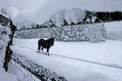
© Toby Talbot, APA horse is seen through a snow-covered fence in a pasture in Calais, Vt., Wednesday, April 28. A spring snowstorm dumped 12 to 18 inches of snow in some areas of Vermont, according to the National Weather Service.
Montpelier, Vermont - A late-season snowstorm dumped up to 2 feet of heavy, wet snow on northern New York, Vermont and New Hampshire by Wednesday morning, cutting off power to thousands, closing some schools and leaving roads slippery.

"It definitely caught people off guard, considering we had 80 degrees back in March. It's a problem because some people swapped their (snow) tires out already," said Vermont highway dispatcher Greg Fox.

About 30,000 customers were without power in Vermont, New Hampshire and northern New York at 8:30 a.m. Wednesday. Utility officials said it could be Thursday before power is fully restored.

"We've been hammered all night," said New York State Police Trooper Eric LaValley of the Ray Brook barracks, in the Adirondack Mountains.

Large storms so late in the season are rare. On April 23, 1993, 22 inches of snow was reported in Malone, N.Y., and on April 27, 1874, 24 inches of snow was reported in Bellows Falls, Vt., said Mark Breen, the senior meteorologist at the Fairbanks Museum and Planetarium in St. Johnsbury.

Attention

Hail, sleet and snow slams southern California

Image
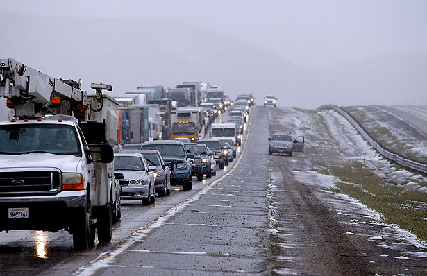
© Kirk McKoy / Los Angeles TimesNorthbound Interstate 5 is gridlocked as inclement weather conditions shut down parts of the freeway Thursday morning.
High winds, low temperatures and snow in some mountain areas forced closure of Interstate 5 over the Grapevine on Thursday morning as forecasters warned of gusts of up to 50 mph in parts of Southern California.

[Update at 10:45 a.m.: As of 9:30 a.m., lanes in both directions of Interstate 5 were reopened to traffic.]

Shortly after 7:30 a.m., the California Highway Patrol closed the southbound lanes of Interstate 5, and then about 8:15 a.m. shut down the northbound lanes at Vista del Lago.

"We've got icy roadway, hail, snow, black ice. You name it, it's up there," said CHP Officer Robert Rodriguez.

Officers were called out on about 20 crashes on the northern slope of the Grapevine early Thursday, including one in which a car ran into the back of a big rig, Rodriguez said. One motorist suffered moderate injuries.

Bad Guys

Whistleblower: BP Risks More Massive Catastrophes in Gulf

Image
© Jared Rodriguez / t r u t h o u t; Adapted: futureatlas.com, US Coast Guard
A former contractor who worked for British Petroleum (BP) claims the oil conglomerate broke federal laws and violated its own internal procedures by failing to maintain crucial safety and engineering documents related to one of the firms other deepwater production projects in the Gulf of Mexico, according to internal emails and other documents obtained by Truthout.

The whistleblower, whose name has been withheld at the person's request because the whistleblower still works in the oil industry and fears retaliation, first raised concerns about safety issues related to BP Atlantis, the world's largest and deepest semi-submersible oil and natural gas platform, located about 200 miles south of New Orleans, in November 2008. Atlantis, which began production in October 2007, has the capacity to produce about 8.4 million gallons of oil and 180 million cubic feet of natural gas per day.

Bizarro Earth

US government fears Deepwater Horizon well could become unchecked gusher

Image
© AP Photo/Pablo Martinez MonsivaisHomeland Security Secretary Janet Napolitano uses a map of the Gulf of Mexico during the daily press briefing at the White House in Washington, Thursday, April 29, 2010. A leaked memorandum obtained by the Press-Register on the unfolding spill disaster in the Gulf makes clear the Coast Guard now fears the Deepwater Horizon well site could be on the verge of becoming an unchecked gusher shooting millions of gallons of oil per day into the Gulf.
A confidential government report on the unfolding spill disaster in the Gulf makes clear the Coast Guard now fears the well could become an unchecked gusher shooting millions of gallons of oil per day into the Gulf.

"The following is not public," reads the National Oceanic and Atmospheric Administration's Emergency Response document dated April 28. "Two additional release points were found today in the tangled riser. If the riser pipe deteriorates further, the flow could become unchecked resulting in a release volume an order of magnitude higher than previously thought."

Asked Friday to comment on the document, NOAA spokesman Scott Smullen said that the additional leaks described were reported to the public late Wednesday night. Regarding the possibility of the spill becoming an order of magnitude larger, Smullen said, "I'm letting the document you have speak for itself."

In scientific circles, an order of magnitude means something is 10 times larger. In this case, an order of magnitude higher would mean the volume of oil coming from the well could be 10 times higher than the 5,000 barrels a day coming out now. That would mean 50,000 barrels a day, or 2.1 million gallons a day. It appears the new leaks mentioned in the Wednesday release are the leaks reported to the public late Wednesday night.

"There is no official change in the volume released but the USCG is no longer stating that the release rate is 1,000 barrels a day," continues the document, referred to as report No. 12. "Instead they are saying that they are preparing for a worst-case release and bringing all assets to bear."

The emergency document also states that the spill has grown in size so quickly that only 1 to 2 percent of it has been sprayed with dispersants.

Bizarro Earth

So Big It's Visible From Space - Gulf of Mexico Oil Spill

Over the weekend, BP's oil spill in the Gulf of Mexico more than tripled in size to 4000+ square miles--about the same size as Chesapeake Bay. The slick is so big, it is visible from space:

Image
© NASA
NASA's Terra satellite captured this natural-color image of the expanding slick near the Mississippi Delta on May 1st. The outskirts of the spill are now reaching sensitive Gulf shore wetlands where the ecological impact could be severe. According to some estimates, as much as 210,000 gallons of crude oil a day are leaking into the Gulf, so the slick is only going to grow larger. Satellite images of Earth are usually beautiful. This is a rare exception. Check NASA's Earth Observatory for updates from orbit.

Eye 2

Mother of all gushers could kill Earth's oceans

mexico oil well blowout
© Unknown
Imagine a pipe 5 feet wide spewing crude oil like a fire hose from what could be the planets' largest, high-pressure oil and gas reserve. With the best technology available to man, the Deepwater Horizon rig popped a hole into that reserve and was overwhelmed. If this isn't contained, it could poison all the oceans of the world.
"Well if you say the fire hose has a 70,000 psi pump on the other end yes! No comparison here. The volume out rises geometrically with pressure. Its a squares function. Two times the pressure is 4 times the push. The Alaska pipeline is 4 feet in diameter and pushes with a lot less pressure. This situation in the Gulf of Mexico is stunning dangerous." -- Paul Noel (May 2, 2010)
Last night we received the following text in an email, author not identified. I passed it by Paul Noel, who is an expert in the field. His response follows thereafter. In calculating the gallons required to kill the oceans, remember that oil goes to the surface, where life is concentrated.
Comment: Cure a disaster with another disaster? Things are rapidly spinning out of control. Or not. What further clamp-downs and controls will this event spawn?


MIB

C'mon, How Big is the Gulf of Mexico Oil Spill, Really?

gulf oil spill boat
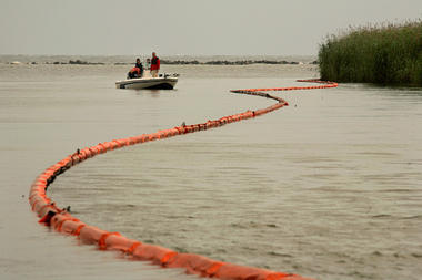
© NewscomA boat drifts along one of the booms placed to block oil at the mouth of the Southeast Pass of the Mississippi River near Venice, Louisiana, where it enters the Gulf of Mexico.
Official estimates for the flow of oil out of the Deepwater Horizon well may be just a drop in the bucket. Critics call for release of worst-case scenario data to describe the oil spill disaster.

Calculating the exact flow of crude out of the bent Deepwater Horizon oil rig "riser" pipe on the bottom of the Gulf of Mexico is difficult. But it's now likely that the actual amount of the oil spill dwarfs the Coast Guard's figure of 5,000 barrels, or 210,000 gallons, a day.

Independent scientists estimate that the renegade wellhead at the bottom of the Gulf could be spewing up to 25,000 barrels a day. If chokeholds on the riser pipe break down further, up to 50,000 barrels a day could be released, according to a National Oceanic and Atmospheric Administration memo obtained by the Mobile, Ala., Press-Register.

Cloud Lightning

Update: Violent storms kill 11 in US Tennessee

Image
A car is stranded on a flooded street in Nashville, Tennessee.
Heavy thunderstorms and flooding have struck the US state of Tennessee, leaving at least eleven people dead and prompting major evacuations.

The unrelenting downpours, which continue to fall after 24 hours, have lifted levels of the Cumberland River in Nashville.

This has led to the closure of inter-state highways and caused dam failures.

The rains have also left some 36,000 houses without power.

The Tennessee Emergency Management Agency has asked the state's Army National Guard for assistance in rescue operations.