Earth Changes
Burundi's Ministry of Public Safety and Disaster Management said in a statement on 05 December that the landslide occurred in Nyempundu, Gikomero and Rukombe in Nyamakarabo zone, Mugina commune in Cibitoke province. Provisional assessments say that 26 people have died, 07 were injured and 10 people are still missing. Some media reports say the death toll has since climbed to 38. Search operations are still in progress. The Ministry said that houses, crops and livestock have also been damaged.
Heavy rain fell between 04 and 05 December, 2019. Images show that complete hillsides have fallen away in several locations. The area is still extremely unstable and the governor of Cibitoke, Joseph Iteriteka, urged people living in affected locations to evacuate their homes until further notice.
In keeping with the pattern of recent years, winter arrived early again in many parts of the Northern Hemisphere, disrupting normal life and food production. The US saw new cold and snowfall records over much of its territory, even as 'Extinction Rebellion' zealots demanded further man-made CO2 reductions to 'save the planet from overheating'. Exceptional snowfalls and early freezing temperatures also left their mark in Europe, and parts of Africa, Asia, and the Middle East.
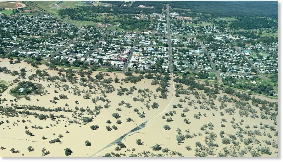
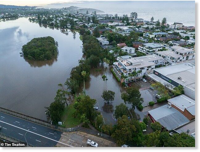
Heavy rain, floods, and landslides also wreaked havoc this month, with South Sudan, Kenya, Congo, Algeria, the UK, France, the Philippines, Australia, and northern Mexico all affected by hundreds of deaths, thousands displaced and significant damage to local infrastructure. Italy was hit once again by extreme weather this month: storms, floods, and early snow left a path of destruction across several provinces.
Our viewers will not be surprised to learn that a significant number of meteor fireballs and unexpected NEOs also made an appearance in our skies last month, shocking and delighting many eyewitnesses and leaving many experts wondering whether their claim that they can track all dangerous NEOs is really just 'pie in the sky'.
All that and more in this month's SOTT Earth Changes Summary...
Here is today's NASA MODIS AQUA satellite image of the West Indian Ocean - a pretty wild image of 5 tropical system simultaneously ongoing, making the Indian Ocean pretty busy from now on.
For those who dub this a conspiracy theory, please refer to the United States patent-4686605 which is valid evidence that the U.S. government is experimenting with the weather by altering regions in the Earth's atmosphere, ionosphere, and the magnetosphere.
The very essentials needed to sustain life on earth are being carelessly destroyed by such programs. This is not a topic that will affect us in several years because it is negatively impacting us right now.
Former Chairman Bart Gordon from the Committee on Science and Technology of the U.S. House of Representatives released a 50-page report in 2010 titled "Engineering the Climate."
"It is important to acknowledge that climate engineering carries with it not only possible benefits, but also an enormous range of uncertainties, ethical and political concerns, and the potential for harmful environmental and economic side-effects," the report states.
In short, the large-scale deployment of climate control may benefit certain populations at the expense of others.

Landslide in Eastern Uganda, December 2019.
Meanwhile in Sironko, the Red Cross says that landslides and flooding have affected Zesui, Masaba Sub County, Budadiri town council and Busulani, Bumumulo Parish. As of late 04 December, 5 deaths were reported and over 200 people were displaced.
Some of the snow totals are mind boggling for early December.
Obviously the highest snow totals have been posted across the Upper Peninsula. Much of the northern half of the U.P. has received at least 2 feet of snow already. The highest seasonal snow total I've found is Chatham, MI, which is between Marquette and Munising and 10 miles from the Lake Superior shoreline. Chatham has already tallied 58.6 inches of snow.
Here's a map showing the snow totals so far this season. I hesitate to use the word "winter" because meteorological winter just started Dec. 1 and astronomical winter doesn't start until around Dec. 21.

Enjoying the late-evening sky over the Southern Ocean just after 23.00 local time with the Sun 15° below the horizon. Some wispy blue-ish clouds low on the southern horizon were quite an unusual sight. They appeared to be high in altitude and very distant. Whether these were actual NLCs, I do not know. It would be an unusual sighting at this latitude.
"This is a clear sign of planetary wave activity," says AIM principal investigator James Russell of Hampton University, which manages the Aeronomy of Ice in the Mesosphere mission for NASA.
Planetary waves are enormous ripples of temperature and pressure that form in Earth's atmosphere in response to Coriolis forces. In this case, a 5-day planetary wave is boosting noctilucent clouds over Antarctica and causing them to spin outward to latitudes where NLCs are rarely seen.
Comment: Could this drift to lower latitudes have something to do with the "grand" solar minimum? Could it be related to the increasingly meandering jet stream? And perhaps also pronounced due to the increased loading of the atmosphere with meteor particulates? See:
- Gulf Stream is 15% weaker, region south of Greenland coldest in 1,000 years
- Scientists say a fluctuating jet stream may be causing extreme weather events
- Professor Valentina Zharkova explains and confirms why a "Super" Grand Solar Minimum is upon us
- Michigan Meteor Event: Fireball Numbers Increased Again in 2017
- Adapt 2030 Ice Age Report: Interview with Laura Knight-Jadczyk and Pierre Lescaudron
- Behind the Headlines: Earth changes in an electric universe: Is climate change really man-made?
- Behind the Headlines: The Electric Universe - An interview with Wallace Thornhill
A brutal Antarctica air-mass blasted southeastern Australia during the opening days of summer, pumping deep snow into parts of Tasmania, Victoria and NSW, as well as limiting temperatures to as much as 15C below the seasonal average.
On Tuesday, December 03, Thredbo Top Station's highest recording was a mere -1.0C (30.2F) — this was Australia's lowest summer daily maximum temperature of all time, busting the -0.8C (30.6F) measured at Mount Buller on Dec 25, 2006 (approaching the historically deep solar minimum of cycle 23).
Furthermore, an overnight low of -4.0C (24.8F) was observed at Tasmania's Mount Wellington early Wednesday morning, Australia's lowest summer temperature in four years.
Sources
Comment: