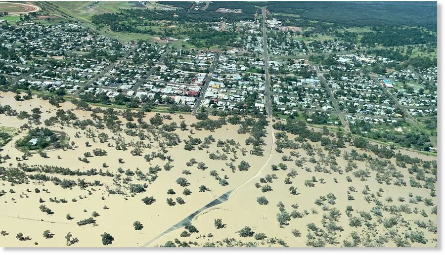
According to the Bureau of Meteorology, the Warrego River gauge near Bakers Bend, in south-west Queensland, recorded a peak of 10.16m on Monday morning.
Source: Katrina Lehmann | Murweh Shire Council

Today as never before we need to comprehend the course, logic, and path of the process of history. Every day we need to make decisions that will affect future generations. It has become obvious that no single nation, confession, social class or even civilization can solve these problems on its own. We increasingly have to listen to one another: Europe and Asia, Christians and Muslims, White and Black peoples, citizens of modern democratic states and places where traditional society survives. The key is to understand one another correctly, avoid hasty conclusions, and acquire the true spirit of tolerance and respect toward those with different value systems, habits, and norms.
How naive? They(Russia) think that they are on the right side ( in spite of the fact that the west has not been a force for good as well), after...
I'd tell him to go to hell but he should be arriving long before that.
Main Stream Politics = Social security for the elite.
Zelensky: Star spangled beggar.
Tell us something all the many readers here don't already know. Not every reader mind ya - but still - what is the point of telling what is...
To submit an article for publication, see our Submission Guidelines
Reader comments do not necessarily reflect the views of the volunteers, editors, and directors of SOTT.net or the Quantum Future Group.
Some icons on this site were created by: Afterglow, Aha-Soft, AntialiasFactory, artdesigner.lv, Artura, DailyOverview, Everaldo, GraphicsFuel, IconFactory, Iconka, IconShock, Icons-Land, i-love-icons, KDE-look.org, Klukeart, mugenb16, Map Icons Collection, PetshopBoxStudio, VisualPharm, wbeiruti, WebIconset
Powered by PikaJS 🐁 and In·Site
Original content © 2002-2024 by Sott.net/Signs of the Times. See: FAIR USE NOTICE
Oh I just noticed its from that bastion of truth, The Guardian. In other words this story is not much more than click bait!