Earth Changes
Froilanis Maireth Rivas Roman, 34, was caught in a thunderstorm on the beach and was struck by lightning as she walked in the Caribbean surf. CCTV footage shows the horrifying moment when Froilanis was hit by a massive electric flash and instantly fell to the ground.
Another beach-goer nearby also felt the shock but seemed to escape the full force of the strike. Shocking phone footage taken by stunned beachgoers shows hairdresser Froilanis lying flat on her back as the sea surrounds her.

Went out stargazing and it was bright out - I could see things clearly in the "darkness". The previous night's SQM read 21.3 mpsas under clear skies, tonight it was reading below 21.0 under equally as clear skies. SQM Readings of less than 21.0 mpsas on a clear night in my location is quite anomalous. The 20 second Nikon D750 exposure revealed the strong green airglow in all directions. It had a flat color density - there were no ripples. There were also no thunderstorms or lighting anywhere near the region. Interestingly, the views through the 12" dob telescope were still quite clear and enjoyable despite the bright sky quality, though the contrast was adversely affected.
A phenomenon rarely seen in centuries might have just appeared in the night sky over Colorado--a "Bright Night." Philosophers and scientists have reported Bright Nights for literally thousands of years. It's when an otherwise dark and moonless night fills with a soft glow, allowing observers to see distant mountains or read a newspaper. Pliny the Elder, an Army commander in ancient Rome, described the phenomenon as a "nocturnal sun" (~ 113 BCE).
Comment: Pliny may, or may not, have been describing airglow: The Cosmic Context of Greek Philosophy, Part One
In the modern world, Bright Nights are seldom seen. Most of our planet's human population lives in cities, and even rural landscapes are somewhat lit by distant urban bulbs. The "nocturnal sun" has been overwhelmed.
Or has it? Enter Aaron Watson, an experienced night-sky photographer who regularly visits the darkest of dark-sky sites in remote parts of Colorado. On multiple occasions this year he has photographed red auroras and green airglow invisible from any ordinary countryside. Last month, he was at one of his favorite inky-dark sites when he may have experienced a modern Bright Night.
Comment: Whilst solar activity may be contributing to the appearance of airglow, if that was solely the cause, then it would have been documented during the previous solar maximum. Instead, it seems that this can be added to the growing list of previously rare, unusual, and even new phenomena that signals an unprecedented shift is occurring on our planet - and throughout our solar system:
- Rare blue jet atmospheric phenomenon photographed over Texas, several sighted in one night
- Cosmic climate change: 'Space plasma hurricane' observed in ionosphere above North Pole!
- Behind the Headlines: Earth changes in an electric universe: Is climate change really man-made?
- MindMatters: The Holy Grail, Comets, Earth Changes and Randall Carlson
- Behind the Headlines: The Electric Universe - An interview with Wallace Thornhill
Snowpack extent in US reaches record levels!
America's first Arctic air blast of the season broke hundreds of low temperature records and led to the largest snowpack extent there in early November in NOAA records.
A high snowpack blanketed the Rocky Mountains, northern Plains, Great Lakes and northern New England, resulting in 17.9% of the Lower 48 under a blanket of snow as the calendar turned to November - a new record in the books dating back to 2003.
Many places recorded their snowiest Halloweens ever.
At 22 inches, Muskegon, MI, not only recorded the snowiest Halloween ever, but also the snowiest October day and month. Glasgow, MT, recorded the snowiest start to the season with 36 inches.
The cold broke hundreds of low temperature records across the country, from Texas to Maine, dropping the average temperature in the Lower 48 to -0.5°C - more than 5 degrees Celsius below normal.
In a paper published by the American Meteorological Society, a group of international scientists note the "statistically significant" rate of temperature decline with the strongest cooling occurring in spring. During this season, the temperature fell by a massive 1.84°C every decade between 1999-2018. In the winter, the decadal fall was 1.19°C. The cooling was measured by a number of databases, while an accurate consistent record was collected from the Marie Byrd weather station. Despite some differences in cooling, all the databases are said to have shared similar changes across seasons and throughout the region. The graph below plots the temperature record at Marie Byrd back to the 1950s.
Comment: See also:
- Quantity of sea ice in Arctic takes 2 Russian oil tankers by surprise, deliveries delayed
- New study destroys 'doomsday glacier' narrative: Today's ice 8 times THICKER than last 8000 years
- Arctic was warmer, ice-free in summertime 10,000 years ago, Aarhus University study finds
- Antarctica suffers coldest August since 2002, planes grounded due to extreme freeze
- BBC goes into Antarctica climate meltdown - but ignores data showing no loss of ice
- Scientists struggle to understand why Antarctica hasn't warmed for over 70 years despite rise in CO2
According to the Jefferson County Coroner, 63-year-old Sharon Portis was found lying on the ground last Thursday morning on 18th St. Ensley after she was killed in a dog attack. Birmingham police say there is no threat to the public after the incident.
Portis's family says she was leaving for work when she was attacked. They added that she did not live far away and that the attack happened maybe 100 yards away. Family members say they have unanswered questions.
"I don't see her walking into an area there that she was well familiar with and knowing what was lurking behind the bushes, in the darkness," said Albert Ford, Portis's brother. "She's walking, or biking, or whatever the route she normally takes, and she's attacked by dogs."
The hailstorm followed after a thunderstorm hit the city late afternoon. Hailstones the size of a golf-ball came down from the dark skies. Numerous cars and buildings were damaged as a result of mother nature's wrath.
Joburg Emergency Services say they remain on high alert as storms are expected Today. Robert Mulaudzi from Joburg EMS says mostly affected areas in the city are Braamfontein, Midrand, Sandton, Paulshof and the metro at large.
"From our side as the City of Johannesburg Emergency Management Services, we remain on high alert throughout the day monitoring all seven regions of the city so that we can be able to respond to all emergencies which are reported through our emergency call centre," Mulaudzi explained.
According to the US agency, the earthquake, with its epicenter in the southern Indian Ocean, struck at around 0700GMT.
Its depth was recorded at nearly 10 kilometers (6.2 miles).
The earthquake came days after a major earthquake of 6.4 magnitude hit the South Asian nation of Nepal. Around 150 people were killed following the strong tremor in the landlocked Himalayan nation.
Authorities in Iceland have declared a state of emergency as the threat of an "imminent" volcanic eruption which "could obliterate the entire town of Grindavik" loomed.
The Icelandic Met Office experts have said a volcanic eruption could last 'for weeks' as 30,000 earthquakes have been recorded since seismic activity began three weeks ago.
Matthew James Roberts, managing director of the service and research division at the Iceland Met Office, told Radio 4's Today Programme: "This would be a lava-producing volcanic eruption along a series of fissures and that would be the main hazard.
"Blowing lava an eruption that persists for weeks possible and that means roads and other forms of infrastructure could be eventually in harm's way."
Photos posted on social media show cars submerged up to their headlights parked near the seafront in the town.
The images were shared by Carlow Weather, who posted this morning that "Official stations show top gusts from Storm Debi was 113kmh at Knock Airport."
"Photos from Salthill in Galway by Neasa Conneally show cars flooded on the prom. Who parks their car there during Storm Debi?
As the volcanic clouds created by the explosions in the mountain have reached an inestimable height, the National Institute of Geophysics and Volcanology (INGV) issued a red code for aviation, noted the public broadcaster Rainews.
INGV announced that a network of surveillance cameras had revealed an increase in Strombolian activity at the southeast crater, accompanied by a lava overflow from the southeast saddle.
From the forecast model of volcanic ash dispersal, the simulation of the eventual dispersion of the volcanic plume indicates an east-southeast direction, it added.
Mount Etna, 3,357 meters (11,014 feet) in height, is one of the world's most active volcanoes and is in an almost constant state of activity.
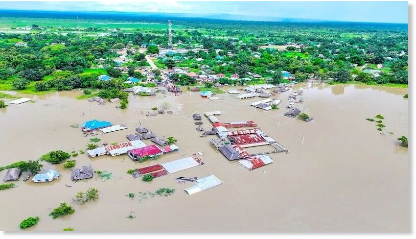
Comment: Also recently an individual and 27 cattle were killed by lightning in two separate incidents in Tanzania on November 15.