Extreme Temperatures
A strong storm will affect the Northwest this weekend with gusty winds, heavy low-elevation rain and high-elevation snow.
A second storm will roll ashore on Tuesday with falling snow levels in the Northwest and heavy snow farther inland in the West.
Northwest Storm to Unleash Heavy Rain, Strong Winds This Weekend
According to AccuWeather Meteorologist Brian Lada, "The worst conditions this weekend will hit from the Cascades to the Pacific coast."
A general 4-8 inches (100 to 200 mm) of rain will fall from the upper Oregon coast to Washington's Olympic Peninsula and the southwestern part of Vancouver Island, British Columbia.
A general 2-4 inches of rain are forecast along Interstate 5, from Eugene and Portland, Oregon, to Seattle and Tacoma, Washington. Similar rainfall with locally higher amounts are possible along the west-facing slopes of the Cascades in Oregon and Washington.
Enough rain will fall to raise the risk of mudslides and flash and urban flooding. Small stream flooding is possible due to melting snow and heavy rain on the intermediate elevations of the Cascades.
Gusty winds will accompany the heavy rain, raising the potential for flight delays and localized power outages.
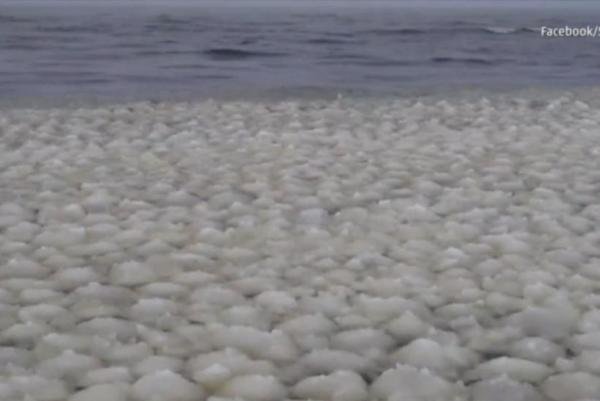
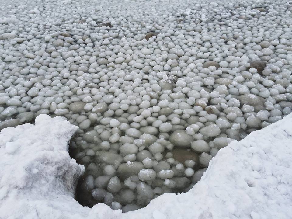
"Ice pancakes" made out of frozen foam have been forming on the River Dee in Aberdeenshire.
The discs, which are roughly the size of dinner plates, were photographed on the Scottish river at Lummels Pool, in Birse.
They are thought to have been formed overnight, when temperatures fall to below freezing, before they rub and bump together to make a roughly circular shape, as temperatures rise during the day.
The phenomenon can happen on rivers or the open sea, but is more usually spotted in the Antarctic, according to experts from the River Dee Trust who made the discovery.
Comment: The BBC host thinks this is a good sight to see. But why are we observing a common Antarctic phenomenon in the UK?
This GFS forecast model for Christmas Day shows the depth of the low, poised to gather moisture from the Great Lakes and dump it into the Northeastern U.S. over the next 24-48 hours, potentially making Christmas and post-Christmas travel a nightmare, but ... there is a twist.
Dr. Maue adds on his Twitter feed:
Exciting to see extreme weather forecasts with an item that requires dusting off the record books. 958 mb lowFor reference, a 958 millibar low pressure system is as low as the central pressure for some tropical storms and nearly that of some hurricanes. For example Hurricane Sandy had a central pressure of 940 mbar or 27.76 inHg.
Total sea ice extent on the northern hemisphere since 2005. The ice extent values are calculated from the ice type data from the Ocean and Sea Ice, Satellite Application Facility (OSISAF), where areas with ice concentration higher than 30% are classified as ice.
The total area of sea ice is the sum of First Year Ice (FYI), Multi Year Ice (MYI) and the area of ambiguous ice types, from the OSISAF ice type product. However, the total estimated ice area is underestimated due to unclassified coastal regions where mixed land/sea pixels confuse the applied ice type algorithm. The shown sea ice extent values are therefore recommended be used qualitatively in relation to ice extent values from other years shown in the figure. In late 2012 sea ice climatology and anomaly data will be available here.
COI | Centre for Ocean and Ice | Danmarks Meteorologiske Institut
Comment: Oops! The Arctic sea ice is holding up to global warming better than anyone expected.
Ice age cometh: No warming left to deny... Global cooling takes over... CET annual mean temperature plunges 1°C since 2000
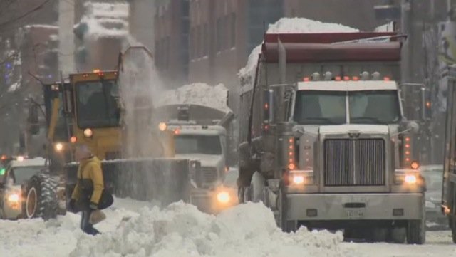
Some 1,350 passengers found themselves spending the night on trains stranded in Japan's northern Niigata Prefecture on Sunday, according to The Japan Times.
The trains were stranded by a power outage resulting from heavy snowstorms.
Comment: Temperatures have been declining for the past 16 years and it looks like that is going to continue, so we will probably be seeing much more of the above scenarios.
30 leading scientists predict global cooling
Average global atmospheric and oceanic temperatures will drop significantly beginning between 2015 and 2016 and will continue with only temporary reversals until they stabilize during a long cold temperature base lasting most of the 2030's and 2040's. The bottom of the next global cold climate caused by a "solar hibernation" (a pronounced reduction in warming energy coming from the Sun) is expected to be reached by the year 2031.
The predicted temperature decline will continue for the next fifteen years and will likely be the steepest ever recorded in human history, discounting past short-duration volcanic events.
Global average temperatures during the 2030's will reach a level of at least 1.5° C lower.

Paleontology student Hillary McLean pieces together a tusk of an ancient mastodon, part of an extensive discovery unearthed from Snowmass, Colo., inside a workroom at the Denver Museum of Nature and Science.
"To think of scattered populations of Ice Age people with primitive technology driving huge animals to extinction, to me is almost silly," said Grant Zazula, chief paleontologist for the Yukon Territory and the study's lead author.
"It's not human nature just to see everything in your path and want to kill it," he said.
The paper, published this week in the Proceedings of the National Academy of Sciences, carbon dated 36 mastodon bones from across Canada and the United States.
A strengthening storm along the mid-Atlantic coast will push northward on Tuesday, then inland Tuesday night through Thursday.
According to AccuWeather Chief Meteorologist Elliot Abrams, "This will be a snowstorm for some areas well inland, while impacts similar to a tropical storm will occur along the coast, including much of Interstate-95."
Heavy Interior Snow
The heaviest snow, a general 6 to 12 inches is forecast to fall on the Endless, Catskill and Adirondack mountains. Locally higher amounts can occur.
While the snow will be welcome by those with skiing interests, travel will become extremely treacherous and AccuWeather.com Meteorologist Ben Noll stated that the "wet-clinging nature of the snow could lead to downed trees and power outages."
Now, a scientist thinks she may have uncovered the answer.
Cecilia Bitz, an atmospheric scientist from the University of Washington in Seattle, believes that oceanic currents are taking heat away from Antarctica and carrying it north, reports the Sunday Times.
During November alone, North America had its most extensive snow cover on record, the Lower 48 had its most extensive snow cover on record, and Canada had its second most extensive snow cover on record,
Not unexpectedly, The Washington Post goes to great lengths to explain why snow cover can increase in a warming world.
Thanks to Jason Cragg for this link
Comment: Superbomb winter storm predicted for Northeastern U.S. at Christmas