Earthquakes
S


Attention

Earthquake swarm hits Morocco's northern region

Earthquake in Morocco
© Moroccan TimesIn the last couple of days, the north region of Morocco, including the southern one of Spain, witnessed recurrent earthquakes.

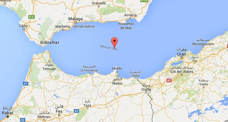
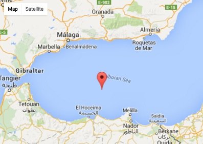
Comment: Another magnitude 5.6 earthquake hit the area today, 63km NNE of Al Hoceima, Morocco.
5.6 earthquake in Morocco
© Google Maps

A sequences of earthquakes stroke this afternoon the northern region of Morocco, with their respective magnitudes averaging from magnitude 3 to 5.2.

The quake's epicenter was 51kms North East of Al Hoceima, Morocco.

The first strike was registered at 15:17:11.80 local time.

At the time of writing, no damage was reported.

In the last couple of days, the north region of Morocco, including the southern one of Spain, witnessed recurrent earthquakes.

As a matter of fact, just two days ago, in the wee hours of the morning, a magnitude 4.4 tumbler hit the same region.
Bizarro Earth

Strong tremor strikes off Atka Island, southwest Alaska

Atka Island Earthquake
© USGS
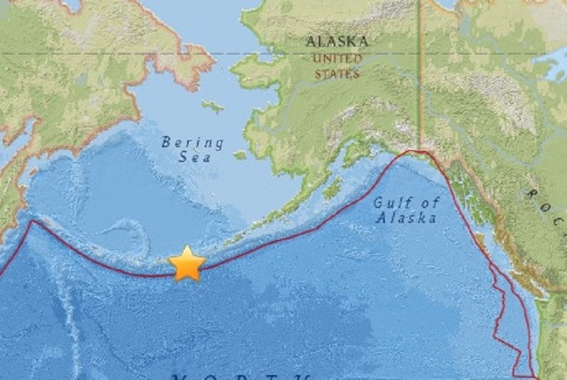
A strong earthquake with a preliminary magnitude of 6.4 has struck off Atka Island in the Andreanof Islands, which are part of the Aleutian Islands in southwest Alaska, seismologists say. No tsunami alerts have been issued.

The earthquake, which struck at 9:06 a.m. local time on Saturday, was centered about 51 miles (82 km) south of Atka, which is a small town located on the eastern side of Atka Island. It struck about 19.9 miles (32 km) deep, making it a shallow earthquake.

The U.S. Tsunami Warning Center said the earthquake was not strong enough to generate a tsunami, and no tsunami alerts have been issued, but the earthquake was likely felt on islands across the region.

Other details about Saturday's earthquake were not immediately available, and there were no immediate reports of damage or casualties from the sparsely-populated region.

Tornado1

Best of the Web: Signs of Change: Earth changes, extreme weather, and meteor fireballs in January and February 2016

Hawkkey Davis
© Hawkkey Davis, YouTube
Warning: This video contains graphic content - Viewer discretion advised.

Hawkkey Davis is back with another documentary of extreme weather, earth changes, and meteor fireball events from around the world in the first two months of 2016. This series does not mean to suggest that the world is ending, but that what is happening across the world is leading to bigger 'earth changes'.

If you're following the series, then you're seeing the signs. It's much more than one video; check out previous installments here.


Alarm Clock

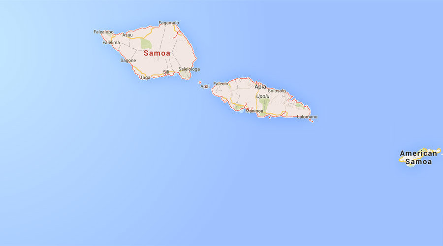
6.2 magnitude earthquake strikes off Samoa

Samoa map
A 6.2 magnitude earthquake has struck off the Samoa islands, Geoscience Australia and the US Geological Survey (USGS) reported, adding that the epicenter of the quake is about 200km from Apia, the capital and largest city of the island country.

Apia has about 37,000 residents.

The earthquake depth is 29.8 km, USGS said. The European-Mediterranean Seismological Centre (EMSC) put the depth of the earthquake at 2km.


According to the most recent USGS estimate, the magnitude of the quake is 5.8 and it took place just 96km from the town of Hihifo in Tonga.

There have not been any reports of injuries or damage, and no tsunami warning has been issued.

The part of South Pacific Ocean where Tonga and Samoa are located is considered to be one of the most seismically active areas of the world due to high rates of convergence between the Australia and Pacific plates, the USGS said.

Bizarro Earth

Massive shift in Alpine Fault in New Zealand

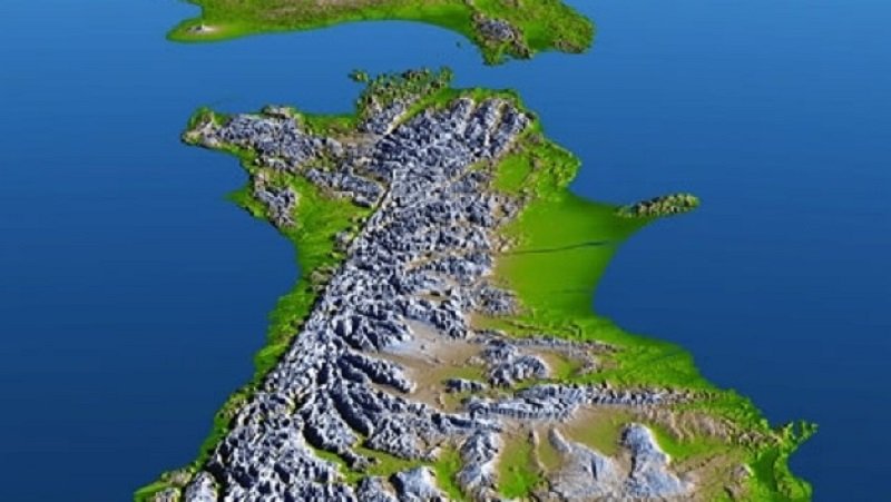
Alpine Fault
© GNS ScienceThe Alpine Fault, which runs up the spine of the South Island, has ruptured five times in the past 1100 years - producing an earthquake of between magnitude 7 and 8 each time.
The Alpine Fault has moved much more than previously thought, and more than any other known fault on land in the world, new research shows.

In the past 25 million years, the two sides of the South Island have shifted more than 700 kilometres relative to each other along the Alpine Fault. That is 250km more than previously thought.

The full extent of the movement was masked because the rocks first moved 250km in one direction, then went back the other way - retracing the first 250km and adding a further 450km.

GNS Science earthquake geologist Robert Langridge has been studying why the Alpine Fault is so susceptible to earthquakes - it's since been discovered that it may be the world's fastest-moving known fault line.

The extent of the movement was worked out by researchers from Victoria University and GNS Science, with the findings published in the American Geophysical Union journal G-Cubed.

Bizarro Earth

Earthquake 'shook houses' in south-east England

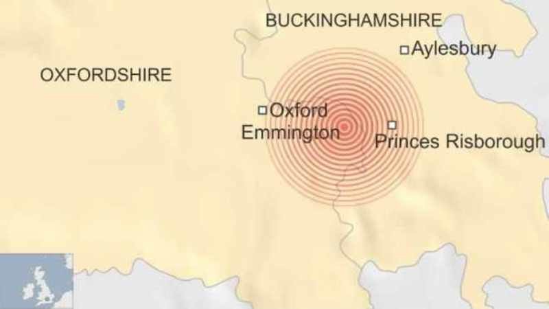
Oxfordshire-Buckinghamshire earthquake
The earthquake at was centred near the Oxfordshire-Buckinghamshire border
An earthquake with a magnitude of 2.3 has been recorded in Oxfordshire, the British Geological Survey (BGS) has confirmed.

Residents in Chinnor and Thame as well as Princes Risborough, Aylesbury and Bledlow in Buckinghamshire reported feeling shaking late on Sunday.

The BGS said the earthquake, centred on the village of Emmington, happened at 23:11 GMT.

Seismologist Glen Ford said: "The fact it was noticed makes it a bit special."

Alarm Clock

Magnitude 4.7 earthquake recorded off Vancouver Island

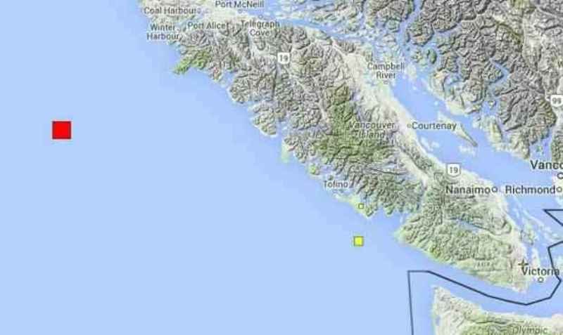
Vancouver Island earthquake
© PNSN
A magnitude 4.7 earthquake was detected off the west coast of Vancouver Island this morning.

According to the United States Geological Survey, the tremor hit at 10:38 a.m. PST and had an epicentre 176 kilometres southwest of Port Hardy - near the border of the Explorer and Juan de Fuca plates. It had a depth of 20 kilometres.

No damage can be expected given the location, and a tsunamis warning was not declared.

Thousands of small earthquakes hit B.C. every year, but only a small fraction have a magnitude of 4.0 or greater.

Attention

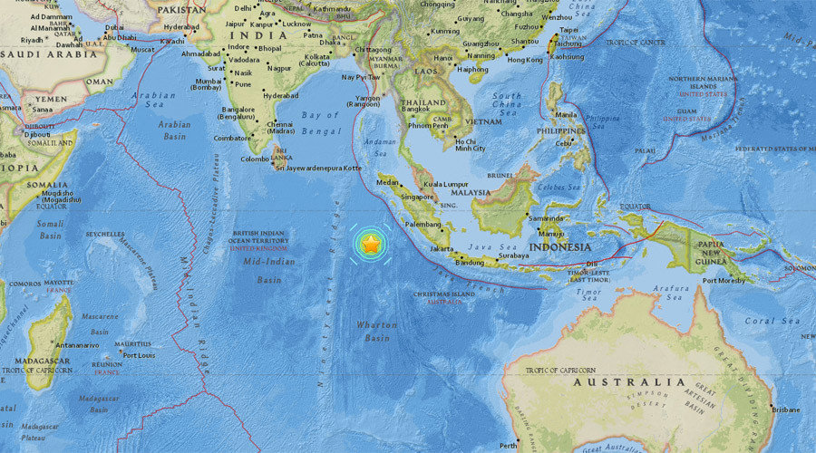
Indonesia issues tsunami warning after 7.9 magnitude earthquake strikes off Sumatra

Indonesia earthquake
© earthquake.usgs.gov
A 7.9 magnitude earthquake has struck off the coast of Indonesia, according to the US Geological Survey (USGS). The country has issued a tsunami warning, the National Meteorolgical Agency reported.

The shallow quake, which hit southwest of the island of Sumatra on Wednesday, had a depth of 10 kilometers (six miles).

The epicenter was located 808 kilometers (502 miles) southwest of Padang.

There were no immediate reports of damage or casualties. However, shallower earthquakes are more likely to cause damage.

The USGS originally categorized the quake as a magnitude 8.2, and later an 8.1, before lowering it to a 7.9.

Indonesia has issued a tsunami warning for West Sumatra, North Sumatra, and Aceh, according to the National Meteorological Agency.

A tsunami watch has also been issued for parts of Western Australia, according to the Joint Australian Tsunami Warning Centre.


Comment: There has also been increased volcanic activity in the region within the last week, as Indonesia's Mount Sinabung erupted twice in one day spewing ash and smoke 3000 meters high


Attention

6,000 emergency and military personnel to conduct Pacific North West megaquake exercise

Earthquake damage
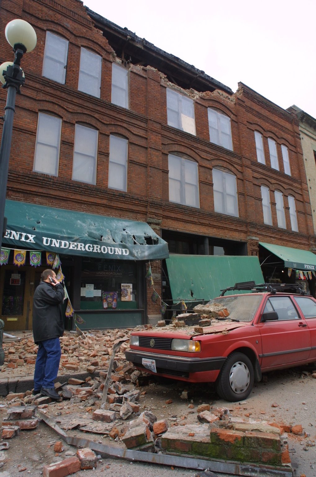
Sunday's 15th anniversary of the Nisqually quake finds FEMA preparing for a June exercise to simulate a much more powerful megaquake and tsunami.

The last damaging earthquake in Washington struck 15 years ago, on Feb. 28, 2001.

The next one is scheduled for June 7.

The ground isn't expected to actually shake this spring. But nearly 6,000 emergency and military personnel will pretend it is during a four-day exercise to test response to a seismic event that will dwarf the 2001 Nisqually quake: A Cascadia megaquake and tsunami.

Called "Cascadia Rising," the exercise will be the biggest ever conducted in the Pacific Northwest. Which is fitting, because a rupture on the offshore fault called the Cascadia Subduction Zone could be the biggest natural disaster in U.S. history.

"It's really going to require the entire nation to respond to an event like this," said Kenneth Murphy, regional director for the Federal Emergency Management Agency, which is coordinating the exercise.

While the Nisqually earthquake measured magnitude 6.8, a Cascadia megaquake is likely to hit magnitude 9 — which is nearly 2,000 times more powerful. It will affect the entire West Coast from British Columbia to Northern California, including Seattle, Portland, Tacoma and Vancouver, B.C. The quake will be closely followed by tsunamis 30 feet high — or bigger — that will slam into oceanfront communities.

Attention

5.9 magnitude earthquake at Western Indian-Antarctic Ridge

earthquake
2016-02-27 21:29:43 UTC

UTC time: Saturday, February 27, 2016 21:29 PM

Your time: 2016-02-27T21:29:43Z

Magnitude Type: mb

USGS page: M 5.9 - Western Indian-Antarctic Ridge

USGS status: Reviewed by a seismologist

Reports from the public: 0 people