Welcome to Sott.net
Fri, 09 Jun 2023
The World for People who Think

Secret History
Map


Blue Planet

Farming came to Africa 7,400 years ago with migrants from Iberia, ancient genomes suggest

Kaf Taht el-Ghar
© Juan Carlos Vera
View of the site Kaf Taht el-Ghar (KTG).
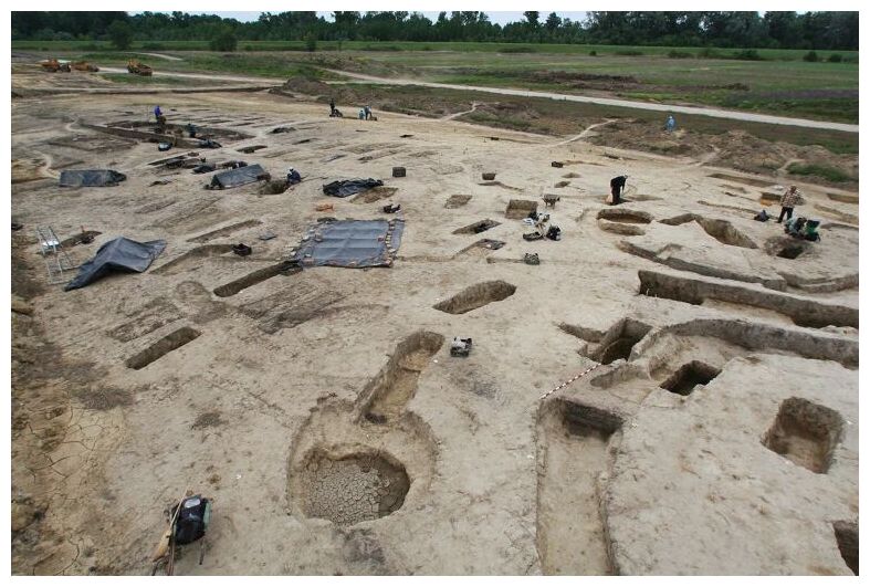
A genomic analysis of ancient human remains from Morocco in northwest Africa revealed that food production was introduced by Neolithic European and Levantine migrants and then adopted by local groups. A research team from Sweden, Spain and Morocco present their results in Nature.

In northwestern Africa, lifestyle transitioned from foraging to farming some 7,400 years ago, but what sparked that change remained unclear. Previous studies support conflicting views: that migrant European Neolithic farmers brought the new way of life to North Africa, or that local hunter-gatherers adopted farming practices.

"We found a remarkable population continuity up until seven and a half thousand years ago in northwestern Africa, where a group of local foragers had been living — isolated — for at least 8,000 years, perhaps since much further back in time," says Professor Mattias Jakobsson, Uppsala University, who led the study.

Comment: See also:


Blue Planet

Mysterious homo naledi species may have been the first to bury their dead

Homo naledi
© JON FOSTER, Nat Geo Image Collection
An Homo naledi group carry one of their dead into Rising Star cave in this artist's depiction. New evidence that these small-brained hominins may have practiced deliberate burial throws a curve into current thinking on human evolution.
An extinct human species that lived hundreds of thousands of years ago may have deliberately buried its dead and carved meaningful symbols deep in a South African cave — advanced behaviors generally deemed unique to Neanderthals and modern Homo sapiens. If confirmed, the burials would be the earliest yet known by at least 100,000 years.

The claims, made today in two research papers uploaded to the preprint server bioRxiv, were also announced by paleoanthropologist Lee Berger at a conference at Stony Brook University in New York.

The publications come eight years after Berger first reported the discovery of a new hominin species inside the Rising Star cave system 25 miles northwest of Johannesburg. Named Homo naledi, the species is characterized by its small size — including a brain roughly a third the size of today's humans — and a baffling mix of very old and relatively modern anatomical features.

Comment: See also: Ancient skull uncovered in China could be million-year-old Homo erectus


Info

3D scans shed new light on mysterious Roman burial practice

Archaeologists in York have used 3D scans to study the Roman burial practice of pouring liquid gypsum over the bodies of adults and children laid to rest in coffins - the first time this cutting-edge technology has been applied to Roman burials of this type anywhere in the world.

3D SCanning
© University of York
A key component of the York project is the 3D scanning of the negative cavities in the gypsum casings.
Researchers say the "unparalleled" 3D images have shed new light on this intriguing and unusual burial practice.

For reasons archaeologists do not entirely understand, the Romans sometimes poured liquid gypsum - a mineral used in making various types of cement and plaster - over the clothed bodies of adults and children in lead or stone coffins before burying them.

As the gypsum hardened around the bodies and they then broke down, a negative cavity formed that preserved the original position and contours of the dead. The imprint of shrouds, clothing, and footwear also survives in the gypsum, providing precious evidence for perishable materials that rarely survive in Roman graves.

Info

Scientists discover 4 new Nazca geoglyphs using AI deep learning

New geoglyphs
© Yamagata University / IBM Japan
Scientists from Japan used AI deep learning to discover new geoglyphs in the Arid Peruvian coastal plain, in the northern part of Peru's Nazca Pampa.

The research has been ongoing since 2004 by a team from Yamagata University, led by Professor Makato Sakai. Yamagata University has been conducting geoglyph distribution surveys using satellite imagery, aerial photography, airborne scanning LiDAR, and drone photography to investigate the vast area of the Nazca Pampa covering more than 390 km2.

The Nazca Lines are thought to have been made over centuries, starting around 100 BC by the Nazca people of modern-day Peru. They were first studied in detail in the 1940s, and by the time they were designated a UNESCO World Heritage Site in 1994, around 30 were identified. They're remarkably well-preserved considering their age, helped by the desert's dry climate and winds that sweep away the sand but are being obscured by floods and human activity.

Archaeologists discovered 142 new designs in the desert over the course of ten years by manually identifying them using aerial photography and on-site surveying. Then, in collaboration with IBM Japan researchers, they used machine learning to search the data for designs that had been missed in previous studies.

Pumpkin

15th century manuscript discovered that records 500 year-old standup comedy routine

manuscript 15th century comedy
© University of Cambridge via SWNS
While this old parchment page may look like one out of a wizard’s spellbook, it’s actually what scholars believe to be the world’s oldest recorded stand-up comedy routine.
In the year 1,480, a household cleric and tutor to a noble family named Richard Heege went to a feast where there was a minstrel performing a three-part act. Heege recorded as much as he could remember, opening with "By me, Richard Heege, because I was at that feast and did not have a drink."

That is illustrative of where the story goes from there — a performance relevant to the humor enjoyed in Britain today, and one which colors the high Middle Ages as a time of artistic liberty, social mobility, and vigorous nightlife.

Heege's booklet contains three texts gleaned from the jester's material: a Hunting of the Hare story featuring a killer rabbit, a mock sermon in prose in which three kings eat so much that 24 bulls explode out of their stomachs and begin sword fighting, and an alliteration nonsense verse entitled The Battle of Brackonwet.

Info

Civilization-tracing project authenticates China's 5,000-year history

Illustration
© Hang Dachuan/Global Times
The study of the origin, formation, development, as well as the characteristics, mechanisms, and traits of Chinese civilization attracts great attention worldwide.

For a long time, some people held a skeptical attitude toward China's 5,000 years of civilization due to a lack of systematic data. Since its launch in 2001, the project to trace the origins of Chinese civilization has made significant achievements in restoring historical truth, countering skepticism, and presenting new evidence from archaeological excavations and scientific research.

The project has demonstrated how China developed its own unique path toward civilization through its unyielding determination and willpower. Studies have shown that around 5,800 years ago, the development in the complexity of prehistoric societies in the middle and lower reaches of the Yellow River and Yangtze River and the west of Liaohe River basin accelerated, showing signs of the origin of civilization. For example, the Hongshan Culture in the west of Liaohe River basin formed a ceremonial and sacrificial center with stone altars, temples, and tombs, showing clear social differentiation and a theocracy-dominated regional civilization.

Starting 5,300 years ago, various regions in ancient China successively formed early states and entered the first stages of civilization. For example, the Liangzhu culture was characterized by mature rice farming, large-scale construction projects, exquisite pottery, jade wares, ivory scepters and textiles. The vast area had common spiritual beliefs, economic forms and a unified society, which formed the centralized social structure and the initial form of a "monarchy state."

Blue Planet

Queen Hetepheres' silver bracelets shed light on trade networks in Ancient Egypt

Hetepheres egypt
© Sowada et al., doi: 10.1016/j.jasrep.2023.103978.
Two silver bracelets of queen Hetepheres.
Silver artifacts first appeared in Egypt during the 4th millennium BCE but the original source then, and in the 3rd millennium, is unknown.

Ancient Egyptian texts don't mention any local sources, but an older view, derived from the presence of gold in silver objects, plus the high silver content of Egyptian gold and electrum, holds that silver was derived from local sources.

An alternative view is that silver was imported to Egypt, possibly via Byblos on the Lebanese coast, owing to many silver objects found in Byblos tombs from the late fourth millennium.

Comment: See also:


Arrow Down

World War II 'horror bunker' run by infamous Unit 731 discovered in China

A bunker discovered near the city of Anda in northeast China is believed to be the largest test site of Imperial Japan's infamous Unit 731, which conducted horrifying human experiments during the 1940s.
Japanese Unit 731
© From History/Universal Images Group via Getty Images
Japanese Unit 731 staff carrying a body from one of the unit's facilities.
Archaeologists in China have uncovered a secret underground bunker used by Japanese scientists to conduct horrific experiments on human subjects during World War II.

The "horror bunker," discovered near the city of Anda in Heilongjiang province, northeast China, was used by the Japanese army's infamous Unit 731 during Japan's occupation of China from 1931 to 1945.

Built by the Japanese in 1941 and running until Japan's surrender at the end of World War II, the lab was Unit 731's largest research site, but its exact location was lost until now. Unit 731 began in 1931 as a Japanese-run public health unit, but it quickly expanded its research to include grotesque biological and chemical warfare experiments using Chinese, Korean, Russian and American captives as test subjects.

Info

2,700-year-old petroglyphs depicting people, ships and animals discovered in Sweden

About 40 ancient rock carvings have been found on a former rocky island in Sweden.
Sweden petroglyphs
© Foundation for Documentation of Bohuslän’s Rock Carvings
The newly found petroglyphs from Sweden include depictions of humans.
On a steep rock face in western Sweden, researchers uncovered a fascinating find: around 40 petroglyphs — depicting ships, people and animal figures — dating back around 2,700 years.

The petroglyphs were carved on a granite rock face that was once part of an island, meaning people would have had to make the carvings while standing on a boat, or from a platform constructed on ice, said Martin Östholm, a project manager with the Foundation for Documentation of Bohuslän's Rock Carvings who is one of the archaeologists who discovered the petroglyphs, told Live Science.
Sweden petroglyphs 1
© Foundation for Documentation of Bohuslän’s Rock Carvings
The petroglyphs are high up on a granite rock face that cannot be climbed, so researchers built a platform to study them.
Bohuslän is already known for its rock carvings, including Bronze Age art made at Tanum, a United Nations Educational, Scientific and Cultural Organization (UNESCO) site. The team was looking for new petroglyphs in the area when they came across the moss-covered rock face. They noticed some lines on it that appeared to be human made, so they removed the moss, revealing the petroglyphs underneath. The rock face is too steep to stand on, Östholm said, so the team had to stand on a platform to do their archaeological work.

Better Earth

Lost since 1362: Researchers discover the church of a medieval trading place sunk by legendary tidal surge

Rungholt
© Dirk Bienen-Scholt
A lightweight survey vehicle provides large-scale magnetic mapping of cultural traces hidden beneath the present-day tidal flat surface.
The medieval trading center of Rungholt, which is today located in the UNESCO Wadden Sea World Heritage Site and currently the focus of interdisciplinary research, drowned in a storm surge in 1362.

Using a combination of geoscientific and archaeological methods, researchers from Kiel University (CAU), Johannes Gutenberg University Mainz (JGU), the Center for Baltic and Scandinavian Archaeology (ZBSA), and the State Archaeology Department Schleswig-Holstein (ALSH), both in Schleswig, have now succeeded in locating the site of the Rungholt church. Thus, they can now finally clarify a much-discussed research question that has been going on for over 100 years.

Comment: See also: