Storms
S

Snowflake Cold

Unique snow system headed into Western North Carolina mountains

Image
© AP Photo/The Victor Valley Daily Press, James Quig
As the season's first major snowstorm barrels into the Western North Carolina mountains, weather watchers are keeping an eye on the system through Internet tools and weather balloons launched into the air.

This storm is shaping up as the first substantial snowfall in more than two years. Last year, the Asheville Regional Airport set a record with the only winter without a measurable snowfall since the airport opened in the 1960s.

"This isn't our typical system where a cold front comes through," explained Pamela McCown of the Institute for Climate Education at Asheville-Buncombe Technical Community College.

Cloud Precipitation

One dead, 900 hurt in Japan 'Bomb cyclone' blizzard

Tokyo snow
© KYODOCommuters walk carefully over snow Tuesday morning near Tokyo's JR Shinbashi Station.
The heavy snow that blanketed eastern Japan over the holiday weekend left one man dead and injured more than 900 others, while Tokyo commuters dealt with slippery streets as they returned to work Tuesday.

A low-pressure system, dubbed a "bomb cyclone" by the local media, dumped 8 cm of snow in nine hours, the heaviest snowfall in the Tokyo region since January 2006, the Meteorological Agency said.

Cloud Lightning

Rare thundersnow in Dallas, Texas: 'How is this possible?'

Dallas thundersnow map
© KOCO.com
You have seen snow, and you have seen a thunderstorm, but have you seen them at the same time? If you were in south Dallas this Tuesday morning you would have.

Thundersnow is rare. Most thunderstorms form when warm air at the surface rises, cools and then condenses. Condensation continues and forms storm clouds aloft.

When the air is cold at the surface something else has to force that air to rise. This Tuesday morning, the thundersnow in north Texas was caused by a short wave trough moving through the region.

This trough created upper-level diverging air which in turn creates converging air at the surface forcing air to rise. The snow and sleet created quite a headache for the morning commute. It also canceled many flights out of DFW.

Snowflake

Heaviest snow in 7 years strikes Tokyo

Image
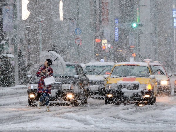
© Photo credit: TOSHIFUMI KITAMURA/AFP/Getty ImagesA pedestrian looks at the falling snow while crossing the road in the Ginza shopping district in Tokyo on January 14, 2013.
The heaviest snowstorm in seven years struck Tokyo Monday, causing thousands of car accidents and disrupting train travel just as the nation celebrated a unique national holiday.

Coming of Age Day, held the second Monday of every January, celebrates those who have turned or are about to turn 20 years old. Ceremonies and parties are held in communities across Japan, and the newly-minted adults often wear traditional kimono for the occasion.

But with wind-driven snow flying in the Japanese capital Monday, getting around proved difficult. Roads were clogged with slush, and the country's extensive rail network experienced delays. The snow was the first of this winter for Tokyo.

Snowflake

11 dead as Mideast battered by hail, snow, rain

Image
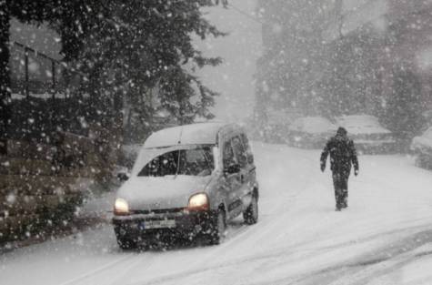
© Image Credit: REUTERSA car drives through the snow in Aley area, eastern Lebanon January 9, 2013. At least 17 people have also died due to the storm in Lebanon, Jordan, Turkey, Israel and the Palestinian territories.
Bad weather has brought misery to Syrian refugees living in Lebanon and Syria.

Abnormal storms which for four days have blasted the Middle East with rain, snow and hail have left at least 11 people dead and brought misery to Syrian refugees huddled in camps.

Officials reported that two women were found dead in the West Bank on Wednesday after their car was swept away in floods, while a 30-year-old man froze to death in Taalabaya, in Lebanon's Bekaa province, after he fell asleep drunk in his car.

Snow carpeted Syria's war-torn cities but sparked no let-up in the fighting, instead heaping fresh misery on a civilian population already enduring a chronic shortage of heating fuel and daily power cuts.

In Occupuied Jerusalem, schools closed at midday and driving wind, hail and rain battered the city as temperatures hovered just above freezing and the polar air mass moving down from Russia sent temperatures plummeting as far south as Cairo.

Raging winds and flash floods caused widespread damage to infrastructure across the Palestinian territories.

"The Palestinian infrastructure is deeply flawed and unable to handle weather like this," said Ghassan Hamdan, head of medical relief in the northern city of Nablus.
Snowflake

Snow blankets parts of Middle East, Jerusalem

Image
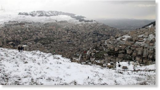
© ALAA BADARNEH - EPAA general view of the snow covered West Bank city of Nablus, taken from a hillside overlooking the city during snowy weather, on 10 January 2013.
Four to six inches of snow fell in Jerusalem Wednesday night into Thursday morning, snarling traffic and closing schools and government offices. The snow in Jerusalem resulted from a large storm system that produced days of inclement weather in the Middle East. Initially, the storm brought mainly wind and heavy rains that caused flooding and damage in some areas.

But as cold air wrapped into low pressure tracking through the region, temperatures plummeted and snow reports spiked. Up to three feet of snow fell on Mount Hermon in northern Israel the Inquisitr reported. Snow was also observed in areas of the West Bank, Turkey, Jordan, Lebanon, Syria and Egypt.

The cold, stormy weather in Syria brought further suffering in war-ravaged cities and for refugees. "The United Nations says millions of people inside Syria and 600,000 refugees outside the country need assistance, including food, blankets and warm clothes," Voice of America wrote.

Snowflake Cold

Heavy snow, torrential rain, gale-force winds batter Greece

Image
© ekathimerini
Bad weather conditions of heavy snowfall, strong torrential rains, sub-zero temperatures and gale-force winds continued to batter parts of the mainland and the Aegean Sea islands in Greece on Wednesday for a third day this week, disrupting land and sea transport.

Several mountainous areas in particular in northern and central provinces, some suburbs of the Greek capital, as well as the southern island of Crete, have been most affected with blocked motorways even for vehicles with snow chains and closure of schools.

As winds of up to 8 on the Beaufort scale sweep the Aegean Sea, a ferry boat crashed into the dock of a port at the eastern island of Lesvos with no injuries or major damage caused, local authorities said.

The Greek National Meteorological Service (EMY) reported the lowest temperature over the past few days, as the thermometer plunged to -11 Celsius in the northern city of Nevrokopi. Experts at EMY forecast that the cold snap will subside on Thursday.

Cloud Grey

Red dust sunset in Australia - Freakish dust storm settles over Western Australia

Mother Nature put on a spectacular display off the coast of Onslow yesterday, where a menacing-looking storm was captured on camera by a tug boat worker. Jurien Bay man Brett Martin and his colleagues were working west of False Island when the thunderstorm, which had gathered dust and sand as it developed, passed over Onslow and out to the Indian Ocean. Mr Martin said the storm built up in a matter of minutes.
Image
© Brett Martin/perthweatherlive.com
"We were steaming along in the boat just before sunset and the storm was casually building in the distance, then it got faster and faster and it went from glass to about 40 knots in two minutes," he said. "It was like a big dust storm under a thunderhead, there was a lot of lightning but not a lot of rain." Bureau of Meteorology duty forecaster Austen Watkins said the stunning view was created as wind and rain caused the storm to dump the sand and dust it had ingested while passing Onslow.

Additional images

Windsock

Cyclone Narelle set to bring dangerous conditions to Western Australia

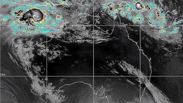
Cyclone Narelle
© Higgins Storm ChasingThis satellite image shows Cyclone Narelle forming off the north-west coast of WA.
People in the Pilbara are preparing for dangerous weather conditions, as Cyclone Narelle bears down ominously on WA's north-west coast

The eye-catching photographs accompanying this story were captured by Brett Martin just before sunset on Wednesday afternoon, 25 nautical miles north-west of Onslow.

They depict a "tropical squall line" and a "gust front ahead of a storm line", with the red tinge resulting from dust picked up in the Pilbara on the way out to sea.

Cloud Precipitation

Residents watching out for flash floods in Louisiana

Image
© National Weather ServiceHeavy rain is expected in southeast Louisiana today.
Plaquemines Parish President Billy Nungesser is advising residents to stay off the roads on Thursday. The National Weather Service has issued a tornado watch until 2 p.m. Thursday and flash flood watch until Thursday evening for most of southeast Louisiana.

View full size Heavy rain is expected in southeast Louisiana today. National Weather Service

Plaquemines drainage canals have been pumped down and all drainage pump stations are fully staffed, according to Plaquemines Parish government.