Extreme Temperatures
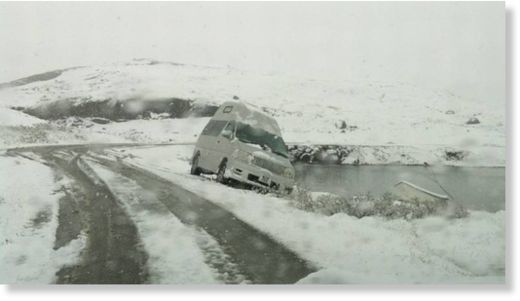
More than 1200 residents of the region were left without electricity after heavy snowfall knocked out power lines and substations.
I've never seen such big flakes of snow. They are as big as the coin two euros. Within 24 hours as much snow fell as usual throughout the winter. Snow cover in some places more than five feet, the governor said.
Plows can not keep up with snow removal routes.
Source: WP.PL (In Polish)

A woman walks down a residential street as snow falls in Toronto on Friday, February 8, 2013.
Other vehicles were reported to be stuck in snowbanks, in ditches or blocking lanes after spinning out of control. At the Bayview entrance of the southbound Don Valley Parkway, cars had trouble negotiating the icy in-ramp. The DVP's Bayview off-ramp was reported to be closed because of slippery conditions. On Highway 401, the eastbound collector off-ramp at Allen Road was also closed because of the road conditions.
On the Queen Elizabeth Way, near Fort Erie, a snowplow fell into a ditch and, a few kilometres further north, a salter truck had rolled.
More than 150 highway car collisions had been reported, said Ontario Provincial Police Sergeant Dave Woodford.
There were only minor injuries, mostly from fender benders, he said.
The satellite image, captured at 9:01 a.m. EST, shows clouds associated with the western frontal system stretching from Canada through the Ohio and Tennessee valleys, into the Gulf of Mexico. The comma-shaped low pressure system located over the Atlantic, east of Virginia, is forecast to merge with the front and create a powerful nor'easter. The National Weather Service expects the merged storm to move northeast and drop between two to three feet of snow in parts of New England.
"It might be the biggest storm since 2011," said Rob Khun, a severe weather meteorologist with Environment Canada, referring to the March 2011 storm that dumped 12.5 cm of snow on the GTA.
Snow from the storm system has begun to fall in southwestern Ontario this morning as the Alberta Clipper tracks through the area, and it should arrive in the GTA by this afternoon. This will leave about 2 cm of accumulation on the ground, however the added moisture arriving from the south this evening will turn this to heavy snowfall overnight and into Friday morning.
Total accumulations for southern Ontario are expected to be between 15 and 25 cm of snow, and strong winds will add blowing snow to the mix, making for hazardous driving conditions tonight, through the Friday morning commute, and possibly into tomorrow afternoon as well.
Eastern Ontario is expected to be even harder hit, as snowfall accumulations already forecast to be up to 25 cm from the Alberta Clipper are pushed up to 35 cm or higher by the approaching storm from the south and local amplification due to winds blowing in off of Lake Ontario.
Environment Canada has issued Snowfall Warnings from London-Essex to Kingston-Prince Edward regions, and from Niagara region up into Grey-Bruce along the shores of Lake Huron and Georgian Bay.
The northeastern United States is preparing for a monster storm, which many are calling Nemo, expected on February 8, 2013. It could easily produce over two feet of snow (.6 meters) and wind gusts over 60 miles (96 km) per hour, causing zero visibility and bringing cities to a standstill.
In many ways, we are looking at an historic storm that could paralyze cities such as Boston, Providence, and Hartford. We're expecting blizzard conditions in eastern and southeastern Massachusetts, Connecticut, Rhode Island, Northeastern New Jersey, Long Island, southeastern Maine, and New York City.
Moderate to major coastal flooding is also possible. Two storm systems will phase together to create a large pressure gradient that will result in winds sustaining around 35-50 mph with gusts over 74 mph. Tonight is the last night to get ready for a significant snowstorm that can be compared to the 1978 blizzard.
As much as 2 feet of snow could fall on a region that has seen mostly bare ground this winter, the National Weather Service said. That's exciting for resort operators who haven't had much snow this year.
The storm would hit just after the 35th anniversary of the historic blizzard of 1978, which paralyzed the region with more than 2 feet of snow and hurricane force winds from Feb. 5-7.
"This has the potential for being a dangerous storm, especially for Massachusetts into northeast Connecticut and up into Maine," said Louis Uccellini, director of the weather agency's National Centers for Environmental Prediction.
The Weather Channel reports that the Midwestern storm pattern, which passed through Chicago and Milwaukee, will mix with wetter weather coming from New Orleans, Louisville, and even Atlanta. By Thursday night, forecasts predict that the clipper system will travel from the Great Lakes region to the East Coast, passing through cities like Philadelphia, New York, and up towards Boston.
Since the beginning of the winter, over 2 meters of snow has fallen on the Russian capital, the Moscow mayor's aide in housing and public utilities Pyotr Biryukov told Interfax. Snowfall is expected in Moscow for four or five more days, he added.
On Monday, 45,000 community services employees and 15,000 units of equipment were attempting to cope with 26 cm of snow - nearly a fifth of the average annual fall.
The latest snowfall has become a nightmare for drivers with the capital's commuters trapped in gridlock.
Many of those who left their workplace in the evening had to spend five to 10 hours getting home. The average speed of vehicles was no more than 7-9 km/h. The number of road accidents - 3,000 - was much higher than during an ordinary day, with minor accidents quadrupling, according to Channel One TV.
Aside from the Meric-Ipsala road, 37 village roads have also been shut down to traffic due to heavy snowfall in the region.
Road crews are working to open the Meric-Ipsala road to traffic again on Sunday.
Snow thickness at Uludag, one of the favorite skiing centers of Europe, reached 215 centimeters on Sunday.
The Weather Department of the north-western province of Bursa said that they expected snowfall at Uludag on both Sunday and Monday.