Earthquakes
S

Attention

Magnitude-4.0 earthquake strikes near Big Bear, California

Image
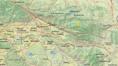
© USGSA magnitude-4.5 earthquake struck at 9:10 a.m. on Sept. 16, 2015, about 6 miles south-southeast of Big Bear Lake.
An earthquake with a magnitude of 4.0 struck near Big Bear on Wednesday morning, according to the U.S. Geological Survey.

The temblor โ€” which had a preliminary magnitude of 4.5 โ€” hit at approximately 9:10 a.m. and had a depth of 7 miles, USGS reported. It was centered 7 miles south southeast of Big Bear Lake and 8 miles south of Big Bear City.

The epicenter was a little more than 3 miles northwest of the 11,503-foot San Gorgonio Mountain, which is Southern California's highest peak. It was located some 4 1/2 miles northeast of the mountain community of Forest Falls.

The earthquake was downgraded to a 4.0 shortly after 9:45 a.m.

Following the quake, USGS seismologist Dr. Lucy Jones tweeted that a magnitude-4.5 earthquake in the San Bernardino Mountains is "normal" earthquake activity in Southern California.

Arrow Down

6.4 magnitude earthquake strikes in east Indonesia, no Tsunami alert: USGS

Image
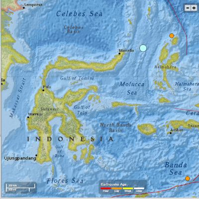
© USGSIndonesia earthquake
An earthquake of 6.4 magnitude struck on Wednesday near Indonesia's Moluccas islands, the United States Geological Survey said. There were no immediate reports of damage or casualties from the islands in the east of the archipelago.

The quake struck at a depth of 52 kilometres under the Molucca Sea at about 3:40 pm (0740 GMT), between the islands of Sulawesi and Halmahera, the US Geological Survey said.

A senior official from Indonesia's meteorology, climatology and geophysics agency, Mochammad Riyadi, said the quake was felt strongly on Halmahera, which is part of the Maluku Island chain. Indonesia is situated on the Pacific "Ring of Fire" where tectonic plates collide, causing frequent seismic and volcanic activity.

Source: Reuters

Calculator

Series of earthquakes strike off west coast of Mexico

Image
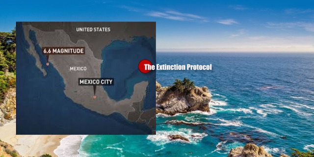
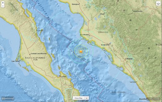
A series of earthquakes, including one of magnitude 6.6, struck in waters off the west coast of Mexico early on Sunday, but there were no immediate reports of any damage.

The 6.6 magnitude quake, which the U.S. Geological Survey initially reported at a magnitude of 6.8, struck at sea around 106 km (66 miles) southwest of Los Mochis, Sinaloa, at a depth of 10 km.

There were three other smaller quakes nearby, ranging in magnitude from 4.9 to 5.3.

"The biggest one felt reasonably strong, but there have been no reports of damage," an emergency services official said by telephone from Los Mochis, which is located in northern Sinaloa, and sits across the Gulf of California from the south of the Baja California peninsula.

Attention

Magnitude 5.2 earthquake recorded near Fiji

Image
An earthquake measuring a magnitude of 5.2 on the Richter scale was recorded at 1:58pm today 157 kilometres off Nukuni Village in Ono-i-Lau island.

This was confirmed in a statement from the Mineral Resources Department's Seismology section in Suva this afternoon.

The evaluation report confirmed that a moderate size earthquake occurred with deep depth source location, however it did not pose any threat to the region and they would keep monitoring the situation.

Attention

2.2 earthquake recorded in central Virginia Saturday night

Image
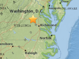
USGS map of Saturday, 9/12 earthquake
The U.S. Geological Survey recorded a magnitude 2.2 earthquake seven miles south of Louisa Saturday night.

The quake occurred at 9:38 p.m., about 39 miles northwest of Richmond. According to the USGS "Did You Feel It?" map, people reported feeling the quake more than 100 miles away.

Earlier this year, the USGS announced it had located a new fault zone in the aftermath of the Aug. 23, 2011 Virginia earthquake that rattled the entire East Coast.

The magnitude 5.8 temblor marked the first time that a fault zone in the eastern United States produced a magnitude 5 or higher earthquake "clearly delineated by aftershocks," according to the USGS report.

The newly-discovered fault lines have been named the "Quail" fault zone.

Attention

3.2 earthquake strikes near Mammoth Lakes, California

Image
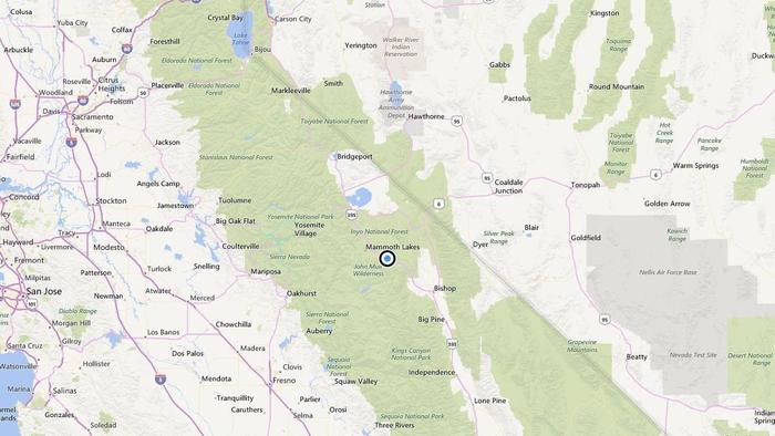
© Bing MapsA map shows the approximate location of the epicenter of Monday morning's quake near Mammoth Lakes, Calif.

A shallow magnitude 3.2 earthquake was reported Monday morning 10 miles from Mammoth Lakes, Calif., according to the U.S. Geological Survey. The temblor occurred at 1:02 a.m. PDT at a depth of 4.3 miles.

According to the USGS, the epicenter was 73 miles from Clovis, 74 miles from Sanger and 77 miles from Reedley.

In the last 10 days, there have been four earthquakes of magnitude 3.0 or greater centered nearby.

This information comes from the USGS Earthquake Notification Service and this post was created by an algorithm.

Family

Nepal suicides increase by 41% following devastating earthquake in April

Image
© EPA
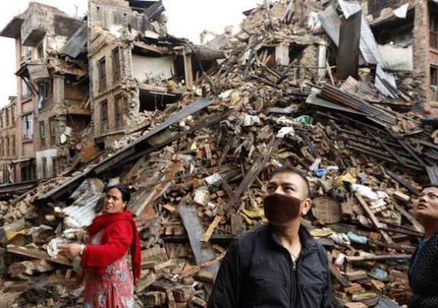
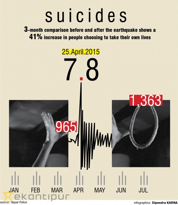
There is a significant rise in the number of people committing suicide, after the devastating earthquake of April 25 and subsequent strong aftershocks. A three months comparison before and after the earthquake shows that there is a 41 percent increase in people choosing to take their own lives, according to Nepal Police data.

The data from January 15 to April 13 show that 965 had committed suicide, while the number rose to 1,363 in three months till July following the earthquake.

"We observed that people were more insomniac, anxious and had chronic fear," said Dr Saroj Ojha, psychiatrist at the Tribhuvan University Teaching Hospital, who had visited Sindhupalchowk for counselling after the earthquake. "However, I should admit our system is yet to reach to as more people as we could. Had we reached these people, we could have saved their lives."

This appears to be a familiar pattern across the world: number of suicide cases spike after a disaster. Studies across the world show that there is increased suicide after floods, hurricanes or earthquakes. The papers basically state that people who have lost their loved ones and property are likely to remain mentally distraught that might proliferate into severe mental illness to a point where they choose to take their lives.

The World Health Organization estimates that 5 to 10 percent of people impacted by humanitarian emergencies will suffer from a mental health condition as a result.

Police data shows that over 4,000 commit suicide each yearโ€”which is four times more than people who die in road accidents. A total of 4,332 people committed suicide last year. Apparently more male resorted to suicide and with a majority of them choosing to hang themselves followed by the use of poison.
Image
© kathmandupost.ekantiput.com

Comment: How the elites cash-in on natural disasters


Bizarro Earth

Earthquake Magnitude 6.6 - Gulf of California

sept 2015 cal earthquake
© USGS
2015-09-13 08:14:12 (UTC)

The U.S. Geological Survey says an earthquake with a preliminary magnitude of 6.6 has hit in the Gulf of California.

It says the earthquake struck Sunday at 1:14 p.m. local time at a depth of 10 kilometers (6 miles). The epicenter is 37 miles (59 kilometers) south-southwest of Topolobampo, Mexico.

Mexico, which lies on three tectonic plates, is one of the world's most seismically active regions.

Attention

5.2 magnitude earthquake rattles Tokyo, Japan - injures thirteen

Image
© The Asahi Shimbun
An earthquake with an estimated magnitude of 5.2 struck the Tokyo metropolitan area at 5:49 a.m. on Sept. 12, injuring at least 13 people.

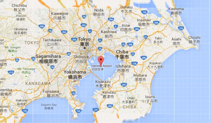
The epicenter of the quake was about 57 kilometers beneath Tokyo Bay, the Japan Meteorological Agency said.

The quake recorded an intensity of lower 5 on the Japanese scale of 7 in Chofu, western Tokyo, and 4 in many of Tokyo's 23 wards, as well as Yokohama, Kawasaki, and other areas in Kanagawa Prefecture, southern Saitama Prefecture and Urayasu, and many other municipalities in Chiba Prefecture.

An intensity of 3 was recorded in parts in Ibaraki, Tochigi, Yamanashi, Gunma, Nagano and Shizuoka prefectures.

According to local fire departments, at least 11 people in Tokyo, one in Matsudo, Chiba Prefecture, and another in Sagamihara, Kanagawa Prefecture were injured in falls.

Among them, a woman in her 80s in Nakano Ward and a resident of Matsudo in her 60s fell from beds and suffered fractured limbs.

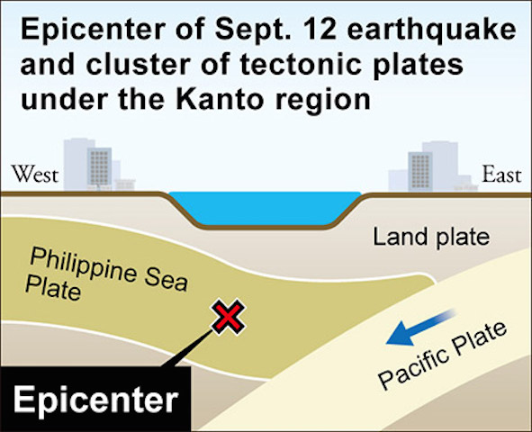
Several tectonic plates meet under Tokyo Bay and their jagged boundary lines trigger magnitude-5 to -6 earthquakes in the Kanto region every few years, agency officials explained.

The earthquake had no relation with major temblors whose epicenter is directly below Tokyo, which have repeatedly rattled the region in the past, the agency said.

It warned of a possible aftershock that could reach an intensity of around 4, which could exacerbate the damage caused by recent torrential rain and extensive floods in eastern Japan.
Attention

5.4-magnitude earthquake rocks Tokyo

Tokyo Bay map
© Google MapsTokyo Bay map
A moderate earthquake hit Tokyo early today (September 12, 2015), waking residents and shaking buildings in the Japanese capital, but there was no immediate report of any damage.

At least 11 people were injured in the capital in connection with the jolt, "but no one was seriously injured," said an official of the Tokyo Fire Department.

The 5.4-magnitude quake, with its epicentre located in Tokyo Bay, struck at 5:49 am (2049 GMT), according to the US Geological Survey.

The Japan Meteorological Agency said no tsunami warning had been issued, and that the quake was 70 kilometres (43 miles) deep.

But the agency warned sizable aftershocks could strike in Tokyo at least in a few days, while calling on residents to stay vigilant against possible landslides in the wake of heavy rain that hit the region earlier this week.