Earthquakes
S


Radar

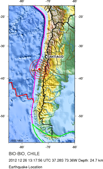
Magnitude 5.5 earthquake at Bio-Bio, Chile, 26 December 2012

Image
© neic.usgs.gov
Magnitude: 5.5

Date-Time: Wednesday, December 26, 2012 at 13:17:56 UTC

Location: 37.281°S, 73.363°W

Depth: 24.7 km (15.3 miles)

Region: BIO-BIO, CHILE

Distances:
11 km (6 miles) WSW of Arauco, Chile

19 km (11 miles) NNW of Curanilahue, Chile

33 km (20 miles) SW of Lota, Chile

40 km (24 miles) NNE of Lebu, Chile
Location Uncertainty: horizontal +/- 19.7 km (12.2 miles); depth +/- 5.1 km (3.2 miles)

Parameters: NST=315, Nph=330, Dmin=283.9 km, Rmss=0.62 sec, Gp= 68°,

M-type=body wave magnitude (Mb), Version=B

Source:
Magnitude: USGS NEIC (WDCS-D)

Location: USGS NEIC (WDCS-D)
Event ID: usc000eg5v

Bizarro Earth

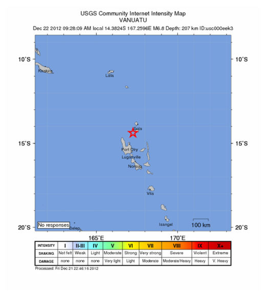
USGS: Earthquake Magnitude 6.8 - SSW of Sola, Vanuatu

Vanuatu Quake_211212
© USGS
Event Time
2012-12-21 22:28:09 UTC
2012-12-22 09:28:09 UTC+11:00 at epicenter

Location

14.382°S 167.260°E depth=207.9km (129.2mi)

Nearby Cities
63km (39mi) SSW of Sola, Vanuatu
127km (79mi) N of Luganville, Vanuatu
387km (240mi) NNW of Port-Vila, Vanuatu
723km (449mi) N of We, New Caledonia
863km (536mi) N of Dumbea, New Caledonia

Technical Details

Bizarro Earth

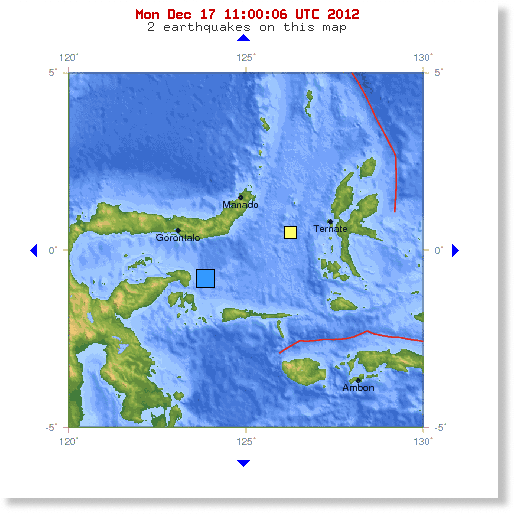
Earthquake Magnitude 6.1 strikes off coast of Sulawesi, Indonesia

Image
© USGS
A strong 6.1-magnitude earthquake struck off the coast of central Indonesia Monday, the US Geological Survey said, sending panicked people rushing into the streets but there was no tsunami alert. The quake struck at 0916 GMT more than 160 kilometers (99 miles) south-southeast of Gorontalo in central Indonesia's Sulawesi Island at a depth of 18 kilometers. The Indonesian Meteorology, Climatology and Geophysics agency (BMKG) measured it at 6.0 at a depth of 10 kilometers. "The epicenter was in the sea but it doesn't have the potential to trigger a tsunami," BMKG official Agung Utomo told AFP. "We haven't received any report of damage so far."

The National Disaster Mitigation Agency said the ground shook for several seconds. "The quake was quite strong and all the guests here - about 30 people - panicked and ran out into the street," said Rudi Gowarno, manager of Ramayana hotel in the town of Luwuk. Indonesia sits on the Pacific "Ring of Fire" where continental plates collide, causing frequent seismic and volcanic activity. A deep 6.0 magnitude also earthquake struck the New Britain region of Papua New Guinea on December 15th. - Times of India

USGS data

Bizarro Earth

USGS: Earthquake Magnitude 6.3 - 263km SSW of Avalon, California

Image
© USGS
Event Time:
2012-12-14 10:36:02 UTC
2012-12-14 02:36:02 UTC-08:00 at epicente

Location:
31.213°N 119.560°W depth=11.3km (7.0mi)

Nearby Cities:
263km (163mi) SSW of Avalon, California
269km (167mi) WSW of Rosarito, Mexico
276km (171mi) WSW of Imperial Beach, California
277km (172mi) SW of Coronado, California
746km (464mi) WSW of Phoenix, Arizona

Bizarro Earth

Magnitude 7.3 earthquake in the Banda Sea off Indonesia felt more than 600 kilometres away in Darwin

Image
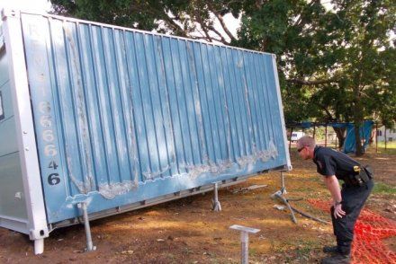
© Credit: Audience submittedA shipping container was shaken off its stands at Nguiu on the Tiwi Islands, about 100 kilometres north of Darwin.
A magnitude 7.3 earthquake in the Banda Sea off Indonesia has been felt more than 600 kilometres away in Darwin.

Geoscience Australia says there could be more aftershocks from the quake that shook the Top End of the Northern Territory overnight.

Tremors were felt in Darwin and Katherine at about 2.30am local time and were the strongest in the north for about 20 years.

Overnight staff at the Darwin weather bureau evacuated their third-storey office while the building shook.

Duty forecaster Angeline Prasad says the tremor was the strongest she has felt.

"The building started shaking and it just became worse," she said.

"It is the worst tremor I've felt in Darwin.

Bizarro Earth

USGS: Earthquake Magnitude 7.1 - 229km NW of Saumlaki, Indonesia

Image
© USGS
Event Time:
2012-12-10 16:53:09 UTC
2012-12-11 01:53:09 UTC+09:00 at epicenter

Location:
6.522°S 129.813°E depth=157.7km (98.0mi)

Nearby Cities:
229km (142mi) NW of Saumlaki, Indonesia
338km (210mi) WSW of Tual, Indonesia
361km (224mi) SSE of Ambon, Indonesia
366km (227mi) SSE of Amahai, Indonesia
519km (322mi) ENE of Dili, East Timor

Radar

Powerful earthquake injures 13 in Japan, 1 still missing

Image
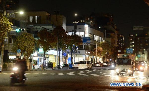
© Xinhua/Ma PingPhoto taken on Dec. 7, 2012 shows the scene of Japan's Tokyo after an earthquake. A 7.3-magnitude earthquake jolted off the east coast of Honshu of Japan, resulting in a tsunami warning for the country's northeastern coastal areas, according to Japan Meteorological Agency (JMA).
Tokyo - About 13 people were injured and one still missing after a magnitude 7.3 earthquake jolted off eastern coast of Japan Friday. Two seniors were found injured in Aomori and Miyagi Prefectures respectively Saturday morning, local police said. The rest 11 injured were reported Friday after the quake, which also triggered tsunami up to one meter high along parts of Japan's Pacific coast. Iwate authorities said they are still searching for a senior, who went missing after evacuating in a boat from Kuji port in the prefecture in response to tsunami alerts.

Bizarro Earth

USGS: Earthquake Magnitude 6.3 - 19km SE of Tokoroa, New Zealand

Image
© USGS
Event Time:
2012-12-07 18:19:08 UTC
2012-12-08 07:19:08 UTC+13:00 at epicenter

Location:
38.334°S 176.044°E depth=167.2km (103.9mi)

Nearby Cities:
19km (12mi) SE of Tokoroa, New Zealand
27km (17mi) SW of Rotorua, New Zealand
38km (24mi) N of Taupo, New Zealand
72km (45mi) S of Tauranga, New Zealand
345km (214mi) NNE of Wellington, New Zealand

Bizarro Earth

USGS: Earthquake Magnitude 7.3 - 245km SE of Kamaishi, Japan and subsequent aftershocks

Image
© USGS
Event Time:
2012-12-07 08:18:24 UTC
2012-12-07 18:18:24 UTC+10:00 at epicenter

Location:
37.889°N 144.090°E depth=36.1km (22.4mi)

Nearby Cities:
245km (152mi) SE of Kamaishi, Japan
245km (152mi) ESE of Ofunato, Japan
251km (156mi) ESE of Ishinomaki, Japan
251km (156mi) SE of Otsuchi, Japan
462km (287mi) ENE of Tokyo, Japan

Attention

Strong magnitude 7.3 earthquake hits off Japan near Fukushima disaster zone

Image
© Reuters/KyodoFirefighters persuade residents to evacuate after a strong earthquake hit the area in Rikuzentakata, Iwate prefecture, in this photo taken by Kyodo December 7, 2012.
Tokyo - A strong earthquake centered off the coast of northeastern Japan shook buildings as far away as Tokyo on Friday and triggered a one-meter tsunami in an area devastated by last year's Fukushima disaster.

The quake had a preliminary magnitude of 7.3, the U.S. Geological Survey said, adding that there was no risk of a widespread tsunami. There were no immediate reports of death or injury.

The March 2011 earthquake and following tsunami killed nearly 20,000 people and triggered the world's worst nuclear crisis in 25 years when the Fukushima-Daiichi nuclear plant was destroyed, leaking radiation into the sea and air.

Workers at the plant were ordered to move to higher ground after Friday's quake. Tokyo Electric Power Co, the operator of the Fukushima nuclear plant, reported no irregularities at its nuclear plants.

The quake measured a "lower 5" in Miyagi prefecture on Japan's scale of one to seven, meaning there might be some damage to roads and houses that are less quake resistant.

The scale measures the amount of shaking and in that sense gives a better idea of possible damage than the magnitude. The quake registered a 4 in Tokyo.