Earth ChangesS

Bizarro Earth

Eruption of Japan's Mt. Fuji volcano could force the evacuation of more than half a million

An eruption of Mount Fuji could force some 567,000 people to evacuate their homes, according to a new estimate. The projection is part of an evacuation plan crafted by the Shizuoka Prefectural Government that also says more than 130,000 people, comprising some 50,000 households, would have to relocate if lava were to reach residential districts in the city of Fuji, which lies just south of the 3,776-meter mountain. Depending on the number and locations of vents, evacuation from wider areas could be needed. The plan is based on a hazard map prepared by the central government based on Fuji's last eruption, in 1707. Under the evacuation plan, 10 zones have been designated at the foot of the mountain based on the expected direction of lava flows. The plan specifies evacuation zones in four grades.
Image
The Yamanashi Prefectural Government is preparing a similar evacuation plan. Plans will be finalized at a consultation forum involving Shizuoka, Yamanashi and Kanagawa prefectures and the central government. Joint evacuation drills in the three prefectures will also be conducted. - Japan Times

Bizarro Earth

Crater lake on White Island volcano, New Zealand dries up, as activity increases

The hot crater lake on White Island has now completely dried up as explosive rocks, mud and gas continue to be thrown into the air from the active volcano. White Island has been spewing a steady stream of gas since activity heated up in December. It's the most active the volcano has been since 2000. GNS Science vulcanologist Brad Scott said a "small tuff cone" was forming on the bottom of the crater lake, and the active vent was producing "vigorous bursts" of mud, rock, steam and gas up to 100 meters into the air. "GNS Science's past monitoring of the island shows that new eruptive episodes often develop out of this type of activity," Scott said.
Image
"Small muddy lakes sometimes form in craters. As the unrest develops, geysering and explosions occur through these lakes, becoming more vigorous with time." He said the activity did not necessarily mean an explosion or full-scale eruption would happen, although one could at any time. Even though there was an elevated risk to tourists on the island, conditions weren't so dangerous that people could not travel there. Tourism has, in fact, been booming at White Island as the volcano heats up, with visitors eager to see some explosive action. Frontier Helicopters is one of three helicopter tour operators which fly around the island.

Ice Cube

New satellite image shows the unusually frigid and snowy conditions that blanketed much of Great Britain

Unusually frigid and snowy conditions blanketed much of the island of Great Britain in snow earlier this month. The winter wonderland was spotted from above by NASA's Terra satellite on Jan. 26. The snow started falling mid-month when a storm system blowing in from over the North Atlantic combined with unusually chilly conditions ushered in by a pattern called the Scandinavian Block, according to Accuweather.com. This high-pressure pattern sits in place over Scandinavia and funnels cold air toward the United Kingdom from over the Baltic and western Russia, according to the U.K. Met Office.
Image
© NASA
As of the afternoon of Jan. 21, Redesdale Camp, Scotland, was the nation's leader in snowfall, with 11 inches (29 centimeters), Accuweather reported. Earlier Accuweather reports said 8 inches (20 cm) had fallen in Sennybridge, Wales, and 6 inches (15 cm) in Dunkeswell, in the southwest of England. The snows closed many schools and forced flight cancellations and delays at London's Heathrow Airport.

Calculator

Beijing urges municipal governments to stabilize food prices

Image
The State Council, or China's cabinet, on Tuesday urged more targeted measures to stabilize food prices as the Spring Festival holiday, a peak time for food consumption, draws near.

In a statement posted on the government's official website, the State Council said agriculture authorities should play a guiding role in introducing cold-resistance and pest prevention measures to boost vegetable production across the country.

Municipal governments in major northern cities should draw up contingency plans and release government reserves of vegetables and meat in a timely fashion, the statement said.

Cloud Lightning

Satellite spies severe weather brewing over U.S.

Severe Weather
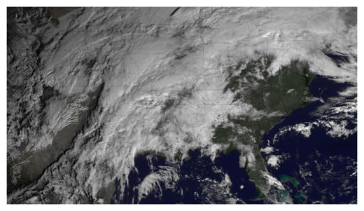
© NOAAIn this GOES East satellite image taken at 10:15 a.m. ET on Jan. 29, 2013, severe weather can be seeing brewing over the central portions of the United States.
After an Arctic blast left much of the United States out in the cold, a new system is bringing the threat of severe weather to the central portions of the country this evening and through the night. A satellite snapped an image of the system earlier this morning (Jan. 29).

The National Weather Service's (NWS) Storm Prediction Center, located in Norman, Okla., has forecast severe thunderstorms, with damaging winds and hail - and possibly even tornadoes - for the lower Ohio Valley, the mid-South and the lower Mississippi Valley. The SPC says the threat will increase through the night, with squall lines (or long lines of thunderstorms) and individual storms rolling through along with a cold front.

Nighttime storms and tornadoes can be particularly deadly, as people tend to be in bed and unaware of warnings and the storms are harder to see as they bear down. A 2008 study in the American Meteorological Society's journal Weather and Forecasting found that nighttime tornadoes were 2.5 times as likely to cause a death as those that occurred in the daytime. The threat of deadly nighttime tornadoes is exacerbated in the winter with the season's shorter daylight hours.

Cloud Lightning

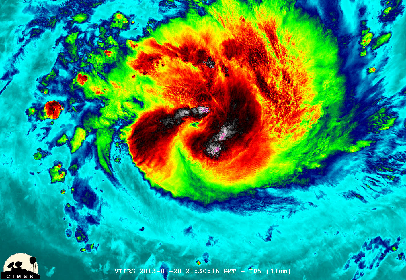
NASA sees powerful "overshooting cloud tops" in Cyclone Felleng

cyclone felleng
© William Straka, UWM/NASA/NOAA NASA-NOAA's Suomi NPP satellite captured this false-colored night-time image of Cyclone Felleng during the night on Jan. 28, 2013. Felleng is northwest of Madagascar.
NASA satellite imagery revealed that Cyclone Felleng is packing some powerful thunderstorms with overshooting cloud tops.

An overshooting (cloud) top is a dome-like protrusion that shoots out of the top of the anvil of a thunderstorm and into the troposphere. It takes a lot of energy and uplift in a storm to create an overshooting top, because usually vertical cloud growth stops at the tropopause and clouds spread horizontally, forming an "anvil" shape on top of the thunderstorms.

During the night-time hours (Madagascar local time) of Jan. 28, NASA-NOAA's Suomi NPP satellite captured a night-time image of Cyclone Felleng when it was located northwest of Madagascar. The image was created at the University of Wisconsin-Madison and was false colored to reveal temperatures. The image showed some pretty cold overshooting cloud tops, topping at ~170K (-153.7F/ -103.1C). The image also showed some interesting gravity waves (waves in the atmosphere) propagating out from the storm in both the thermal (infrared) and visible imagery. The infrared imagery also showed that Felleng has strengthened significantly since the previous day as convective bands of thunderstorms are wrapping more tightly into the eye.

Cloud Precipitation

Four dead as floods hit New South Wales and Queensland states, Australia

Bundaberg flood
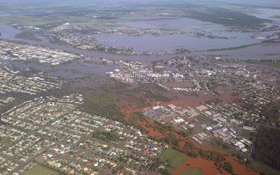
© ReutersFloodwaters from the Burnett River inundate parts of Bundaberg, 300km north of Brisbane, on Tuesday.
Massive summer floods have killed four people and forced thousands of people to evacuate their homes across two Australian states on Tuesday, disrupting air and rail travel and coal production.

A deluge fed by the ex-tropical cyclone Oswald dumped more than 200mm of rain in some areas of the Queensland and New South Wales states over the past three days, swelling rivers and swamping towns.

The worst-hit areas were around Bundaberg, Rockhampton and Ipswich in Queensland, and around the northern New South Wales towns of Grafton and Lismore.

Bizarro Earth

Dozens killed and injured, homes destroyed in Sumatra landslide

flooding in Jakarta
© AFPIndonesian authorities have started cloud seeding to prevent more major flooding in Jakarta.
More than two dozen people have been killed, injured or are missing as a result of a landslide caused by heavy rain on the Indonesian island of Sumatra.

By last night, 14 people had died in the muddy landslip, a further nine were injured and six were still missing.

The side of a hill in Agam, west Sumatra, slid away on Sunday, wiping out homes, rice paddies and an orchard.

Cloud Lightning

Tornadoes in January! Wide area of U.S. faces unusual early threat

Tornado
© Inconnu
A wide area of the central and southeast U.S. faces the unusual threat of tornadoes in January over the next 12 to 18 hours as an approaching cold front clashes with unusually warm air, a meteorologist said on Tuesday.

The first tornado warning of the approaching storm was issued on Tuesday for western Missouri, said meteorologist Bill Bunting at the National Weather Service Storm Prediction Center in Norman, Oklahoma.

A warning is intended to signal residents to take cover because a tornado could be forming. A less urgent tornado watch is in effect for a region from extreme northeast Texas through virtually all of Arkansas, western Tennessee and extreme southern Illinois.

"It's a little unusual," Bunting said of the tornado threat. "We don't see this every winter with this kind of warmth preceding a storm system."

Cloud Lightning

Rare tornado spotted in Bristol Channel as storms hit North Somerset, UK

Bristol channel tornado
© Sue HewittThe photo of a waterspout taken by Sue Hewitt on Sunday afternoon
Snow, hail, heavy rain and thunder - the North Somerset area has experienced it all over the past two weeks.

And now the wild weather has caused a spectacle in the Bristol Channel, with local people capturing a picture of what appears to be a mini tornado in the estuary.

This picture was taken by Sue Hewitt, of Downend, who spotted the event while out walking along the coastal path between Clevedon and Portishead at around 1pm on Sunday.