Storms
S


Ice Cube

Massive winter storm wallops Texas, much of the U.S. Midwest - possible prolonged power outages

Image
© Amanda FancherA large tree toppled due to ice early Friday in a suburb north of Dallas.
Tens of thousands of homes and businesses are without power here after a massive winter storm caked North Texas in a thick coat of freezing rain and sleet.

Motorists are being encouraged to stay off roads, and ice on power lines forced public transportation officials to suspend the region's light rail service.

Dallas' woes are part of a severe cold snap stretching hundreds of miles from Texas to Kentucky.

"Every few years there is a blockbuster ice storm somewhere in the U.S., and these storms are no stranger to the South Central region," said Jesse Ferrell, weather expert and storm chaser for AccuWeather.com, told Reuters.

As of Friday morning, the National Weather Service had issued ice and winter storm warnings for 10 states. Oklahoma, Arkansas and Tennessee already have declared states of emergency. At least two deaths had been reported on roads in Texas and Missouri, according to Reuters.

Government forecasters warned of possible prolonged power outages across portions of the southern Great Plains toward the Lower Ohio Valley.

Cloud Precipitation

9 dead, thousands affected as storm Xaver sweeps east across Europe

Storm Xaver in Helsingborg
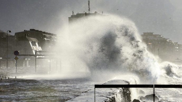
© AFP Photo / TT News Agency / Johan Nilsson / Sweden outThe sea hits the flooded Harbour Road in Helsingborg, southern Sweden, on December 6, 2013 as storm Xaver hit southern Sweden on Thursday night
Hundreds of thousands have been left without power or stranded by transportation chaos as the storm Xaver is sweeping across northern Europe. At least nine people have died in the disaster.

Emergency services across the region battled overnight to sandbag sodden dykes, evacuate flooded harbor areas and repair damage from toppled trees that crashed onto houses, roads and power lines.

Atlantic storm Xaver swept into northern Europe late Thursday after disrupting transport and power in northern Britain where two people have died.

The winds of up to 158 kilometers per hour barreled across Germany, the Netherlands, Poland and southern parts of Scandinavia.

Blackouts hit 400,000 homes in Poland and affected 50,000 people in Sweden, while thousands of air passengers were stranded as flights were canceled at Amsterdam, Berlin, Hamburg, Gdansk and other airports, AFP reports

Igloo

Hurricane Xaver brings icy tidal surges and flooding across Northwestern Europe

Image
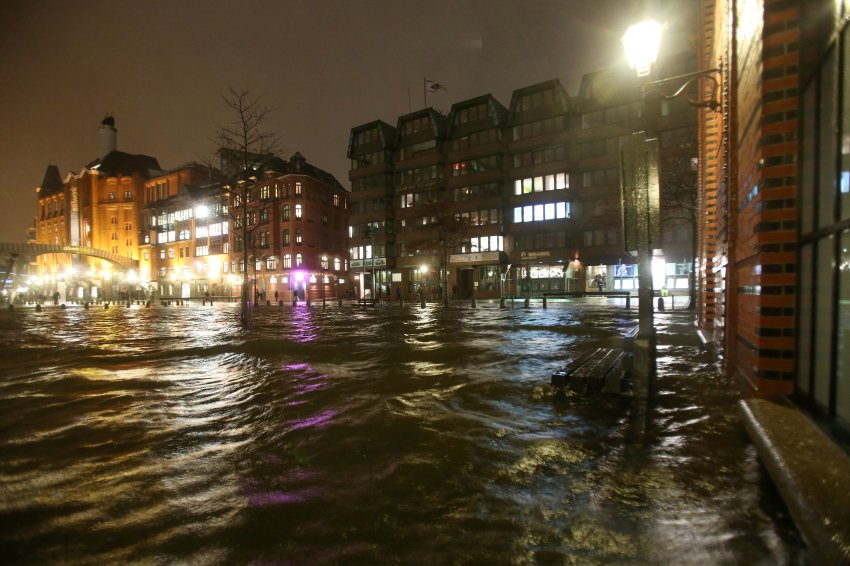
© DPA Floodwaters in Hamburg early on Friday morning. City officials closed off flooded areas and some people reportedly had trouble reaching work in the morning.
A low-pressure system is bringing the worst flooding in decades to parts of Northern Europe, which is being pummeled by snow, rain and hurricane-force winds. At least three deaths have been reported.

A major storm surge threatened parts of northern Europe on Friday as a low-pressure system dubbed "Xaver" began battering the coasts with chilly hurricane-force winds. The United Kingdom, Germany, the Netherlands and Scandinavia were most heavily affected by the severe storm, but cancelled flights and trains caused problems across Europe. By Thursday night, officials had reported at least three storm-related deaths in the UK and Denmark.

Thousands of residents living in the UK's eastern coastal areas were forced to spend the night in schools or emergency shelters amid warnings of flooding, which the UK's Environment Agency said could be the highest in some 60 years. Late on Thursday, authorities closed the Thames Barrier to protect London from rising waters.

The storm brought rain, hail and snow with the tidal surge, and the German port city of Hamburg has seen its worst flooding in decades, forcing authorities to close off parts of the city center on Thursday night. "We have a tidal surge the likes of which we have rarely seen in the last 10 or 20 years," said a city official on Friday. Water levels were reportedly some 6 meters (20 feet) above sea level early on Friday morning, a level last reached just twice in the early 1990s.
Windsock

European storm and tidal surge cause evacuations and travel chaos

Image
Winds of up to 228 km/h (142 mph) battered Scotland
A major storm has hit northern Europe, leaving at least four people dead or missing, causing transport chaos and threatening the biggest tidal surge in decades.

Dozens of flights were cancelled or delayed in the Netherlands, Germany and Scotland, while rail services were shut down in several countries.

One of Europe's longest bridges - connecting Sweden to Denmark - closed.

Tens of thousands of homes were also left without power as the storm hit.

Winds of up to 228 km/h (142 mph) battered Scotland, where a lorry driver was killed when his vehicle was blown over near Edinburgh. At least two other people were injured by falling trees.

Police have confirmed reports that a man has been killed by a falling tree in Nottinghamshire, central England.

Snowflake Cold

Britain battered by hurricane-force winds, worst coastal surges in 60 years

  • More than 240 Environment Agency flood alerts in place in England and Wales, with most in East Anglia
  • Gusts of 140mph in parts of Aberdeenshire and Inverness-shire as ALL trains in Scotland are cancelled
  • Environment Secretary Owen Paterson will chair emergency Cobra meeting today on storm disruption
  • Police Scotland advise motorists not to drive in the south, west, central belt and south Perthshire
  • Storm will create the biggest waves in living memory off north-east over next few days, peaking on Saturday
  • Public should expect 36 hours of disruption, Norfolk Police warns as Great Yarmouth homes are evacuated
  • Evacuations planned in Essex and Suffolk as people are seen being rescued in North Wales and Merseyside
  • Image
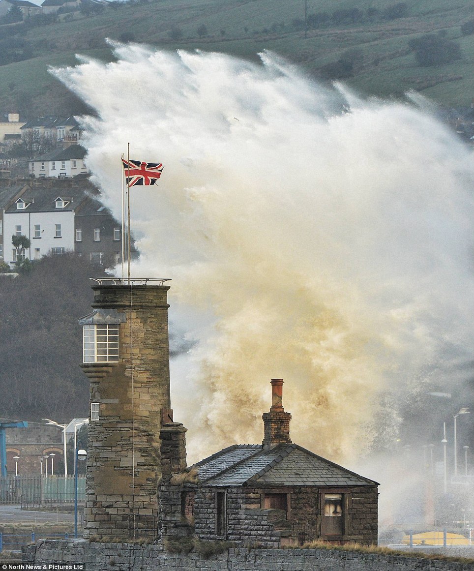
    Huge waves engulf Whitehaven harbour, in the northwest of England. This part of the British coastline is usually protected by Northern Ireland, meaning there are never normally such big waves and tidal surges

    Thousands of people have been evacuated and hundreds rescued today as 140mph winds battered Britain in a hurricane-force storm.

    A lorry driver died in Scotland and a man riding a mobility scooter in King's Park in Retford, Nottinghamshire, was also killed when hit by a falling tree.

    More than 120,000 homes were left without power as the most serious tidal surge for 60 years is predicted to hit the east coast tonight.

    More than 10,000 homes in Norfolk, Suffolk and Essex are being evacuated, while residents were also rescued in Rhyl, North Wales, and Merseyside.

    As they were taken away from their homes in dinghies, forecasters feared the worst is yet to come during tonight's high tide at around 10pm.


Ice Cube

Millions affected by U.S. ice storm from Northern Texas to Kentucky - power outages likely

Image
An ice storm will affect millions of people into Friday and threaten to cut power for hundreds of thousands from northern Texas to western Kentucky. Travel by vehicle or foot will be dangerous during and after the storm, due to icy roads and falling trees and power lines. Snow and ice is already making travel difficult across Oklahoma, Texas and northern Arkansas. Conditions will worsen tonight.

Metro areas from Dallas to Little Rock, Ark.; Cape Girardeau, Mo.; Memphis, Tenn.; Evansville, Ind.; and Louisville, Ky.; will be affected by a period of freezing rain that will build up on exposed surfaces, including trees and power lines.

In some locations, the storm has the potential to allow one half an inch or more of ice to accumulate on the ground and accrue on elevated surfaces.

The storm is similar in size and may be similar in magnitude to a storm just several years ago.

According to Jesse Ferrell, weather expert and storm chaser for AccuWeather.com, "This will be the worst ice storm for the United States since January 2009 and will affect many of the same areas as that storm."

Snowflake

Swedes warned: 'Expect up to 30 cm of snow'

Snow storm in Sweden
© Björn LarssonA file image of a previous snow storm in Sweden
Sven, a winter storm expected to hit Sweden on Thursday night, has prompted warnings for heavy snow and fierce winds as Swedes brace for what's being billed as the seasons' first major snowstorm.

Swedish weather agency SMHI called Wednesday the "calm before the storm" as it issued class 2 warnings for rough seas off Sweden's west coast, as well as for strong winds and snow in Dalarna, Gästrikland, and Uppland across central Sweden.

A class 2 warning entails weather conditions that could put the public in danger, cause material damage, or disrupt vital public services.

On Thursday, the low pressure system is expected to reach southwestern Sweden, with "large amounts" of snow expected to cover the Götaland and Svealand regions in central Sweden overnight into Friday.

Wind gusts as high as 100 kilometres per hour are expected along with the heavy snowfall.

"In some areas, we may be talking about up to 20 or 30 centimetres," SMHI meteorologist Marcus Sjöstedt told the Aftonbladet newspaper.

"There are definitely going to be problems on the roads and for different types of transport. People should expect a number of delays when it comes to trains."

Comment: Germany is also preparing for this storm, which in Germany is named Xaver:
Gale-force winds: Germans brace for major winter storm


Cloud Precipitation

Gale-force winds: Germans brace for major winter storm

North Sea storm
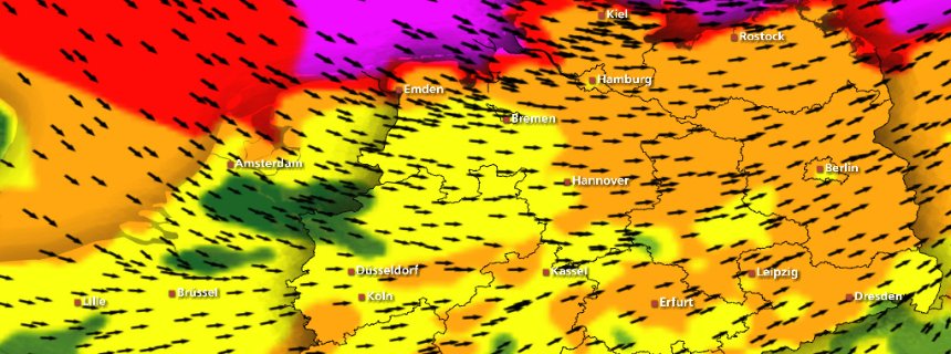
© wetterspiegel.deA massive North Sea storm is expected to strike large parts of Germany on Thursday.
Northern Germany is preparing for a major winter storm expected to make landfall on Thursday. Weather forecasters are warning that winds of up to 180 kilometers per hour could be the worst seen in decades.

People in Germany and other parts of Northern Europe began preparations on Wednesday for a major North Sea storm that is expected to bring hurricane-strength winds to the region. The low-pressure front "Xaver" is currently on a course from Newfoundland, Canada to Europe. The storm is expected to arrive in southern Norway on Thursday before continuing towards northern Germany with gale-force winds. The storm is expected to be strongest in the north and east of the country, although rain and winds are expected in the south, too.

With gale force winds of up to 180 kilometers per hour (111 miles per hour), public officials are already bracing for what could be one of the worst storms in decades. Deutsche Bahn, Germany's national railway, is advising travelers in the states of Schleswig-Holstein, northern Lower-Saxony, Hamburg and Bremen to cancel their plans if possible. The company said it was preparing for possible disruptions to services or closures in those regions. Airports are also warning of possible delays or cancellations of flights because of the inclement weather.


Comment: The same storm system is called "Sven" in Sweden and "Bodil" in Denmark and both places are equally gearing up for a major storm.
Swedes warned: 'Expect up to 30 cm of snow'


Ice Cube

Global warming? Winter superstorm hits half the U.S. as millions are warned to prepare for the worst storm in a decade with temperatures dropping to MINUS 40

A wintry storm pushing through the western half of the country is bringing bitterly cold temperatures that prompted safety warnings for residents in the Rockies and threatened crops as far south as California. The jet stream is much farther south than normal, allowing the cold air to push in from the Arctic and drop temperatures by 20 to 40 degrees below normal levels, AccuWeather meteorologist Tom Kines said on Tuesday.

Areas of Montana and the Dakotas were forecast to reach lows in the minus-20s, while parts of California could see the thermometer drop to the 20s. The icy, 'Polar Express' blast was expected to be followed by another one later in the week, creating an extended period of cold weather that hasn't been seen since the late 1990s, meteorologists said.

Officials warned residents to protect themselves against frostbite if they are going to be outside for any length of time. 'When it gets this cold, you don't need 30, 40 mile-per-hour winds to get that wind chill down to dangerous levels. All it takes is a little breeze,' Kines said.

Image
Additional images

Snowflake Cold

Arctic Plunge: Winter storm wallops Rockies, Plains, 2 to 3 feet of snow on the way


Winter storm Cleon is heading toward the Pacific Northwest and, besides bringing chilly temperatures and cold winds, is expected to drop 2 to 3 feet of snow.


A winter storm dropped 30 inches of snow in Idaho Tuesday, and is forecast to bring temperatures well below zero elsewhere in the country as the week goes on.

Frigid temperatures swept across the northern Rockies and the northern Plains on Tuesday, and heavy sheets of snow are likely in Colorado, Utah, Wyoming, Montana and swaths of North Dakota. Parts of nine states were under winter storm warnings; nine other states were under various levels of advisories for current or future wintry precipitation.

Snow accumulation was racking up by Tuesday afternoon. By 3 p.m. ET, 30 inches of snow had fallen in Idaho's Saddle Mountain, and 22 inches had fallen north of Two Harbors, Minn. Stuart Mountain in Montana received 20 inches. Duluth had gotten 14 inches of snow and was forecast to receive another foot-plus as the flakes continued to fall.