Storms
S

Bizarro Earth

Hundreds of thousands evacuated as Typhoon Haima strikes southern China

Typhoon Haima
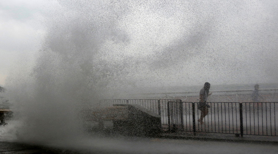
© Bobby Yip / ReutersPeople run away from a big wave on a waterfront as Typhoon Haima approaches in Hong Kong, China, October 21, 2016 .
Hundreds of thousands of people have been evacuated as Typhoon Haima slammed into southern China after killing at least 13 people in the Philippines.

The storm struck the city of Shanwei in eastern Guangdong on Friday afternoon, forcing more than 700,000 evacuations from the region, according to CCTV News.

The tropical cyclone reached wind speeds of up to 166 kilometers (103 miles) per hour before weakening to a tropical storm.

Comment: Update: Typhoon Haima kills at least 8 in the Philippines; tens of thousands of homes destroyed


Ice Cube

Freak hailstorm hits drought stricken Bloemfontein, South Africa

Bloemfontein hailstorm
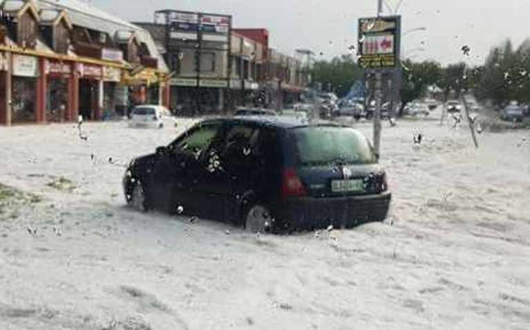
© Arrive Alive official Facebook page.Hail storm in Bloemfontein on 20 October, 2016 around Langenhovenpark.

A heavy storm passed through Bloemfontein last night with hail wreaking havoc in the drought stricken area.

The hail storm caused damaged to some cars.

The thick layer of hail, which could almost be mistaken for snow, covered the streets of Bloemfontein.


People on Twitter, though, have reacted with relief and have expressed how happy they are to receiving the rain:

Windsock

Update: Typhoon Haima kills at least 8 in the Philippines; tens of thousands of homes destroyed

typhoon haima damage
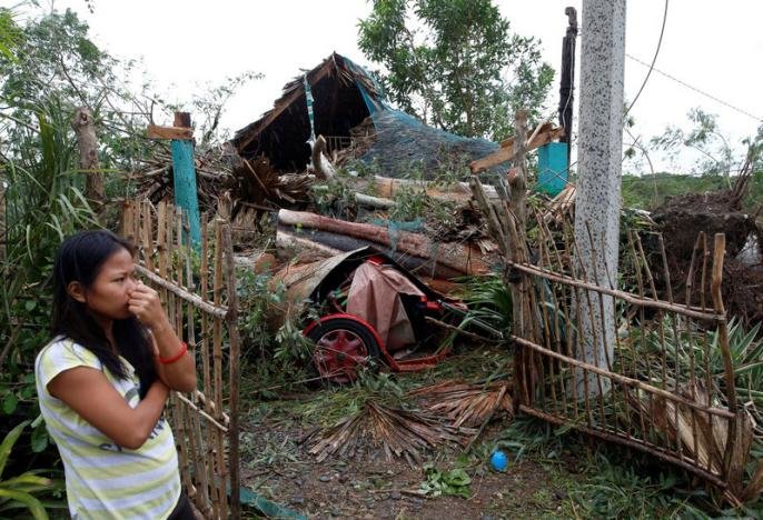
© REUTERS/Erik De CastroA woman stands outside her house which was damaged by a fallen tree during Typhoon Haima, in Bangui, Ilocos Norte in northern Philippines, October 20, 2016.
One of the most powerful typhoons to ever hit the Philippines killed at least eight people on Thursday as ferocious gales and landslides destroyed tens of thousands of homes.

Super Typhoon Haima struck late on Wednesday night with winds similar to those of catastrophic Haiyan in 2013, which was then the strongest storm to strike the disaster-prone Southeast Asian archipelago and claimed more than 7,350 lives.

Haima then roared across mountain and farming communities of the northern regions of the main island of Luzon overnight, causing widespread destruction and killing at least eight people, authorities said.

"We were frightened because of the strong winds. There was no power, no help coming," Jovy Dalupan, 20, told AFP as she sheltered at nightfall on the side of a highway in San Pablo, a badly damaged town of 20,000 people in Isabela province.

Dalupan, her two young daughters and husband, were forced to flee to the highway along with their neighbours during the height of the storm when their shanty homes, made of plywood, were ripped apart.


Comment: Haima is now approaching Hong Kong and is the third severe typhoon to hit the city in October - the last time that happened in that month was in 1989.


Jupiter

Jupiter spacecraft captures images of towering polar storms

Jupiter storms
© NASA/JPL-Caltech/SwRI/MSSSStorms larger than half the size of Earth at Jupiter's north pole.
A spacecraft taking pictures of Jupiter with a camera that a Tucson-based scientist manages has sent back pictures of a storm that would dwarf any earthbound hurricane.

NASA's Juno spacecraft made a first pass by Jupiter in August, and its instruments were turned on just to test them. The camera pictured a storm more than half the size of Earth.

Candice Hansen of the Planetary Science Institute in Tucson says what her camera captured amazed everyone.

"We always thought we would do some science with JunoCam," she said.

Hansen says the camera's main purpose is to connect the public to the space mission by asking for online voting on what will be photographed.

Windsock

Typhoon Haima strikes the Philippines; second powerful storm in a week

Typhoon Haima
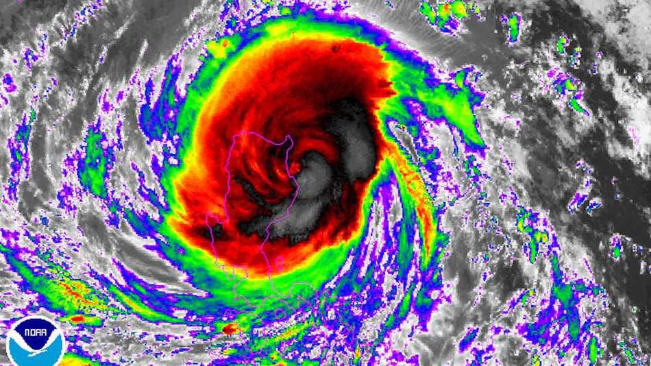
© NOAAInfrared satellite image of Typhoon Haima making landfall in Luzon, Philippines on Oct. 19, 2016.
Typhoon Haima, which on Tuesday became the planet's seventh Category 5 storm of the year, is slamming northern Luzon in the Philippines with damaging winds, storm surge flooding and heavy rains.

Fortunately, Haima lost some of its punch shortly before striking land, coming ashore at about 10:30 p.m. local time, or 10:30 a.m. EDT, packing maximum sustained winds of 140 miles per hour, according to the Joint Typhoon Warning Center (JTWC). The storm is known locally in the Philippines as Typhoon Lawin.

The weakening trend can be primarily traced to a phenomenon known as an eyewall replacement cycle, known to meteorologists by the acronym "ERC."

During such cycles, which typically occur in the most intense tropical cyclones, the storm's inner eyewall โ€” where the worst winds and some of the heaviest rains tend to be concentrated โ€” collapses, while an outer eyewall forms and gradually contracts inward toward the storm's center. During such a process, the storm's maximum sustained winds tend to diminish slightly, while the area of strong winds expands overall.

Eventually the outer eyewall replaces the inner eyewall, and the storm's maximum wind speed increases once again.

As Typhoon Haima showed, such cycles are unpredictable, and can take 12 hours or more to complete. The storm had been forecast to make landfall as a Category 5 storm.

The replacement cycle that occurred within Super Typhoon Haima was fortuitous, since it spared areas of northern Luzon from a truly catastrophic blow.
Comment: Typhoon Sarika leaves two dead, thousands stranded in Philippines


Tornado2

Tornado causes damage in Ontario, Canada; 11th so far this year

Ontario tornado damage
Car crushed by roof in storms on Monday, October 17, 2016
Environment Canada has confirmed it was a tornado that touched down near Stayner just west of Barrie Monday afternoon.

It was relatively small, an E-F 1.

Damage in Collingwood where trees and hydro poles were knocked over is still being assessed.

A down-burst is believed to have hit the area which blew the roof off a Mr. Transmission Shop.

This is the 11th tornado so far this year in Ontario. Normally we get 12 tornadoes a year.

Gear

Global warmists attempting to change the definition of a hurricane so we'll have more of them!

Hurricane Joaquin
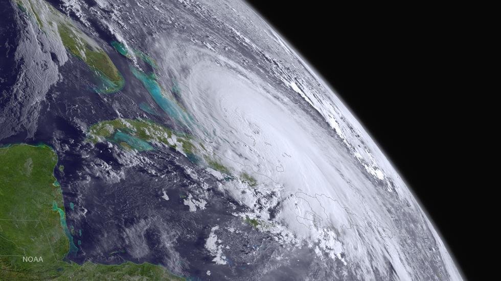
Hurricane Joaquin as a category 4 storm in October 2015
This op-ed from IBD points out what we have been saying for years, that even though there is no trend in hurricane frequency of intensity, alarmists like Mashable's Andrew Freedman are trying to get the definition of a hurricane redefined, so that the trend will become a positive one. Recall that hateful science blogger Greg Laden asked Should There be a Category 6 for Hurricanes? after super typhoon Haiyan hit in 2013, something that ABC news opined had "already happened" without one shred of evidence to back up that opinion for a Category 6 storm. They also note:
Only three Category 5s have come ashore in the United States in the past century โ€” the 1935 Labor Day Hurricane, Camille in 1969 and Andrew in 1992.

But because of man-made global warming, most hurricane scientists say now we will probably be getting Category 4 and 5 hurricanes more frequently in the coming decades.

Windsock

Philippines braced for Typhoon Haimi

typhoon Haima
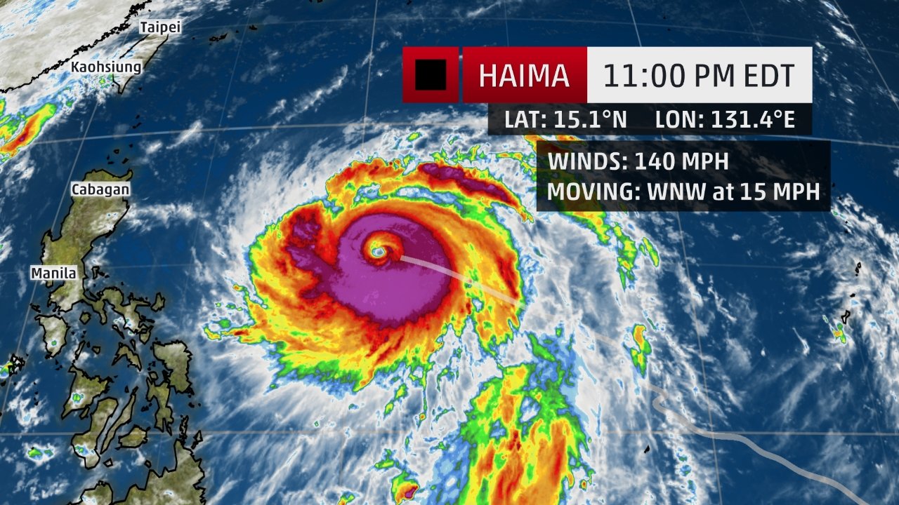
© The Weather ChannelThe highest cloud tops, corresponding to the most vigorous convection, are shown in the dark red and purple colors.
Typhoon Haimi bore down on the Philippines Tuesday, with the country's northern island of Luzon bracing for strong winds and heavy rainfall that could trigger landslides in the mountainous region, forecasts say.

The storm is expected to become a super typhoon -- with winds over 150 mph (240 kph) -- in the next 12 to 24 hours and make landfall Wednesday night.

It's currently the equivalent of Category 4 hurricane -- the second-most powerful in the ranking. "Since this storm is very strong where, or if, it makes landfall in the Philippines will be very important.

The area around the center will have extreme damage from the winds as well as a significant storm surge," said CNN Meteorologist Taylor Ward. Haimi is then expected to veer northwest and hit the Chinese coast by Friday evening.

"Current projections take the storm into eastern Guangdong Province, to the east of Hong Kong, but we will keep a close eye on Hong Kong in the coming days as some models take the storm fairly close," said Ward.

Comment: Typhoon Sarika leaves two dead, thousands stranded in Philippines


Windsock

Typhoon Sarika leaves two dead, thousands stranded in Philippines

Typhoon Sarika
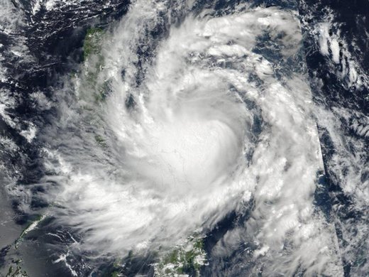
© EPA/NASA/NOAA/Goddard MODIS Rapid Response / HANDOUTTyphoon Sarika approaches the Philippines
A powerful typhoon slammed into the northeastern Philippines on Sunday, leaving at least two people dead, knocking out power and isolating villages amid floods and toppled trees.

Typhoon Sarika, locally known as Karen, blew into Aurora province early Sunday and was barreling fast through heavily-populated agricultural provinces with sustained winds of 130 kilometres (80 miles) per hour and gusts of 220 kph (136 mph), officials said.

Mayor Nelianto Bihasa of Baler, a popular surfing town in Aurora, said howling wind ripped tin roofs off many houses and knocked down trees and electric posts, causing power outages and blocking access roads to some villages.

Coastal villagers were warned early to move to safer areas and there have been no immediate reports of casualties other than two injured residents, he said.

In eastern Catanduanes province, a man drowned after being swept by strong river currents and a farmer died after his head hit the ground in fierce wind, provincial safety officer Gerry Beo said.

Three fishermen were reported missing, he said.

Tornado1

Rare tornado hits Manzanita, Oregon

Tornado damages Manzanita
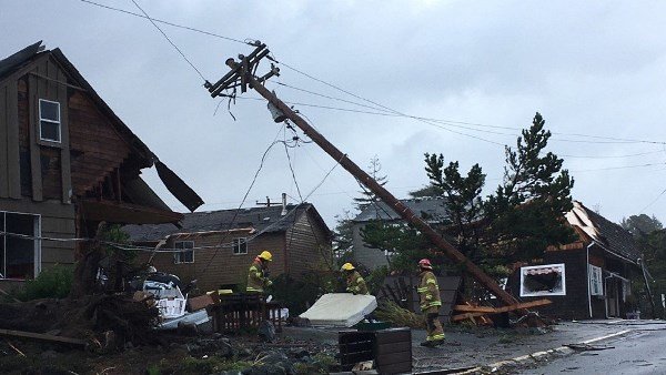
Two tornadoes struck the Pacific Northwest Friday as a major storm system closed in on Oregon and Washington State.

One began as a waterspout over the ocean, before moving overland and causing damage in the beach town of Manzanita, Oregon. A video shared on Twitter Friday afternoon appears to show the waterspout moving overland.

The National Weather Service Portland twitter account appeared to support the video's authenticity. Two men can be heard discussing the sight, and at one point one describes it as a "freaking twister."

Stunning video of the Tornado heading towards #Manzanita #CoastTornado #koin6news pic.twitter.com/rVLJg6P6l5

โ€” Dan Tilkin (@DanTilkinKOIN6) October 14, 2016

Comment: See also: Rare tornado hits Oregon as Pacific Northwest braces for more extreme weather