Storms
S

Tornado1

Tornadoes touch down in Oklahoma, Kansas as storms batter Midwest - one was 'multi-vortex'

Storm damage to a home and an overturned truck caused by a tornado that hit in the early morning hours Wednesday near SW 49 and Czech Hall Road in Mustang.
© CHRIS LANDSBERGER/THE OKLAHOMANStorm damage to a home and an overturned truck caused by a tornado that hit in the early morning hours Wednesday near SW 49 and Czech Hall Road in Mustang.
Multiple tornadoes touched down in Oklahoma and Kansas late Tuesday into Wednesday after days of violent weather damaged homes and businesses and knocked out power to thousands of people.

Many Oklahomans woke up to storm sirens as two likely tornadoes touched down in the Oklahoma City area Wednesday, according to the National Weather Service.

Oklahoma City Mayor David Holt said there were no reported injuries in the city, but some roofs were damaged. "All in all, we're okay!" Hold wrote on Twitter Wednesday.

Two other suspected twisters touched down in the western part of the state, near Frederick and Clinton, about 85 miles west of Oklahoma City. The National Weather Service was surveying the area to confirm the intensity and scale of the tornadoes.

A twister in Clinton ripped off the roof of an auto repair shop and knocked over power lines and traffic signs. The Clinton Regional Airport reported 28 out of 29 hangars took damage; one collapsed on a plane and a vehicle. In Mustang, a vehicle was seen flipped over on its side near buildings with damaged roofs.

Cloud Lightning

Severe storms batter Sydney, and much of eastern Australia remains in the firing line

Storms across the Sydney area have dumped large hail.
The latest round of wild weather has brought large hail and heavy rain as supercell thunderstorms formed over eastern Australia.

Parts of Sydney have already felt the brunt; large hail has fallen in several areas and 24mm hit the rain gauge at Penrith between 3:00pm and 5:00pm AEDT.

The Bureau of Meteorology added a "risk of tornado activity" to its Sydney storm warning just after 3:00pm but it has since been removed.

Severe weather warnings remain current in several states so keep on top of the warnings for your local area.

South-east Queensland and northern New South Wales could well be in for more severe storms tomorrow.


Attention

Storm surge so strong wave monitor was washed away in Wellington, New Zealand - swells up to 6 meters high

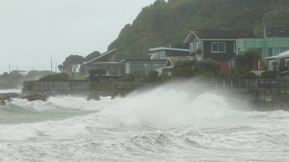
Swells were as high as 6m in yesterday's wild weather.
© Jack CrosslandSwells were as high as 6m in yesterday's wild weather.
Wellington's weather was so wild yesterday that a wave-height monitor was washed away across the harbour.

The Lower Hutt suburb of Eastbourne was completely cut off by large swells and debris. Roads on Wellington City's south coast were also closed after rocks from the seawall ended in the path of motorists.

Flights were disrupted and ferries across the Cook Strait cancelled.

By pure coincidence, regional and city councillors were visiting what is the maritime equivalent of an air traffic control centre on Beacon Hill at the time of the storm.

The signal station is staffed 24 hours a day and is the first point of contact for ships arriving to and departing from Wellington Harbour.


Comment: Related: The sting of spring: Late snowfall covers parts of South Island, New Zealand - up to a foot of snow


Snowflake

Snowstorm hits Wyoming with as much as 20 inches of early snow

snow
© Dan Cepeda, Oil City
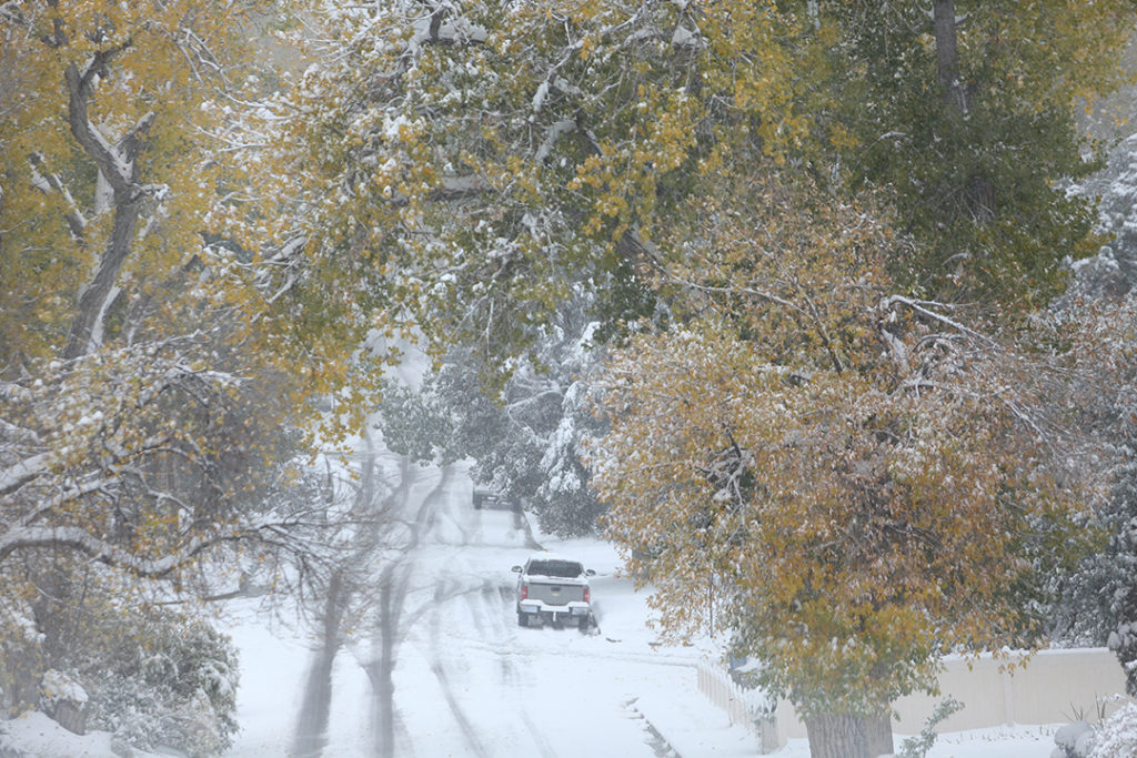
The first snowfall of the season dropped as much as 17.4 inches of snow in the Casper area, according to final totals shared by the National Weather Service in Riverton on Wednesday.

The storm moved in on Monday night and dropped 17.4 inches by Wednesday west southwest of Casper. The Casper-Natrona County International Airport saw 12.7 inches of snow, according to the NWS in Riverton.

Snow telemetry (SNOTEL) sites in the eastern Bighorns recorded the highest snowfall totals in the storm. 20 inches fell at Soldier Park, 19 inches at Hansen Sawmill and 18 inches at Cloud Peak.


Boat

Typhoon Kompasu causes flooding in China's Hainan province

makes landfall in south China island province
Typhoon Kompasu makes landfall in south China island province
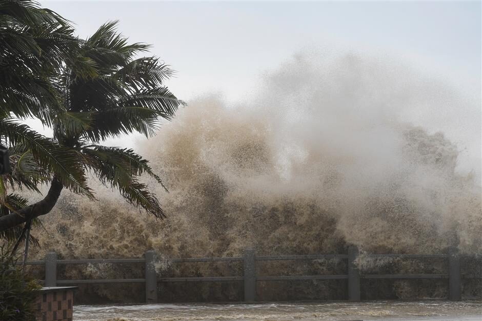
Typhoon Kompasu made landfall in China's Hainan island on October 13, 2021, bringing heavy rains and coastal flooding to the southern island province. The local meteorological office recorded winds up to 119km/h (74mph) as the storm hit the seaside city of Qionghai.


Video source: CCTV

Cloud Precipitation

Hurricane Pamela hits Mexico as a Category One storm

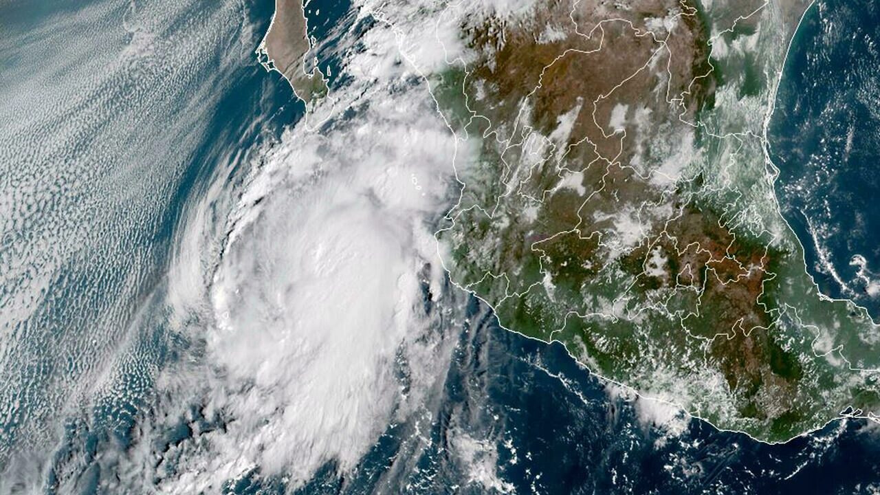
This National Oceanic and Atmospheric Administration (NOAA) satellite handout image shows Hurricane Pamela at 15:10:20 UTC, on October 12, 2021
Hurricane Pamela made landfall on the western coast of Mexico Wednesday as a Category One storm, with life-threatening storm surge and heavy rainfall predicted, the US National Hurricane Center said.

At 1200 GMT, Pamela crossed on to land about 65 kilometers (40 miles) north of the Pacific port of Mazatlan, in the northwestern state of Sinaloa, with sustained winds of 120 kph (75 mph) and was moving at 22 kph (14 mph), according to data from the Miami-based NHC.

The "center of Hurricane Pamela was making landfall on the west-central coast of Mexico near Estacion Dimas," a community of about 3,600 inhabitants, the NHC reported.


Tornado2

Giant waterspout spotted off Greek island of Kythera

The waterspout at Kythera, Greece.
© Notos PressThe waterspout at Kythera, Greece.
A waterspout formed off the coast of the island of Kythera on Monday. A waterspout is a cylindrical vortex that forms over water and connects to the clouds in the sky.

Waterspouts are typically known as 'sea-tornadoes.' These rotating winds appear to reach down to the sea and take it up as they spiral into the air, but in reality, the water inside the spout originates in the clouds above and snakes its way down to the sea.

Such weather events can be extremely dangerous, especially when they occur over dry land in the form of twisters and tornadoes. Human fatalities from these vortexes are typically between 300-400 each year, according to the World Meteorological Organization.

Snowflake

Rocky Mountains experience 1st big snowfall early in the season - over 2 feet of snow reported

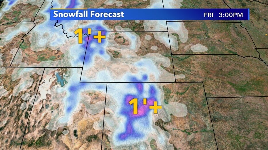
While Wisconsin struggles to get any hint of fall weather, parts of the Rocky Mountains have already received their first big snowfall of the season. Since Monday, Oct. 11 parts of Montana, Idaho, and Wyoming have received well over 2' of snow with isolated pockets at higher elevations receiving more.

Another system that arrives Wednesday, Oct. 13 lasting into the weekend of the 15th will drop easily over a foot of snow in some areas of Wyoming and Colorado.

Snowfall forecast from Wednesday, Oct. 13 through Friday, Oct. 15
Generally, higher elevations are the first to start seeing big snows in Fall but a sign of changing seasons is yet to arrive in the midwest. Enjoy this abnormally warm start to Fall while we have it. Start planning those ski trips soon!

Comment: For videos and images, view: Winter weather arrives early, foot or more of snow in high country of Colorado


Snowflake

Summer and winter are clashing, delivering tornadic weather and feet of snow to US

WEATHER
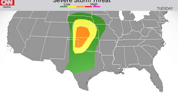
A clash between summer and winter across the central US is causing an autumn outbreak of snow where the air is colder and severe storms, along with tornadoes and flash flooding, where it's warmer.

There's a "big temperature contrast across the country as a battle of the seasons commences," said the Weather Prediction Center.

Cooler-than-average temperatures have infiltrated the West, while above-average temperatures are occupying the East.

Between the two competing air masses is where the extreme weather will battle.

Autumn severe weather is very similar to severe outbreaks we see in early spring -- as colder air clashes with oncoming warming, says CNN meteorologist Chad Myers.

"The shorter fall severe weather season occurs when the warm air of summer is pushed away by the incoming colder air of winter."

Snowflake

Winter weather arrives early, foot or more of snow in high country of Colorado

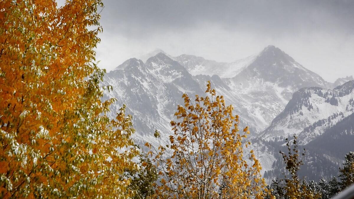
Clouds lift from the West Needles on Tuesday morning to reveal the snow-covered San Juan Mountains north of Durango.
© Jerry McBride/Durango HeraldClouds lift from the West Needles on Tuesday morning to reveal the snow-covered San Juan Mountains north of Durango.
Mountain passes turn icy; Wolf Creek Pass closes for five hours

Winter may be a couple of months away, but Southwest Colorado got its first taste of cold and snow Tuesday, with reports of over a foot of snow in the high country.

Scott Stearns, a meteorologist with the National Weather Service in Grand Junction, said an official inch count of how much snow fell in the mountains north of Durango will not be available until Wednesday.

"We usually get a lot of reports the morning after the snow occurs," Stearns said.

Snow reportedly started falling just after midnight Tuesday, with the Colorado Department of Transportation reporting 6 inches of snow on mountain passes as early as 5:30 a.m.

"Our plow drivers were out plowing the surface of the roadways, and they've been after it throughout the day," said CDOT spokeswoman Lisa Schwantes.