Many Oklahomans woke up to storm sirens as two likely tornadoes touched down in the Oklahoma City area Wednesday, according to the National Weather Service.
Oklahoma City Mayor David Holt said there were no reported injuries in the city, but some roofs were damaged. "All in all, we're okay!" Hold wrote on Twitter Wednesday.
Two other suspected twisters touched down in the western part of the state, near Frederick and Clinton, about 85 miles west of Oklahoma City. The National Weather Service was surveying the area to confirm the intensity and scale of the tornadoes.
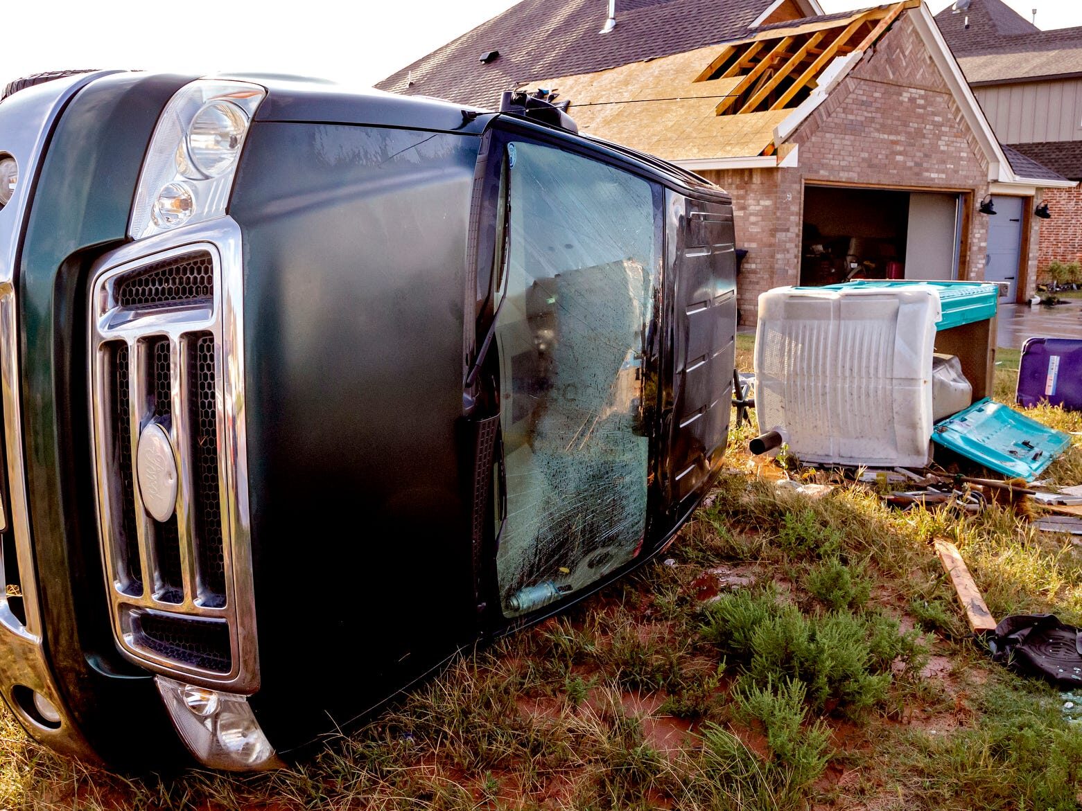
A twister in Clinton ripped off the roof of an auto repair shop and knocked over power lines and traffic signs. The Clinton Regional Airport reported 28 out of 29 hangars took damage; one collapsed on a plane and a vehicle. In Mustang, a vehicle was seen flipped over on its side near buildings with damaged roofs.
Several tornadoes also touched down in western Kansas, but there were no initial reports of injuries or major damage, according to the National Weather Service.
KFOR-TV Meteorologist Mike Morgan said one of the tornadoes in the Oklahoma City area was a "multi-vortex" tornado.
"It was a pretty good size, cone-shaped tornado and then went over to a multi-vortex tornado," he said.
AccuWeather Senior Meteorologist Dan Pydynowski said a multi-vortex tornado is created when wind is rotating around several different, small centers within the tornado as opposed to one center of a tornado.
"Sometimes you have two or three centers that the wind is whipping around," he said. "They can be a little more dangerous, you can have a little more damage, a couple different swaths of damage along the path of each of the vortices. But it still comes down to what the winds speeds are, more than anything."
Towns throughout Oklahoma are still recovering after a severe storm system Sunday that brought tornadoes, heavy rain, damaging winds, baseball-size hail and flash-flooding. At least seven tornadoes had been confirmed and several others were awaiting verification, according to the National Weather Service. Thousands of Oklahomans lost power because of storms whipping wind gusts of up to 70 mph.
The storms were spreading over parts of Kansas, Missouri and Texas, Pydynowski said, adding that the front was weakening.
"There will be thunderstorms, especially later today across Texas, but the threat may turn into a flood threat in Texas as opposed to violent storm threat."
Meanwhile, Hurricane Pamela made landfall on Mexico's Pacific coast Wednesday. The storm could approach Texas by Thursday.
Moisture being drawn northeastward from Pamela will "enhance the threat heavy rain" across the southern Plains by Wednesday night, the National Weather Service said.
This has been a relatively quiet year for tornadoes thus far, and the overall number of tornadoes for 2021 is below the recent three-year average. But there have been some spikes during the spring and summer, according to the National Weather Service Storm Prediction Center.
Bacon reported from Arlington, Va. Contributing: The Associated Press


Severe storms batter Sydney, and much of eastern Australia remains in the firing line
The latest round of wild weather has brought large hail and heavy rain as supercell thunderstorms formed over eastern Australia. Parts of Sydney have already felt the brunt; large hail has fallen...