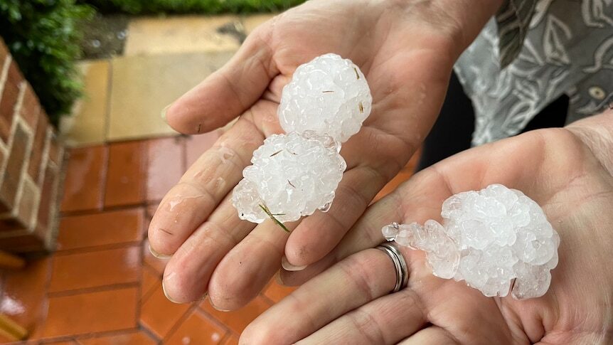
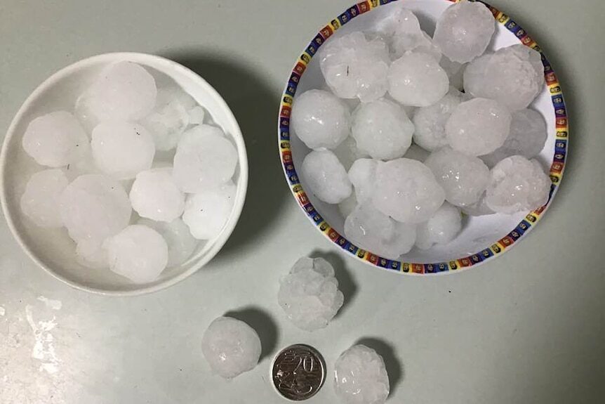
Parts of Sydney have already felt the brunt; large hail has fallen in several areas and 24mm hit the rain gauge at Penrith between 3:00pm and 5:00pm AEDT.
The Bureau of Meteorology added a "risk of tornado activity" to its Sydney storm warning just after 3:00pm but it has since been removed.
Severe weather warnings remain current in several states so keep on top of the warnings for your local area.
South-east Queensland and northern New South Wales could well be in for more severe storms tomorrow.
On Wednesday night and early Thursday the initial band of the system brought widespread falls; Brisbane City recorded 51mm, while 85mm fell at Upper Springbrook on the Gold Coast, where onshore winds and elevation helped boost the total.
Falls of up to 55mm were recorded in the north-east and south-east of New South Wales, with up to 25mm over South Australia and Victoria; Melbourne clocked 15mm.
But conditions ramped up again this afternoon.
"We've seen a secondary band redevelop over the inland plains of New South Wales ... so expecting a significant storm outbreak to take place today and actually be the peak of the action," according to Jackson Browne, senior meteorologist with the weather bureau.
Usually, storm forecasts talk about damaging winds with large hail; on Thursday the forecast is for possibly destructive winds and giant hail.
"These are the sort of storms that are capable of bringing down trees and power lines and cause building and crop damage and create dangerous and hazardous driving conditions," Mr Browne said.
Severe storms had been forecast from East Gippsland north to Rockhampton Thursday, while a flash flooding warning was issued for Traralgon.
Residents were asked to keep away from floodwater as the State Emergency Service received more than 55 calls for help.
A flood warning was also issued for the Latrobe River downstream of Traralgon.
With excellent foresight when asked at approximately 2:00pm Mr Browne said:
"I'd be watching Sydney if I was a betting man."Not the day to forget Tasmania
A band of moisture is extending from South Australia to Tasmania, where it is being forced up over the usually dry east of the state — it is the west of Tasmania that usually gets drenched.
Just over 80mm have fallen since 9:00am at Gray near St Marys in the north-east.
Flood watches and warnings have been issued for parts of Tasmania, Victoria and New South Wales, with flooding expected to continue into Friday.
"But what happens into the weekend is more uncertain," Mr Browne said.
"It really depends on the finer-scale movements of these multiple lows which are caught up in this system."
But he warns the flooding could extend into next week.
While Thursday is expected to be the big day for New South Wales, in particular, Queensland and far northern New South Wales could still get more storms tomorrow.
It is not over yet.


This summer will be the summer of floods, hail and tornadoes. You heard it here first.
And no, unlike USA, tornadoes are exceedingly rare here in Aus. In my entire lifetime of 39 years I can count 3 of them - the two mentioned above, and there was one in Wollongong region 2 years ago. The MSM are now putting on a propaganda campaign saying, "Oh, tornadoes are normal in Australia. We've had them for decades." [Link]