Earthquakes
S


Bizarro Earth

USGS: Earthquake Magnitude 5.6 - Bulgaria

Bulgaria Quake_220512
© USGSEarthquake Location
Date-Time:
Tuesday, May 22, 2012 at 00:00:33 UTC

Tuesday, May 22, 2012 at 03:00:33 AM at epicenterTime of Earthquake in other Time Zones

Location:

42.686°N, 23.009°E

Depth:
9.4 km (5.8 miles)

Region:

BULGARIA

Distances:
24 km (14 miles) W of SOFIA, Bulgaria

73 km (45 miles) N of Blagoevgrad, Bulgaria
115 km (71 miles) SE of Nis, Serbia

141 km (87 miles) NNE of Strumica, Macedonia

Bizarro Earth

Why Italy's Earthquake Was Weird

Italy Quake
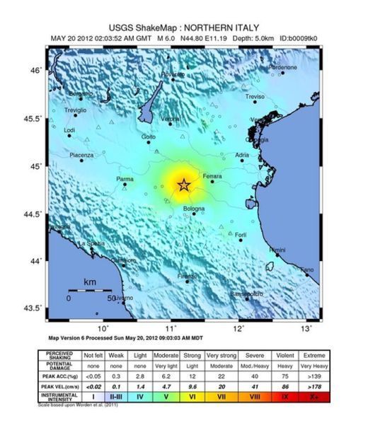
© USGSThe intensity of shaking from the 6.0 magnitude earthquake that struck northern Italy on May 20, 2012.
A strong and unusually shallow earthquake struck northern Italy over the weekend, fracturing pavement, sending torrents of brick and rubble raining down from buildings, and killing seven people. The powerful shaking was a first for the region in centuries - and fairly surprising to seismologists.

Data indicate the magnitude-6.0 quake, which struck just after 4 a.m. local time on Sunday (May 20), just north of Bologna, was a thrust quake - the type of earthquake caused when two tectonic plates smash together - yet it occurred at a depth of just 3 miles (5 kilometers).

"It is kind of surprising that it's that shallow, because it's pretty far from the plate boundary," said Paul Caruso, a geophysicist with the U.S. Geological Survey. "Normally we expect things to get deeper as they move northward," he told OurAmazingPlanet.

Shallow shaking

The quake hit about 470 miles (750 km) north of the plate boundary - the place where the two colliding plates meet - which runs along the sole of Italy's "boot."

It is here that the African plate is plowing slowly northward, crashing into the Eurasian plate.

Caruso explained that the shallower a quake, the more damage it can cause. "If a quake is 500 kilometers deep, and you're right on top of it, you're going to feel it a lot less strongly than if it's 5 kilometers deep," he said. "As the seismic energy moves through the ground some of it is dissipated."

The strong quake rocked an area with a long history of earthquakes, yet one that has kept relatively quiet for hundreds of years.

"There has not been a whole lot of action in that area," Caruso said. "The fact that they do have records of earthquakes going back a couple thousand years shows this area hasn't been seismically active for a long time," he said.

Thousands of people were displaced by the quake, and many people spent the night in tents hurriedly erected on soccer fields.

Bizarro Earth

M6.2 quake and several above M5.0 hit off Northeast Japan in last day

Earthquake Information
Japan Meteorological Agency

17:50 JST 20 May 2012 17:42 JST 20 May 2012 Sanriku Oki M5.1 2
17:27 JST 20 May 2012 17:21 JST 20 May 2012 Sanriku Oki M5.4 2
16:54 JST 20 May 2012 16:49 JST 20 May 2012 Ibaraki-ken Hokubu M3.3 1
16:38 JST 20 May 2012 16:28 JST 20 May 2012 Sanriku Oki M5.7 2
16:32 JST 20 May 2012 16:20 JST 20 May 2012 Sanriku Oki M6.2 3
14:57 JST 20 May 2012 14:52 JST 20 May 2012 Fukushima-ken Oki M3.6 1
12:56 JST 20 May 2012 12:49 JST 20 May 2012 Niigata-ken Chuetsu-chiho M1.8 1
04:24 JST 20 May 2012 04:17 JST 20 May 2012 Sanriku Oki M4.8 1
04:20 JST 20 May 2012 04:14 JST 20 May 2012 Sanriku Oki M5.4 1
04:11 JST 20 May 2012 04:05 JST 20 May 2012 Sanriku Oki M5.8 3
03:36 JST 20 May 2012 03:31 JST 20 May 2012 Akita-ken Nairiku-hokubu M2.8 1
01:23 JST 20 May 2012 01:18 JST 20 May 2012 Aki-nada M3.3 1
23:27 JST 19 May 2012 23:22 JST 19 May 2012 Ibaraki-ken Hokubu M3.3 1
23:25 JST 19 May 2012 23:20 JST 19 May 2012 Miyagi-ken Oki M3.9 1
09:14 JST 19 May 2012 09:09 JST 19 May 2012 Sanriku Oki M4.8 1
07:41 JST 19 May 2012 07:36 JST 19 May 2012 Miyagi-ken Oki M3.4 1
07:02 JST 19 May 2012 06:57 JST 19 May 2012 Ibaraki-ken Nambu M3.1 1
06:37 JST 19 May 2012 06:32 JST 19 May 2012 Sanriku Oki M4.7 1
06:28 JST 19 May 2012 06:23 JST 19 May 2012 Sanriku Oki M5.1 2

Bizarro Earth

USGS: Earthquake Magnitude 6.0 - Off The East Coast of Honshu, Japan

Honshu Quake_200512
© USGSEarthquake Location
Date-Time:
Sunday, May 20, 2012 at 07:19:55 UTC

Sunday, May 20, 2012 at 05:19:55 PM at epicenterTime of Earthquake in other Time Zones

Location:

39.597°N, 143.242°E

Depth:
10 km (6.2 miles)

Region:

OFF THE EAST COAST OF HONSHU, JAPAN

Distances:
179 km (111 miles) E of Morioka, Honshu, Japan

181 km (112 miles) SE of Hachinohe, Honshu, Japan

251 km (155 miles) ESE of Aomori, Honshu, Japan

532 km (330 miles) NE of TOKYO, Japan

Brick Wall

In pictures: Italy earthquake

Image
© ReutersA 6.0-magnitude earthquake has rocked a swathes of northern Italy, killing at least four people.
Image
© AFPMany historic buildings across Emilia Romagna were destroyed, with the government describing the damage to the region's cultural heritage as "significant".

Bizarro Earth

Update: Powerful quake kills at least 3 in northern Italy

Italy tower quake
© AFP/Getty ImagesA bell tower in Santuario, Italy, was damaged after an earthquake on Saturday.
Rome - One of the strongest earthquakes to shake northern Italy rattled the region around Bologna early Sunday, a magnitude-6.0 temblor that killed at least three people, toppled some buildings and sent residents running into the streets, emergency services and news reports said.

The quake struck at 4:04 a.m. Sunday between Modena and Mantova, about 35 kilometers (22 miles) north-northwest of Bologna at a relatively shallow depth of 5 kilometers (3.2 miles), the U.S. Geological Survey said.

It was one of the strongest quakes to shake the region, seismologists said, and initial television footage indicated that older buildings had suffered damage: roofs collapsed, church towers showed cracks and the bricks of some stone walls tumbled into the street. As dawn broke over the region, residents milled about the streets inspecting the damage.

Bizarro Earth

USGS: Earthquake Magnitude 6.0 - Northern Italy

N.Italy Quake_200512
© USGSEarthquake Location
Date-Time:
Sunday, May 20, 2012 at 02:03:52 UTC

Sunday, May 20, 2012 at 04:03:52 AM at epicenterTime of Earthquake in other Time Zones

Location:

44.800°N, 11.192°E

Depth:
5.1 km (3.2 miles)

Region:

NORTHERN ITALY

Distances:
36 km (22 miles) NNW of Bologna, Italy

69 km (42 miles) E of Parma, Italy

72 km (44 miles) SSE of Verona, Italy

339 km (210 miles) NNW of ROME, Italy

Bizarro Earth

Lessons From Past Earthquakes and Implications For Today and The Future

Image
© Unknown
The 1811-1812 New Madrid earthquakes were intense beginning initially with dual earthquakes on December 16, 1811. These earthquakes remain the most powerful to hit the eastern United States in recorded history according to the U.S. Geological Survey.

The events were named for the Mississippi River town of New Madrid now within Missouri. Some sections of the Mississippi River appeared to run backward for a short time during the 1811-1812 earthquakes. A request, dated January 13, 1812, by William Clark , then the governor of the Louisiana Territory, asked for expeditious federal relief for the "inhabitants of New Madrid County".

There are estimates that the earthquakes were felt considerably over a 50,000 sq. mi. area. By comparison, the 1906 San Francisco earthquake was felt moderately over a much smaller area and a repeat event is expected soon. The New Madrid Seismic Zone consists of reactivated faults that formed when North America began to split during the breakup of a supercontinent during the Neoproterozoic Era. Faults were created along the rift and igneous rocks formed from magma which pushed multi-directionally toward the surface.

In a report filed in November 2008, the U.S. Federal Emergency Management Agency warned that a serious earthquake in the New Madrid Seismic Zone could result in "the highest economic losses due to a natural disaster in the United States," further predicting "widespread and catastrophic" damage across Alabama, Arkansas, Illinois, Indiana, Kentucky, Mississippi, Missouri, and particularly Tennessee, where a 7.7 magnitude quake or greater would cause damage to tens of thousands of structures affecting water facilities, transportation and other vital infrastructure.

Question

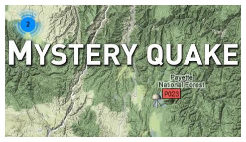
Mystery Earthquake Near McCall Puzzles Scientists, Technicians

Mystery Quake
© KTVB.com
McCall, Idaho -- You could call it a mystery earthquake, a sonic boom, or maybe nothing at all.

Several witnesses report waking up to what they say was a small earthquake south of McCall early Thursday around 4:30 a.m. However, those shaky claims have employees at Idaho's U.S. Geological Survey scratching their heads in disbelief.

Mickey Hart lives five miles south of McCall just off Highway 55. The 50-year-old resident said she's experienced one previous earthquake here in the summer of 2001.

The second earthquake came early Thursday around 4:30 a.m. Hart says that's when her beloved border collie, Mr. Mac, detected the tremor before it hit.

"It was four in the morning, and the house shook," Hart said. "It woke up my husband and scared the crap out of my dog."

However, for some folks here in Idaho, those reports just don't seem to make sense.

U.S. Geological Survey Technical Information Specialist Tim Merrick said his agency's seismographs haven't shown any recent earthquake activity in Idaho.

"If there was anything, it would almost certainly show up," Merrick said. "Our seismology network across the United States is very sensitive."

Scott VanHoff, USGS Geospatial Mapping Coordinator, agrees.

"Idaho looks amazingly quiet, and I don't see anything," VanHoff said, adding that the only earthquake he'd seen recorded was yesterday. USGS records show that event was a magnitude 2.2 earthquake recorded around 9:30 p.m., at a location northwest of Weiser, Idaho.

However, other folks in the Valley County area maintain they positively did feel an earthquake early Thursday morning.

Captain Brandon Swain with the McCall Fire Department says he heard reports of the mystery earthquake from his brother, Clint Swain, who lives near Lake Fork.

"My brother was awake at about 4:30 or 5 a.m., and the earthquake woke up his wife," Swain said.
Bizarro Earth

USGS: Earthquake Magnitude 6.2 - Off The Coast of Aisen, Chile

Aisen Quake_180512
© USGS
Date-Time:
Friday, May 18, 2012 at 02:00:41 UTC

Thursday, May 17, 2012 at 09:00:41 PM at epicenterTime of Earthquake in other Time Zones

Location:

44.594°S, 80.073°W

Depth:
10 km (6.2 miles)

Region:

OFF THE COAST OF AISEN, CHILE

Distances:
542 km (336 miles) WSW of Castro, Los Lagos, Chile

639 km (397 miles) W of Coihaique, Aisen, Chile

676 km (420 miles) WSW of Puerto Montt, Los Lagos, Chile

1478 km (918 miles) SSW of SANTIAGO, Region Metropolitana, Chile