Earth ChangesS

Igloo

Heaviest snowfall in many years hits Polish-Slovakian border

Due to heavy snowfall a state of emergency was imposed in 20 towns at the Polish-Slovakian Border, near to Orava. Last night it was seen 75 cm of snow!

More than 1200 residents of the region were left without electricity after heavy snowfall knocked out power lines and substations.

I've never seen such big flakes of snow. They are as big as the coin two euros. Within 24 hours as much snow fell as usual throughout the winter. Snow cover in some places more than five feet, the governor said.

Plows can not keep up with snow removal routes.

Source: WP.PL (In Polish)

Cloud Precipitation

Major snowstorm in Ontario causes flight cancellations, school closings

snowstorm toronto
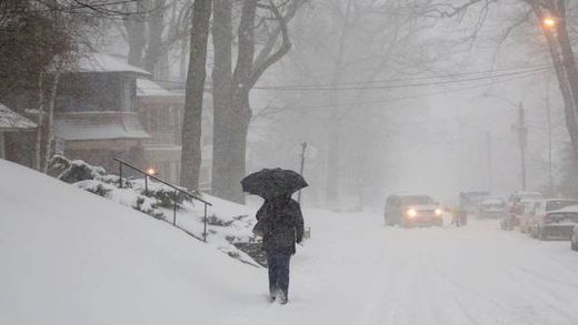
© Chris Young /The Globe and MailA woman walks down a residential street as snow falls in Toronto on Friday, February 8, 2013.
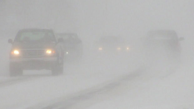
The worst of a winter storm into southern Ontario landed during morning rush hour, covering the region in a white shroud of snow flurries and sleet, forcing schools to close and disrupting land and air traffic. (For a list of school closures, transit delays and flight information,click here.)

Other vehicles were reported to be stuck in snowbanks, in ditches or blocking lanes after spinning out of control. At the Bayview entrance of the southbound Don Valley Parkway, cars had trouble negotiating the icy in-ramp. The DVP's Bayview off-ramp was reported to be closed because of slippery conditions. On Highway 401, the eastbound collector off-ramp at Allen Road was also closed because of the road conditions.

On the Queen Elizabeth Way, near Fort Erie, a snowplow fell into a ditch and, a few kilometres further north, a salter truck had rolled.

More than 150 highway car collisions had been reported, said Ontario Provincial Police Sergeant Dave Woodford.

There were only minor injuries, mostly from fender benders, he said.

Windsock

Predicting Weather with a Pig Spleen

Have you ever heard of a pig spleen being able to predict the weather? You can call it folklore - but what do you call it when it works?

Legendary forecaster Gus Wickstrom of Tompkins, Saskatchewan

gus forecast pig spleen
Gus, a man of Swedish descent who lived in this prairie province all of his life, was a weather forecaster. He predicted weather conditions six months in advance, yet his technology required no fancy equipment, no high-tech razzle-dazzle. All Gus needed was a barn and a farmhand or two standing by. . .because he predicted the weather by looking at a pig spleen.

Every 6 months or so, Gus slaughtered a pig, and in the frugal way of farm families, he found a way to use everything but the squeal, as they say. Gus closely scrutinized the spleen, using a method he learned from his father and Harold Pearson, a neighbor.

Gus's method

(See image to the right.) Gus divided the spleen into six areas, each representing 1 month. The top of the spleen (closest to the pig's head) shows the current month. The bottom indicates the end of the upcoming six-month period. Where the spleen thickens, a change in the weather is indicated, usually pointing to a cold spell. Where there's a pronounced bulge, expect even more inclement weather. Gus could even read wind and rain into the variations in the spleen.

Snowflake

NASA's satellite view of massive Nor'easter - frontal system stretching from Canada through the Ohio and Tennessee valleys, into the Gulf of Mexico

A massive winter storm is coming together as two low pressure systems are merging over the U.S. East Coast. A satellite image from NOAA's GOES-13 satellite on Feb. 8 shows a western frontal system approaching the coastal low pressure area.

Image
© NASA
The satellite image, captured at 9:01 a.m. EST, shows clouds associated with the western frontal system stretching from Canada through the Ohio and Tennessee valleys, into the Gulf of Mexico. The comma-shaped low pressure system located over the Atlantic, east of Virginia, is forecast to merge with the front and create a powerful nor'easter. The National Weather Service expects the merged storm to move northeast and drop between two to three feet of snow in parts of New England.

Arrow Down

2 Great Lakes hit lowest water level on record


Two of the Great Lakes have hit their lowest water levels ever recorded, the U.S. Army Corps of Engineers said Tuesday, capping more than a decade of below-normal rain and snowfall and higher temperatures that boost evaporation.


Measurements taken last month show Lake Huron and Lake Michigan have reached their lowest ebb since record keeping began in 1918, and the lakes could set additional records over the next few months, the corps said. The lakes were 29 inches below their long-term average and had declined 17 inches since January 2012.

The other Great Lakes - Superior, Erie and Ontario - were also well below average.

"We're in an extreme situation," said Keith Kompoltowicz, watershed hydrology chief for the corps district office in Detroit.

The low water has caused heavy economic losses by forcing cargo ships to carry lighter loads, leaving boat docks high and dry, and damaging fish-spawning areas. And vegetation has sprung up in newly exposed shoreline bottomlands, a turnoff for hotel customers who prefer sandy beaches.

Snowflake Cold

Southern Ontario braces for biggest snowstorm in years

Image
© CBC News
The Friday morning commute is looking to be an ugly one for Southern Ontario as the Alberta Clipper swinging through the area today is amplified by moisture from another storm system moving up from the United States.

"It might be the biggest storm since 2011," said Rob Khun, a severe weather meteorologist with Environment Canada, referring to the March 2011 storm that dumped 12.5 cm of snow on the GTA.

Snow from the storm system has begun to fall in southwestern Ontario this morning as the Alberta Clipper tracks through the area, and it should arrive in the GTA by this afternoon. This will leave about 2 cm of accumulation on the ground, however the added moisture arriving from the south this evening will turn this to heavy snowfall overnight and into Friday morning.

Total accumulations for southern Ontario are expected to be between 15 and 25 cm of snow, and strong winds will add blowing snow to the mix, making for hazardous driving conditions tonight, through the Friday morning commute, and possibly into tomorrow afternoon as well.

Eastern Ontario is expected to be even harder hit, as snowfall accumulations already forecast to be up to 25 cm from the Alberta Clipper are pushed up to 35 cm or higher by the approaching storm from the south and local amplification due to winds blowing in off of Lake Ontario.

Environment Canada has issued Snowfall Warnings from London-Essex to Kingston-Prince Edward regions, and from Niagara region up into Grey-Bruce along the shores of Lake Huron and Georgian Bay.
Snowflake

Monster blizzard Nemo headed for U.S. Northeast

Blizzard_1
© Kelly Keene
A significant snowstorm is expected, which can be compared to the 1978 blizzard. Snowfall could exceed two feet (.6 meters) in some areas.

The northeastern United States is preparing for a monster storm, which many are calling Nemo, expected on February 8, 2013. It could easily produce over two feet of snow (.6 meters) and wind gusts over 60 miles (96 km) per hour, causing zero visibility and bringing cities to a standstill.

In many ways, we are looking at an historic storm that could paralyze cities such as Boston, Providence, and Hartford. We're expecting blizzard conditions in eastern and southeastern Massachusetts, Connecticut, Rhode Island, Northeastern New Jersey, Long Island, southeastern Maine, and New York City.

Moderate to major coastal flooding is also possible. Two storm systems will phase together to create a large pressure gradient that will result in winds sustaining around 35-50 mph with gusts over 74 mph. Tonight is the last night to get ready for a significant snowstorm that can be compared to the 1978 blizzard.
Blizzard
© Google/NWSBlizzard warnings are in effect for parts of the Northeast.

Sun

Crepuscular rays over the Gulf of Mexico

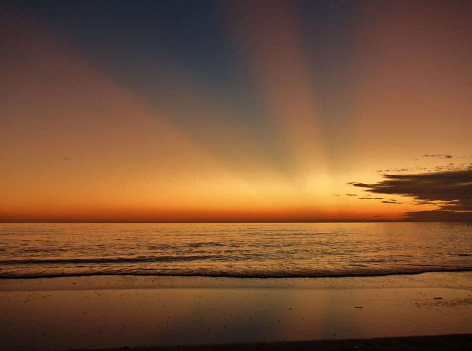
Our friend on Facebook, Rick Trommater in St. Peterburg, Florida, captured this beautiful photo of crepuscular rays at sunset on the evening of February 5, 2013.
Crepuscular Rays
© Rick Trommater/EarthSky OrgCrepuscular rays, sometimes called sunrays, via Rick Trommater. View Larger
Crepuscular rays are columns of sunlit air, streaming through gaps in clouds or other objects (for example, mountain peaks). Darker cloud-shadowed regions lie between the sunlit columns.

These rays are really parallel to each other. But they appear to diverge, much as a road that looks narrow in the distance appears wide beneath your feet. This beautiful photo of a winter sunset over the Gulf of Mexico shows them clearly.

Bizarro Earth

More volcanic activity in Solomons quake zone

The National Disaster Management Office in Solomon Islands says volcanic activity has increased on an island in Temotu province since the magnitude 8.0 earthquake two days ago.

Sipuru Rove says the uninhabited island of Tinakula, which is about 50 kilometres north of Lata, has being making loud and strange sounds.

He says help and information is needed from technical experts to assess the risk posed to the local community by the volcano as they are worried an eruption could be near.
"The volcanic activity on one of the islands that is off Lata is alarming at the moment. And this will really require scientific special people to assist us in assessing this volcanic activity which is beginning to be abnormal."
Sipuru Rove says there are also significant aftershocks which meant a plane with supplies and medical staff couldn't land and was forced to return to Honiara.

Bizarro Earth

Researcher discovers future megavolcano

Megavolcano
© Fox13 News
Salt Lake City - A researcher at the University of Utah is making waves in the scientific community with a discovery deep within the Earth that could cause extinction.

Michael Thorne, a seismologist and assistant professor at the University of Utah, has discovered a dark red blob in the Earth's core that could prove devastating.

Research shows that two rock piles the size of continents are colliding, creating a molten rock the size of Florida that could eventually cause a giant eruption.

"Something like the size of Alaska eruption probably coming out in the Pacific Ocean. This is something that might be down the road some 100 million years or so," Thorne said. "This is the kind of eruption that would make a super volcano eruption look pretty small."