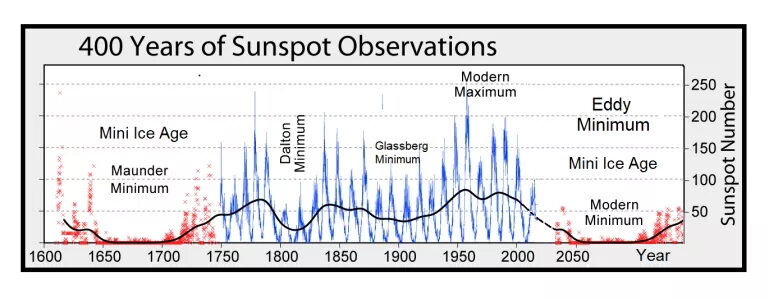
Cloud cover is increasing across the planet as the Sun's magnetic field continues to weaken, decreasing the outward pressure of the solar wind and allowing more cosmic rays to penetrate Earth's atmosphere.
This year's record start to the Northern Hemisphere snow season is due to two factors: 1) falling temperatures across the mid-latitudes, and 2) an increase in cloud cover.
Both of these factors are linked to low solar activity, and while each impacts the other, factor 1 is mainly due to a weakening of the jet stream, with factor 2 predominantly the result of an influx of cloud nucleating cosmic rays.
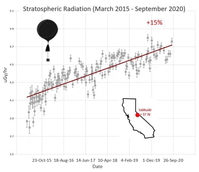
Very briefly, Galactic Cosmic Rays are a mixture of high-energy photons and sub-atomic particles accelerated toward Earth by supernova explosions and other violent events in the cosmos. Solar Cosmic Rays are the same, though their source is the sun. Both Galactic and Solar Cosmic rays hitting Earth's atmosphere create aerosols which in turn seed clouds (Svensmark et al) — making them an key component in our weather and climate. Recent balloon flights by spaceweather.com and Earth to Sky Calculus reveal that cosmic rays are intensifying:
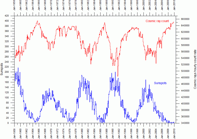
It has been revealed that cosmic rays increase during times of low solar activity:
And when the cosmic ray count is high, cloud nucleation increases with it (Svensmark et al).
Many scientists across a multitude of disciplines have now concluded that clouds play the most crucial role in Earth's climate, including Kauppinen & Malmi, Ueno et al, and Nikolov, to name just three. Also, the quote from Dr. Roy Spencer springs to mind: "Clouds are the Earth's sunshade, and if cloud cover changes for any reason, you have global warming — or global cooling."
An increase in cloud doesn't just bring with it cooling, of course, localized precipitation also increases. And while cloudbursts are currently increasingly falling as snow in the Northern Hemisphere -as the region approaches winter- spring is dawning in the southern hemisphere and here precipitation is increasingly falling as rain.
Wellington, New Zealand has received less than four hours of sunshine a day this month, and is on track to suffer its gloomiest November on record.
"We had 12 hours on the first and everything went downhill," said MetService meteorologist Lewis Ferris. "We've had 66.7 hours in total and that's a long way from the average of 210 hours."
"The smallest number of sunshine on record is 133 hours, back in 1954," said Ferris, whose extended forecast reveals the next 10 days all feature thick cloud cover, meaning the record will almost certainly go. Also, that year of the previous dullest November, 1954, falls bang in the depths of solar minimum of cycle 18-further supporting the low solar activity/increased cloud cover hypothesis.
All this cloud has, unsurprisingly, also seen Wellington exceeded its monthly average rainfall — the city is now just 60 mm short of this being its wettest November on record. While elsewhere in New Zealand, the sea-level cities of Dunedin and Invercargill were recently blanketed in rare spring snow. While further north, Napier was besieged by flash flooding in what was described as a "one-in-150 year" event.
And finally, South Korea's capital city of Seoul has suffered a historic soaking Thursday, November 19 — with further rain predicted before the day is out.
According to the Korea Meteorological Administration (KMA), 68.2 mm of rain fell in Seoul as of 8 a.m., surpassing November's previous daily record of 67.4 mm set on Nov. 7, 1916 — a year which again lands within a spell of low solar activity, this time near the end of the long and drawn-out solar minimum of cycle 14, during the abyss of the Centennial/Gleissberg Minimum.
Thursday's totals signal heaviest daily precipitation recorded in the capital during the month of November since weather observations began in 1907.
The COLD TIMES are returning, localized PRECIPITATION is increasing, the mid-latitudes are REFREEZING — all in line with historically low solar activity, cloud-nucleating Cosmic Rays, and a meridional jet stream flow.
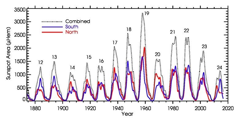
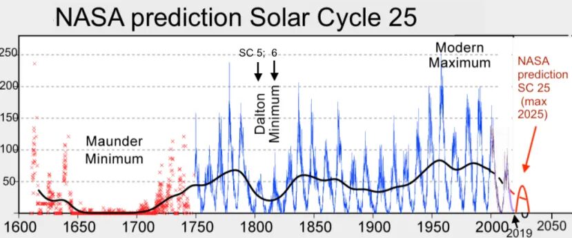
Both NOAA and NASA appear to agree, if you read between the lines, with NOAA saying we're entering a 'full-blown' Grand Solar Minimum in the late-2020s, and NASA seeing this upcoming solar cycle (25) as "the weakest of the past 200 years", with the agency correlating previous solar shutdowns to prolonged periods of global cooling here.
Furthermore, we can't ignore the slew of new scientific papers stating the immense impact The Beaufort Gyre could have on the Gulf Stream, and therefore the climate overall.
Prepare accordingly — learn the facts, relocate if need be, and grow your own.
Social Media channels are restricting Electroverse's reach: Twitter are purging followers while Facebook are labeling posts as "false" and have slapped-on crippling page restrictions.
Be sure to subscribe to receive new post notifications by email (the box is located in the sidebar >>> or scroll down if on mobile).
And/or become a Patron, by clicking here: patreon.com/join/electroverse, and/or consider "allowing ads" for www.electroverse.net if you use a blocker.
The site receives ZERO funding, and never has. So any way you can, help us spread the message so others can survive and thrive in the coming times.



Comment: See also: