Storms
S


Cloud Lightning

US: Oklahoma Tornadoes: Death Toll from Tornadoes Rises to 10

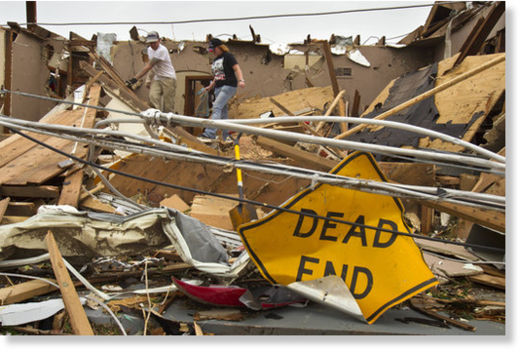
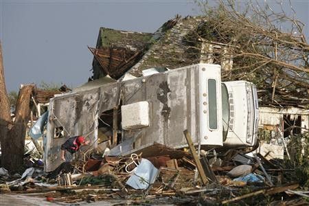
Oklahoma tornadoes: A teenage girl and her boyfriend were among the deceased, along with a 3-year-old Piedmont boy whose body was found Thursday morning.


A teenager who loved the rodeo, two children ripped from their mother's arms and a woman intent on saving her dogs were among those killed in the deadliest Oklahoma tornado outbreak in more than a decade.

Two days after the tornadoes left a path of destruction from Chickasha to Stillwater, authorities on Thursday recovered the body of a 3-year-old boy lost in a twister and finished identifying all 10 known victims.

The tornadoes left at least 238 people injured. Typical sheltering places, bathrooms and closets, could not withstand some of these killing winds. Initial reports indicate more than 600 homes and businesses were damaged, according to the Oklahoma Department of Emergency Management. The National Weather Service said that in terms of loss of life in Oklahoma, this was the worst tornado outbreak since May 3-4, 1999, when 44 people died in the state.

Cloud Lightning

US: The Weather Phenomena Causing 2011's Tornado Explosion

Meteorologist Jeff Masters says that while it might not be climate change, the tornadoes are just one of many weird weather phenomena this year that may be signaling major shifts in the climate.
Image
© NOAA
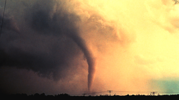
From April 25 to 28, 2011, a fierce and deadly storm system produced a total of 327 confirmed tornadoes in 21 states from Texas to New York, and even isolated tornadoes in Canada. Alabama was struck particularly hard. These April 2011 tornadoes killed at least 344 people people in the Southeast, Midwest, and Northeast. Then--on May 22, 2011--the deadliest single tornado since 1953 struck Joplin, Missouri, with at least 124 people now confirmed dead and more than 1,000 people reportedly injured. Shortly before the tornado struck Joplin, EarthSky spoke to meteorologist Jeff Masters of Weather Underground. He explained some of the science that has caused these fierce 2011 tornadoes in the U.S.

In particular, he said, the location and strength of the jet stream played a role.

"The jet stream, which is that powerful river of air aloft over the country, turned out to be very strong this year. It had very high wind speeds in it. And it was moving over tornado alley, where we tend to get cold, dry air from Canada colliding with warm, moist air from the Gulf of Mexico. The combination of those contrasting air masses, and then the very powerful jet stream, was just the perfect storm of conditions to make a lot of tornadoes."
Bizarro Earth

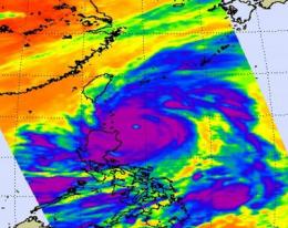
NASA sees a 14-mile-wide eye and powerful Super Typhoon Songda

Typhoon Songda became a Super Typhoon in the evening on May 26, 2011 (Eastern Daylight Time) was it reached a Category 5 status on the Saffir-Simpson Scale. NASA satellite data shows that the monster storm with a 14 mile-wide eye has weakened due to adverse wind conditions today and is still a powerful Category 4 typhoon.

Image
© NASA/JPL, Ed OlsenThis infrared image of Super Typhoon Songda was captured by the AIRS instrument on NASA's Aqua satellite on May 27, 2011, at 5:05 UTC (1:05 a.m. EDT). At this time, Songda was a Category 4 storm. The purple areas indicate very strong thunderstorms with heavy rainfall and there is a large area of them that surround the visible eye. Taiwan is northwest of the storm.
The Atmospheric Infrared Sounder (AIRS) instrument on NASA's Aqua satellite captured an infrared image of Super Typhoon Songda on May 27, 2011 at 5:05 UTC (1:05 a.m. EDT). At that time Songda was a Category 4 storm. The infrared image showed a large area of very strong thunderstorms with heavy rainfall surrounding the eye of the storm. The eye is almost 14 miles (12 nm/22 km) in diameter and those thunderstorms were dropping rainfall as much as 2 inches (50 mm) per hour.

On May 27 at 1500 UTC (11 a.m. EDT), Typhoon Songda's maximum sustained winds were near 125 knots (143 mph/231 kmh) down from its peak of 140 knots (161 mph/260 kmh) which it reached late on May 26. Sondga has tracked north-northwest but is expected to turn to the north-northeast.

Bizarro Earth

US: East Coast on storm alert after overnight blast

Severe thunderstorm watches were issued for much of the East Coast on Friday, marking a stormy start to the Memorial Day weekend after overnight storms covering an even broader swath left 3 people dead in Atlanta and flooded homes in New England.

Areas from the Carolinas up into New England were told by the National Weather Service that 70 mph winds and 2-inch hail would be possible through early evening.

Image
© Toby Talbot / APRene Crete looks over damaged cars at Buy Right Auto on Friday in East Montpelier, Vt. Schools and roads are closed across central Vermont as heavy overnight rains caused flooding that overflowed riverbanks.
"Damaging winds and large hail are the main threats, however isolated tornadoes cannot be completely ruled out," weather.com reported.

Radar

NASA: Songda Becomes a Super Typhoon

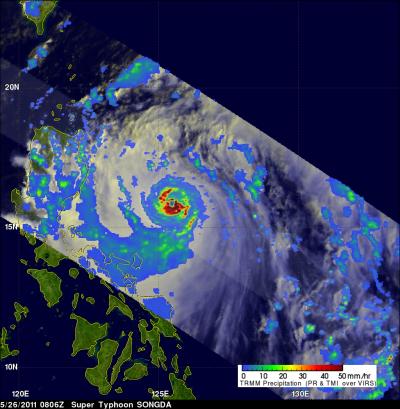
As predicted, Typhoon Songda intensified and was a super typhoon with wind speeds estimated at over 130 knots ( ~145 mph) when NASA's TRMM satellite passed directly over head on May 26, 2011 at 0806 UTC (4:06 a.m. EDT).

Songda had a circular eye
© NASA/SSAI, Hal PierceSongda had a circular eye with extremely heavy rainfall, particularly in the southeast quadrant. The red areas represent heavy rainfall (falling at about 2 inches/50 mm per hour). The yellow and green areas are moderate rainfall, falling at a rate between .78 to 1.57 inches (20 to 40 mm) per hour.

Umbrella

US: Storms Will Drop Heavy Rains for 2 Days in West Michigan

Image
© Grand Rapids Press
A flood watch has been issued for much of West Michigan, with several rounds of heavy rain likely today and Thursday.

Two to four inches are possible, along with the threat of severe storms, and a tornado watch is issued through 7 p.m. today for these counties: Berrien, Branch, Cass and St. Joseph.

"A warm front moving could bring some nastier stuff later this afternoon. Heavy rain is a probability, not a possibility," said Mike Kalembkiewicz of the National Weather Service in Grand Rapids.
Image
© National Weather ServiceRainfall could accumulate to two inches or more through Thursday.

Attention

US: Joplin Storm Contained a Rare Multivortex Tornado

Image
© David EulittShawn and Joella Zaccarello of Joplin pitched in Tuesday to help sort through the damage of their uncle’s home, which was destroyed by Sunday evening’s tornado that swept through the city’s central section.

The death toll from Sunday's tornado has risen to 122, making it the eighth-deadliest tornado in U.S. history, the National Weather Service said.

The Joplin twister was upgraded to EF-5, the strongest category on the Enhanced Fujita Scale, with winds exceeding 200 mph. The storm was apparently a "multivortex" tornado, with two or more small and intense centers of rotation orbiting the larger funnel, a rare occurrence.

It's the country's deadliest storm since 1950.

The number of those still missing isn't known because many have left Joplin to stay with relatives and friends. Rescue workers on Tuesday were able to save two more people from the wreckage, bringing the total to nine, even as they braced for more storms Tuesday night.

Those storms brought their own misery: Several tornadoes struck Oklahoma City and its suburbs during rush hour, killing at least five people and injuring at least 60 others, including three children who were in critical condition, authorities said.

Cloud Lightning

US: The Tornado Epidemic Of April 2011

There were more tornado deaths in April than any other time in history. The cause is unknown, but the damage is enormous.

The weekend's tornado in Joplin, Mo., was just the latest--and most devastating--of what has been a rash of tornadoes. In April, more than 360 people were killed by tornadoes. The previous record was 267, in 1974. As of yesterday, there had been 1,151 tornadoes this year. Last year at this time, there had only been 506. NOAA has documented the tornadoes reported in the month in this chilling video:


Cloud Lightning

Oklahoma Tornadoes: Home shelter shields 14 from twister in Cole

Image
© David Zizzo, The OklahomanVeterinarian Patrick Young attends to Baxter, a Labrador that was in the garage of a home destroyed Tuesday by a tornado in Cole.
Cheryl Mayo and 14 other people huddled in a shelter as a monstrous tornado churned overhead late Tuesday afternoon.

The tornado blew open the door of the storm shelter, Mayo said about 30 minutes after the storm passed by. "As soon as it blew the lid open you could see that the house was gone."

The home was destroyed, along with a double-wide trailer on the same property on State Highway 74B east of Cole, a small town about 15 miles southwest of Norman.

Cloud Lightning

U.S. tornado death toll mounts, many still missing

Image
© REUTERS / Ed ZurgaA man looks through a friend's trailer as he tries to find anything salvageable after a devastating tornado hit Joplin, Missouri May 23, 2011.
The death toll from a monster tornado that hit Joplin, Missouri on Sunday rose to 123 with 750 people injured and many more missing, authorities said on Tuesday.

Rescue and recovery teams scoured the wreckage of the small Midwestern city, which was devastated by a high-velocity whirl of wind that destroyed about 2,000 buildings.