Volcanoes
S


Attention

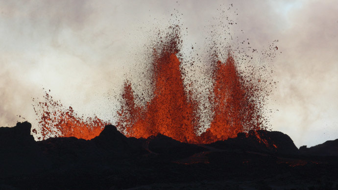
Bardarbunga erupts with lava fountains up to 50 meters

Image
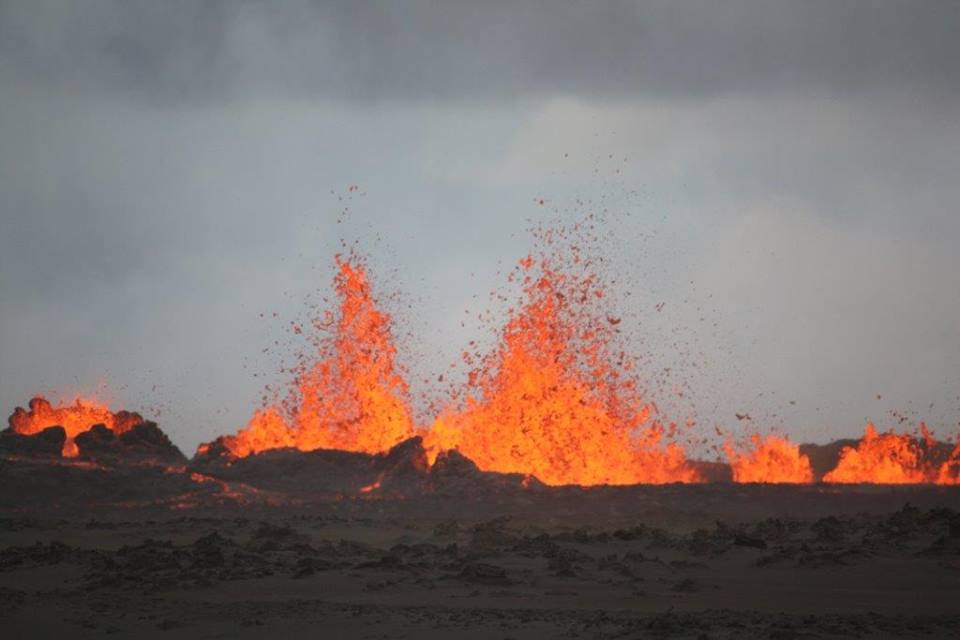
© Reuters/Armann HoskuldssonLava fountains are pictured at the site of a fissure eruption near Iceland's Bardarbunga volcano September 2, 2014.
A volcanic eruption has created an almost post-apocalyptic landscape in Iceland. Streams of lava are spewing out, reminiscent of Mount Doom in Lord of the Rings. And there is still a significant risk to air traffic, with the current 'Orange' warning.

The Orange level, is the second highest on a five-color scale. So far no ash has been visible, but this could change.

Lava fountains rose to around 50 meters on Sunday at the Bardarbunga volcano, which took the aviation warning to red, the highest on the scale. There has been a lot of seismic activity in the area and Einar Heinarsson, a spokesman from Iceland's department of civil protections says, "The eruption is still going on at the same pace as before. It has been continuous."


Info

Extinct underwater volcano discovered beneath Pacific Ocean

Underwater Volcano
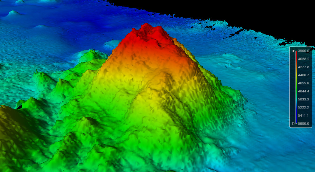
© Image courtesy of the Center for Coastal and Ocean Mapping/Joint Hydrographic CenterThe newly discovered seamount rises up some 3,600 feet (1,100 meters) from the seafloor near the Johnston Atoll, at a depth of about 16,730 feet (5,100 m) under the Pacific Ocean.
Lurking some 3.2 miles (5.1 kilometers) beneath the Pacific Ocean, a massive mountain rises up from the seafloor, say scientists who discovered the seamount using sonar technology.

The seamount is about two-thirds of a mile high (1.1 kilometers), researchers said. Seamounts, rocky leftovers from extinct, underwater volcanoes, are found on ocean floors around the world. The newly discovered seamount is about 186 miles (300 km) southeast of Jarvis Island, an uninhabited island in a relatively unexplored part of the South Pacific Ocean, experts said.

"These seamounts are very common, but we don't know about them, because most of the places that we go out and map have never been mapped before," James Gardner, a University of New Hampshire research professor who works at the university's NOAA Center for Coastal and Ocean Mapping/Joint Hydrographic Center, said in a statement. [See Images of the Newfound Pacific Ocean Seamount]

Attention

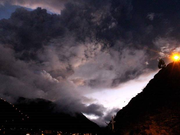
Increase in volcanic activity continues: Ecuadoran volcano called 'Throat of Fire' in local language starts spewing ash 28,000ft into air

Tunguarahua volcano
The eruption is latest after months of activity around Tunguarahua volcano.

An Ecuadorean volcano is spewing ash five miles into the air, closely monitored by experts, after an eruption this weekend.

Ash from the Tunguarahua volcano, whose name means 'Throat of Fire' in the local Quechua language, was blown five miles, 28,000 ft, into the sky and drifted west.

It was the latest eruption from the volcano after a period of calm.

Tunguarahua volcano erupted on 29 July, 4 August and then again on 19 August.

Homes nearby have felt the strength of the eruptions, with the blast causing windows and roofs to vibrate.

Over the weekend the volcano started spewing small pyroclastic flows, a fast-moving current of hot gas and rock which can reach speeds of 450mph and temperatures of about 1,000 C.

Bizarro Earth

Iceland volcano blasts back to life

Iceland Lava Fountains
© University of Iceland/Ármann HöskuldssonLava fountains during an Iceland eruption on Aug. 31.
A new volcanic eruption in southeast Iceland on Sunday (Aug. 31) fountained lava nearly 200 feet (60 meters) into the air.

Lava is spewing from the same crack as a small eruption that occurred Friday (Aug. 29). The fissure slices through the 200-year-old Holuhraun lava field, between Bardarbunga volcano and Askja volcano.

The "calm" eruption is 50 times more powerful than Friday's outburst, according to the Iceland Met Office. Lava was streaming from the fissure at 15.9 million gallons per minute (1,000 cubic meters per second) at 7 a.m. local time (3 a.m. ET) on Sunday, three hours after the flare-up began. The basalt flow covered almost 2 miles (3 kilometers) by mid-morning local time. The crack feeding the lava flow has also expanded to the north and south, and is now almost 1 mile (1.5 km) long.

The eruption can be seen on live webcams here and here, though a storm severely lowered visibility Sunday.

Emergency officials briefly raised the aviation alert warning to red, but no commercial flights have been affected.

Attention

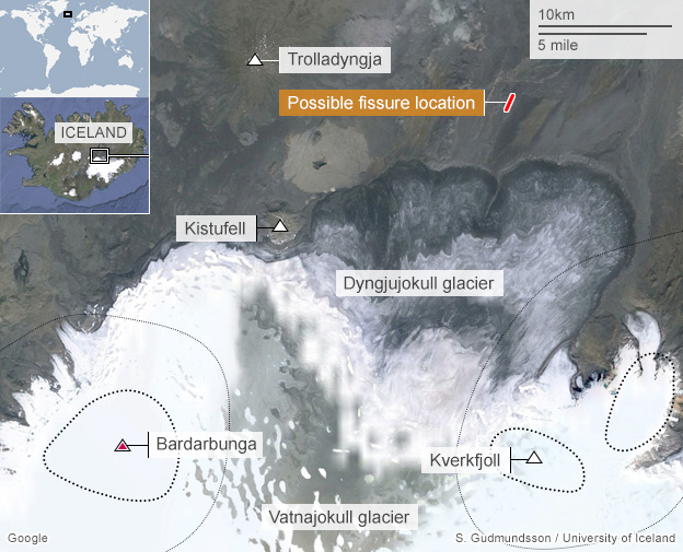
Volcanic fissure erupted in Holuhraun, near Dyngjujökull Glacier

Image
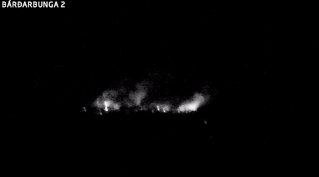
Screenshots from a webcam set up by Icelandic telecom company Mila show the eruption of the Bardarbunga volcano on Friday, Aug. 29, 2014.
After an earthquake hit in the area, a volcanic eruption occurred Friday in Iceland, resulting in a temporary no-fly order.

The eruption started in Holuhraun, north of the Dyngjujökull Glacier, which is located in northern Vatnajökull, just after midnight Friday, local time, the Icelandic Meteorological Office said.

Scientists who are in the area close to the eruption estimate that the volcanic fissure in Holuhraun is about 1 km (0.62 miles) long, according to the Iceland Civil Protection Department.

Four likely scenarios exist for future seismic and volcanic activity in the area, government officials said.

They include the migration of magma stopping, which would result in a gradual reduction in seismic activity and no further eruptions; a dike could reach the Earth's surface north of Dyngjujökull causing another eruption, possibly on a new fissure; or an eruption occurs again where either the fissure is partly or entirely beneath Dyngjujökull and likely produce a flood in Jökulsá á Fjöllum and perhaps explosive, ash-producing activity, according to the Met Office website.

The fourth scenario is for Bardarbunga to erupt, causing an outburst flood and possibly an explosive, ash-producing activity.
Blue Planet

Volcanoes erupting around the world this week in pictures

Restless volcanoes from around the world spew ash, steam, and concern in their wake.

Image
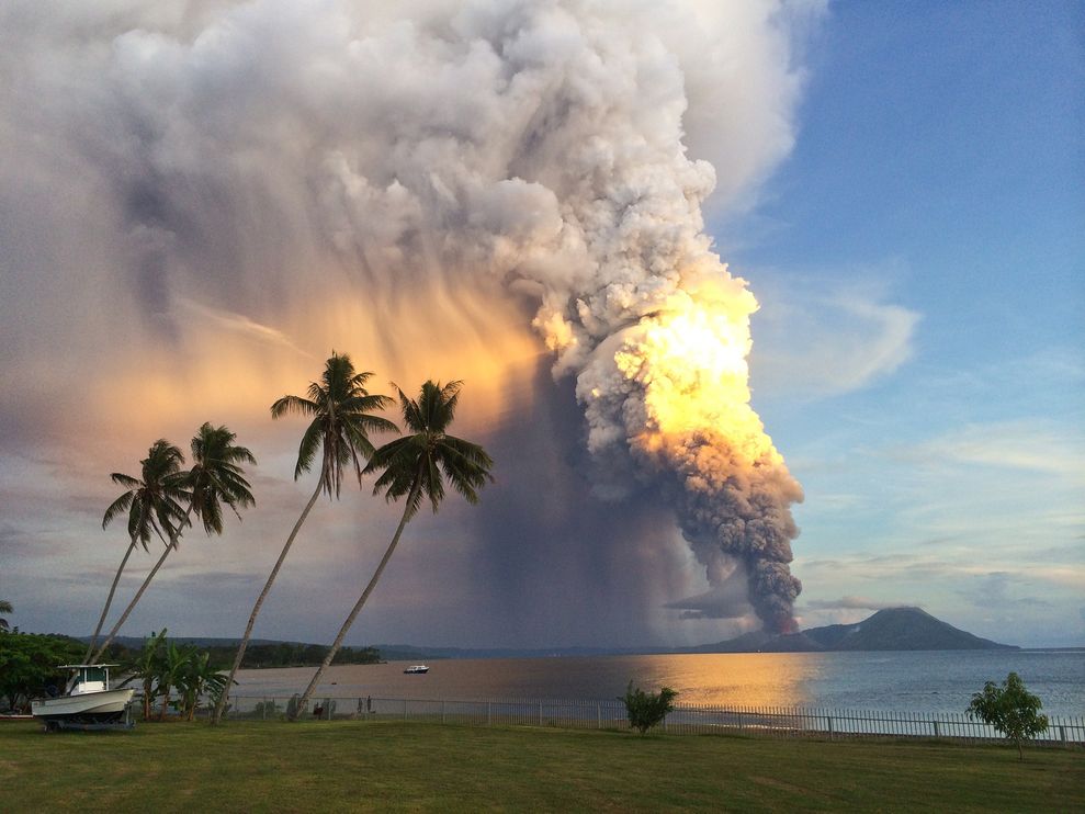
© Oliver Bluett, AFP/GettyMount Tavurvur erupts in eastern Papua New Guinea on Friday.
The Mount Tavurvur volcano in eastern Papua New Guinea jolted awake early Friday morning, belching rocks, ash, and steam (see above) nearly 60,000 feet (18,288 meters) into the air.

Local residents evacuated their homes on Friday, and Qantas Airways modified flight paths for planes heading to Tokyo and Shanghai from Sydney, Australia, according to news reports. (Watch video: "Volcano 101.")

The last time Mount Tavurvur erupted, in 1994 - at the same time as nearby Mount Vulcan - both volcanoes destroyed the town of Rabaul in Papua New Guinea.

Comment: Actually, they missed some impressive activity. Check out Sott Worldview's volcanic entries from this past week for more information:


Blue Planet

Papua New Guinea Mount Tavurvur volcano erupts

Mt Tavurvur eruption
© Emma EdwardsThe ash cloud is spreading at heights of 60,000 feet.
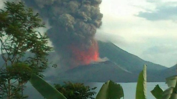
Residents near an erupting volcano in Papua New Guinea are waiting to see if they need to evacuate, and a giant ash cloud is affecting some flights to and from Australia.

Mt Tavurvur, in East New Britain province, began erupting overnight. The volcano destroyed nearby Rabaul township in 1994, and residents fear a repeat, PNGLoop reported.

Authorities were still considering the situation.

The eruption, which began between around 3.30am local time, caused explosions strong enough to rattle residents' windows.

Ash covered Rabaul and shops were closed, but otherwise life was continuing as normal, PNGLoop reported.


Comment:


Airplane

Iceland lowers alert for erupting volcano and reopens airspace

Iceland Bardarbunga volcano
The Icelandic Met Office has lowered its aviation warning from red to orange near the Bardarbunga volcano, which saw an eruption begin overnight.

The new alert, the second-highest, means that aviation authorities can now decide if planes may travel over the volcano's airspace.

Scientists said a fissure eruption 1km (0.6 miles) long started in a lava field north of the Vatnajokull glacier.

The volcano has been hit by several recent tremors.

The Icelandic Met Office confirmed to the BBC that since no ash was detected in emissions from the volcano's eruption, it was now possible to downgrade the earlier alert level.

Civil protection officials said Icelandic Air Traffic Control had closed the airspace above the eruption up to a height of 5,000ft (1,500m), but now some aircraft will be able to pass over the volcano if aviation authorities give airliners the go-ahead.

The fissure eruption took place between Dyngjujokull Glacier and the Askja caldera, according to a statement from the Department of Civil Protection.

Attention

Sub-glacial eruption of Iceland's Bardarbunga volcano forms deep 'cauldrons' of melted ice

Icelandic volcano activity increased on Wednesday, with scientists detecting 10-15 meters deep cauldrons of melted ice at the Vatnajökull glacier, prompting fears of an imminent eruption.
Image
© Reuters / Sigtryggur Johannsson

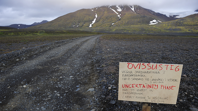
A warning sign blocks the road to Bardarbunga volcano, some 20 kilometres (12.5 miles) away, in the north-west region of the Vatnajokull glacier August 19, 2014.
Icelandic scientists have detected a series of 10-15m deep cauldrons at Bardarbunga volcano glacier. They apparently are a result of melting following a sub-glacial eruption, the Icelandic Civil Protection Scientific Advisory Board reported. A surveillance flight over the surface of Vatnajokull has shown the cauldrons to be 1 km wide, located in a straight line some 4-6 kilometers south of the Bardarbunga caldera.
The 10-15 m deep cauldrons, 1 km wide, south of the #Bárðarbunga caldera. Picture by https://t.co/ZiKocZlLJSpic.twitter.com/lSLWDJZnEO
- Almannavarnir (@almannavarnir) August 28, 2014
"The cauldrons have been formed as a result of melting, possibly a sub-glacial eruption, uncertain when," country's Meteorological Office said, pointing out that the data is still being analyzed.

"During the night (Wednesday) we have had three larger events, two of them in the Bardarbunga caldera. Those were 5.2 and 5.3, and very similar to the events that we have seen there before," Palmi Erlendsson, a geologist at the Met Office told the country's RTE news.

At the same time, scientists have registered more than 1,300 earthquakes since midnight Wednesday. Meanwhile 50km to the north, a 4.5 magnitude quake shook the Askja volcano, presumably because magma from Bardarbunga crater is traveling in that direction.

Comment: Earthquakes, volcanic eruptions, sinkholes and flooding all in one: Iceland examines Bardarbunga volcano 'cauldrons'


Bizarro Earth

Earthquakes, volcanic eruptions, sinkholes and flooding all in one: Iceland examines Bardarbunga volcano 'cauldrons'

barbarbunga cauldrons
Scientists in Iceland say they are examining several 'cauldrons' found near Bardarbunga volcano, which could potentially be a sign of an eruption.

The cauldrons, depressions in the volcano's surface, each between 10-15m (49 ft) deep and 1km (0.6 miles) wide, were seen during a flight on Wednesday.

Iceland's Met Office said they were formed "as a result of melting, possibly a sub-glacial eruption."

Bardarbunga volcano has been hit by several recent tremors.

The area experienced a magnitude 5.7 earthquake on Tuesday. Experts say these earthquakes are caused as magma flows beneath the ground, cracking the rocks as it moves.

The Met Office has kept its aviation warning level - indicating the potential threat of volcanic activity to air travel - at orange, its second-highest.

Comment: Iceland's Bardarbunga volcano: Magma moving towards new volcanic system