Volcanoes
S


Bizarro Earth

Iceland tells airlines Bardarbunga volcano under glacier may erupt, raises alert to orange

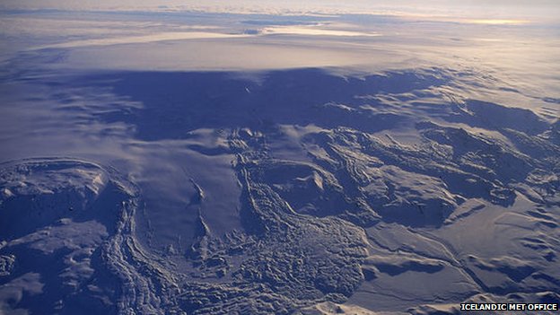
Bardarbunga
File photo: Bardarbunga, 7 November 1996
Seismic activity has been detected at Bardarbunga, including a strong earthquake
Iceland warned airlines that there may be an eruption at one of the island's largest volcanoes located underneath Vatnajokull, Europe's biggest glacier.

The alert level at Bardarbunga was raised to "orange," indicating "heightened or escalating unrest with increased potential of eruption," the Reykjavik-based Met Office said in a statement on its website. Over 250 tremors have been measured in the area since midnight. The agency said there are still no visible indications of an eruption.

The volcano is 25 kilometers (15.5 miles) wide and rises about 1,900 meters above sea level. Bardarbunga, which last erupted in 1996, can spew both ash and molten lava.
Comment: Given the news, this quote from an article that we published in 2011 seems timely and pertinent:
Bardarbunga's last major eruption was horrendous. It changed the weather pattern in northern Europe and darkened the skies for months during 1477. That gigantic eruption generated the largest lava flow in 10,000 years and significantly expanded Iceland's land mass.

Grim experts concede that if the volcano's current activity culminates in an eruption equal to that of 1477, all of Scandinavia and much of northern Russia and Europe will be left reeling.The UK will be slammed by choking volcanic dust, grit and poisonous superheated gases. Commerce will grind to a halt, the skies will blacken for weeks, perhaps months, and agriculture would be severely affected.

The late Cornell University professor, astronomer Carl Sagan, used the consequences of large volcanic eruptions impact on global cooling as part of his theoretical model for the frightening prospect of a nuclear winter.

Ken Caldeira, an earth scientist at Stanford University, California, and member of Britain's prestigious Royal Society working group on geo-engineering, explained that "dust sprayed into the stratosphere in volcanic eruptions is known to cool the Earth by reflecting light back into space."

That simple process has led to the starvation of whole nations in the past. Volcanic gases and dust suspended in the atmosphere cool the Earth to a point where the growing seasons significantly shrink and crops cannot reach maturity.


Phoenix

Peru's Sabancaya volcano registers explosion, entering new eruptive phase

Experts say that Peru's Sabancaya has entered into a new eruptive stage
Image
© Peru21/Ingemmet
According to Peru21, the explosion took place at around 4:30 on Saturday morning. The phenomenon went on for just under a minute. According to the Arequipa Volcanological Observatory (part of the Peruvian Geophysical Institute), the explosion generated 9,083 megajoules.

The explosion resulted in the emission of ash and gases, which rose into a column three kilometers in height. Peru21 reports that the smoke-like substance seen rising from the volcano is mostly steam, but some blue gases likely composed of sulfur dioxide have also been spotted coming out of Sabancaya.

Peru21 writes that geological authorities believe that the explosion may have been connected to the recent increased seismic activity in the region.

Authorities are warning citizens to take precautions in case another explosion occurs soon. Peru21 reports that geological and civil defense groups will meet soon in order to determine the risk to local populations.

Comment: Sabancaya Volcano in southern Peru becomes active after 15 years of silence


Attention

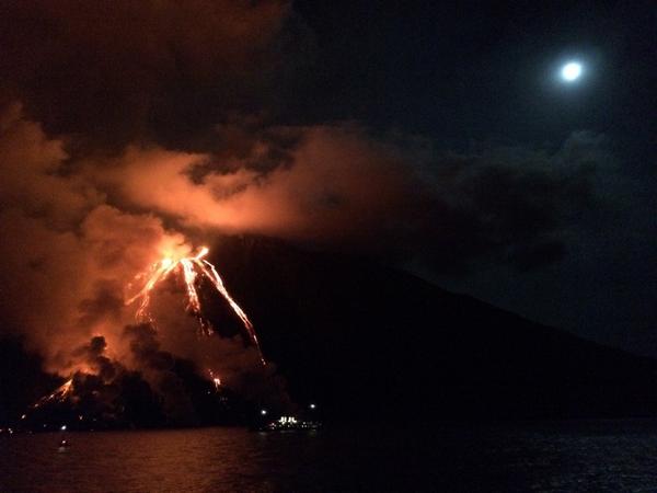
Stromboli volcano erupts, Italy

Image
© Jonas Wiesand
Tourist trips to Stromboli have been cancelled this week as a volcanic eruption overwhelms the island, a tour agency for the Aeolian islands told The Local.

Stromboli, an island volcano north of Sicily, starting erupting on Wednesday afternoon, the National Institute of Geophysics and Volcanology (INGV) said.

Tourist trips have been cancelled as the volcano remains "too active", a spokesperson for the Eolnet agency for the Aeolian Islands told The Local. Excursions may resume on Monday, depending on how the eruption plays out over the weekend.
Stromboli erupting, awestruck doesn't quite do it justice. So close I could feel the heat. pic.twitter.com/Da7JVK579U
- Jonas Wiesand (@jonaswiesand) August 8, 2014

Attention

Mysterious noises emanating from volcano in Iceland

Image
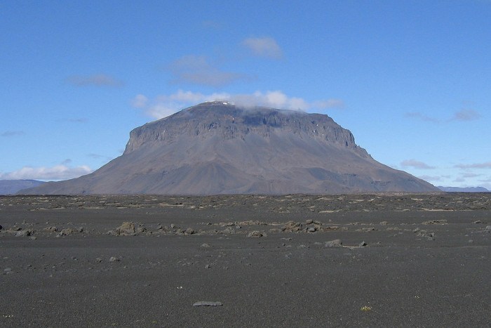
Strange rumblings coming from the tuya Herðubreið are confounding observers as to their possible source.

Vísir reports that visitors to the mesa-shaped volcano in northeast Iceland have been unable to determine if the persistent rumblings coming from Herðubreið are being caused by an avalanche, landslide, or something else entirely. Rangers around Herðubreið were the first to announce the rumblings, which lasted about 30 seconds.

Yesterday, Icelandic rescuers who had been searching for a group of French tourists found them at the foot of Herðubreið safe and sound, although they said there had been an avalanche. News of the avalanche was reported, but upon further inspection, no evidence of an avalanche could be found - except for the rumbling.

Avalanches have been reported from mountains all over Iceland recently, which is highly unusual for the summer months. Tómas Jóhannesson, a meteorologist at the Met Office, told reporters that they intend to get to the bottom of the mystery.

Bizarro Earth

Japanese volcano Kuchinoerabu-Jima erupts for first time in 34 years

kuchinoerabu-Jima volcano
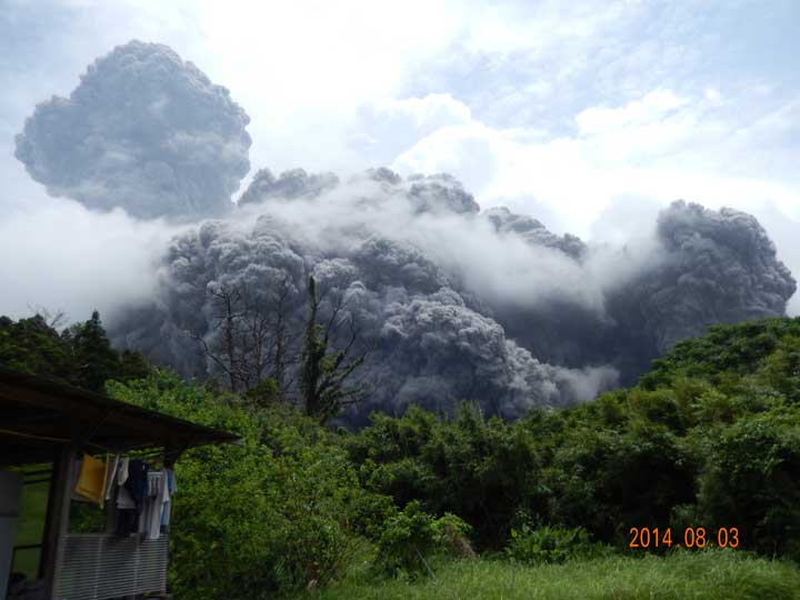
A new eruption occurred yesterday at the volcano at 12h25 local time. It consisted of a single powerful explosion from the Shin-Dake crater. An ash plume rose to approx 1.5 km height, and a pyroclastic flow was generated. The eruption lasted about 10 minutes and much of the erupted mass collapsed into an impressive pyroclastic flow (hot avalanche of fragmented lava and gasses). There are no reports of victims or damage. Japanese volcanologists raised the alert level to 3 and closed access to the summit area.

Bizarro Earth

Scientist map Mount Rainer magma, say it will erupt again

mount rainier magma map
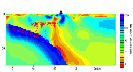
Scientists from the University of Utah have determined that Mount Rainier, one of the most prominent peaks in North America, will erupt again. The question of when remains unanswered, but science has recently discovered how: By measuring how quickly Earth conducts electricity and seismic waves, they've effectively "mapped" Rainier's magma "plumbing."

"This is the most direct image yet capturing the melting process that feeds magma into a crustal reservoir that eventually is tapped for eruptions," says geophysicist Phil Wannamaker, of the university's Energy & Geoscience Institute and Department of Civil and Environmental Engineering. "But it does not provide any information on the timing of future eruptions from Mount Rainier or other Cascade Range volcanoes."

Comment: For more information see:

Rainier, third most dangerous U.S. volcano, USGS says
Mapping the deep magma reservoir below Washington's Mt. Rainier


Bizarro Earth

Mapping the deep magma reservoir below Washington's Mt. Rainier

Image
© R. Shane McGary / Woods Hole Oceanographic InstitutionMap shows, in purple and pink, the west-east line of magnetotelluric sensors that were placed north of Mount Rainier.
Experts have mapped a huge magma reservoir below Mount Rainier in Washington state that begins melting deep in the Earth's mantle before pushing upwards to where it will eventually be tapped for eruption. Researchers from the United States and Norway used seismic imaging and the measurement of variations in electrical and magnetic fields to create a detailed road map of the pathway molten rock takes to the surface.

Their findings, published this week in the journal Nature, are aimed at helping experts understand the volcano's inner workings, and eventually determine when it might again erupt. A state landmark, Mount Rainier last erupted in the 19th century. It is widely expected to erupt again, according to the U.S. National Park Service.

The tallest volcano and fifth-highest peak in the contiguous United States, it towers some 14,410-feet (4,392 meters) about 58 miles (93 km) southeast of Seattle, from most of which it is visible.

Comment: No such thing as a dormant volcano: Magma chambers awake sooner than thought


Alarm Clock

Volcanic earthquakes detected at Philippine's Bulusan volcano

Image
© USGS/Chris Newhall
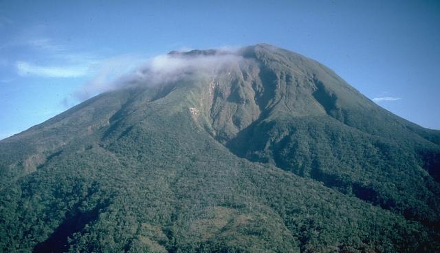
Although not posing any serious threats at the moment, the Philippine Institute of Volcanology and Seismology (Phivolcs) on Sunday told the public to stay away from Bulusan volcano's permanent danger zone in Sorsogon after volcanic earthquakes were detected.

"During the 24-hour observation period, the seismic network detected thirteen (13) volcanic earthquakes. Ground deformation data from continuous GPS and precise leveling survey also indicated that the volcano is slightly inflated," Phivolcs said in a statement.

The agency said the volcano's status is still at alert level 0.

"The local government units and the public are reminded that entry to the four-kilometer radius Permanent Danger Zone (PDZ) is strictly prohibited due to the possibility of sudden and hazardous steam-driven or phreatic eruptions," Phivolcs said.

It warned against aircraft flying near the volcano's summit since sudden eruption may be harmful.

Attention

Mount Sinabung volcano erupts (again) in Indonesia

Image
© Baltimore Sun/Matt Bracken
Mount Sinabung, one of the most active volcanoes in Indonesia, has erupted, spewing ash to the sky. No casualty was reported, official said here Sunday.

The volcano located in Karo district of North Sumatra province erupted at 23.05 p.m. Saturday, Sutopo Purwo Nugroho, spokesman of national disaster management agency, said.

"The height of the eruption could not be determined as it took place at night and there were many clouds," he told Xinhua by phone.

"Rains of hot ash occurred in several place in Karo district, but it did not trigger further evacuation," Sutopo added.

The 2,600-metre (8,530-foot) Mount Sinabung last erupted June 29, shooting columns of ash by up to 4,000 metres into the sky.


Bizarro Earth

El Salvador's Chaparrastique volcano continues to show significant levels of internal seismic activity

The Chaparrastique volcano near San Miguel, El Salvador continues to show significant levels of internal seismic activity. Authorities are on a high level of preparedness should actions be needed. The activity since yesterday has been at the highest levels seen. The chart below shows activity during July -- the average, normal level is 50, and current levels are above 1100.
Image
This graphic shows the location of micro-quakes on the northern slopes of the volcano:
Image