Extreme Temperatures
The snow started to fall early Monday morning and stopped at around 11:00 am. Streets in downtown Arxan were covered by 10 centimeter thick snow and residents going outdoors were seen dressing in layers to keep themselves warm after a sharp drop in temperatures.
Number of cars hit on road apparently decreased due to the snowy weather. Those who hit on road slowed down their speed and drove cautiously.
Local border police division dispatched soldiers to help pull the cars stranded in snow to safety.
Municipal authorities have organized personnel to clear the tough heavy snow from streets since morning. Flights at the local airport were not affected as the snowfall continued only a short time.
Spring snow in Alto Adige. On the A22 motorway on the Austrian border movement of vehicles partially restricted. Huge traffic jams and many accidents.
Snows from early in the morning at the Brenner Pass: as shown in the photo taken by the webcam Site A22 snow is creating heavy traffic disruption in both carriageways between Sterzing and the state border. Especially heavy vehicles proceeding slowly slowing down the entire flow of vehicles.
Up to half a meter (18 inches) of snow hit higher elevations yesterday Snow covers the landscape around the Herzogstand in the Bavarian Alps at around 1730 meters altitude.
Not far away is the Walchensee, a popular destination for the residents of Munich.
Thanks to Loher for this link
A thin layer of snow covered the capital area early this morning but had disappeared before 9 am.
The temperature in Reykjavík dropped to 1.2ºC (34.1ºF) during the night but was already up to 3.4ºC (38.1ºF) at peak hour between 8 am and 9 am this morning, according to the Icelandic Met Office. The temperature fell below freezing at many mountain passes around Iceland last night.
The highest temperature in Iceland last night was recorded at Hallormstaðir in East Iceland, 8.8ºC (47.8º F). Papey island off East Iceland had the strongest wind and Patreksfjörður, the West Fjords, had the most rainfall.
Light snowfall returned for several minutes around midday but has now disappeared.
Gleðilegt sumar ('Happy Summer') as we say in Icelandic.
The Colorado Department of Transportation says crews had only cleared six miles of the 14.7-mile road as of Monday.
About four 4 feet of snow has fallen in May, canceling out previous clearing work that began on April 28. CDOT officials say they also have yet to complete work stabilizing eroding parts of the highway above Lincoln Lake.
CDOT officials say they don't know when the road up to the 14,000-foot-plus peak will open.
However, they are still hoping to have Independence Pass to Aspen open on Thursday in time for the holiday weekend.
Source: Associated Press
Both Xcel Energy and the Intermountain Rural Electric Association each had about 1,800 customers without power Tuesday afternoon.
The customers without power live in Alma, Fairplay, Como, and the Grant areas in Park County.
IREA said the heavy, wet snow loaded on power lines and brought them down along with some tree limbs. Some of those branches fell on power lines and brought them down.
More than a foot of snow has fallen in Fairplay since Monday. Some places have received up to 14 inches.
Additional IREA crews are working to make repairs to restore power to all customers. There is no estimate on when power will be restored.
Xcel crews were also out Tuesday afternoon trying to fix dozens of problem areas.
This snowfall provided wintry tableaux in locations such as Los Llanos del Hospital, a cross-country skiing resort in the Benasque valley in the province of Huesca (region of Aragón), and throughout the Pyrenees and other northern mountain ranges the overnight temperatures are again forecast to drop below zero on Wednesday night. In many parts of the mountains along the border between France and Spain even Wednesday's maximum temperatures were forecast to remain close to 5ºC.
These distinctly cool conditions in the mountains of the north are forecast to continue until the weekend, while maximum temperatures of close to 30ºC will be recorded in parts of the south-west.
An arctic high pressure ridge settled over southern areas of the province last night producing clear conditions and widespread frost.
A new record low temperature was set in North Battleford at -4.5°C. The previous mark was set in 1895 at -3.3°C.
Swift Current also broke a record at -5.9°C, beating out -5.6°C, which was set in 1923.
The federal agency says these figures may be preliminary and do not constitute a final report.
Snow fall was reported to Snow Report SA's Facebook page by travellers on the Sani Pass in KwaZulu-Natal, and from Lesotho's AfriSki Mountain Resort.
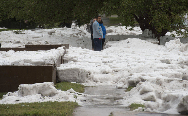
There were reports of hailstones the size of golf balls in the state of Baden-Wuerttemberg.
Winds of up to 120 km/h (75mph) were reported on Wednesday night and residents near the Bavarian city of Augsburg spoke of seeing a tornado.
Roofs were badly damaged, blocks of flats had to be evacuated and a local school had to be closed on Thursday.