Extreme Temperatures
S


Snowflake

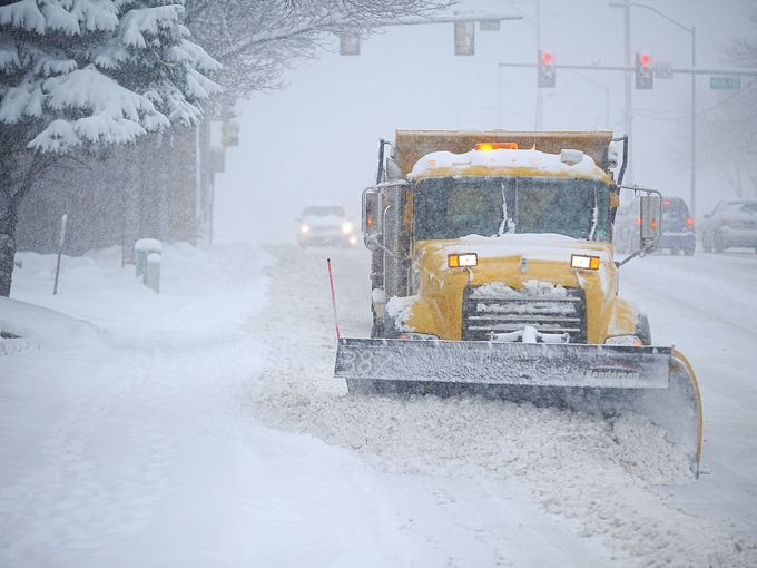
Ft. Collins, Colorado shatters snowfall record, more snow on the way

Snowfall in Ft. Collins
© Valerie Mosley/The Coloradoan
Just days after Fort Collins received a record-setting snow of more than a foot of powder and slush, more snow might on the way for Easter weekend.

The National Weather Service predicts a 40 percent chance of snow and rain Friday night and a 30 percent chance of snow Saturday morning.

If the snow does come, it won't be much. Less than an inch is forecast between 9 p.m. and midnight, and about half-inch is on the forecast for Saturday before noon.

Still, that's another 1.5 inches atop a mounting snow total for March, historically the snowiest month of the year for Fort Collins. Wednesday's snowfall of 13.4 inches put us at 21.1 inches for the month. The 1981-2010 average for March is 12.6 inches, so Fort Collins has collected 168 percent of the monthly average with a week remaining until April.

And that snow was wet. Between the rain and snow from the storm, Fort Collins received 1.44 inches of moisture, which puts the city nearly 2 inches over average for this time of year, and boosted the snow total for the season to 67 inches, which is 19 inches above average.

This bodes well for snowpack. In the South Platte River Basin, snowpack was 102 percent of average for this time of year before Wednesday's storm. It's now 106 percent of average, according to data from the National Water and Climate Center.

Wednesday's storm set a record, too. The previous record snowfall for March 23 was 6.7 inches in 2013, according to records from the Colorado Climate Center at Colorado State University.

Snowflake Cold

350,000 farm animals die due to extreme cold in Mongolia

A pile of animal carcasses in Uvs province, Mongolia
Hundreds of thousands of farm animals have perished in a slow-moving natural disaster in Mongolia and the international aid response has been insufficient, the Red Cross said Friday.

Mongolia has been hit by a devastating natural phenomenon known as a "dzud", said the International Federation of Red Cross and Red Crescent Societies (IFRC) -- a hot summer drought followed by a severe winter.

The combination spells doom for livestock in a country where IFRC said a third of the thinly-spread population rely on animal husbandry for their livelihoods.

Goats, sheep and cows die en masse, unable to graze sufficiently in the warmer months to build up the reserves necessary to withstand later temperatures that regularly drop to -50 degrees Celsius.

More than 350,000 animals have already died, but more than a million deaths are expected, according to the latest available data from the UN mission in the country, IFRC said.

Snowflake

Spring snowstorm to hit U.S. east coast

Snowfall
© AccuWeather
With the first day of spring ending up colder than Christmas Day, the stage is set for disruptive snow to ride up the coast of the northeastern United States Sunday evening into Monday.

After wet snow in the mid-Atlantic struggles to stick to roads, the threat of snow-covered roads will heighten Sunday evening into Monday as an offshore storm begins to strengthen and cause moderate to heavy snow along the Northeast coast.

As the snow along the coast unfolds Sunday evening, a couple of inches of snow will create slick spots in the southern Appalachian Mountains.

The snow will increase as it spreads up the Northeast coast, leading to totals of around an inch on grassy surfaces in Delaware to travel-disrupting amounts approaching or exceeding six inches in eastern Long Island and far eastern New England.

The heaviest amounts will be measured on grassy and elevated surfaces, but motorists should prepare for roads to still become slick. This includes in Islip and Montauk, New York; Providence, Rhode Island; Boston and Plymouth, Massachusetts; and Portland and Bangor, Maine.

In Boston, snow totals will be greatest toward the South Shore with less in the northern and western suburbs.

"When temperatures fall after sunset, bridges and overpasses will be the first surfaces to see snow accumulate, which may sneak up on drivers experiencing otherwise wet roads," AccuWeather Meteorologist Brian Thompson said.

AccuWeather Meteorologist Jim Andrews also warned of persistently shaded areas being among the first surfaces to turn slick.

Ice Cube

Blizzard to swing through central U.S. for the first week of Spring

Snowfall central US
© AccuWeather
A dramatic swing in temperatures will bring both a taste of late spring and then a blizzard to the central United States for the first week of spring.

The upswing in temperatures will cause record highs to be challenged during the first half of the new week, while the return of colder air will set the stage for snow and blizzard conditions to sweep from the northern Rockies to the Upper Midwest at midweek.

"As is expected in the spring, a volatile pattern is shaping up through the new week across the central U.S.," AccuWeather Meteorologist Ed Vallee said.

"After some chillier air this weekend, a dome of high pressure will control the weather through midweek. This will usher in much warmer air with some places experiencing high temperatures nearly 30-40 degrees higher than this weekend."

Highs across most of the north-central states will trend from the 30s and 40s on Saturday to the 60s and 70s early in the new week.
Weather changes
© AccuWeather
In the southern Plains, temperatures will swing from the 50s and lower 60s this weekend to the 70s and 80s. Some communities in the southern High Plains will even flirt with or crack the 90-degree mark.

The warmth will erase the snow that recently whitened Denver and will challenge record highs in Pueblo, Colorado; Dodge City, Kansas; Oklahoma City; and Amarillo and Lubbock, Texas.

As quickly as the warmth makes a comeback, colder air will be advancing southward.

Snowflake

Hundreds evacuated from raging snowstorm in Kazakhstan

Kazakhstan snowstorm
© tvoygorodpskov.ru
9 March 2016 - In the North-Kazakhstan region about 630 people have become hostages of bad weather, said the news agency Novosti-Kazakhstan.

Employees of emergency services evacuated 700 people and hundreds of cars on the Buran highways .

Rescue work is continuing on the roads of North Kazakhstan, Akmola and Kostanay districts (oblasts), said an official from the Committee for Emergency Situations.

Akmola evacuated 444 people, including 11 children, and towed 174 vehicles, where the snowstorm was raging.

Snowflake Cold

White Spring? Significant snowfall closes roads in Mexico

Snow in Chihuahua
© Via twitter@conagua_clima"Report snowfall # Temosachic , # Chihuahua at 9:30 pm"
Chihuahua, Sonora and Durango reported snowfall and road closures. In some municipalities the snowfall is "significant".

On 8 March 2016, the State Coordination of Civil Protection in Chihuahua reported snowfall in 17 municipalities:
- Uruachi 20 cm (8 inches),
- Ocampo, 18 cm;
- Maguarichi, 15 cm;
- Bocoyna, 12 cm
- Guerrero, 12 cm
The governor, Cesar Duarte, asked the public to exercise caution before the arrival of a new cold front.

Snowfall was reported in Madera, Buenaventura, Matachi, Temosachi, Bachíniva, Farias, Ignacio Zaragoza, Ocampo, Bocoyna, Moris, Uruachi, Guerrero, Carichi, Maguarichi, Guazapares, Guachochi and Chínipas.


Comment: Mexico enduring the coldest winter in its history


Snowflake Cold

Arctic blast blankets Fort St. John, BC with record snowfall

Crews clearing snow
© Bronwyn ScottCity crews clear snow at 102nd Street and 105th Avenue in Fort St. John Tuesday morning following Sunday's record snowfall.
It was a snowy weekend in Fort St. John and there's a new record to prove it.

According to Environment Canada, a total of 17 centimetres of the white stuff blanketed the city over the weekend, with a record 9.8 centimetres falling on Sunday on top of the seven centimetres that fell on Saturday.

Dawson Creek had only a light dusting of snow on Saturday, but saw 6.5 centimetres fall on Sunday.

"It was a good little Arctic front that passed over you guys," said Matt MacDonald, meteorologist with Environment Canada.

"It's been not the snowiest of winters up there, and, as I always caution people, March typically comes in like a lion, and I think it was a perfect example," he said.

The previous snowfall record for March 6 in Fort St. John was 6.6 centimetres in 1966.

El Nino Weakening, Expect La Nina Next year

Warmer temperatures are in the forecast for the rest of the week, with a high temperature of 7 C predicted for Wednesday in Fort St. John. The normal high for this time of year is -1 C, MacDonald said.

"So that's a good seven, eight degrees warmer than normal," he said.

It's typical of what we've seen this winter - "It's been very mild, been one of the mildest winters on record, and that's all owing to good old El Nino," he said.

Tornado1

Best of the Web: Signs of Change: Earth changes, extreme weather, and meteor fireballs in January and February 2016

Hawkkey Davis
© Hawkkey Davis, YouTube
Warning: This video contains graphic content - Viewer discretion advised.

Hawkkey Davis is back with another documentary of extreme weather, earth changes, and meteor fireball events from around the world in the first two months of 2016. This series does not mean to suggest that the world is ending, but that what is happening across the world is leading to bigger 'earth changes'.

If you're following the series, then you're seeing the signs. It's much more than one video; check out previous installments here.


Snowflake Cold

160% above seasonal norm: Moscow experiences one of its snowiest winters in history

Moscow snow
© Sergei Fadeichev/TASS
More than 160% of seasonal norm.

From March 3, 2016 the increase of fresh snow in the city was 245 cm (8 feet).

And there is still almost a month of winter weather.

This means this winter will be one of the snowiest in the annals of Moscow weather.

Thanks to Martin Siebert for this link

"Global Warming or Climate Change," says Martin. "I know."

Comment: Moscow has heaviest Spring snowstorm in over 50 years


Ice Cube

High winds invert waterfall in Catalonia, Spain, freezing nearby vegetation

inverted waterfall
© Twitter meteoprades ‏@meteoprades
Strong winds sweeping through Capafonts, Spain have created this amazing inverted waterfall on March 5, 2016.

Due to the frigid temperatures in the region, the water instantly freezes, covering the nearby vegetation with icicles despite any signs of winter around.

According to gravity water falls down.

frozen
However, if you add an additional factor, such as strong wind, the water can start flowing upwards: