Earthquakes
S


Hardhat

Did Fracking Cause Oklahoma's Largest Recorded Earthquake?

Oklahoma Earthquake fracking
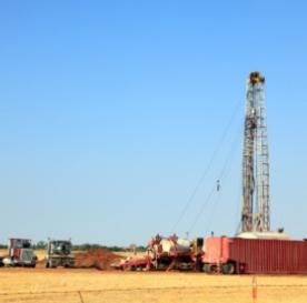
© iStockphoto.com / cstar55QUAKE CAUSE?: Oklahoma recently experienced its strongest earthquake ever and some suggest drilling for oil and gas may have played a role.
Probably not, as the gas drilling practice tends to be associated with minor quakes, not big ones, seismologists say

The biggest earthquake ever recorded in Oklahoma struck on November 5, a magnitude 5.6 temblor that buckled a highway and ruptured water pipes. This quake is part of a skyrocketing rise in seismic activity the state has seen in the past three years, leading many to wonder - and worry - about its cause. Might the practice of fracking, a controversial method of drilling into rock for natural gas, be to blame?

The earthquake struck around 10 P.M. local time about 50 kilometers east of Oklahoma City, and was felt from Saint Louis to Dallas. Until then, the state's largest temblor was a magnitude 5.5 event near the town of El Reno in 1952.

Overall, only minor injuries and damage were reported after last weekend's earthquake. A magnitude 4.7 foreshock preceded the quake by about 20 hours, and dozens of aftershocks were detected as well. These all apparently happened on the well-mapped Wilzetta Fault. "It seems the east side of the fault moved a bit southward," says seismologist Randy Keller, director of the Oklahoma Geological Survey (OGS).
Bizarro Earth

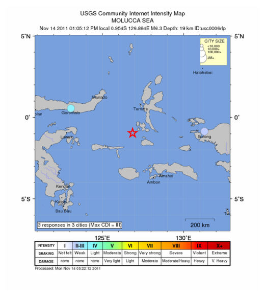
Molucca Sea - Earthquake Magnitude 6.3

Molucca Quake_141111
© USGSEarthquake Location
Date-Time
Monday, November 14, 2011 at 04:05:12 UTC

Monday, November 14, 2011 at 01:05:12 PM at epicenter

Time of Earthquake in other Time Zones

Location
0.954°S, 126.864°E

Depth
19.4 km (12.1 miles)

Region
MOLUCCA SEA

Distances
200 km (124 miles) SSW of Ternate, Moluccas, Indonesia

337 km (209 miles) NNW of Ambon, Moluccas, Indonesia

853 km (530 miles) N of DILI, Timor-Leste

1347 km (836 miles) NNW of DARWIN, Northern Territory, Australia

Bizarro Earth

US: Wanna experience the apocalypse before it happens? Visit Oklahoma!

Image
© Unknown
After one of the strangest local weather days in memory, an Oklahoma woman with a sense of humor asked on Twitter earlier this week:

"Wanna experience the apocalypse before it happens? Visit Oklahoma!"

She posted that on Monday night shortly after a 4.7-magnitude aftershock earthquake shook the state. The temblor occurred not long after six tornadoes ripped through southwest Oklahoma, which was preceded by flash-flooding in an area that's been plagued by a historic drought.

"Seriously, WHAT'S GOING ON?" someone else tweeted that night.

The answers vary. Global warning? Coincidence? Bad luck? Bad timing? End of time?

There's agreement on only one thing: It's been weird all year.

"Even for Oklahoma, this is crazy," said Rick Smith, a National Weather Service meteorologist in Norman. "Since January, we've been setting records. People are just kind of amazed and shocked."

State records set this year have ranged from the lowest temperature (31 degrees below zero in Nowata in northeast Oklahoma) to snowfall in a 24-hour period (27 inches, also in Nowata) to the largest hail stone (a spiky, six-inch piece recovered in Gotebo, in southwest Oklahoma).

This year also produced the state's highest-ever-recorded surface wind speed (151 miles per hour near El Reno, outside of Oklahoma City) and biggest known earthquake (5.6 magnitude, breaking the 1956 record).

Bizarro Earth

US: Earthquake Magnitude 4.2 Western Montana

Image
© USGS
Date-Time:
Friday, November 11, 2011 at 17:51:53 UTC

Friday, November 11, 2011 at 10:51:53 AM at epicenter

Time of Earthquake in other Time Zones

Location:
46.618°N, 113.557°W

Depth:
12.1 km (7.5 miles)

Region:
WESTERN MONTANA

Distances:
21 km (13 miles) SE (145°) from Clinton, MT

32 km (20 miles) W (260°) from Drummond, MT

37 km (23 miles) NNW (328°) from Philipsburg, MT

314 km (195 miles) ESE (111°) from Spokane, WA

666 km (414 miles) N (349°) from Salt Lake City, UT

Bizarro Earth

New Caledonia: Earthquake Magnitude 5.2 Offshore

Image
© USGS
Date-Time:
Friday, November 11, 2011 at 19:00:47 UTC

Saturday, November 12, 2011 at 06:00:47 AM at epicenter

Time of Earthquake in other Time Zones

Location:
22.750°S, 168.268°E

Depth:
130.7 km (81.2 miles)

Region:
NEW CALEDONIA

Distances:
138 km (85 miles) SSE of Tadine, Loyalty Islands, New Caledonia

194 km (120 miles) ESE of NOUMEA, New Caledonia

369 km (229 miles) SSW of Isangel, Tanna, Vanuatu

1624 km (1009 miles) ENE of BRISBANE, Queensland, Australia

Bizarro Earth

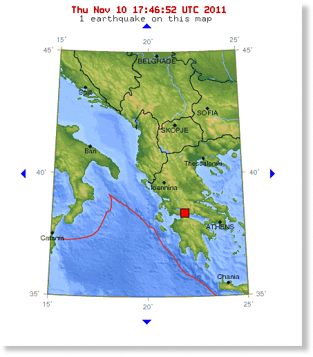
Greece: Earthquake Magnitude 5.2 Northwest of Athens

Image
© USGS
A 5.2 magnitude earthquake struck about 167 km (104) miles from Athens and about 27 km from Patras, Greece. The shallow earthquake was reported at a depth of just 6.9 km (4.3 miles) below the surface. There have been no initial reports of damages.

Ambulance

Turkey: Earthquake kills at least 7, dozens trapped in area hit by deadly temblor last month

Image
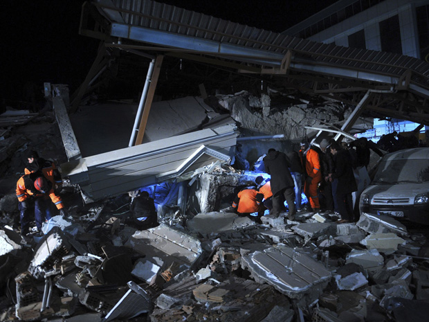
© Evrim Aydin / Anadolu Agency / ReutersRescue workers search for survivors at a collapsed building in Van, eastern Turkey, on Wednesday.
A strong earthquake rocked eastern Turkey, killing at least seven people in a grim replay of the temblor that devastated the area last month. Rescue workers had managed to pull out 25 survivors from the rubble of three collapsed buildings, including a top hotel where journalists and foreign aid workers were staying, authorities said Thursday.

The 5.7-magnitude quake Wednesday toppled 25 buildings in the city of Van, Deputy Prime Minister Besir Atalay said. The death toll could have been even worse: Only three of the buildings were occupied because the others were evacuated after the Oct. 23 quake that killed more than 600 people and destroyed at least 2,000 buildings.

Rescue workers sped up their search for survivors by daylight on Thursday, pulling a man in his 60s out of the wreckage of a pancaked hotel, live NTV television broadcast showed. Soon after, rescuers dug a young man from the rubble of an apartment building, the state-run Anatolia news agency said. The young man became the 25th people to be survived alive so far.

The workers used the glare of high-powered lights to work throughout the night despite several aftershocks. Atalay said rescue work was concentrating at the site of two collapsed hotels and one apartment building.

Bizarro Earth

Turkey: Earthquake with preliminary 5.7-magnitude collapses buildings

Image
© USGS
Intial Report: Earthquake with preliminary 5.7-magnitude collapses buildings in eastern Turkey.

USGS date here.

Compass

US: Oklahoma - Earthquake rattles Graham

For many in Young County, the house was a rockin' Saturday night.

Oklahoma's biggest earthquake in history, a 5.6 magnitude quake occurred late Saturday and originated near Sparks, Okla. east of Oklahoma City, more than 200 miles from Graham.

"The important thing to understand is that if you take the same magnitude earthquake and you put one here and one in California, it will be felt over a much larger area than the same magnitude in California," said Gary Patterson, geologist and director of education and outreach for the U.S. Center for Earthquake Research and Information.

He said because the geology of the central United States is different - the Earth's crust is harder, colder and denser than in California, the energy travels efficiently, like running a jack hammer on a concrete slab. "If you had a continuous slab, you'd feel it in your feet a greater distance away," Patterson said. He said 95 to 98 percent of the earthquakes in the world happen in places like California.

Bizarro Earth

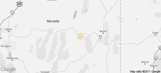
US: Nevada - Magnitude 4.0 earthquake strikes east of Reno

A shallow, magnitude 4.0 earthquake was reported Tuesday night east of Reno, according to the U.S. Geological Survey. The temblor occurred at 10:40 p.m. at a depth of 0 miles.

Reno quake
According to the U.S. Geological Survey, the Nevada quake's epicenter was 216 miles north of Las Vegas. It also was about 19 miles from Eureka, 25 miles from Duckwater, 32 miles from Willow Grove and 47 miles from Ely.