Earthquakes
S

Ambulance

Costa Rica Earthquake: 2 dead

Costa rica quake
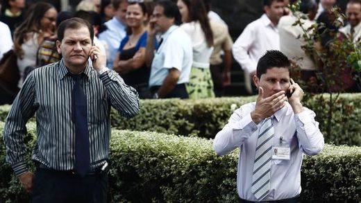
© Juan Carlos/ReutersPeople gathered in front of the Supreme Court talk on their mobile phones after being evacuated from buildings following an earthquake in San Jose September 5, 2012. A 7.9 magnitude earthquake struck northwestern Costa Rica on Wednesday, the U.S. Geological Survey said
A powerful earthquake rocked Costa Rica on Wednesday, causing the deaths of at least two people, damaging buildings, and briefly triggering a tsunami warning.

Residents of the capital San Jose said phones went down, electricity poles rattled on the streets and water flowed out of pools after the 7.6-magnitude quake. The were also unconfirmed media reports of people being treated for injuries.

A spokesman for the local Red Cross said two people died during the earthquake, one from a heart attack. He was not immediately able to confirm media reports the other person had been crushed under a collapsing wall.

Locals were shocked by the force of the quake, the biggest to hit Costa Rica since a 7.6 magnitude quake in 1991 left 47 dead.
Bizarro Earth

Watch Costa Rica Quake Vibrations Hit US

Shock Waves
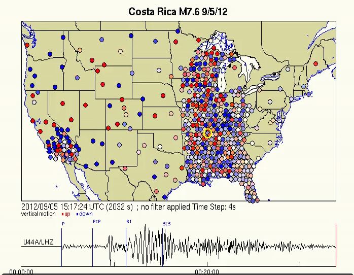
© IRISA screen capture of an animation that shows waves from the Costa Rican earthquake rattling the earth beneath the US. Blue means downward ground motion while red represents upward ground motion with the darker colors indicating larger amplitude.
A new animation shows the shockwave from the 7.6 magnitude earthquake that struck Costa Rica this morning (Sept. 5) arriving and reverberating through the ground beneath the United States.

The visualization was made by scientists at Incorporated Research Institutions for Seismology (IRIS) and shows the Earth slowly moving up and down. Red spots show seismometers moving upward; the darker the hue, the higher they are moving up. The opposite goes for blue.

The visualization shows how earthquakes create waves of motion through the Earth's crust, just as a pebble tossed into a pond creates a ripple. "But in this case, the pond is North America," said John Taber, head of outreach for IRIS.

Better Earth

Costa Rica earthquake, tsunami warning issued


A major earthquake hit northwestern Costa Rica on Wednesday, the U.S. Geological Survey said, but there were no immediate reports of casualties.

The quake -- initially given a magnitude of 7.9 but then revised to 7.6 -- struck at 10:42 a.m. ET at a depth of about 25 miles and about seven miles southeast of Nicoya, a town of some 15,000 people on a coastal area on the Pacific about 90 miles from the capital San Jose.

The Pacific Tsunami Warning Center issued tsunami warnings for Costa Rica, Panama and Nicaragua, after initially issuing warnings for a much larger area.

"It is not known that a tsunami was generated. This warning is based only on the earthquake evaluation. An earthquake of this size has the potential to generate a destructive tsunami that can strike coastlines near the epicenter within minutes and more distant coastlines within hours," the PTWC said.

Bizarro Earth

USGS: Earthquake Magnitude 7.6 - 8km NE of Samara, Costa Rica

Image
© USGS
Event Time:
2012-09-05 14:42:09 UTC
2012-09-05 08:42:09 UTC-06:00 at epicenter
2012-09-05 07:42:09 UTC-07:00 system time

Distances:
8km (5mi) NE of Samara, Costa Rica
24km (15mi) S of Nicoya, Costa Rica
38km (24mi) SSE of Santa Cruz, Costa Rica
68km (42mi) W of Puntarenas, Costa Rica
151km (94mi) W of San Jose, Costa Rica

Bizarro Earth

USGS: Earthquake Magnitude 5.9 - NW of Sola, Vanuatu

Image
© USGS
Event Time
2012-09-05 13:09:09 UTC
2012-09-06 00:09:09 UTC+11:00 at epicenter
2012-09-05 06:09:09 UTC-07:00 system time

Nearby Cities
196km (122mi) NW of Sola, Vanuatu
344km (214mi) NNW of Luganville, Vanuatu
613km (381mi) NNW of Port-Vila, Vanuatu
783km (487mi) ESE of Honiara, Solomon Islands
935km (581mi) N of We, New Caledonia

Bizarro Earth

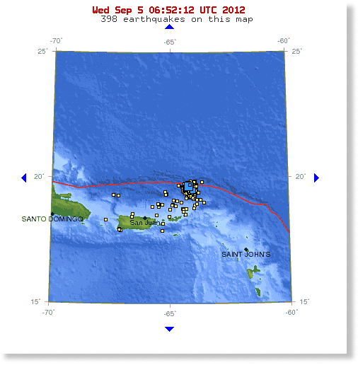
Virgin Islands and Caribbean region joins growing list of seismically-tense hotspots

Image
© USGS
The VIDN say on August 30, 2012: "The V.I. Territorial Emergency Management Agency said that V.I. Alert subscribers who have noticed a recent increase in earthquake notifications from the service should not be alarmed. Between 3 a.m. Monday and continuing throughout the day Wednesday, more than 50 very minor to moderate earthquakes were recorded near Latitude 19 degrees north, north of the Virgin Islands, according to a statement VITEMA issued Wednesday. Those tremors included a 5.2-, 4.6- and 4.7-magnitude earthquake between 3 and 5 p.m. Wednesday.

Victor Huerfano, director of the Puerto Rico Seismic Network, confirmed that the increase in earthquake activity is a swarm of tremors, a phenomenon that occurs four or five times a year in different parts of the Caribbean region, according to VITEMA. A swarm is defined as three or more earthquakes occurring within an hour, and the Puerto Rico Seismic Network has been recording these instances since Saturday. "It is normal but we cannot say what it means," Huerfano said. "It is more important that we make sure we are calm and prepared, and that emergency systems are in place in case a major earthquake happens." The Virgin Islands is located in a seismically active region, which has a potential for a major earthquakes to occur at any time, according to VITEMA's statement." - VIDN

Bizarro Earth

Quakes hit hydropower plant area in Quang Nam

Image
© Dan TriThe area of Song Tranh 2 Hydropower Plant in Quang Nam Province, where a series of tremors occurred yesterday evening
A series of tremors along with underground explosions that were heard from above and caused walls to crack occurred yesterday in the area of the Song Tranh 2 Hydropower Plant in Quang Nam Province's Bac Tra My District.

Experts at the plant are analyzing data collected from earthquake observation stations in the area but have yet to announce how powerful the quake was on the Richter scale, said Tran Van Hai, head of the Management Board of Hydropower Project 3.

The incident happened from 7 to 9 pm Monday at the Bac Tra My Town and several communes nearby, causing thousands of locals to rush out of their houses in panic after they heard loud blasts and found the ground shaken, houses' walls cracked and things inside the houses falling.

Ho Van Loi, chairman of the Tra Doc commune People's Committee said his house's floor was shaken five times during last night, with the most powerful seismic intensity occurring at 9 pm.

Bizarro Earth

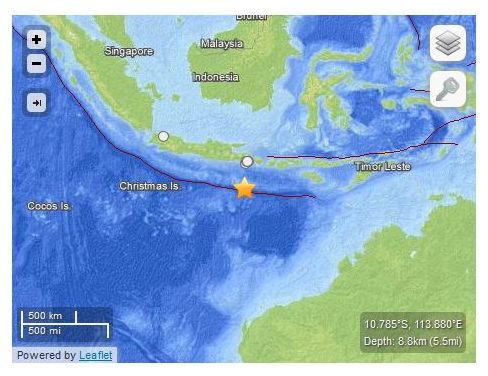
USGS: Earthquake Magnitude 6.4 - South of Sidorukun, Indonesia

Indon Quake_030912
© USGS
Event Time
2012-09-03 18:23:04 UTC

2012-09-04 02:23:04 UTC+08:00 at epicenter

Nearby Cities
244km (152mi) S of Sidorukun, Indonesia
264km (164mi) S of Muncar, Indonesia
266km (165mi) S of Gambiran Satu, Indonesia
267km (166mi) S of Srono, Indonesia
924km (574mi) SE of Jakarta, Indonesia

Bizarro Earth

Beverly Hills Earthquake of 3.3 Felt Across Los Angeles

Image
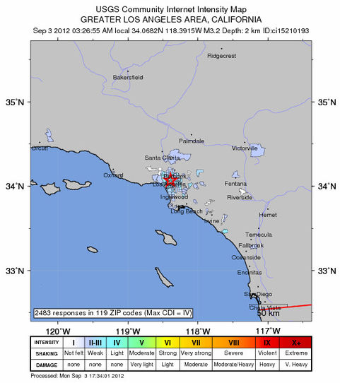
An earthquake early Monday centered in Beverly Hills was upgraded from to 3.2 to 3.3. and was felt around Los Angeles, according to the U.S. Geological Survey.

The temblor occurred at 3:26 a.m.

According to the USGS, the epicenter was one mile from West Hollywood, two miles from Century City and eight miles from Los Angeles Civic Center.

The USGS "Do You Feel It" site said the quake was most strongly felt on the Westside but also in the South Bay, downtown L.A. area and the San Fernando Valley.

In the past 10 days, there has been one earthquake magnitude 3.0 and greater centered nearby.

Better Earth

Quake off Philippines spurs small tsunami; 1 dead

A 7.6-magnitude quake struck off the eastern coast of the Philippines late Friday, killing at least one person in a house collapse, knocking out power in several towns and generating negligible tsunami surges.

A tsunami alert originally was issued for several countries in the region including Indonesia and Japan and for Pacific islands as far away as the Northern Marianas, but they all were later lifted, the Pacific Tsunami Warning Center said.

The center said that very small tsunami waves of 3 centimeters meters (just over an inch) were recorded along the eastern Philippine coast near Legazpi city and another nearby location.

Benito Ramos, a retired general who heads the country's disaster-response agency, said in an advisory broadcast nationwide that residents should be on the alert for aftershocks.