Earthquakes
S


Bizarro Earth

Nearly 1,000 earthquakes recorded in Arizona over 3 years

Image
© Incorporated Research Institutions for Seismology (funded by NSF EarthScope)Nearly 60 USArray stations were installed in Arizona from 2006 to 2009 as part of the EarthScope project. Station 118A, seen in this photo, recorded ground motion north of Wilcox in southeastern Arizona from April 6, 2007 to Jan. 21, 2009.
Earthquakes are among the most destructive and common of geologic phenomena. Several million earthquakes are estimated to occur worldwide each year (the vast majority are too small to feel, but their motions can be measured by arrays of seismometers). Historically, most of Arizona has experienced low levels of recorded seismicity, with infrequent moderate and large earthquakes in the state. Comprehensive analyses of seismicity within Arizona have not been previously possible due to a lack of seismic stations in most regions, contributing to the perception that widespread earthquakes in Arizona are rare.

Debunking that myth, a new study published by Arizona State University researchers found nearly 1,000 earthquakes rattling the state over a three-year period. Jeffrey Lockridge, a graduate student in ASU's School of Earth and Space Exploration and the project's lead researcher, used new seismic data collected as part of the EarthScope project to develop methods to detect and locate small-magnitude earthquakes across the entire state of Arizona. EarthScope's USArray Transportable Array was deployed within Arizona from April 2006 to March 2009 and provided the first opportunity to examine seismicity on a statewide scale. Its increased sensitivity allowed Lockridge to find almost 1,000 earthquakes during the three-year period, including many in regions of Arizona that were previously thought to be seismically inactive.

"It is significant that we found events in areas where none had been detected before, but not necessarily surprising given the fact that many parts of the state had never been sampled by seismometers prior to the deployment of the EarthScope USArray," says Lockridge. "I expected to find some earthquakes outside of north-central Arizona, where the most and largest events had previously been recorded, just not quite so many in other areas of the state."

Bizarro Earth

Iran quake kills 306; disease fear for survivors

Image
Twin earthquakes that devastated rural villages in northwest Iran on the weekend killed 306 people, most of them women and children, and have sparked fears of disease outbreak, officials said on Monday. Another 3,037 people were injured, of whom 2,011 were given first aid at the scene and the rest were taken to hospital, where 700 surgeries were performed, Health Minister Marzieh Vahid told lawmakers in a report published on the parliament's website.

"We are continuing the search for bodies," she said. Authorities called off rescue operations on Sunday after saying all possible survivors had been recovered.

Bizarro Earth

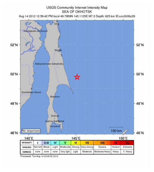
USGS: Earthquake Magnitude 7.7 - Sea of Okhotsk

Sea of Okhotsk Quake_140812
© USGSEarthquake Location
Date-Time:
Tuesday, August 14, 2012 at 02:59:42 UTC
Tuesday, August 14, 2012 at 12:59:42 PM at epicenter

Time of Earthquake in other Time Zones

Location:
49.796°N, 145.113°E

Depth:
625.7 km (388.8 miles)

Region:
SEA OF OKHOTSK

Distances:
160 km (100 miles) ENE (66°) from Poronaysk, Russia

361 km (225 miles) NNE (28°) from Yuzhno-Sakhalinsk, Russia

445 km (277 miles) SSE (160°) from Okha, Russia

1630 km (1013 miles) NNE (14°) from TOKYO, Japan

Arrow Up

Pacific quake swarm sparked underwater volcano eruption

Image
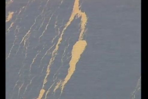
© RoyalW1979 / YouTubeA screenshot of the Pumice island that the volcano is believed to have birthed.
A swarm of more than 150 earthquakes over two days last month caused a previously dormant volcano to erupt beneath the Pacific Ocean, a scientist said Monday.

The eruption of the Havre Volcano, about halfway between New Zealand and Tonga, is believed to have caused a floating island of pumice larger than 4,000 square miles that was encountered by a New Zealand navy ship last week.

Cornel de Ronde, principal scientist of New Zealand's Institute of Geological and Nuclear Sciences, told Radio New Zealand the source of the pumice had been identified in cooperation with French researchers in Tahiti who monitor earthquakes in the southwest Pacific.

"When they looked at their physical records they saw that on July 17th and 18th, there were some 157 earthquakes of magnitudes between 3.0 and 4.8," he said.

Bizarro Earth

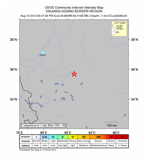
USGS: Earthquake Magnitude 6.3 - Xinjiang-Xizjang Border Region

Xinjiang Quake_120812
© USGS
Date and Time:
Sunday, August 12, 2012 at 10:47:06 UTC

Sunday, August 12, 2012 at 06:47:06 PM at epicenter

Time of Earthquake in other Time Zones

Location:
35.681°N, 82.516°E

Depth:

11 km (6.8 miles)

Region:

XINJIANG-XIZANG BORDER REGION

Distances:
282 km (175 miles) ESE of Hotan, China

481 km (298 miles) ENE of Leh, India

549 km (341 miles) SSE of Aral, China

560 km (347 miles) ESE of Shache, China

Bizarro Earth

Update: Two earthquakes in Iran kill 250 and injure 1,800

  • Two quakes hit northwest Iran near city of Tabriz
  • Quakes were 6.4 and 6.3 in magnitude
  • Casualties may rise as rescuers reach new areas on Sunday
  • Some 16,000 people given emergency shelter
Image
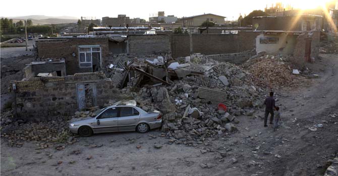
© The Associated PressRuins of a houses are seen after an earthquake in the city of Varzaqan in northwestern Iran, on Saturday, Aug. 11, 2012.
Two powerful earthquakes killed 250 people and injured around 1,800 in northwest Iran, where rescue workers frantically combed the rubble of dozens of villages throughout the night and into Sunday as medical staff desperately tried to save lives.

Thousands huddled in makeshift camps or slept in the streets after Saturday's quakes in fear of more aftershocks, 40 of which have already struck.

Casualty figures are expected to rise, Iranian officials said, as some of the injured were in critical condition while others were still trapped under the rubble inaccessible to rescue workers hampered by darkness in the first hours after the quakes.

Six villages were destroyed and about 60 sustained more than 50 percent damage, Iranian media reported. About 110 villages were damaged in the quakes, Deputy Interior Minister Hassan Ghadami was quoted by Fars as saying.

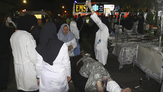
Photographs posted on Iranian news websites showed numerous bodies, including children, lying on the floor of a white-tiled morgue in the town of Ahar and medical staff treating the injured in the open air as dusk fell.

Attention

Update: Iran Back-to-Back Quakes Death Toll Hits 180, with Hundreds Injured, Six Villages Leveled

Image
© The Associated PressAug. 11, 2012: Medics tend a woman who was injured in an earthquake in the city of Varzaqan in northwestern Iran.
Northwestern Iran was struck Saturday by a series of major earthquakes and strong aftershocks, as state TV reported at least 180 dead, 1,350 injured and at least six villages leveled.Officials asked residents in affected areas to stay outdoors through the night, the Fars news agency reported.The U.S. Geological Survey put the first earthquake, which struck midday, at magnitude 6.4, followed by a 6.3 quake. There were numerous aftershocks, registering as high as magnitude 5.0.

Bizarro Earth

Back-to-Back 6.4 and 6.3 Magnitude Earthquakes hit Iran, followed by a 5.0 Magnitude Aftershock

Image
© USGS
Two strong earthquakes struck northwest Iran on Saturday, killing between 40 and 50 people and injuring 400, Iranian media said. The Iranian Students' News Agency quoted the head of the government's emergency centre, Gholamreza Masoumi, as announcing the casualty figures.

A local official in the area told ISNA that six villages had been completely destroyed and 60 villages had been 50 to 70 percent destroyed. The U.S. Geological Survey measured the first quake at 6.4 magnitude and said it struck 60 km (37 miles) northeast of the city of Tabriz at a depth of 9.9 km (6.2 miles). A second quake measuring 6.3 struck 49 km (30 miles) northeast of Tabriz 11 minutes later at a similar depth.

The second quake struck near the town of Varzgan, Fars news agency said. "The quake was so intense that people poured into the streets through fear," it said.

USGS data

Bizarro Earth

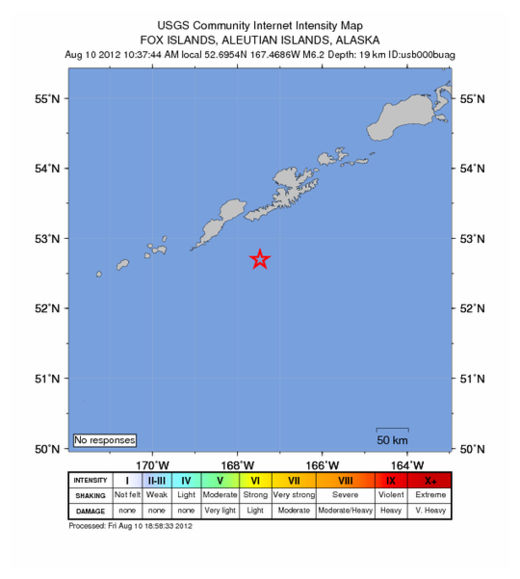
USGS: Earthquake Magnitude 6.2 - Fox Islands, Aleutian Islands, Alaska

Alaska Quake_100812
© USGSEarthquake Location
Date-Time
Friday, August 10, 2012 at 18:37:44 UTC

Friday, August 10, 2012 at 10:37:44 AM at epicenter

Time of Earthquake in other Time Zones

Location
52.695°N, 167.469°W

Depth
19 km (11.8 miles)

Region
FOX ISLANDS, ALEUTIAN ISLANDS, ALASKA

Distances
97 km (60 miles) ESE of Nikolski, Alaska

1420 km (882 miles) SW of Anchorage, Alaska

1452 km (902 miles) SW of Knik-Fairview, Alaska

1591 km (988 miles) SE of Anadyr', Russia

Bizarro Earth

Update: Los Angeles rattled by two 4.5 magnitude earthquakes within 10 hours

Image
© USGS
A magnitude 4.5 earthquake struck near the Southern California town of Yorba Linda for the second time in just over 10 hours on Wednesday, rattling the Los Angeles area, but no damage or injuries were immediately reported. The latest quake was recorded shortly after 9:30 a.m. (12:30 p.m. EDT) 2 miles (3 km) northeast of Yorba Linda, an affluent Orange County community southeast of Los Angeles that was the birthplace of the late former President Richard Nixon and houses his presidential library and museum.

It was centered about 5.5 miles (9 km) beneath the surface. The earlier temblor occurred at about 9:20 p.m. on Tuesday in about the same area at about the same depth, and was followed by more than a dozen smaller aftershocks overnight, according to the U.S. Geological Survey.

The two 4.5-magnitude quakes were both felt as far away as downtown Los Angeles, about 35 miles (56 km) away, where rattling and rumbling was felt for several seconds at a time.

USGS Data