Earth ChangesS


Igloo

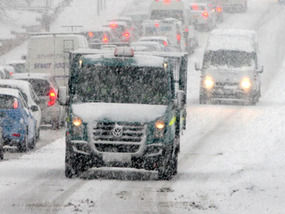
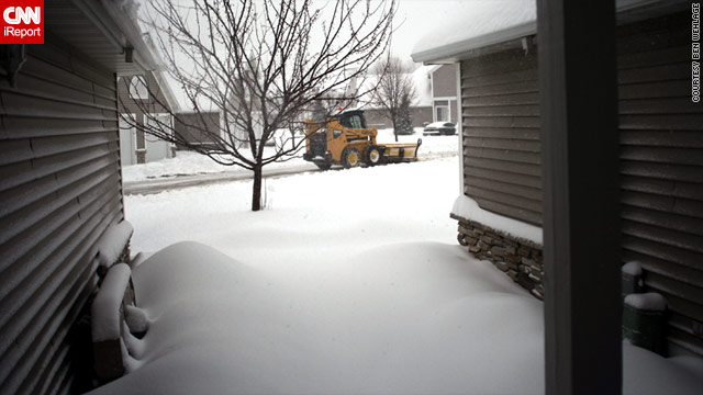
Snow, 50-mph winds in picture for Northeastern US

Image
© Matt Rourke/APThe first rain from the systems moving into the Northeast started falling Thursday evening in places such as downtown Philadelphia, Pa.
Nor'easter expected to make for messy evening commute, and up to 16 inches of snow in high elevations

Strong winds, heavy rain and even snow moved into the Northeast on Friday, with the weather expected to get worse for evening commutes and overnight.

By late Friday morning, flights into La Guardia and Newark airports were being delayed by more than an hour due to the wind and rain.

Killington, Vt., had five inches of snow Friday morning and other areas above 4,000 feet saw the white stuff as well, Jim Cantore of weather.com reported for MSNBC. By the time the storm blows through on Sunday, he added, some Vermont and New Hampshire mountains could see 16 inches of snow.

Forecasters say two low pressure systems will combine to create a strong nor'easter covering most of the northeastern half of the nation, stretching from the Atlantic to the Great Lakes.

The system will pull moisture and energy in from the Atlantic Ocean, kicking up winds up to 50 mph and rainfall ranging between 1 to 3 inches in most areas.

Fish

New species of fish discovered in ocean's deepest depths

Image
© PAThe snailfish was found living at a depth of 7,000m in a trench in the South East Pacific Ocean, which was previously thought to be free of fish
A new species has been discovered in a part of the ocean previously thought to be entirely free of fish, scientists said yesterday.

The new type of snailfish was found living at a depth of 7,000m in the Peru-Chile trench of the South East Pacific Ocean.

Mass groupings of cusk-eels and large crustacean scavengers were also discovered living at these depths for the first time, scientists said. The findings, in one of the deepest places on the planet, were made by a team of marine biologists from the University of Aberdeen and experts from Japan and New Zealand.

The team took part in a three-week expedition, during which they used deep-sea imaging technology to take 6,000 pictures at depths between 4,500m and 8,000m within the trench.

The mission was the seventh to take place as part of HADEEP, a collaborative research project between the University of Aberdeen's Oceanlab and the University of Tokyo's Ocean Research Institute, supported by New Zealand's National Institute of Water and Atmospheric research (NIWA).

Info

Drought Return Forecast

The Colorado River watershed may face a dry winter - and water rationing, according to several recent, unsettling studies.

In fact, Lake Mead may soon fall below the mark that will trigger a reduction in the supply of water for Arizona and Nevada, according to an alarming study by researchers from the University of California at Los Angeles published in the October issue of the Journal of the American Water Resources Association.

The researchers said that the overlap of ocean currents and temperatures in the Atlantic and Pacific Oceans will deliver a dry winter, with Lake Mead already just half full and only nine feet above the level that will trigger rationing.

Most of the studies suggesting a dry winter and serious drought have focused on the upper Colorado River watershed, rather than Rim Country. Fortunately, a wet winter last season filled Roosevelt Lake, which will give the Valley a cushion if drought results in a cutoff of water through the Central Arizona Project.

Bizarro Earth

US: Earthquake Magntitude 3.8 - Arkansas

Magnitude 4.4 Earthquake - Arkansas
© USGS
Date-Time
Friday, October 15, 2010 at 10:20:19 UTC

Friday, October 15, 2010 at 05:20:19 AM at epicenter

Time of Earthquake in other Time Zones

Location:
35.276°N, 92.323°W

Depth:
5 km (3.1 miles) set by location program

Region:
ARKANSAS

Distances:
25 km (15 miles) NNE of Conway, Arkansas

55 km (35 miles) W of Searcy, Arkansas

60 km (35 miles) N of LITTLE ROCK, Arkansas

70 km (40 miles) SSW of Mountain View, Arkansas

Igloo

Global Warming Causes Snow to hit Britain!

Image
© PASnow could fall on high ground
Winter will come early to Britain next week as snow is forecast for the north while the south will shiver in frosty sub-zero nights.

The cold snap will seem worse after temperatures soared to 75F (23C) last weekend.

Forecasters warned snow is due in Scotland and possibly northern England next week, with frost as far south as southern England, which will see bitter 48F (9C) daytime maximum temperatures.

"A northerly air stream in the middle part of next week means coldest conditions will probably be in Scotland, with sleet or snow showers and snow settling on higher ground," said forecaster Brian Gaze of independent forecasters The Weather Outlook.

"Even southern England will feel distinctly chilly."

Forecasters Positive Weather Solutions have already predicted a 'white-out' winter almost as harsh as last winter - with widespread snow, temperatures down to -4F (-20C) and transport chaos.

The Weather Outlook, which has an accurate seasonal forecasting record, warned the UK is now being gripped by a bitter series of winters comparable with the harsh 1939-42 winters which made conditions so horrendous during the Second World War.

Question

A Whale of a Journey, Captured in Photos

Brazilian Whale Journey
© F. Johansen, via Associated PressThe image above, taken in 2001, was used to identify a female humpback whale who traveled more than 6,000 miles from Brazil to Madagascar.

If you cruise the Web you can find long-lost friends, high school sweethearts and ... far-traveling humpback whales.

With the help of Flickr, a photo-sharing site, Peter Stevick, a biologist at the College of the Atlantic, in Bar Harbor, Me., and colleagues have identified a whale that made an unprecedented journey, an epic 6,000 miles from Brazil to Madagascar, about 10 years ago. The whale's adventure is described in Biology Letters.

Carole Carlson, an author of the paper and a researcher at the College of the Atlantic, often checks Flickr for whale photos because humpbacks can be identified by their tails, which are as individual as fingerprints. An amateur photographer had taken a photo on a film camera in 2001 and only recently posted it. That photo matched one taken by researchers of a whale off the coast of Brazil in 1999.

Brick Wall

Photo shows leak in reservoir months before Hungarian sludge spill

Sludge Leak
© BAKO GABOR/AP PHOTO/INTERSPECTPicture taken in June 2010 by Hungarian air photo company Interspect shows the dam of the reservoir in Kolontar, Hungary, with red stains that allegedly indicate red sludge leaking through - nearly four months before the wall broke on October 4 killing at least eight people .
An aerial photo taken months before a gigantic reservoir unleashed torrents of toxic sludge shows a faint red trail trickling through the container wall - part of a growing body of evidence that inspectors who gave the pit a clean bill of health may have missed warning signs.

Police were examining the photo Tuesday as part of an investigation into how part of the wall containing the 10 million cubic metres of caustic slurry could have given way without structural weaknesses being detected by a team of inspectors from the government environmental agency who inspected the container pond less then two weeks before the spill. The flood of red sludge killed eight people.

Red Flag

Hurricane gains strength as it heads to Mexican coast

Hurricane Paula
© APStrong winds have already hit Mexico
Hurricane Paula is gaining strength as it is heading towards Mexico's Yucatan Peninsula.

The hurricane intensified to a category-two storm with winds of up to 160km/h (100 mph), forecasters at the US National Hurricane Center said.

It has brought strong winds and heavy rain to north-east Honduras and damaged homes in Honduras, officials said.

The centre of the hurricane was expected to hit the Mexican coast early on Wednesday.

Cloud Lightning

Brooklyn hail storm produces rivers of ice (VIDEO)

Hailstorm in Boerum Hill, Brooklyn New York.


Bizarro Earth

US: Earthquake Magntitude 4.5 - Oklahoma

Image
© USGS
Date-Time:
Wednesday, October 13, 2010 at 14:06:29 UTC

Wednesday, October 13, 2010 at 09:06:29 AM at epicenter

Location:
35.206°N, 97.307°W

Depth:
5 km (3.1 miles) set by location program

Region:
OKLAHOMA

Distances:
10 km (10 miles) E of Norman, Oklahoma

35 km (20 miles) SSE of OKLAHOMA CITY, Oklahoma

35 km (25 miles) WSW of Shawnee, Oklahoma

60 km (35 miles) ENE of Chickasha, Oklahoma