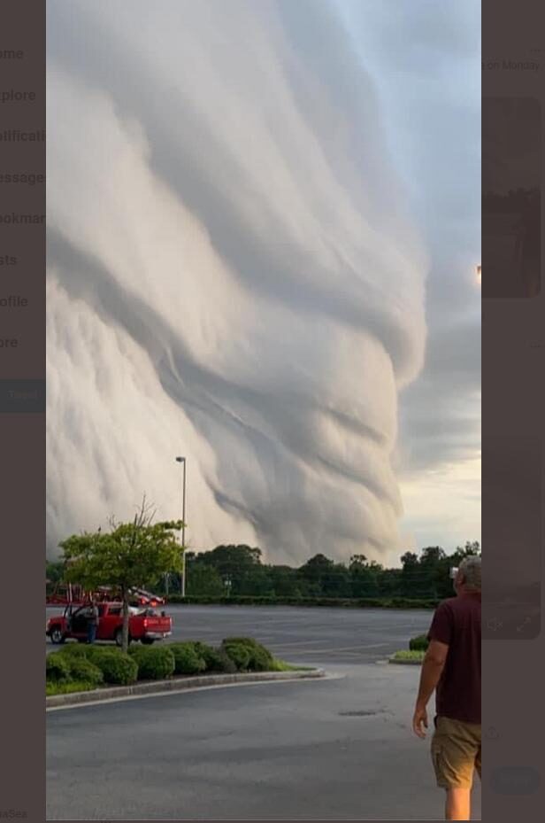
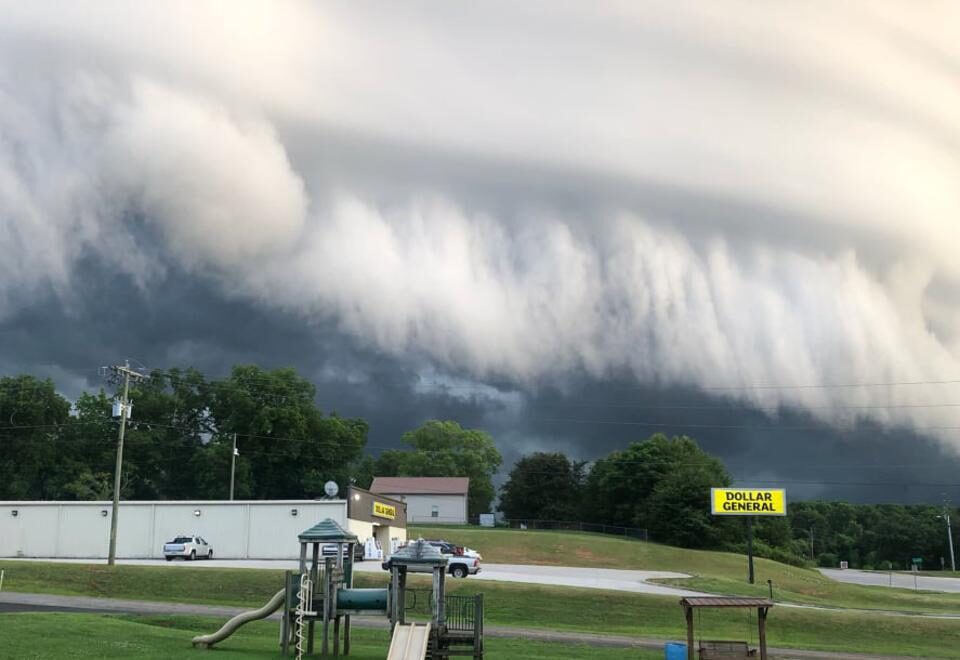
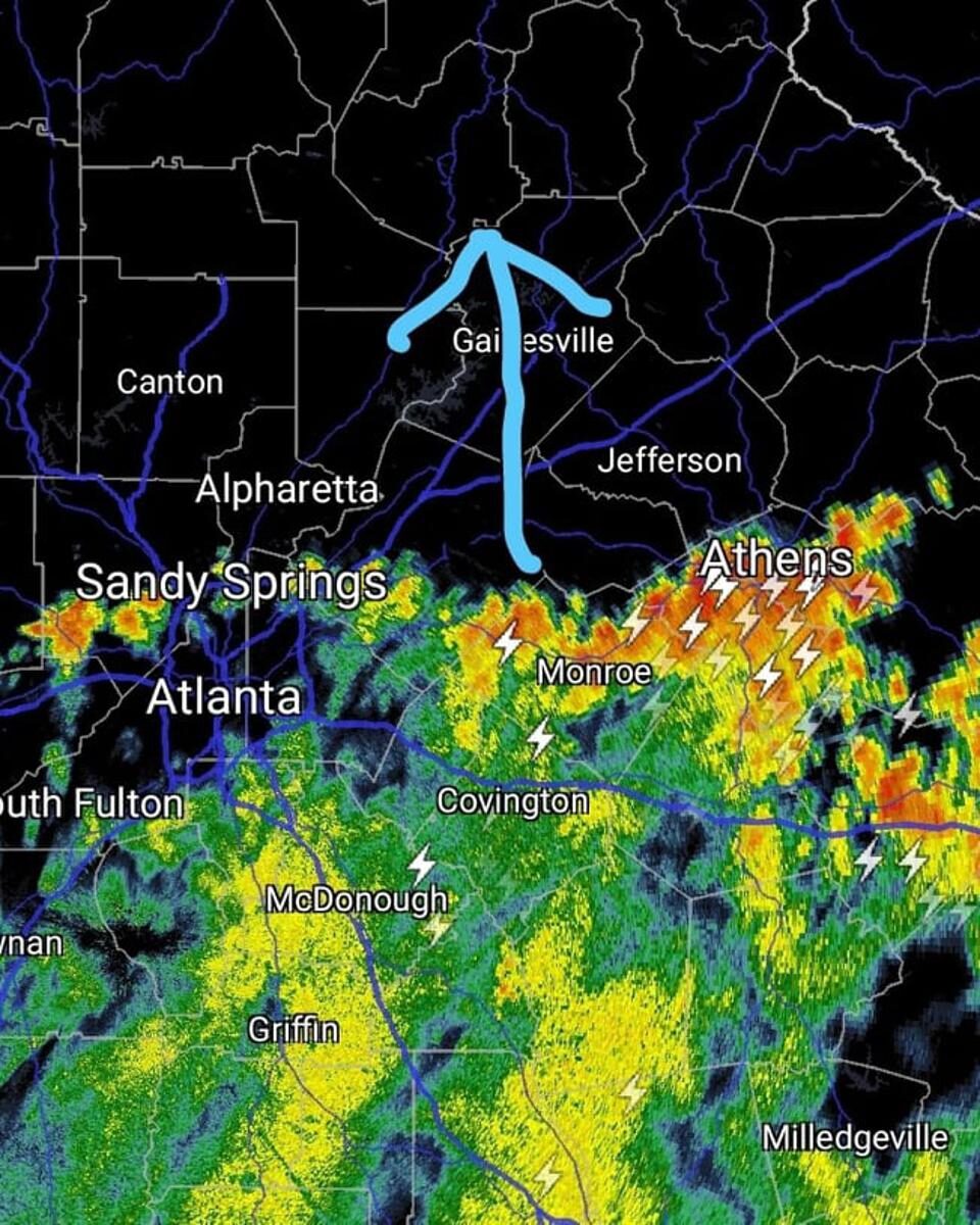
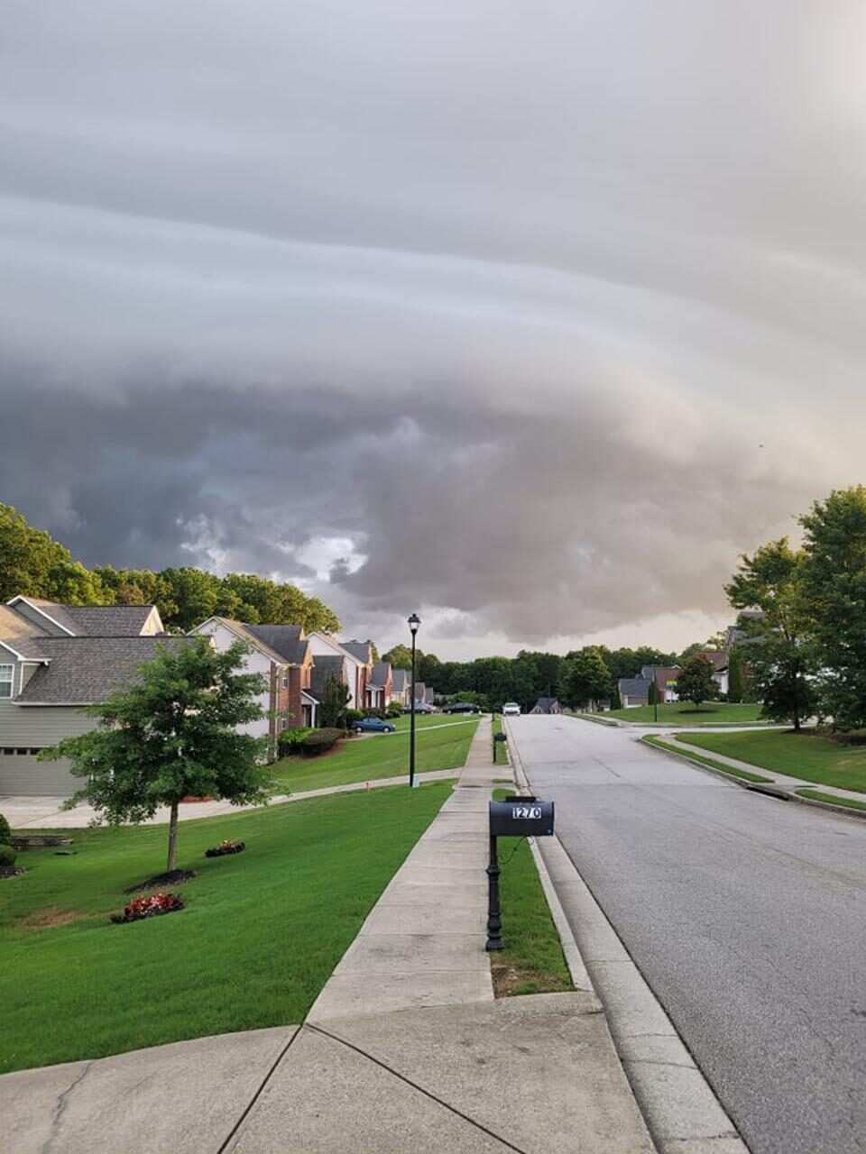
The shelf cloud can be quite scary-looking, particularly to the untrained eye. The examples that moved into the Atlanta and Athens area on the leading edge of a squall line creeping up from South Georgia were particularly so. The radar image captured from my phone shows an east-west oriented squall line of storms drifting northward on Monday afternoon. Once I saw the line approaching, it was impossible for me to not peak outside (safely) to see if there was a shelf cloud or what is technically called an Arcus cloud (see my photo below).
The National Oceanic and Atmospheric Administration (NOAA) Glossary is a good place to start for a definition. According to the Glossary, an Arcus cloud is, "A low, horizontal cloud formation associated with the leading edge of thunderstorm outflow (i.e., the gust front)." Shelf and roll clouds are types of arcus clouds. The Glossary further defines a roll cloud as, "A low, horizontal tube-shaped arcus cloud associated with a thunderstorm gust front (or sometimes with a cold front)." They are typically detached from the base of the thunderstorm cloud, which distinguishes it from its "shelf cloud" sibling.
Shelf clouds, which are probably what many of us saw this week in Georgia, are also usually associated with rising cloud motion along the leading edge and rather turbulent looking skies beneath it. The thunderstorm outflow is the result of evaporation of raindrops behind the leading edge. The more dense, evaporatively cooled air moves forward as a density current. I often describe it to my family as imagine pouring pancake syrup into a less dense fluid like water. The dense current can lift moist air producing the shelf cloud appearance. Outflow boundaries can also lift the air and initiate new storms. I spent a good portion of my doctoral dissertation at Florida State University thinking about them.
As I reflect, arcus, shelf, and roll clouds are very strange-looking clouds. As a meteorologist, they often evoke, "Hey, what I am seeing here?" in my inbox. I suspected yesterday would be one of those days. By the way, some of the video of the Georgia shelf clouds rolling in are pretty impressive if you can find one on Twitter.
Comment: Here:
.
Follow me on Twitter. Check out my website. Marshall Shepherd
Dr. J. Marshall Shepherd, a leading international expert in weather and climate, was the 2013 President of American Meteorological Society (AMS) and is Director of the University of Georgia's (UGA) Atmospheric Sciences Program. Dr. Shepherd is the Georgia Athletic Association Distinguished Professor and hosts The Weather Channel's Weather Geeks Podcast, which can be found at all podcast outlets.


Comment: See also: