I received numerous emails, photos and phone calls about it.
From earliest times; people have tried to understand the weather. Great thinkers from Aristotle to French philosopher René Descartes tried to explain atmospheric phenomena through the formation and lifespan of clouds.
First, what are clouds?
Clouds are the condensation of invisible water vapor on very small nuclei of dust, pollen, salt from ocean spray or sulfite particles from phytoplankton in the oceans along with pollution from cars and factories or smoke from forest fires.
Clouds exist in the atmosphere in thousands of forms and sizes, like so many different rocks on Moonstone Beach.
That diversity seemingly makes it impossible for anyone to successfully classify and thus predict the weather.
In 1803, English naturalist and amateur meteorologist Luke Howard developed a simple classification system. His system used Latin words to describe three basic families of clouds: cirrus ("curl of hair"), cumulus ("heap or pile") and stratus ("layer or sheet").
In other words, he divided clouds into three types: hair, heaps and layers.
Howard later went on to name any type of cloud that produced precipitation as nimbus ("cloud or violent rain").
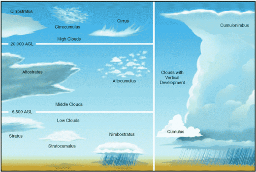
He later refined his cloud classification system and divided hair, heaps and layers into four primary cloud groups by the height of the cloud base above the Earth's surface. Those classifications include:
- High-level clouds are classified as cirrus, cirrostratus and cirrocumulus and form at altitudes from 16,000 to 43,000 feet at our latitude. They are primarily composed of ice crystals and can appear in a luminescent array of colors.
- Middle-level clouds are classified as altostratus and altocumulus and form at altitudes from 6,500 to 23,000 feet. They are primarily composed of water droplets. However, they can also be composed of ice crystals.
- Low clouds are classified as stratus, stratus cumulus and nimbostratus and form from just above the surface of the ground to 6,500 feet of altitude. When on the surface, they are called fog. If the temperatures are cold enough, these clouds may also contain ice particles or snow.
- And last, but not least, clouds with vertical development are cumulus and cumulonimbus. As the air rises thousands of feet into the sky, it cools and releases tremendous amounts of latent heat. That condition keeps the air rising inside the cloud and can trigger thunderstorms.
Those convective storms can contain areas of organized rotation a few miles up in the atmosphere. If the conditions are right, the thunderstorms can spin out tornadoes. Those types of clouds can, on rare occasions, burst into the stratosphere!
However, like the many different rocks along a beach, many other types of clouds exist in nature, like mammatus, pileus, wall, jellyfish, iridescence, contrails, etc.
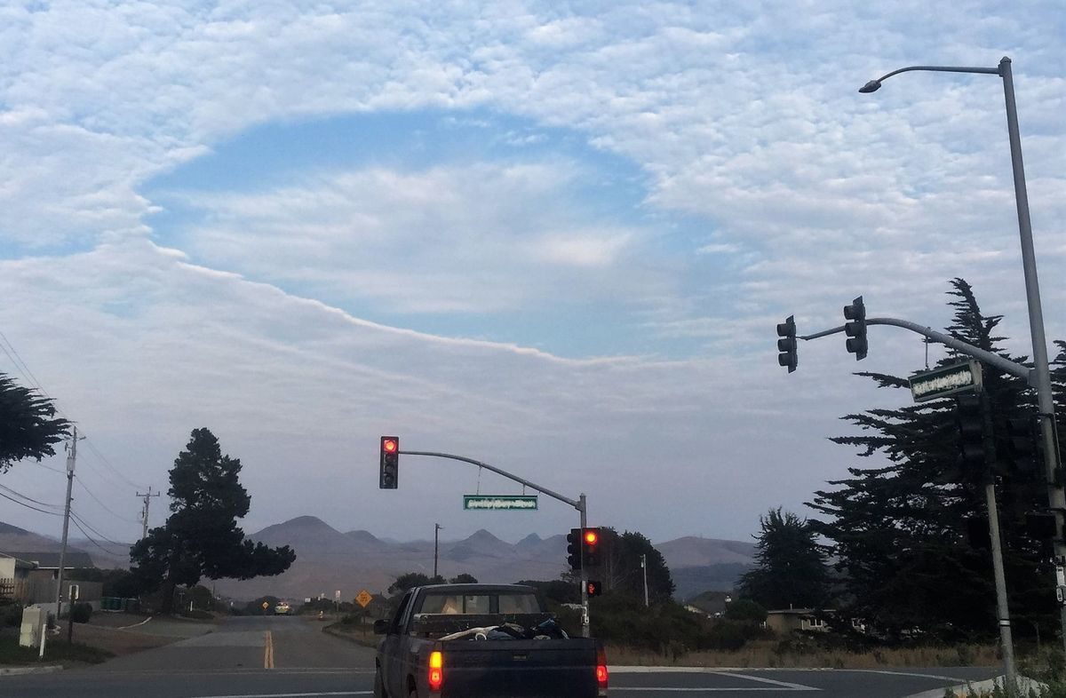
That brings us back to last weekend's curious cloud. That cloud was classified as a "fallstreak hole" or altocumulus stratiformis translucidus lacunosus.
Fallstreak holes are usually formed in altocumulus clouds when an aircraft cuts through them.
From time to time, water droplets in the altocumulus cloud layer can be "supercooled." In other words, they are at a temperature below 32 degrees Fahrenheit but have not frozen yet.
When an aircraft flies through those clouds, air pressure momentarily drops as the supercooled water droplets in the cloud pass over the aircraft wings, causing an immediate drop in air temperature.
That can be just enough to cause the droplets to freeze suddenly, creating a chain reaction.
When the water droplets freeze they release latent heat, which causes the air to expand and rise, like a hot air balloon. In response to that rising air, the surrounding air sinks producing those fascinating fallstreak clouds.


Comment: In recent times this rare cloud phenomena has appeared over Southern California, UK, Texas, Louisiana, Mississippi and Alabama.
Other strange cloud anomalies seem to be appearing globally with higher frequency and intensity. Factors which may contribute to these 'strange skies' are atmospheric dust loading from increased comet and volcanic activity and changes in the layers of the atmosphere.
An indicator of this dust loading is the intensification of noctilucent clouds we are observing. As explained in Pierre Lescaudron's book, Earth Changes and the Human-Cosmic Connection: See also: Chemtrails? Contrails? Strange skies