Storms
S

Cloud Lightning

2 dead after storms rake U.S. South, take aim at East

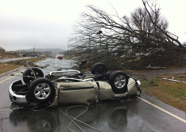
Kandi Cash trudged in rain through the splintered debris of her grandparents' home, hoping to salvage photos and other keepsakes after violent storms and tornadoes scoured the Southeast, leaving two people dead before the system advanced on the Northeast. The demolished home was one of many in the Georgia city of Adairsville splintered by a massive storm front as it punched across the Southeast on Wednesday and then headed across the densely populated Eastern seaboard on Thursday.
Image
© AP Photo/David GoldmanA vehicle lies on a road after a tornado moved through Adairsville, Ga. on Wednesday, Jan. 30, 2013. A fierce storm system that roared across northwest Georgia has left at least one person dead and a trail of damage that included demolished buildings in downtown Adairsville and vehicles overturned on Interstate 75 northwest of Atlanta.
The vast storm front stretching on a slanting north-south arc for hundreds of miles shattered homes and businesses around the Midwest and South with tornadoes and high winds earlier in the week. By Thursday, it had spread power outages from the Carolinas to Connecticut, triggered flash floods and forced water rescues in areas outside Washington, D.C.

In the Northeast, utilities reported power outages affecting 74,000 users in Connecticut, nearly 25,000 others in Rhode Island and some 24,000 in upstate New York. Authorities in Rhode Island said gusting winds blew the roof off a building in Central Falls. A wind gust of 63 mph was recorded in the Finger Lakes region of upstate New York as temperatures plunged with the cold air mass creeping up behind the front. Forecasters said snowfall was possible from the Great Lakes to the Northeast - some of it lake-effect snow.

Windsock

Tornadoes tear through four states in the U.S., killing at least two

Image
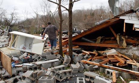
© Photograph: Butch Dill/APResidents search through debris after a suspected tornado ripped Coble, Tennessee, destroying several homes and businesses.
Tornadoes were reported in Mississippi, Georgia, Indiana and Tennessee, an unusual development in January

Tornadoes ripped through four states on Tuesday night and Wednesday, killing at least two people, as an Arctic cold front clashed with warm air to produce severe weather over a wide swath of the nation.

Tornadoes were reported in Mississippi, Georgia, Indiana and Tennessee, an unusual development in January when the focus is more likely to be on snow and ice.

The National Weather Service said twisters touched down in Sardis, Mississippi, and heavily damaged homes in Solsberry, Indiana, wiping out power in the surrounding areas. Three twisters were confirmed in Tennessee and a possible tornado hit southeastern Arkansas.

In Georgia, a man was killed when a tornado hit his mobile home late Wednesday morning, said Bartow County administrator Pete Olson.

In north Nashville, a man died when a tree fell on his garage apartment, according to Jeremy Heidt, spokesman for the Tennessee Emergency Management Agency.
Cloud Lightning

1 dead as powerful winds, rain batter the U.S. South

Powerful winds, rain and hail battered parts of the South on Wednesday, killing at least one person as the large storm system damaged homes, overturned cars on an interstate and knocked out electricity to thousands.At least one tornado was confirmed and several more suspected, and conditions remained ripe for more. Since Tuesday, the system had caused damage across a swath from Missouri to Georgia.

In recent days, people in the South and Midwest had enjoyed unseasonably balmy temperatures in the 60s and 70s. A system pulling warm weather from the Gulf of Mexico was colliding with a cold front moving in from the west, creating volatility.

Police said high winds toppled a tree onto a shed in Nashville, Tenn., where a man had taken shelter, killing him. As the storm crept eastward, officials reported a possible tornado in Adairsville, Ga., about 60 miles northwest of Atlanta. At least 10 cars were overturned on Interstate 75, and emergency crews were trying to get to people reported trapped in homes and buildings, said Bartow County Fire Chief Crag Millsap.

Across the region, downed power lines, trees and tree limbs were making it difficult to reach people who needed help.

Cloud Lightning

Satellite spies severe weather brewing over U.S.

Severe Weather
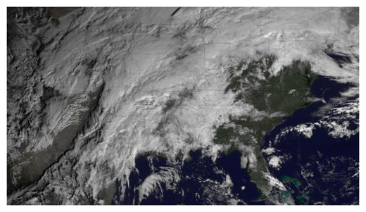
© NOAAIn this GOES East satellite image taken at 10:15 a.m. ET on Jan. 29, 2013, severe weather can be seeing brewing over the central portions of the United States.
After an Arctic blast left much of the United States out in the cold, a new system is bringing the threat of severe weather to the central portions of the country this evening and through the night. A satellite snapped an image of the system earlier this morning (Jan. 29).

The National Weather Service's (NWS) Storm Prediction Center, located in Norman, Okla., has forecast severe thunderstorms, with damaging winds and hail - and possibly even tornadoes - for the lower Ohio Valley, the mid-South and the lower Mississippi Valley. The SPC says the threat will increase through the night, with squall lines (or long lines of thunderstorms) and individual storms rolling through along with a cold front.

Nighttime storms and tornadoes can be particularly deadly, as people tend to be in bed and unaware of warnings and the storms are harder to see as they bear down. A 2008 study in the American Meteorological Society's journal Weather and Forecasting found that nighttime tornadoes were 2.5 times as likely to cause a death as those that occurred in the daytime. The threat of deadly nighttime tornadoes is exacerbated in the winter with the season's shorter daylight hours.

Cloud Lightning

NASA sees powerful "overshooting cloud tops" in Cyclone Felleng

cyclone felleng
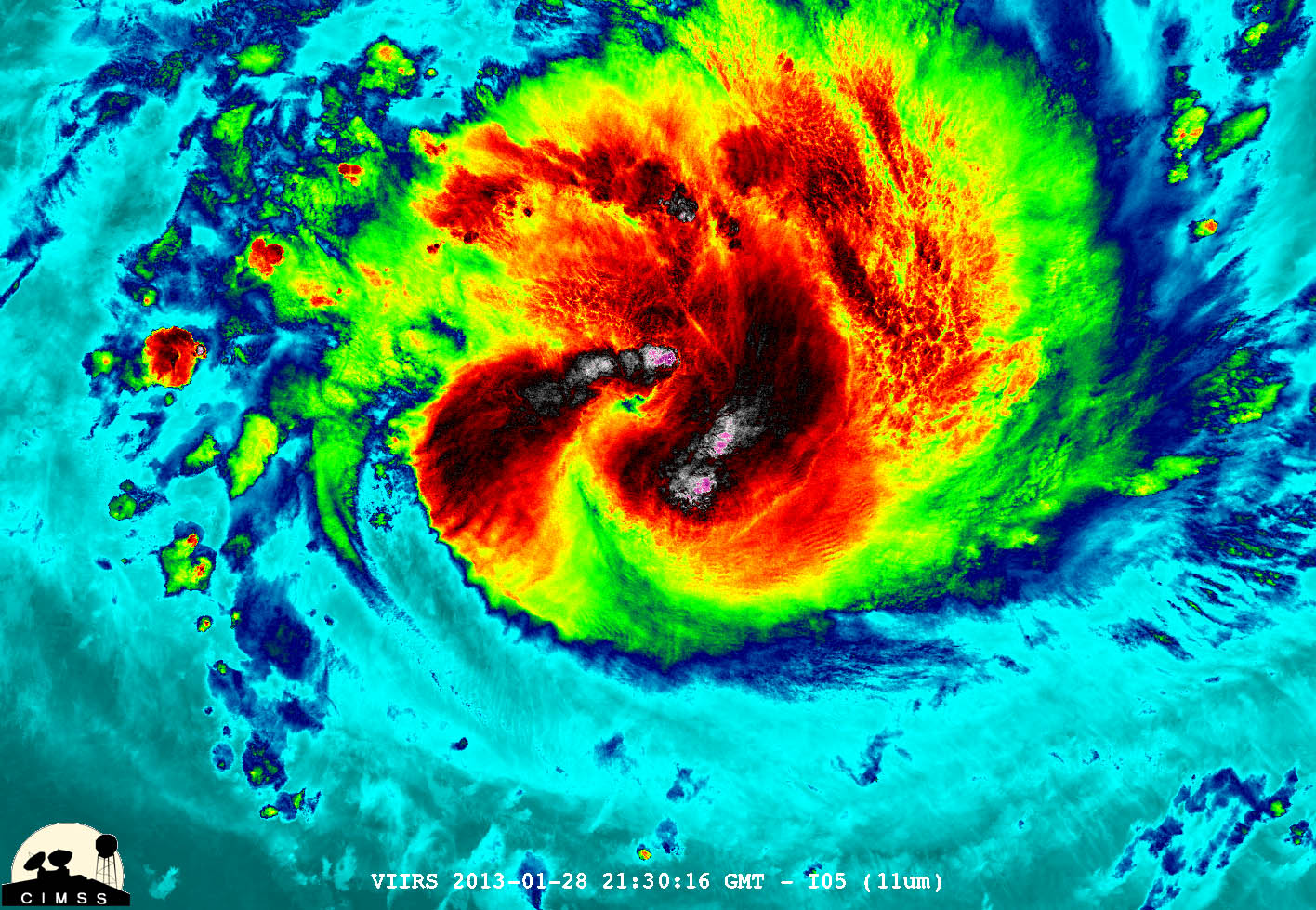
© William Straka, UWM/NASA/NOAA NASA-NOAA's Suomi NPP satellite captured this false-colored night-time image of Cyclone Felleng during the night on Jan. 28, 2013. Felleng is northwest of Madagascar.
NASA satellite imagery revealed that Cyclone Felleng is packing some powerful thunderstorms with overshooting cloud tops.

An overshooting (cloud) top is a dome-like protrusion that shoots out of the top of the anvil of a thunderstorm and into the troposphere. It takes a lot of energy and uplift in a storm to create an overshooting top, because usually vertical cloud growth stops at the tropopause and clouds spread horizontally, forming an "anvil" shape on top of the thunderstorms.

During the night-time hours (Madagascar local time) of Jan. 28, NASA-NOAA's Suomi NPP satellite captured a night-time image of Cyclone Felleng when it was located northwest of Madagascar. The image was created at the University of Wisconsin-Madison and was false colored to reveal temperatures. The image showed some pretty cold overshooting cloud tops, topping at ~170K (-153.7F/ -103.1C). The image also showed some interesting gravity waves (waves in the atmosphere) propagating out from the storm in both the thermal (infrared) and visible imagery. The infrared imagery also showed that Felleng has strengthened significantly since the previous day as convective bands of thunderstorms are wrapping more tightly into the eye.

Bizarro Earth

Dozens killed and injured, homes destroyed in Sumatra landslide

flooding in Jakarta
© AFPIndonesian authorities have started cloud seeding to prevent more major flooding in Jakarta.
More than two dozen people have been killed, injured or are missing as a result of a landslide caused by heavy rain on the Indonesian island of Sumatra.

By last night, 14 people had died in the muddy landslip, a further nine were injured and six were still missing.

The side of a hill in Agam, west Sumatra, slid away on Sunday, wiping out homes, rice paddies and an orchard.

Cloud Lightning

Tornadoes in January! Wide area of U.S. faces unusual early threat

Tornado
© Inconnu
A wide area of the central and southeast U.S. faces the unusual threat of tornadoes in January over the next 12 to 18 hours as an approaching cold front clashes with unusually warm air, a meteorologist said on Tuesday.

The first tornado warning of the approaching storm was issued on Tuesday for western Missouri, said meteorologist Bill Bunting at the National Weather Service Storm Prediction Center in Norman, Oklahoma.

A warning is intended to signal residents to take cover because a tornado could be forming. A less urgent tornado watch is in effect for a region from extreme northeast Texas through virtually all of Arkansas, western Tennessee and extreme southern Illinois.

"It's a little unusual," Bunting said of the tornado threat. "We don't see this every winter with this kind of warmth preceding a storm system."

Cloud Lightning

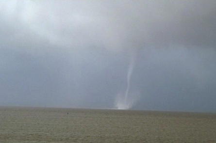
Rare tornado spotted in Bristol Channel as storms hit North Somerset, UK

Bristol channel tornado
© Sue HewittThe photo of a waterspout taken by Sue Hewitt on Sunday afternoon
Snow, hail, heavy rain and thunder - the North Somerset area has experienced it all over the past two weeks.

And now the wild weather has caused a spectacle in the Bristol Channel, with local people capturing a picture of what appears to be a mini tornado in the estuary.

This picture was taken by Sue Hewitt, of Downend, who spotted the event while out walking along the coastal path between Clevedon and Portishead at around 1pm on Sunday.

Igloo

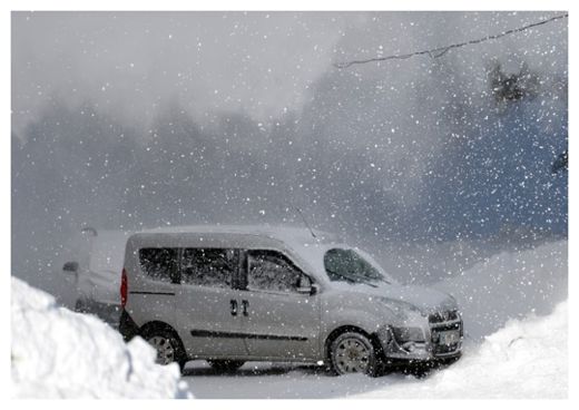
Heavy snowfall closes dozens of roads in Turkey

Snow in Turkey
© aabadoluajansi
Meric-Ipsala road in the Thrace region of Turkey has been shut down to motor vehicle traffic on Sunday due to heavy snowfall which began in Edirne province.

Aside from the Meric-Ipsala road, 37 village roads have also been shut down to traffic due to heavy snowfall in the region.

Road crews are working to open the Meric-Ipsala road to traffic again on Sunday.

Snow thickness at Uludag, one of the favorite skiing centers of Europe, reached 215 centimeters on Sunday.

The Weather Department of the north-western province of Bursa said that they expected snowfall at Uludag on both Sunday and Monday.

Windsock

Australian Army on stand-by amid Queensland tornado warnings

Bargara tornado
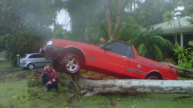
© Darren Curtis / Channel 9Devastation caused by a twister that tore through the Queensland town Bargara.
A sixth tornado has hit Queensland's Bundaberg region and forecasters say more could develop, including over Brisbane, as the day wears on.

The army has been put on standby and dam releases sped up in southeast Queensland as ex-cyclone Oswald moves south unleashing floods and the threat of more tornadoes.

Six tornadoes have hit Queensland's Bundaberg region in the past 24 hours and forecasters say more could develop later today, including on the Sunshine Coast, Brisbane, and on the Gold Coast.

Hundreds of homes are at risk of flooding in the central Queensland cities of Gladstone and Bundaberg.