Storms
S


Cloud Lightning

Devastating 'Mini-Tornado' Hits Australian City

Image
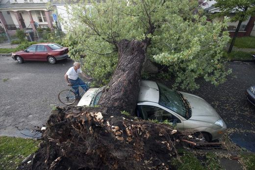
© Agence France-Presse The devastation caused by a "mini-tornado" after it tore through the Australian city of Townsville, ripping roofs off houses, bringing down power lines and injuring nine people
A devastating "mini-tornado" tore through the city of Townsville on Tuesday, ripping roofs off houses, snapping trees in half and injuring 13 people as wild weather pounded northern Australia.

The Queensland State Emergency Service (SES) said it received dozens of calls for help, with 13 people needing treatment, mostly for cuts and abrasions. Three were hospitalised.

"Rapid Damage Assessments in the Townsville area have recorded approximately 60 homes with varying degrees of roof damage," the SES said, adding that at least six of the properties suffered significant structural damage.

Meteorologists, who said the freak storm could not officially be called a tornado as there was no funnel, recorded winds of up to 111 kilometres (69 miles) per hour, leaving thousands of homes without power.

The weather bureau forecast further heavy rain.

One resident told Sky News that when the storm hit it sounded like "a jet taking off". Another said it was like "being in a washing machine".

Queensland Premier Anna Bligh, who faces being thrown out of office in state elections this weekend, said it was a frightening experience for the people affected.

Cloud Lightning

NASA Sees More Severe Weather Over Eastern Texas, Oklahoma

A low pressure area is centered over eastern Oklahoma, and its associated cold front drapes south into eastern Texas. The front is stalled over eastern Texas and eastern Oklahoma and is generating severe weather today. NASA's Aqua satellite and NOAA's GOES-13 satellite have been providing infrared, visible and microwave images to forecasters of the stalled frontal system.

On March 20, a flood warning was in effect up and down the eastern sides of Texas and Oklahoma, including Dallas and Fort Worth, Texas. The National Weather Service posted a flood warning for the double cities because of heavy rainfall over the last 36 hours. More isolated thunderstorms are expected to develop late afternoon and evening, generating more heavy rainfall, lightning and small hail.
Image
© NASA/JPL, Ed OlsenThe AIRS instrument onboard NASA's Aqua satellite captured an infrared image that showed cloud top temperatures in the severe frontal system over Texas and Oklahoma on March 20 at 0753 UTC 34:53 am EST). The strongest thunderstorms, heaviest rainfall and coldest cloud top temperatures (around 220 Kelvin/ -63.6 F/-53.1 C) appear in purple.

Cloud Lightning

Tornado Hits San Antonio as Severe Weather Rattles South and Midwest


US - Severe weather hammered the Midwest and South from Minnesota to Texas including a tornado that touched down in San Antonio, where at least 50 homes were damaged or destroyed.

Residents across this broad region were bracing for flooding Tuesday after the severe weather brought heavy rain and hail that is anticipated to continue for the next few days. With the storm system slowing significantly, tornadoes are becoming less likely but flash flooding becomes a major concern, forecasters said.

The slow-moving weather pattern will bring thunderstorms with heavy rain as it moves over the same area, according to the National Weather Service, which said that some locations will receive a foot of rain by midweek.

The NWS reported that the tornado touched down 25 miles southwest of San Antonio on Monday evening, and that parts of the city and surrounding areas were under a tornado warning. Although some were trapped inside their homes, no fatalities were reported by early Tuesday morning.

Tornado warnings across the San Antonio area were canceled around 11 p.m. Monday, according to ABC News affiliate KSAT. Crews began assessing damage to the area late Monday night.

Umbrella

Flooding feared after storms sock south-central US

Image
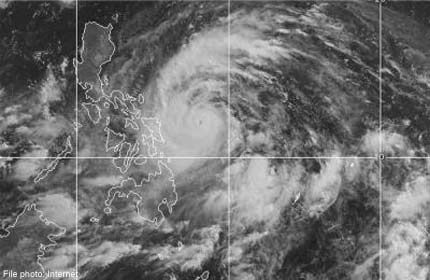
© Associated Press/Weather This NOAA satellite image taken Monday, March 19, 2012 at 10:45 AM EDT shows dense cloud cover over much of the Plains as active weather ramps up across the region.
Residents and businesses from southeast Texas north through western Missouri braced for flooding Tuesday after a violent band of storms brought heavy rain, hail and at least one tornado, with more of the same forecast for the next several days.

The National Weather Service said a tornado touched down Monday evening about 25 miles southwest of San Antonio. The twister damaged several homes, trapping some people inside their mobile homes, but no fatalities were reported, according to The San Antonio Express-News.

The fresh crop of storms comes after two tornadoes damaged homes and railcars in North Platte, Neb., on Sunday. The EF3 twister with winds up to 165 mph injured four people.

Flooding remains a serious concern across the affected areas.

Igloo

Hail, rain, snow at 1,500 feet elevation keep California utility crews busy

Sacramento Valley
© Tim Reese / Scaramento BeeStorm clouds hover over the Sacramento Valley as seen from on top of Cantelow Hill in Yolo County looking east on Sunday.
Rain and hail pounded the chilly Sacramento region, snow shrouded the foothills at elevations as low as 1,500 feet, and thousands of customers were without power Sunday, capping one of the year's wettest weeks.

By mid-afternoon Sunday, pea-sized hail was reported throughout the area - from Curtis Park to midtown to Rancho Cordova.

"We got hail here for about 10 minutes," Rancho Cordova Councilwman Linda Budge emailed The Bee. "Also thunder once. Temps dropped noticeably between noon and three."

And if you thought it was colder than usual, you were right. Sunday's daytime high of 55 was well below the normal temperature on March 18 of 67 degrees, the National Weather Service said.

Cloud Lightning

Baseball-Sized Hail in Forecast for Oklahoma and Texas

Image
© UnknownIllustration only
Storms are expected to sweep through the middle of the country over the next several days, bringing heavy rain and the threat of hail and tornadoes. Flood warnings stretch from southeast Texas north through western Missouri on Monday, but after a year of drought in much of the region and a largely snowless winter, fears of flooding aren't what they otherwise might be in several states, where the ground is expected to absorb inches of rain with ease.

The forecast for northern Texas and southeast Oklahoma also calls for baseball-sized hail, damaging winds and possibly tornadoes, according to the National Weather Service's Storm Prediction Center in Norman, Okla. Two tornadoes damaged homes and rail cars in North Platte, Neb., on Sunday.

Eight inches of rain are expected in southeastern Kansas, which has been unusually dry for nearly a year. The area has had less than three-fourths of the precipitation it typically gets since last April, state climatologist Mary Knapp said.

Cloud Lightning

Tornadoes strike Nebraska, flipping tractor-trailer and rail cars

Image
© The Weather Channel/Today
Severe storms overnight in Nebraska, Texas and Ohio damaged homes and tossed rail cars as well as at least one tractor-trailer, and the threat continued Monday with a large part of the central U.S. on alert.

The greatest damage overnight was just outside North Platte, Neb., where two confirmed tornadoes tore roofs off several homes, downed power lines and injured two people.

One twister crossed Interstate 80, flipping a tractor-trailer in its path. The truck's driver was hospitalized.

A rail yard also was hit, with 15 cars derailed or knocked over, the North Platte Telegraph reported. One worker there was hit by flying debris, treated at a hospital and then released.

In central Ohio, tornado sirens went off as large hail and high winds swept through Sunday night. In Gardendale, Texas, two people were hurt when high winds flipped over their mobile home. No tornadoes were reported in either state.

The mix of warm weather in recent weeks with cold pockets across the Midwest and central U.S. has led to an early start to the tornado season.

"It has been an active season already for tornadoes, and that's part of the reason we've scooched up our siren testing starting in March," Paul Johnson, emergency manager for Douglas County in North Dakota, told KETV.

Tornado watches have been issued for parts of Texas and Oklahoma for Monday, while the rest of the central U.S. is under severe weather warnings that include the possibility of large hail and high winds.

The threat will shift slightly to the east on Tuesday, weather.com reported, with parts of Illinois, Arkansas, Louisiana and Texas seeing the biggest threat.

Igloo

Arizona cities buried in rare snowstorm as much of U.S. enjoys balmy weather

Image
© Joshua Lott/REUTERSFlagstaff, Arizona was hit with a late winter storm that dumped more than of foot of snow in the area on March 18.
A winter storm and high winds struck parts of Arizona and New Mexico on Sunday, causing hazardous driving conditions, power outages and school cancellations. The fast moving storm forced the National Weather Service to place parts of northern New Mexico under a winter storm warning until midnight Monday as heavy snow and wind from Arizona quickly blanketed the area.

The electric company PNM reported that around 33,000 customers were out of power at one point Sunday afternoon in the Albuquerque area due to high winds. A spokesman for PNM said emergency crews were working to restore power, and by 9 p.m. the number without electricity was down to 4,500.

Heavy winds and blowing dust forced the closure of parts Interstate 10 in southern New Mexico due to low visibility, but the road was back open later in the day. A flight carrying the University of New Mexico men's basketball team home after its loss in the NCAA tournament was delayed due to high winds.

Arizona Department of Transportation crews were fully deployed Sunday after heavy snow in Arizona fell from Flagstaff to the White Mountains. The winter storm forced officials to temporary close Interstate 40 in both directions and parts of Interstate 17. Both highways later reopened Sunday afternoon.

Umbrella

Australia: Cyclone Lua hammers the Pilbara region


As residents in Western Australia's Pilbara region assess the damage caused by Tropical Cyclone Lua overnight, Queensland's Gulf communities are being warned to prepare for a cyclone heading their way.

Pilbara residents emerged from a night of wild weather this morning after a cyclone crossed the coast north of Port Hedland as a category four system yesterday afternoon, before later weakening to category two strength.

There are reports of extensive damage at the small community of Pardoo, while Nullagine, Newman and Marble Bar were also in the firing line overnight.

Cloud Lightning

St. Patrick's Day Strong Storms: Missouri to Indiana

Image
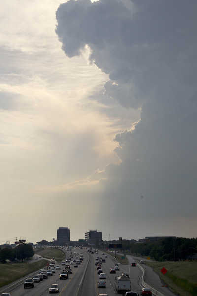
© Paul KPhoto of a towering thunderstorm cloud, submitted by AccuWeather.com Facebook fan Paul K. on Saturday.
Strong thunderstorms are threatening to ruin St. Patrick's Day celebrations from southern Missouri to southern Indiana into this evening.

The stage is set for potent thunderstorms to erupt from St. Louis and Poplar Bluff, Mo., to Louisville, Ky., with record warmth and moist air in place.

Other cities at risk include Cape Girardeau, Mo., Paducah, Ky., and Evansville, Ind.

Some of the same areas being threatened this St. Patrick's Day were the targets of the massive tornado outbreak earlier this month.

A repeat of that outbreak is not expected since any tornado that touches down into this evening will be an isolated event. Damaging winds, hail and downpours are greater concerns.