Earthquakes
S


Bizarro Earth

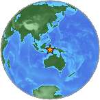
Indonesia: Earthquake Magnitude 7.7 - Kepulauan Mentawai Region

Image
© USGS
Date-Time:
Monday, October 25, 2010 at 14:42:22 UTC

Monday, October 25, 2010 at 09:42:22 PM at epicenter

Time of Earthquake in other Time Zones

Location:
3.484°S, 100.114°E

Depth:
20.6 km (12.8 miles)

Region:
KEPULAUAN MENTAWAI REGION, INDONESIA

Distances:
240 km (150 miles) W of Bengkulu, Sumatra, Indonesia

280 km (175 miles) S of Padang, Sumatra, Indonesia

305 km (190 miles) W of Lubuklinggau, Sumatra, Indonesia

795 km (500 miles) WNW of JAKARTA, Java, Indonesia

Bizarro Earth

US: Earthquake Magnitude 4.6 - Wyoming

Image
© USGS
Date-Time:
Sunday, October 24, 2010 at 17:43:59 UTC

Sunday, October 24, 2010 at 11:43:59 AM at epicenter

Time of Earthquake in other Time Zones

Location:
43.626°N, 110.331°W

Depth:
5 km (3.1 miles) set by location program

Region:
WYOMING

Distances:
40 km (25 miles) ENE of Jackson, Wyoming

60 km (35 miles) W of Dubois, Wyoming

95 km (60 miles) NNW of Pinedale, Wyoming

530 km (330 miles) WNW of CHEYENNE, Wyoming

Bizarro Earth

Earthquake Magnitude 6.9 - Gulf of California

Image
© USGS
Date-Time:
Thursday, October 21, 2010 at 17:53:14 UTC

Thursday, October 21, 2010 at 11:53:14 AM at epicenter

Time of Earthquake in other Time Zones

Location:
24.843°N, 109.171°W

Depth:
10 km (6.2 miles) set by location program

Region:
GULF OF CALIFORNIA

Distances:
105 km (65 miles) S of Los Mochis, Sinaloa, Mexico

125 km (75 miles) SW of Guamuchil, Sinaloa, Mexico

140 km (85 miles) NE of La Paz, Baja California Sur, Mexico

1200 km (740 miles) WNW of MEXICO CITY, D.F., Mexico

Bizarro Earth

Indonesia: Earthquake Magnitude 6.1 - 16th Oct 10

Indonesia Quake_161010
© USGSEarthquake Location.
Date-Time:
Saturday, October 16, 2010 at 15:44:32 UTC

Sunday, October 17, 2010 at 12:44:32 AM at epicenter

Time of Earthquake in other Time Zones

Location:
7.343°S, 125.662°E

Depth:
20.6 km (12.8 miles)

Region:
KEPULAUAN BARAT DAYA, INDONESIA

Distances:
135 km (85 miles) N of DILI, Timor-Leste

385 km (240 miles) NE of Kupang, Timor, Indonesia

395 km (245 miles) ESE of Baubau, Sulawesi, Indonesia

795 km (495 miles) NW of DARWIN, Northern Territory, Australia

Bizarro Earth

US: Earthquake Magntitude 3.8 - Arkansas

Magnitude 4.4 Earthquake - Arkansas
© USGS
Date-Time
Friday, October 15, 2010 at 10:20:19 UTC

Friday, October 15, 2010 at 05:20:19 AM at epicenter

Time of Earthquake in other Time Zones

Location:
35.276°N, 92.323°W

Depth:
5 km (3.1 miles) set by location program

Region:
ARKANSAS

Distances:
25 km (15 miles) NNE of Conway, Arkansas

55 km (35 miles) W of Searcy, Arkansas

60 km (35 miles) N of LITTLE ROCK, Arkansas

70 km (40 miles) SSW of Mountain View, Arkansas

Bizarro Earth

US: Earthquake Magntitude 4.5 - Oklahoma

Image
© USGS
Date-Time:
Wednesday, October 13, 2010 at 14:06:29 UTC

Wednesday, October 13, 2010 at 09:06:29 AM at epicenter

Location:
35.206°N, 97.307°W

Depth:
5 km (3.1 miles) set by location program

Region:
OKLAHOMA

Distances:
10 km (10 miles) E of Norman, Oklahoma

35 km (20 miles) SSE of OKLAHOMA CITY, Oklahoma

35 km (25 miles) WSW of Shawnee, Oklahoma

60 km (35 miles) ENE of Chickasha, Oklahoma

Bizarro Earth

Menominee County Shakeup was an Earthquake, says Tech Researcher

Image
© UnknownClose up shows crack from Menominee County earthquake on October 4.
That shaking and loud noise experienced recently in Menominee County of Upper Michigan was indeed an earthquake, albeit a small one, according to a Michigan Tech researcher.

"The large crack and ridge were created most probably by a magnitude 1 or 2 earthquake," said Wayne Pennington, chair of geological and mining engineering and sciences, of the events that took place Monday, October 4.

The ridge and crack are 361 feet long, and the ridge is 4 to 5 feet high and 20 to 30 feet wide at its largest point, Pennington said after visiting the site. The crack is 2 feet wide and 4 to 5 feet deep at its largest point. Trees are tipped away from the crack at about 14 degrees on either side, showing that the surface is now tipping, having formed the ridge.

Bizarro Earth

Tonga: Earthquake Magnitude 6.1 - 12th Oct 10

Tonga Quake_121010
© USGSEarthquake Location
Date-Time:
Tuesday, October 12, 2010 at 12:02:55 UTC

Wednesday, October 13, 2010 at 01:02:55 AM at epicenter

Time of Earthquake in other Time Zones

Location:
20.485°S, 173.951°W

Depth:
9.9 km (6.2 miles)

Region:
TONGA

Distances:
150 km (90 miles) ENE of NUKU'ALOFA, Tonga

205 km (125 miles) S of Neiafu, Tonga

495 km (305 miles) E of Ndoi Island, Fiji

2115 km (1320 miles) NE of Auckland, New Zealand

Bizarro Earth

US: 2 Injuries Reported After 2 Quakes Hit Arkansas

Image
© USGS
The U.S. Geological Survey says two small earthquakes have struck two areas in Arkansas more than 150 miles apart. Local officials say no injuries or damages have been reported from either quake.

An estimated 3.8-magnitude quake shook the small town of Guy in Faulkner County at about 8:30 a.m. Monday. The U.S. Geological Survey says the quake happened 15 miles north-northeast of Conway and 40 miles north of Little Rock.

Another quake hit at almost the exact same time about 150 miles away in northeast Arkansas. The U.S. Geological Survey says the 3.9-magnitude earthquake was centered about 15 miles southeast of Paragould.

Bizarro Earth

Indonesia: Earthquake Magnitude 6.3 - Halmahera

Indon Quake_081010
© USGSEarthquake Location
Date-Time:
Friday, October 08, 2010 at 05:43:10 UTC

Friday, October 08, 2010 at 02:43:10 PM at epicenter

Time of Earthquake in other Time Zones

Location:
2.754°N, 128.198°E

Depth:
144.9 km (90.0 miles)

Region:
HALMAHERA, INDONESIA

Distances:
235 km (145 miles) NNE of Ternate, Moluccas, Indonesia

400 km (245 miles) ENE of Manado, Sulawesi, Indonesia

1530 km (950 miles) SSE of MANILA, Philippines

2565 km (1600 miles) ENE of JAKARTA, Java, Indonesia