Earth ChangesS


Bulb

US: Tempers flare over 6 days of Connecticut power outages

Image
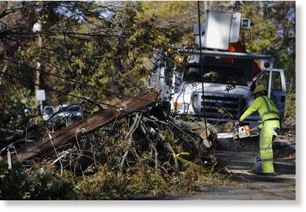
© The Associated Press/Jessica HillWorkers remove trees around downed lines in Simsbury, Conn., Friday, Nov. 4, 2011. Six days into an epic power outage that still has roughly 300,000 Connecticut residents in the dark, tempers are snapping as fast as the snow-laden branches that brought down wires across the region last weekend.
Tempers are snapping as fast as the snow-laden branches that brought down power wires across the Northeast last weekend, with close to 300,000 Connecticut customers still in the dark and the state's biggest utility warning them not to threaten or harass repair crews.

Angry residents left without heat as temperatures drop to near freezing overnight have been lashing out at Connecticut Light & Power: accosting repair crews, making profane criticisms online and suing. In Simsbury, a hard-hit suburban town of about 25,000 residents, National Guard troops deployed to clear debris have been providing security outside a utility office building.

At a shelter at Simsbury High School, resident Stacy Niezabitowski, 53, said Friday she would love to yell at someone from Connecticut Light & Power but hadn't seen any of its workers.

"Everybody is looking for someplace to vent - not a scapegoat, just someplace to vent your anger so somebody will listen and do something," said Niezabitowski, who was having lunch at the shelter with her 21-year-old daughter. "Nobody is doing anything."

The October nor'easter knocked out power to more than 3 million homes and business across the Northeast, including 830,000 in Connecticut, where outages now exceed those of all other states combined. Connecticut Light & Power has blamed the extent of the devastation partly on overgrown trees in the state, where it says some homeowners and municipalities have resisted the pruning of limbs for reasons including aesthetics.
Cloud Lightning

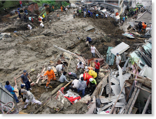
Landslide in northwest Colombia leaves 14 dead, dozens more missing

Image
© Agence France-Presse
A landslide caused by heavy rains left 14 people dead and dozens more missing in northwest Colombia on Saturday, a Red Cross official said.

Cesar Uruena, a Red Cross rescue director, said the landslide buried more than 14 homes in the city of Manizales in Caldas state, 165 kilometres (102 miles) northwest of the capital, Bogota.

Rescuers have reports of 14 people dead and 13 injured, Uruena said.

"We are talking about an average of 60 people missing. This could be a bit speculative, but the number is high," Uruena told The Associated Press by telephone.

He said that because of the many people listed as missing, rescuers would continue the search through the night.

Caldas emergency services director Sandra Lopez said heavy rains pounded the area the night before and caused a part of a mountain to collapse onto the houses.

As a preventative measure, authorities are asking that 35 homes near the landslide site be evacuated.

Source: The Canadian Press

Bizarro Earth

US: California - Is A Volcanic Eruption Possible At The Salton Sea?

Image
© USGS
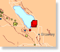
The Salton Sea covers more than 380 square miles and is 35 miles long.

And along the southeast shoreline in the Imperial Valley near Niland lies an explosive history going back thousands of years.

A series of what would appear to be four rather ordinary hills are actually volcanoes known as the Salton Buttes.

"A variety of people, when it comes to the Salton Sea, ask, 'Why invest in the Salton Sea?' There's more of a history to it than what we see here today," said Chris Schoneman, the manager at the Sonny Bono Salton Sea National Wildlife Refuge.

One of the volcanoes, a butte called Rock Hill, comes at the end of a hiking trail and provides fantastic views of the sea and wildlife.

"The hill formed about 16,000 years ago. It was an active volcano -- last active about 8,000 to 10,000 years ago," said Schoneman.

Image
© geoepicenter.comObsidian bolders
Obsidian Butte has more of a volcano-look -- covered with chunks of obsidian rock. Obsidian is volcanic glass that results from lava quickly cooling above ground.

Another volcano, Mullett Island, can only be reached by boat. It's also a nesting spot for 10,000 seabirds.

The hundreds of species of birds are a big draw for the 20,000 yearly visitors to the refuge.

But Schoneman says most don't know anything about the volcanoes there. And it's not like there are lava flows or spewing ash to catch a glimpse of.

But there is molten magma miles below the earth's surface. The geothermal activity is shown by surrounding power plants, tapping into that heat to create electricity.

X

Ontario, Canada: Giant sinkhole closes section of Toronto's Bayview Ave

Image
© Unknown
Click here to see more pictures.

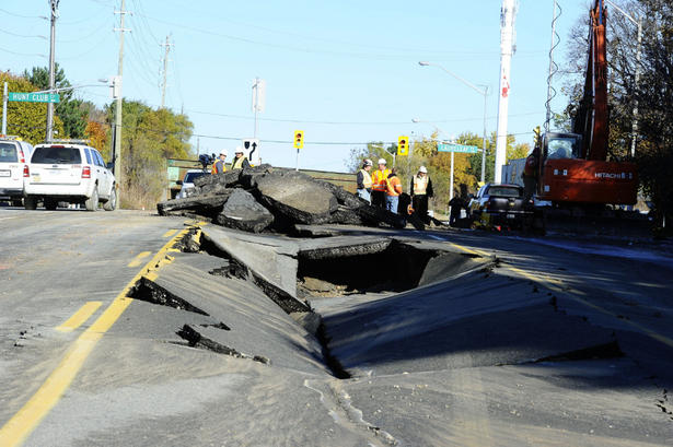
A large sinkhole that resembles something out of a Hollywood movie has closed a section of Bayview Avenue to traffic.

It happened overnight on Thursday after a water main break. Bayview Avenue just north of Steeles Avenue is closed between Proctor Avenue and Laureleaf Road as crews work to fix the buckled pavement.

In some sections, the crack is as wide as a traffic lane.

CBC's Lorenda Reddekopp was at the scene and said York Regional police officers were describing the nine-metre deep sinkhole as "something out of Jurassic Park."

Better Earth

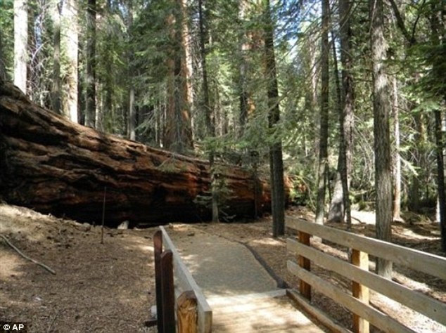
US: Timber! The dramatic moment a pair of 250ft giant sequoias that have stood for 1,500 years fell to the ground

These incredible pictures show how a pair of 1,500-year-old giant sequoias - whose branches are the size of normal trees - dramatically fell to the ground.

A German tourist watched the two 250ft trees fall to the ground at the Trail of 100 Giants in California and captured the amazing moments and the crushing sound on video.

The trees lay the length of a football pitch and their diameter of their torn roots and base was 20ft.

sequoias
Huge: One of two downed trees lies across the popular Trail of 100 Giants at Sequoia National Forest, California, temporarily closing the trail

Cloud Lightning

UK: Tornado rips the roof off a stable as wet weather turns Bonfire Night into a damp squid

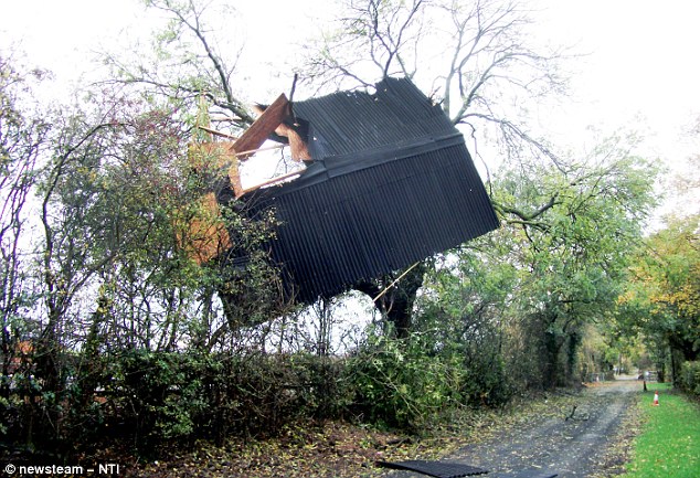
It looks like the aftermath of a tropical storm, but this scene of destruction took place on a farm in Worcestershire yesterday.

A tornado uprooted trees and tore the roof of a stable as it swept past the village of Inkberrow in the mid-afternoon.

Amazingly, the fierce winds threw the stable roof 20metres through the air before it came to rest stuck in the branches of a nearby tree.

Other trees were left broken in half at the Knowle Fields Barn Farm complex.
Worcestershire ,tornado
Twister: A tornado ripped the roof off a building and pulled up trees in Worcestershire yesterday

Radar

US: 4.7 Magnitude Earthquake Shakes Central Oklahoma

Earthquake
© redOrbit
At least a couple of aftershocks have been confirmed following a 4.7-magnitude earthquake in central Oklahoma on Saturday morning, according to the United States Geological Survey.

The latest aftershock came at 2:44 a.m. and was a 2.7-magnitude quake, according to the USGS website .

The epicenter of the initial quake was about 6 miles north of Prague, 7 miles east-southeast of Sparks, 9 miles west-northwest of Paden or roughly 20 miles northeast of Oklahoma City. The first aftershock happened in the same area, according to the United States National Weather Service office in Norman, which posted this message to Facebook at about 3 a.m.

Radar

US, Virginia: Six Hundred Aftershocks and Still Shaking

Image
© Getty Images
2.3 magnitude aftershock Thursday

Needles at the U.S. Geological Survey jumped again on Thursday morning, when a 2.3 magnitude aftershock rattled Louisa County.

Geological Survey staffers said in a lecture this week they've actually recorded over 600 aftershocks following the August 23 quake.

Staff geologist and Mineral, Virginia resident Mark Carter lectured on the Virginia quake's aftershocks on November 2 in Fairfax. The lecture was also shared via the USGS twitter feed.

The geologist said that in central Virginia, seismic activity is "somewhat regular." However, the strength of the August 23 quake had not been seen in a century, and the damage has been unprecedented.

"It was a miracle that there were no casualties given the damage we found," he wrote.

Radar

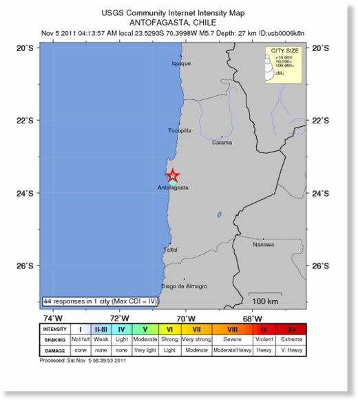
Earthquake Magnitude 5.7 - Antofagasta, Chile

Image
© USGS
Date-Time

Saturday, November 05, 2011 at 07:13:57 UTC
Saturday, November 05, 2011 at 04:13:57 AM at epicenter

Time of Earthquake in other Time Zones

Location 23.529°S, 70.400°W

Depth 27.3 km (17.0 miles)

Region ANTOFAGASTA, CHILE

Distances 22 km (13 miles) NNE of Antofagasta, Antofagasta, Chile

154 km (95 miles) S of Tocopilla, Antofagasta, Chile

177 km (109 miles) SW of Calama, Antofagasta, Chile

1106 km (687 miles) N of SANTIAGO, Region Metropolitana, Chile

Radar

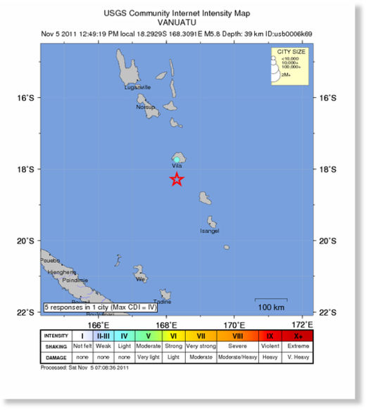
Earthquake Magnitude 5.8 - Vanuatu

Image
© USGS
Date-Time

Saturday, November 05, 2011 at 01:49:19 UTC
Saturday, November 05, 2011 at 12:49:19 PM at epicenter

Time of Earthquake in other Time Zones

Location 18.293°S, 168.309°E
Depth 39.5 km (24.5 miles)

Region VANUATU

Distances
61 km (37 miles) S of PORT-VILA, Efate, Vanuatu

172 km (106 miles) NW of Isangel, Tanna, Vanuatu

328 km (203 miles) SSE of Luganville, Espiritu Santo, Vanuatu

1869 km (1161 miles) ENE of BRISBANE, Queensland, Australia