
Storms
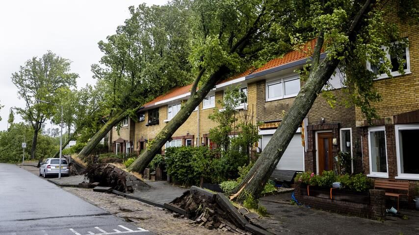
On March 13th, the first storm of 2023 hit the country, including the Dutch city of Groningen, with winds of up to 107 km/h (66 mph) leading to a flying trampoline, uprooted trees, blown off roofs, fallen flagpoles, and overturned trucks.
Due to the storm, a homeless person passed away in North Amsterdam as a branch fell on his tent. In the Dutch city of Vlissingen, a person sustained serious injuries from falling from stairs due to strong winds.
A thunderstorm on April 11th came with exceptionally strong and loud lightning strikes. In the Dutch city of Emmeloord, a lightning strike carried an electric current of 440 kiloampere, which was reported to be an extremely high current for lightning as the average is usually 30 kiloampere.
On April 21st, another storm wreaked havoc in the country with hail, lightning strikes, and strong winds. In the Dutch town of Bussum, lightning struck a house and blew the chimney off the house. In the Dutch town of Sliedrecht, several trees were splintered from lightning strikes.
In April, the wind direction was northeast, north in May and northeast in June. Since the beginning of 2023, the average wind direction has been northwest (rather than (south) west from the North Sea) which hasn't been the case since 1984. Plus, the last time the country saw a northeast wind in the first half of June was in 1963, as reported by Weer.nl.
On July 5th, storm Poly, the strongest summer storm in the Netherlands since measurements began, left a trail of destruction across the country. In the Dutch port city of IJmuiden, winds of up to 146 km/h (91 mph) were measured, which is the strongest wind gust measured in the month of July since measurements began.
The storm caused overturned trucks on the A9 highway, and uprooted trees damaging houses, beach houses and cars. One tree fell on a school in the Dutch town of Putten, damaging more than 200 roof tiles. While the children were shocked, luckily no one was injured.
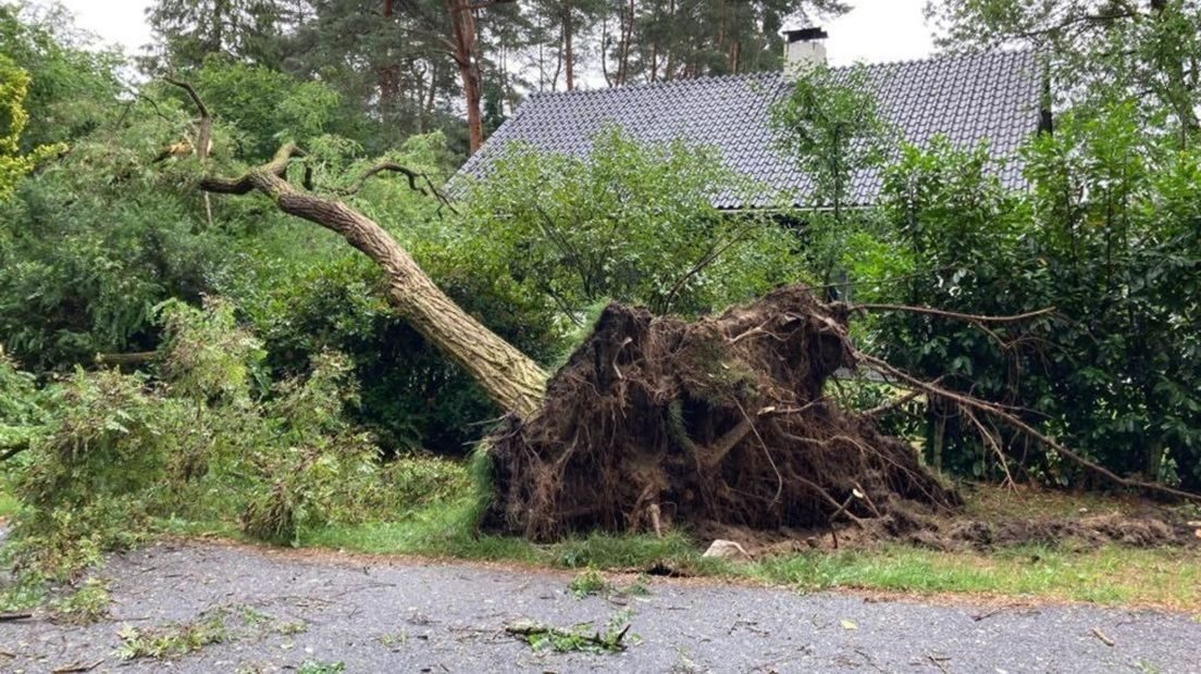
Sadly, the storm caused at least three injured and one death. Two people were injured in Amsterdam after trees fell on their cars. Another person had to be resuscitated due to a broken overhead line of a tram, and in the Dutch city of Haarlem a 51-year-old woman passenger passed away after a tree fell on the car.
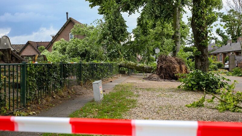
On August 25th, a more localized storm hit the Dutch provinces of Limburg and Brabant causing floods and uprooted trees. Due to the many uprooted trees, fallen branches and damaged cars in the Dutch village of Vught, a Dutch photographer told the daily newspaper AD that the village "looks like a warzone".
The third storm of 2023, and the first autumn storm in three years, made landfall on September 19th with winds of up to 96 km/h (60 mph). The second autumn storm (storm Ciarán) hit the country on November 2nd and the third on November 24th. It's the first time since 2017 that it stormed three times in autumn.
On December 21st, storm Pia wreaked havoc across the country with strong winds of up to 110 km/h (68 mpi). Several people were injured and one person died during the storm. A 39-year-old tandem cyclist from the Dutch municipality of Deventer was heavily injured after a tree fell on her, she passed away a day later. The other person on the bycicle was lightly injured.
Sheets of rain and floods
January was an exceptionally wet month, with rainfall of 108 mm (4.3 in), while the average is 68 (2.7 in) for the month. In some areas it even rained 150 mm (5.9 in).
March also saw sheets of rain, and got the record for being the eighth wettest March since measurements began in 1906. During the month, it rained 98 mm (3.9) with the average for the month being 56 mm (2.2). On March 6th, sheets of rain hit the Dutch province of Zeeland, with 30 mm (1.2 in) of rain in 24 hours. "Thirty millimeters is a lot for one day. That's more than fifty percent of what normally falls in the entire month of March," said meteorologist van Straaten of weather site WeerOnline. The heavy rainfall caused flooding in various areas.
April was no exception, as it was the wettest April in 25 years with an average rainfall of 79 mm (3.1 in) which is almost twice as much as normal (41 mm or 1.6 in).
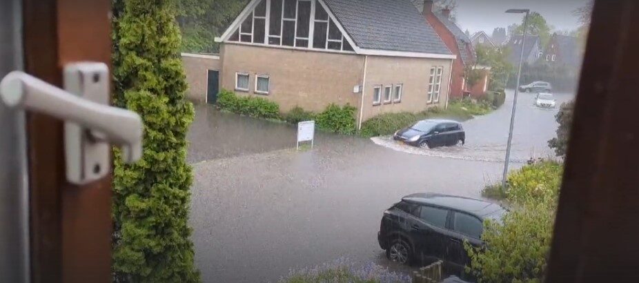
In the northern Dutch city of Groningen, it rained heavily on both May 6th and 7th. On May 7th, up to 50 mm (2 in) rain fell in a short amount of time. Other parts of the country also experienced a downpour. Around 30 mm (1.2 in) rain fell in the Dutch city of Eindhoven, turning streets into rivers.
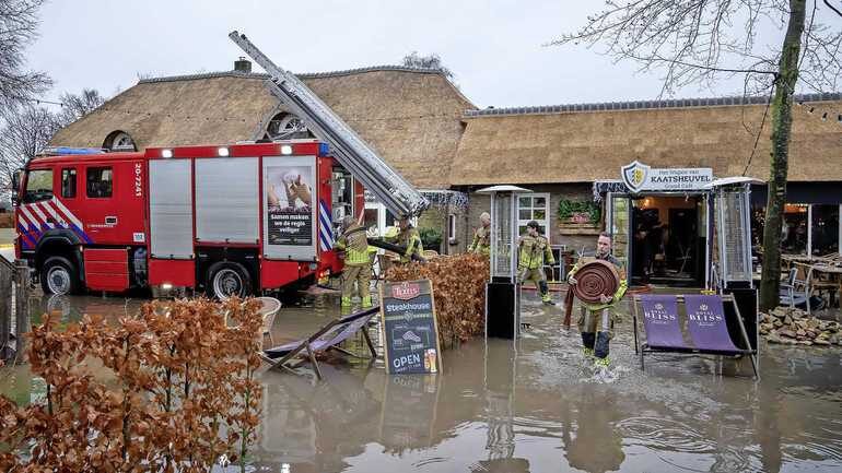
On June 20th, streets were inundated after torrential rains in the Dutch city of Rotterdam and Alphen aan den Rijn. Besides rain, hailstones of up to 3 cm (1.2 in) were reported. Two days later, more heavy rains hit the country, especially in the southeast, such as the Dutch municipality of Limburg where it rained up to 70 mm (2.8 in). The heavy rainfall caused flooded basements, hotels, restaurants and inundated streets.
The heavy rainfall on June 20th and 22nd caused the death of fish in the Dutch municipality of Noord-Brabant. Water authority Brabantse Delta told news site Breda Vandaag:
After several reports from residents in our work area, employees have removed dead fish from ponds and ditches in recent days. The reason for this is the large amount of rain in recent days. This caused the sewer to overflow and untreated sewage to end up in the water. This removes a lot of oxygen from the water, making it difficult for fish.

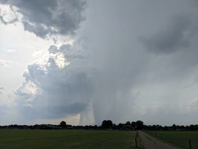
Later in August, on the 25th, the provinces Noord-Brabant and Limburg were hit again by torrential rains leading to widespread flooding. On September 12th, Limburg was once again hit by flooding after heavy rainfall. In Maastricht, the capital city of Limburg, flooding caused damage to houses, buildings, basements, sewers, and roads as 70 mm (2.8 in) rain fell in less than an hour, three times more rain than what the sewers can handle. It normally rains up to 70 mm in the entire month of September in Limburg, so this was unusual.
October was exceptionally wet as it rained 220 mm (8.7 in) during the month making it the wettest October since measurements began in 1906. It beat the record from 1932 when it rained 193 mm (7.6 mm) in October. It rained a lot in the center of the country and along the coast (average 150 mm or 5.9 in), while it rained the least in Limburg (80 mm or 3.1 in). On October 12th, it rained up to 45 mm (1.8 in) rain in the Dutch western village of Poeldijk in one day, which is more than half of the amount of rain that normally falls in October (77 mm or 3 in).

With the arrival of storm Pia, more flooding was caused by heavy rainfall in December.
On average, it rained 1160 mm (45.7 in), making 2023 the wettest year since measurements began in 1906. The Dutch municipality of Purmerend even saw 1435 mm (56.4 in) of rain in 2023, which is also a record. It hasn't rained that much in one area since measurements began.
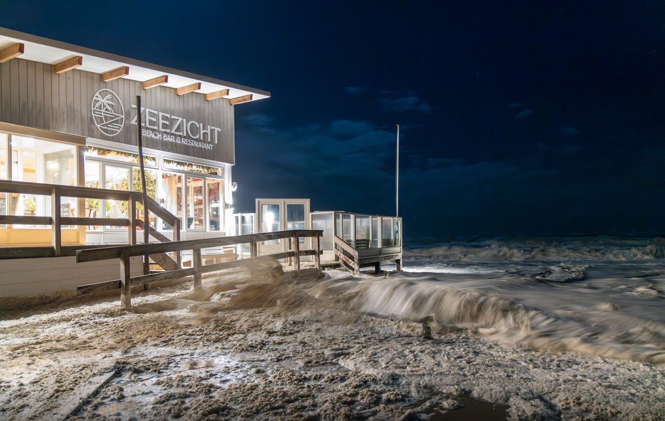
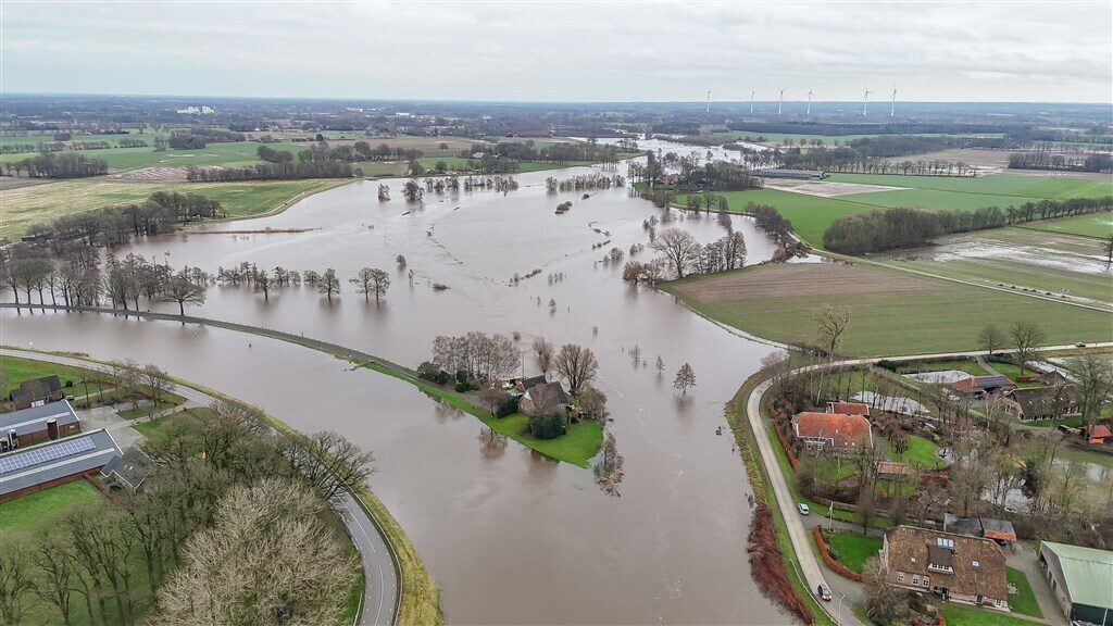
The many heavy rainfalls caused record high water levels across the country. On Novemberd 23rd, Rijkswaterstaat (Directorate General for Public Works and Water Management) reported that "the water is high in both the Rhine river and the IJsselmeer (or Lake IJssel) area. Due to storms at sea, there's also high water on the coast."
They further note that the combination of high water in rivers, the IJsselmeer area and on the coast made it unusual. All rivers, ditches, streams and lakes were full. Elja Huibregtse, chairman of the National Flood Threat Coordination Committee (LCO), said in an interview:
"This situation is special, because our entire water system has high water levels at the same time. ... It has rained a lot in recent months. The rivers and lakes are therefore quite full. For example, Rijkswaterstaat already discharged water from the IJsselmeer, via the Afsluitdijk (dam and causeway) to the Wadden Sea, to lower the water level. This wasn't possible, however, because the water in the Wadden Sea was too high or the wind was in the wrong direction. Then you can't get rid of all the water.To protect the country against high water, several flood defenses were closed. The Maeslantkering, a storm surge barrier, automatically closes when the Dutch city of Rotterdam is threatened by floods. It closes at an expected water level of 3 m (10 ft) above NAP at Rotterdam or 2.9 m above NAP at the Dutch city of Dordrecht. On December 21st, due to high water in combination with storm Pia, the Maeslantkering closed for the first time since its completion in 1997.

Impact on farmers
In early May this year, Dutch weather site Weer.nl reports that farmers in the Dutch provinces of Gelderland, Overijssel and Flevoland didn't manage to even sow half of the planned beet area, because of the heavy rains. The planting of potatoes and sowing of corn, flax and vegetables was also delayed. Farmers can't always get into the wet fields with their heavy machines. In places where there are already beets and potatoes, the excessive rainfall even caused some damage.
In early June, potato farmers were struggling as the country experienced record-breaking drought (39 consecutive days with no rainfall), in particular in the Dutch province of Drenthe and northern parts of the country. The soil was so dry, the potatoes had a hard time growing. However, the farmers weren't hoping for the sheets of rain that fell in October. The flooded soil delayed the potato harvest and damaged other crops. Onion farmers also experienced difficulties. In early November, farmers were wishing for drought, so they could harvest their potatoes or plant their tulip bulbs.

On January 19th, up to 4 cm (1.6 in) snow fell in several parts of the country. The following Tweet shows heavy snowfall in the Dutch village of Groesbeek on January 19th:
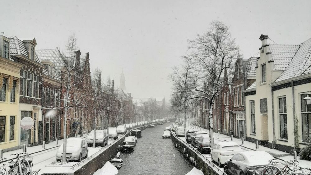
On March 8th, it snowed in the southern Dutch provinces of Noord-Brabant and Limburg. Two days later, it also snowed in northern parts of the country, including the Dutch city of Haarlem, the Dutch municipality of Friesland, the municipality and island Texel, and the city Groningen. It snowed up to 15 cm (6 in).
It wasn't just snowy at the start of Spring, but also cold. For the third year in a row, April has been colder than usual. The average temperature of April was 8.7 C (48 F) compared to the usual average of 9.9 C (50 F). April also had five days of frost with temperatures below zero. On April 1st, the lowest temperature measured was -7.6 C (18 F).
May started with freezing temperatures as well, with -4.9 C (23 F) being the lowest temperature measured on the ground in the eastern Dutch region of Achterhoek.
July was also colder than usual, with an average temperature of 19 C (66 F) compared to 23 C (73 F). August 6th was the coldest August 6th since measurements began in 1906. With 15.8 C (60.4 F) it beat the record from 1941 (15.9 C or 60.6 F). In some places, it was even colder than it was on January 1st.
On November 11th, temperatures reached below zero. In response to this, weatherman Thomas Indra of news site MeteoScience said the following:
"The timing couldn't have been worse. Many victims were still recovering from the storm that hit our country on Friday. We can safely say that 2023 is truly a disastrous year. Nothing seems to be sparing our country."On November 25th and 26th, it snowed again in the country, in particular in the south and east. On December 3rd, it snowed in southern and northern parts of the country. Two days later, it snowed up to 10 cm (3.9 in) in the north, east, and northeast.
Tornadoes and a waterspout
On July 4th, a rare tornado hit the Dutch municipality of Apeldoorn, causing widespread damage. A caravan was lifted into the air and ended upside down on the highway, trees were pulled out of the ground, entire terraces were blown away, and garden furniture and roof tiles flew around. A resident of the Dutch village of Lieren said the following to news site RTL Nieuws:
"Very creepy actually. I was talking on the phone when I suddenly saw a lot of junk flying through the air. Some tiles flew off the roof of the house diagonally behind us. It was very chaotic. It lasted maybe five minutes and then it was over. Very strange. I'd never seen anything like it before."
On July 20th, a tornado started to develop in the Dutch region of Drechtsteden, but disappeared shortly after. A day later, a waterspout was spotted near the Dutch town of Hoek van Holland.
On September 12th and on September 18th, a tornado started to develop in the Dutch city of Amsterdam and one in Brunssum, respectively, but they were both of short duration.
Meteor/fireballs
A search on The International Meteor Organization reveals there have been 63 meteor/fireball events that include reported sightings from the Netherlands.

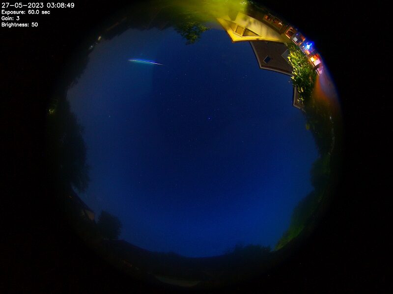
On May 26th, a meteor/fireball flew over the Netherlands from Belgium. Below is a picture of the fireball, taken by Martijn S. in the Dutch municipality of Dalfsen:
The meteor/fireball possibly landed in the Dutch region of Deventer.
On September 16th, a blue-green meteor/fireball was spotted in the Netherlands, in particular in northern parts of the country.
Northern lights and light pillars
On February 26th, northern lights and light pillars were spotted across the country, including the south. Weather man Wouter van Bernebeek told news site BD: "No one expected that they would appear this far south." The last time that northern lights were this visible in the country was in 2015.



Two months later, on November 5th and on November 25th northern lights were spotted across the country.

Sinkholes were yet again a common phenomenon during 2023; at least twenty small sinkholes appeared across the country.
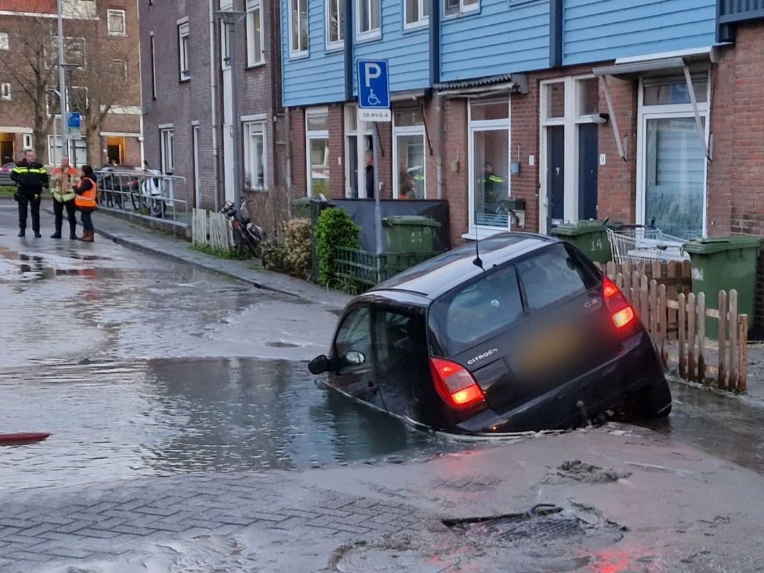
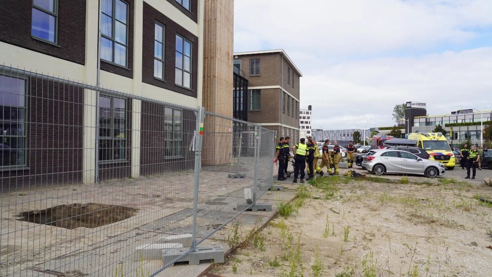
In the first two months of the year, Weesp saw two sinkholes; on March 3rd a sinkhole appeared in Nijkerk; on March 11th, a sinkhole appeared in the street in Velp; in March, sinkholes appeared near several houses in Krimpen aan den IJssel; on April 3rd, a sinkhole appeared in Rotterdam and swallowed bycicles and pavement tiles; on April 11th, a sinkhole in Rotterdam swallowed a car partly; on April 25th, another car was partly swallowed by a sinkhole that appeared in Monnickendam; on May 11th, a sinkhole appeared in Eygelshove, swallowing the front wheel of a car; on May 15th, a small sinkhole appeared in Breda; on May 18th, a sinkhole appeared near one of the buildings of the University of Leiden; on May 30th, a sinkhole appreared in the street in Eindhoven and a sinkhole appeared in Almere; on July 29th, a sinkhole appeared in Groningen and swallowed the vibrating platform of one of the street workers; on September 12th, a sinkhole appeared in Loon op Zand; a day later, a sinkhole appeared in Maastricht; on September 25th, two elderly people fell into a sinkhole in Alkmaar; several sinkholes appeared in the Hague on October 22nd; and on October 23rd, a big truck got its front wheel stuck in a sinkhole in Tolbert.
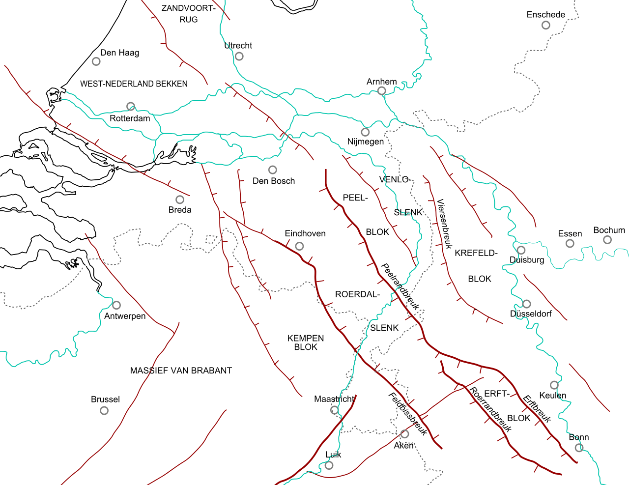
While earthquakes often occur in northern parts of the country, possibly induced by gas extraction, the following two earthquakes were reported to be due to a fault line. On April 16th, residents of the Dutch cities of Roermond and Venlo felt the 2.8 magnitude earthquake with its epicenter in the German municipality of Brüggen. A week later, on April 23rd, a 2.4 magnitude earthquake hit the Dutch municipality of Maastricht.
In short
While the Netherlands is a small country in western Europe, it had to endure many extreme or rare weather events in 2023.
Probably the most worrying are the sheets of rain. Dutch news site EenVandaag published an article in March, 2023, where a study conducted by EenVandaag showed that only 1 out of 5 people are worried about their region getting flooded. Most of the 25,000 people questioned didn't see flooding as a serious danger. However, 65% of the people who live in high-risk regions are aware that floods can happen where they live. It should be noted that even low-risk regions can get flooded.
As these weather events are likely to intensify in coming years, perhaps the best approach would be to keep an eye on these events, recognize high-risk regions, prepare for the worst and hope for the best. Explanations of why these events are occurring can be found in the highly recommended book: Earth Changes and the Human Cosmic Connection by Pierre Lescaudron and Laura Knight-Jadczyk. For worldwide weather events, watch our SOTT Earth Changes Summaries.







Comment: See also: