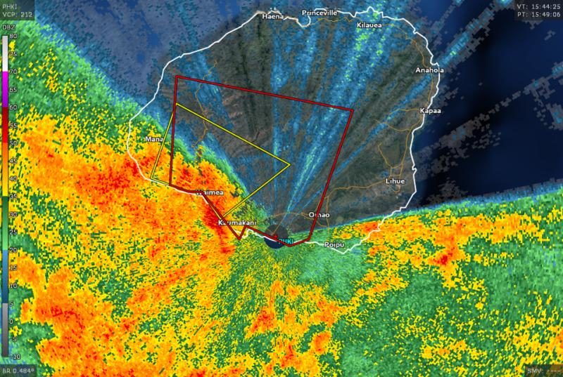
The first tornado warning went up for the island of Niihau just before 1:30 AM Tuesday local time, followed by a second for Kauai around 6:00 AM local time.
The most serious of the two thunderstorms affected southern Kauai. The National Weather Service in Honolulu issued a severe thunderstorm warning for southwestern Kauai before the storm came ashore, warning residents that damaging wind gusts up to 60 MPH were possible. The storm began to take on some characteristics of a supercell, complete with a hook-like appendage that began rotating as it approached shore. A nearby radar site showed strong low-level rotation that prompted the tornado warning. The rotation quickly dissipated once the storm came ashore near Kaumakani just after 6:00 AM. There have been no reports of damage so far.
This week's exceptionally unsettled weather in Hawaii is the result of a "Kona low," a nickname given to a wintertime low-pressure system that forms to the west of the islands. The placement of the low directs a deep surge of tropical moisture over the island chain and provides the lift needed to produce drenching showers and thunderstorms. There's enough lift and wind shear in the atmosphere for some of the storms to turn severe with damaging winds and tornadoes, which is what happened over Kauai today.
While the threat for severe storms on the western Hawaiian Islands will subside through the day on Tuesday, a statewide threat for flash flooding from heavy rains will persist for the next day or two.


Reader Comments
to our Newsletter