A storm system the National Weather Service described as "strong" swept the northern Sierra Nevada Saturday and continued to blast the mountain range Sunday.
After a prolonged period of mostly dry conditions, the Tahoe Basin finally reported impressive 24-hour snowfall totals Sunday morning: As of 8:30 a.m., Squaw Valley had recorded 18 inches at its based and up to 30 inches at its highest peaks. Tahoe City measured 23 inches, Homewood 33 and Incline Village 22.
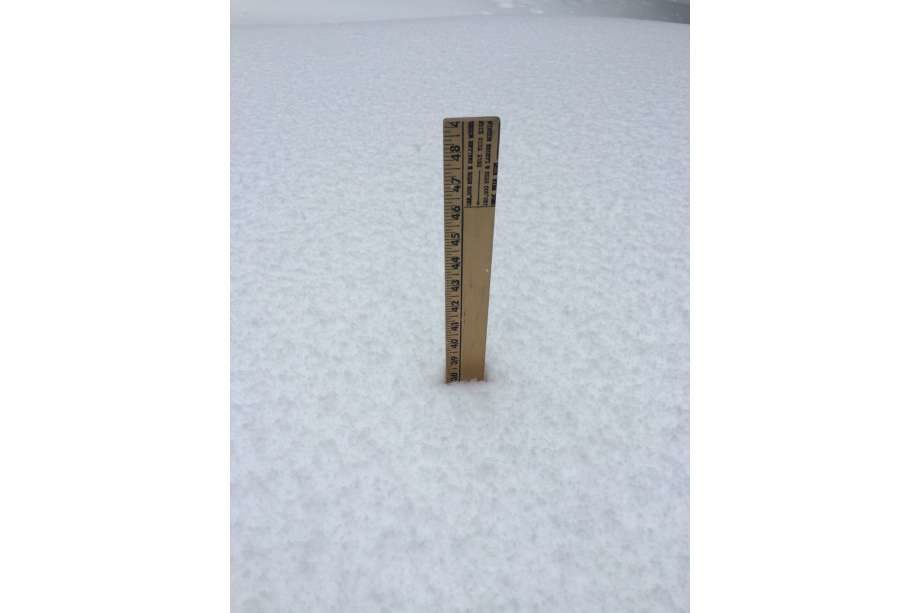
Truckee Resident Neil Lareau recorded 38 inches in the mountain town and shared an image on Twitter of a ruler measuring the snowfall.
Yesterday I took video of the approaching storm. Today I shot video at the same spot. What a difference! @Northstar_CA @NWSReno @TahoeWeather pic.twitter.com/JdongXrXoS
— Mark Jarvis (@voicepatrol) March 14, 2020
Truckee has really been in the sweet spot for this storm: Strong forcing from a storm spinning down the coast, persistent upslope enhancement, and temperatures supportive of ideal snow crystal growth," Lareau wrote in a message to SFGATE. "The result is some remarkable 24-hour snow totals!"
Heavy snow and low visibility forced closures of many Sierra passes early last night and Interstate 80, SR 49, and SR 88 have been closed on and off.
Snowfall rates of one to two inches an hour are expected to occur intermittently through the day Sunday.
"Snowfall rates will slowly lessen Sunday night into Monday, but travel could remain challenging in and around the Sierra well into Monday," the NWS Reno office said.
Despite the fresh powder, ski resorts throughout the Sierra closed amid concern over coronavirus spread. Shuttered resorts in California include Heavenly, Northstar, Kirkwood Squaw Valley and Mammoth.
The National Weather Service warned of "very dangerous" avalanche conditions amid the heavy snowfall. "Today is not the day to use the backcountry as your backup plan for closed ski resorts due to COVID-19," the NWS warned.
More snow showers are expected Monday and Tuesday.


Reader Comments
to our Newsletter