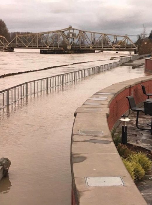
According to the Associated Press, flooding forced the closure of more than a dozen roads and authorities with the Skagit County Department of Emergency Management were preparing for the possible evacuation of some 250 people. Further downstream, residents in Mount Vernon are also preparing for rising waters.
The Skagit River is in major flood stage in Mount Vernon with water still forecast to rise as of Friday morning.
"The water just came so fast. We tried to leave with our van, and it started floating. It filled with water," Hamilton resident Sandi Potter told KING5. "We just couldn't stay anymore so I called 911. I didn't know what else to do."
Lyman City Councilman Mark Harris told KING5 TV his home is sliding into the river piece by piece.
"It's pretty tough to watch," Harris said.
Other residents are facing similar scenarios, including Harris' neighbor Richard Guidinger.
"Here I am on Thanksgiving. No Thanksgiving dinner for me. No Christmas. I'm more worried about what I can save out of my house," Guidinger told KING5.
The river crested at 36.56 feet just after 2 p.m. Thursday near Concrete, Washington, the National Weather Service says, the highest it's been since 2006.
"With rain in the forecast through the weekend, water levels will remain high and additional flooding is likely," weather.com meteorologist Brian Donegan said.
The river is expected to recede beginning on Friday but warnings remain in effect until Saturday. Other Washington rivers including the Snohomish, Snoqualmie, Skykomish, Skokomish, Satsop, White, Nooksack, Nisqually and the Cowlitz are also under flood warnings.


"It's pretty tough to watch," Harris said. " Unquote.
Sorry, but try as I might, I simply cannot dig up any sympathy for folks who IGNORE the dangers of living near a river and it's associated flood plan.
I myself, would never, in a 100 years, buy a home in such a location, despite the fact it may have views to die for. Same goes for ocean front living, crazy idea.