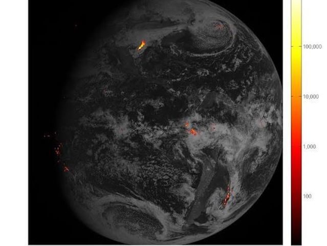
© NOAALightning strikes (yellow and red flashes) over the course of one hour on Feb. 14, 2017.
Every second, dozens of bolts of lightning crack across the sky with flashes that can have a temperature of 50,000 degrees — five times as hot as the surface of the sun.
Pinpointing exactly where and when these dangerous bolts hit the Earth is key for forecasting severe weather outbreaks. Now, for the first time, thanks to a new satellite instrument, forecasters are getting the best views ever of where lightning flashes.
The first images from the Geostationary Lightning Mapper, a new instrument onboard the recently launched GOES-16 satellite, were released Monday. The instrument is "transmitting data never before available to forecasters," the National Oceanic and Atmospheric Administration (NOAA) said.
They're not only spectacular images, they will also help meteorologists increase lead times for severe storm warnings. It's "a quantum leap in forecasting severe weather such as tornadoes," said engineer Tim Gasparrini of Lockheed Martin, which designed and built the instrument.
The first lightning detector in a geostationary orbit, the instrument takes a whopping 500 images a second, Gasparrini said. The mapper continually looks for lightning flashes in the Western Hemisphere, so forecasters know when a storm is intensifying and becoming more dangerous.
It takes photos not only of the lightning bolts that hit the Earth but also the bolts that go between or within clouds, which are actually more common and a precursor of cloud-to-ground strikes. "It will show the lightning activity at the tops of the clouds," said Steve Goodman, a NOAA program scientist.
Rapid increases of lightning are a signal that a storm is strengthening quickly and could produce severe weather, NOAA said. A significant increase in total lightning activity will now be able to be spotted, often many minutes before radar detects the potential for severe weather. "We will be able to warn sooner than if we only had radar," Goodman said. "This adds information the forecaster can really use."
When combined with radar and other satellite data, this data should help forecasters anticipate heavy rain and issue flood and flash flood warnings sooner. In dry areas, especially in the Western U.S., information from the instrument will help forecasters, and ultimately firefighters, identify areas prone to wildfires sparked by lightning, NOAA said.
It "should revolutionize severe storm forecasting," Gasparrini agreed.
NOAA's GOES-16 satellite, which orbits 22,300 miles above the Earth, was launched in November 2016. (GOES stands for geostationary operational environmental satellite.)
The school-bus-size satellite, known as "GOES-R" when it launched and now by its new name "GOES-16," is in a "geosynchronous" orbit of the Earth. This means it hovers in the same spot above the planet, about 22,000 miles above the equator. It moves as the Earth rotates
In addition to this lightning mapper, there are five other new instruments aboard the satellite that will generate new or improved meteorological, solar and space weather products, NOAA said.

Reader Comments
to our Newsletter