Ophelia strengthened into a Category Two hurricane over the Atlantic Ocean on Friday morning, forecasters said, and is expected to threaten the British overseas territory of Bermuda during the weekend. Some additional strengthening is forecast during the next 48 hours.

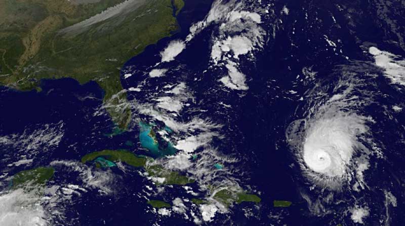
© GOES satelliteOphelia is clearly visible (right) in this GOES satellite image from Friday
Ophelia first emerged as a low pressure system in the far eastern Atlantic on September 16 before it strengthened into a tropical storm on September 20 as it headed towards the Caribbean. It eventually degenerated into a remnant low on Sunday but became better organised again on Monday and Tuesday, re-establishing itself as a Tropical Storm on Wednesday.
As of 5 a.m. EDT (1000 GMT) on Friday, the centre of Ophelia was located about 695 miles (1120 kilometres) south-southeast of Bermuda. It is moving toward the north-northwest at a speed near 9 miles (15 kilometres) per hour. An increase in forward speed is expected later today.
Ophelia's maximum sustained winds have increased to around 100 miles (160 kilometres) per hour, with higher gusts.
"Satellite images and microwave data indicate that the cloud pattern has continued to acquire organization," said Lixion Avila, a senior hurricane specialist at the U.S. National Hurricane Center (NHC). "There is a cyclonically curved convective band wrapping around the center and the upper-level outflow has expanded in all quadrants. There has been an eye feature intermittently appearing on visible images, but there is definitely a distinct one at the mid-levels on earlier microwave data. [..] Ophelia has been upgraded to hurricane status, the fourth of the 2011 (Atlantic) season."

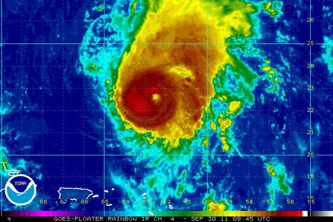
© GOES Satellite image of Ophelia
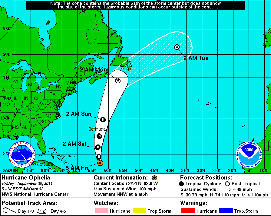
The hurricane is expected to pass east of Bermuda on Saturday, likely bringing tropical storm conditions to the island. The closest point of approach to Bermuda is forecast to be about 123 nautical miles (227 kilometers) to the east, according to the Bermuda Weather Service.
"Tropical-storm-force winds are possible on Bermuda starting Saturday afternoon," Avila said, prompting a tropical storm watch for the British overseas territory. "Large swells created by Ophelia will cause hazardous surf conditions along the south shore beaches of Bermuda. Rainfall accumulations of 1 to 2 inches (2.5 to 5 centimeters) can be expected on Bermuda in association with Ophelia."
After passing east of Bermuda, Ophelia is forecast to merge with a frontal system and be over much colder water, which will result in the cyclone becoming a strong post-tropical winter-type low pressure system that will turn toward the northeast near the Canadian maritimes.
Ophelia is the fifteenth named storm of the 2011 Atlantic hurricane season, following Tropical Storm Nate which formed in the Bay of Campeche in the Gulf of Mexico earlier this month. It made landfall in Mexico, killing four people.
According to figures released last month, NOAA's Climate Prediction Center is expecting an above-normal hurricane season in the Atlantic this year. The outlook calls for 14 to 19 named storms, with seven to ten becoming hurricanes and three to five expected to become a major hurricane (category 3 or higher).

© NWS National Hurricane CenterOphelia Wind Speeds/ Path
An average Atlantic hurricane season produces 11 named storms, with six becoming hurricanes and two becoming major hurricanes. The Atlantic hurricane season runs from June 1 through November 30, with peak activity in September.
Reader Comments
to our Newsletter