The image was released by the National Oceanic And Atmospheric Association (NOAA) on the day half of North America suffered in the grip of a severe winter storm.
The map was created using multiple satellites from government agencies and the US Air Force.
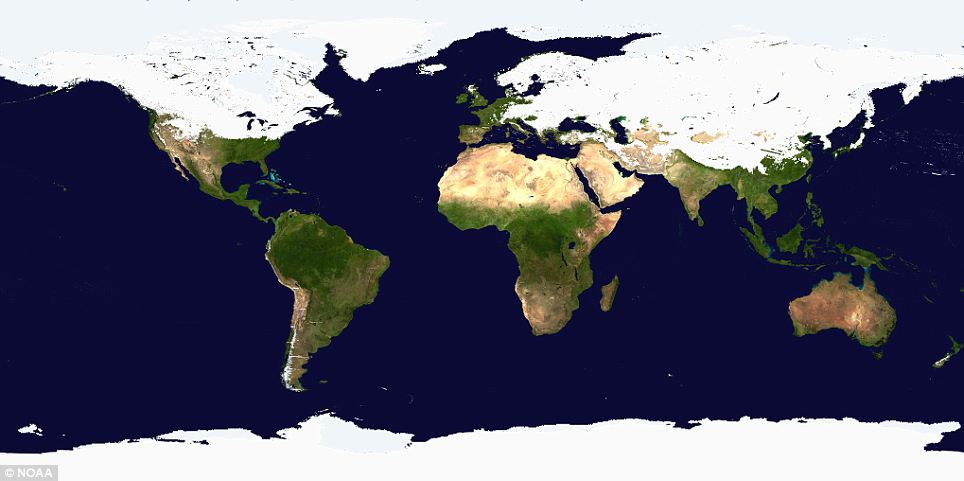
The startling image was released on the same day Al Gore stepped up to defend his claim that global warming causes more snow. Thirty states in America were affected by a two-day blizzard.
'As it turns out, the scientific community has been addressing this particular question for some time now and they say that increased heavy snowfalls are completely consistent with what they have been predicting as a consequence of man-made global warming,' Gore wrote on his blog Al's Journal.
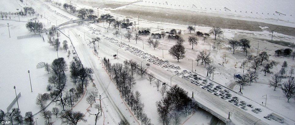
Hundreds of drivers on Lake Shore Drive in Chicago, which was blasted by 20 inches of snow, abandoned their cars in an almost apocalyptic scene as authorities closed the road
Mother Nature's wrath is not confined to the top half of the world, of course.
Cyclone Yasi, with a destructive core of more than 20 miles wide, is walloping Queensland in north east Australian with 186mph winds. Authorities are calling it the worst storm to hit the country for generations. Tens of thousands of people are tucked away in evacuation shelters or their homes and the country is braced for many casualties.


Incredible! I'm sitting here comfortable, just bordering 40-50 miles away from the real dumping and 25'ish from Mt. Glacier, we seem very fortunate here in the Pac. NW (for the moment at least). I'm so thankful cause I think the building I'm in has a risk of collapse in a certain area. Then I have to wonder, what about a week, a month.. from now?
I hope you all are keeping warm, for those of you in the thick of it. If where I live were in it, it would actually be hard to type since the building I live in is breezy.
Amazing! Beautiful.