Volcanoes
S

Hourglass

Japan finds another gap in its disaster readiness - Mount Fuji

Mt Fuji
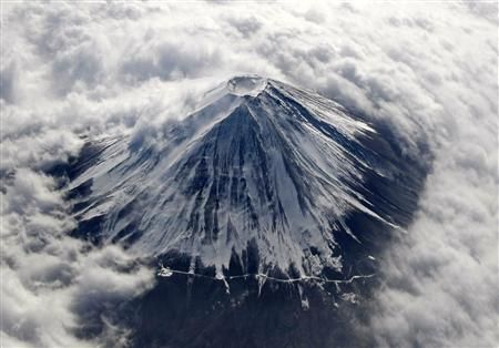
© REUTERS/Toru Hanai/FilesJapan's Mount Fuji, covered with snow and surrounded by cloud, is seen from an airplane in this February 2, 2010 file photo.
When Toshitsugu Fujii became head of a Japanese task force on disaster response at Mount Fuji, he was confronted with a startling oversight. Japan had no plan in place to deal with a disaster in which an earthquake sparks a volcanic eruption at the country's most famous landmark.

Fujii said a tremor "greatly increases" the chance of an eruption in a country that has experienced nearly 12,000 earthquakes since the magnitude 9.0 tremor that led to disaster on March 11, 2011.

"They always forget about the volcanoes," he said. "The government has never included Mt. Fuji in its earthquake scenarios."

Bizarro Earth

Nicaragua volcanic activity: San Cristobal volcano acts up for the second time in a week

Nicaragua boosted its responses to volcanic activity in the northwestern region Saturday, as the San Cristobal volcano acted up for the second time in a week. Authorities installed 43 radio communication stations along the Pacific coast to monitor San Cristobal and another volcano, Telica.

The radio posts aim to "ensure improved monitoring of seismic and volcanic behavior in the area," said civil defense chief Colonel Nestor Solis, enabling authorities to issue more accurate warnings sooner. A number of towns near San Cristobal, located some 135 kilometers (83 miles) northwest of the capital, were evacuated last week after the volcano began rumbling, sending a column of smoke and ash high into the sky, before subsiding.

On Saturday, the 1,745-meter (5,725-foot) tall volcano again spewed "abundant gas emissions moving toward the northeast" and increased seismic tremor and sulfur concentrations, according to the Nicaraguan Institute of Territorial Studies, or INETER.

Bizarro Earth

Guatemala's Volcano Of Fire Eruption Forces Mass Evacuation

Image
© AP Photo/Moises CastilloIn this image with a cell phone plumes of smoke rise from the Volcan de Fuego or Volcano of Fire spews ash seen from Palin, south of Guatemala City, Thursday, Sept. 13, 2012.
Guatemala's head of emergency evacuations says more than 33,000 people are fleeing the eruption of a long-active volcano just outside one of the country's most famous tourist attractions. Sergio Cabanas says the evacuees are leaving some 17 villages around the Volcano of Fire, which sits about 10 miles (16 kilometers) from the colonial city of Antigua.

The agency says the volcano spewed lava nearly 2,000 feet (600 meters) down slopes billowing with ash on Thursday.

Seismologists also say a series of explosions have been coming from the 12,346-foot-high (3,763-meter-high) volcano.

Bizarro Earth

Chamber of Molten Rock Inflates under Santorini

Image
A new survey suggests that the chamber of molten rock beneath Santorini's volcano expanded 10-20 million cubic metres - up to 15 times the size of London's Olympic Stadium - between January 2011 and April 2012. The growth of this 'balloon' of magma has seen the surface of the island rise 8-14 centimetres during this period, a team led by Oxford University scientists has found. The results come from an expedition, funded by the UK's Natural Environment Research Council, which used satellite radar images and Global Positioning System receivers (GPS) that can detect movements of the Earth's surface of just a few millimetres.

The findings are helping scientists to understand more about the inner workings of the volcano which had its last major explosive eruption 3,600 years ago, burying the islands of Santorini under metres of pumice. However, it still does not provide an answer to the biggest question of all: 'when will the volcano next erupt?' A report of the research appears in this week's Nature Geoscience. In January 2011, a series of small earthquakes began beneath the islands of Santorini. Most were so small they could only be detected with sensitive seismometers but it was the first sign of activity beneath the volcano to be detected for 25 years.

Attention

Highest volcano in Nicaragua erupts: 3000 Residents evacuated


Bizarro Earth

Indonesian Vulcanology Office Issues Warning for Tangkuban Perahu

Image
© Antara Photo/Fahrul Jayadiputra
The Indonesian Vulcanology Office issued a warning on Thursday for the public to take extra caution when visiting Mount Tangkuban Perahu just northwest of Bandung in West Java, after a series of tremors shook the mountain and put officials on edge.

"Tourist operators and tourists should understand that no matter how sophisticated the equipment, it's useless if the warnings are not heeded," Surono, the head of the Vulcanology and Geological Disaster Agency (PVMBG) said.

Surono said that from 9:30 p.m. on Wednesday up until 4:20 a.m. on Thursday, a series of tremors shook the mountain, while poisonous gases seeped from the crater.

"Those inhaling the gas [will] not die . . . but can suffer from dizziness and nausea; therefore, we are recommending no activity whatsoever be held within a radius of 1.5 kilometers from the crater," Surono said.

Bizarro Earth

Mount Fuji 'under more pressure than last eruption'

Image
Pressure in the magma chamber of Japan's Mount Fuji is now higher than it was the last time the volcano erupted more than 300 years ago, scientists say, according to a report Thursday. Tectonic shifts triggered by last year's huge 9.0 magnitude undersea quake have left the chamber under 16 times the minimum pressure at which an eruption can occur, researchers said. Researchers at the National Research Institute for Earth Science and Disaster Prevention studied the tectonic movements caused by the tsunami-triggering quake on March 11, 2011 and a magnitude 6.4 quake that rocked central Japan four days later, Kyodo News reported.

They estimated that 1.6 megapascals of pressure, equivalent to atmospheric pressure of some 15.8 kilograms per square centimetre (226 pounds per square inch), was being exerted on the magma chamber. Volcanic eruptions can be triggered by as little as 0.1 megapascals of pressure, and the reading of 1.6 megapascals is "not a small figure", said senior researcher Eisuke Fujita, according to Kyodo. Mount Fuji, an almost perfectly cone-shaped mountain that stands as one of Japan's national symbols, last erupted in 1707, after an earthquake struck and boosted the pressure on its magma chamber, the report said, citing researchers.

Bizarro Earth

Flights on alert as volcano erupts in central America

The Fuego volcano in central Guatemala is continuing to erupt, shooting lava and columns of ash into the air, and causing concerns of a possible ash cloud that could halt flights in the area. The volcano overlooks the tourist city of Antigua and is one of central America's most active volcanoes. Lava flows of around 1000m are being spewed out down the west and east sides of the volcano. No evacuations have been ordered, but aviation authorities have been alerted about a potential ash cloud, and air traffic is expected to be hindered. - AOL News


Attention

Indonesia's Anak Krakatau Volcanic Activity Increases to Almost 90 Eruptions Daily

Image
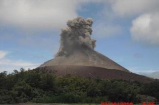
© Reuters Anak Krakatau in the Sunda Strait, 130 kilometers west of Jakarta, was created by the same tectonic forces that led to the 1883 Krakatoa eruption that killed tens of thousands of people.
Bandarlampung - Volcanic ash from the increasingly active Anak Krakatau has reached a number of areas in Lampung, prompting officials on Monday to issue a warning for local residents and tourists.

"The ash was carried by wind from the southeast to the south, reaching Bandarlampung," Nurhuda, who heads the observation and information section of the Meteorology, Climatology and Geophysics Agency (BMKG) in Lampung, said according to state news agency Antara.

Nurhuda said the ash fell over several subdistricts in Bandarlampung, about 130 kilometers away from Anak Krakatau.

"It is rather unusual for the dust to be this thick," said Juniardi, a resident of Bandarlampung who complained that the falling dust was also hampering visibility.

Officials warned that the ask posed health hazards and asked local residents to wear masks when going outdoors or driving motorcycles.

Bizarro Earth

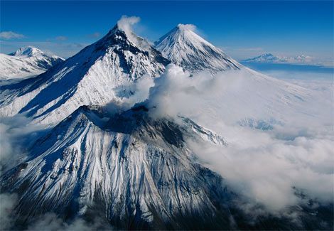
Large Explosive Eruption Reported at Kamchatka's Bezyianni Volcano

kamchatka volcanos
Russia - A larger explosive eruption occurred at Bezyianni volcano in Kamchatka yesterday evening (1 Sep) around 19h15 GMT. The explosion produced an ash cloud rising to about 10 km altitude (flight level 340) and was first detected by Tokyo VAAC who sent out an ash-cloud aviation warning (major intercontinental routes pass this area).

The ash plume is rapidly drifting west and has already reached hundreds of kilometer length.

As of today (2 Sep), the eruption of the volcano is gradually finishing, but ash plumes are extending more 370 mi (600 km) to the east-north-east of the volcano. Ongoing activity could affect international and low-flying aircraft.

According to seismic data by KB GS RAS, the eruption began at 19:16 UTC on September 01, 2012. According to visual data, ash plumes rose up to 32,800 - 39,400 ft (10-12 km) a.s.l. at 19:30 UTC on September 01. According to seismic data, an explosive phase of eruption continued till 19:45 UTC on September 01, and later there was a volcanic tremor was registered about 2 hours.

There is no ash near Bezymianny volcano now, but ash plumes are extending to the east-north-east of the volcano about 550-600 km of the volcano (MTSAT at 2132 UTC on September 01).

Source: KVERT