Volcanoes
S


Attention

Mount Bulusan spews ash 1.5 kilometer high in the Philippines

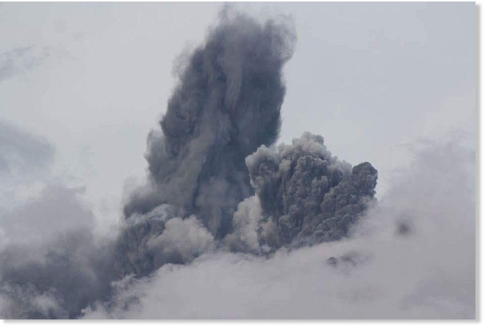
Mount Bulusan in Sorsogon spews a 1.5-kilometer high ash column in a steam-driven or phreatic explosion
© Crisanto GamisMount Bulusan in Sorsogon spews a 1.5-kilometer high ash column in a steam-driven or phreatic explosion
Mount Bulusan in Sorsogon, Bicol spewed a 1.5-kilometer- high ash column Friday afternoon, in a steam-driven explosion.

According to the Provincial Disaster Risk Reduction and Management Office (PDRRMO) in Sorsogon, the phreatic explosion occurred at approximately 4:54 p.m. Friday, and lasted for close to four minutes.

The dark gray ash plume expelled by the volcano drifted towards the northeast, causing ash to fall in Casiguran, Juban, Barcelona, and Gubat.

Alert Level 1, indicating abnormal activity, remains over Bulusan Volcano, said the Philippine Institute of Volcanology and Seismology (Phivolcs) in its 6 p.m. notice.

This indicates that hydrothermal processes are underway beneath the volcano, which may lead to more steam-driven eruptions, the agency said.


It also reminded the public not to enter the 4-kilometer radius Permanent Danger Zone (PDZ).

Attention

Scientists warn of magma buildup inside Japan's Sakurajima volcano

Japan's Sakurajima volcano
© wdeon / Shutterstock Southwestern Japan's Sakurajima volcano is seen erupting on February 15, 2011. New research suggests a much larger, more violent eruption is likely to happen within the next 25 years.
Researchers are worried Japan's Sakurajima volcano could be primed for a violent eruption. A new study suggests magma is filling the volcano's reservoir and pressure is building. The stage is set, scientists warn, for a repeat of Sakurajima's deadly 1914 eruption. The natural disaster killed 58 people, with lava flows from the stratovolcano lasting several months.

The overflow of magma filled the narrow strait separating the volcanic island from southwestern Japan's Osumi Peninsula, causing flooding in the city of Kagoshima, which has since been nicknamed the "Naples of the Eastern World."

Recently, a team of researchers from the University of Exeter and University of Bristol developed a new method for imaging the underground plumbing system that supplies Sakurajima with its molten rock.

The results of their imaging survey were published this week in the journal Scientific Reports.

"What we have discovered is not just how the magma flows into the reservoir, but just how great the reservoir is becoming," lead researcher James Hickey said in a news release.

Attention

Kilauea volcano lava lake level fluctuates amid increased seismic activity

Kilauea volcano lava lake
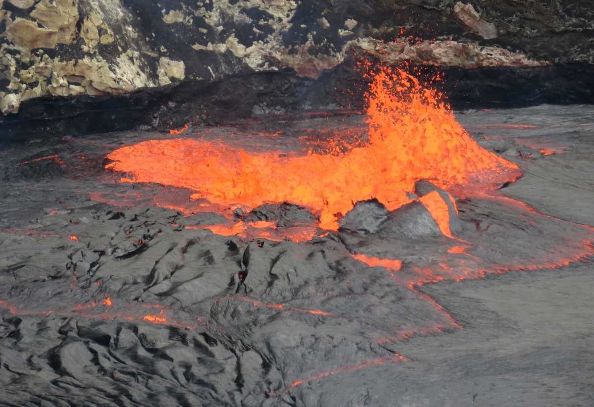
© USGSZoomed in view of the spattering at the south edge of the lava lake. Note the black high-lava mark from this morning on the wall just behind the spattering.
After an "exceptionally high" lava level at the summit of Kīlauea volcano on Saturday, inflation switched to deflation late yesterday afternoon and the lava lake dropped.

Deflation continued overnight and stopped this morning, the USGS Hawaiian Volcano Observatory reported Sunday morning. The lava lake dropped down to 66 feet below the floor of Halemaʻumaʻu Crater this morning.

"It is likely that the summit will begin to inflate, and the lava lake will begin to rise again, sometime today," scientists noted.

Yesterday, the summit lava lake rose to its highest level since May 2015, and earthquakes were also on the rise in vicinity. At one point the lava lake was within 16 feet of the rim. The sloshing lava was clearly visible from Jaggar Museum within the Hawaii Volcanoes National Park.


Comment: Earlier this year the Puʻu ʻŌʻō cone, part of the Kilauea volcano, unleashed its largest volume of lava in the past 500 years. Lava also flowed into the ocean for the first time since 2013.


Fire

Volcano erupts on French island of Réunion

Reunion Island volcano erupts
© YouTube/RT (screen capture)
Piton de la Fournaise (Peak of the Furnace), one of the world's most active volcanos, erupts on Sunday on the French island of Réunion. This is the second time the volcano has erupted this year.

Piton de la Fournaise is classified as a shield volcano because of its low profile and multiple lava flows when it erupts. No one was injured in the eruption.


Bizarro Earth

Philippines institute warns of 'big' Mayon volcano eruption in coming days

Mayon volcano
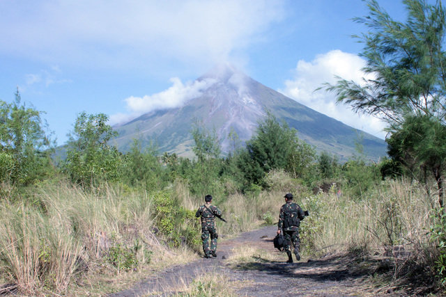
© Rhaydz B. Barcia/RapplerMayon volcano, the Philippines: Volcanologists say magma beneath the so-called 'perfect cone' is building up.
Phivolcs cites 'abnormal activity' such as drying wells, more earthquakes, and increased sulfur dioxide emission of the volcano

The Philippine Institute of Volcanology and Seismology (Phivolcs) has warned of a possible "big" Mayon volcano eruption in the coming days.

"Phreatic explosion may happen anytime but a big explosion is expected in the coming days," said Philvolcs resident volcanologist Eduardo Laguerta. Laguerta cited "abnormal activity" similar to what happened prior to the Mayon eruption in 1984.

The 1984 Mayon eruption is classified as a Vulcanian-type eruption which involves relatively small but violent explosions of thick lava producing columns of ash, gas, and occasional pyroclastic flows.

"The massive drying up of wells across Albay, specifically in the municipalities surrounding the volcano, may be attributed to the magma movement activity beneath the restive volcano," Laguerta added. He also cited the 3 consecutive earthquakes in August originating from the Sto Domingo fault line, which can affect volcanic activity.

Laguerta said his office asked geodetic engineers from the Phivolcs central office to conduct a ground survey around the volcano following the earthquakes.

"We noted after the survey, Mayon is inflated, magma beneath the volcano is building up. Deep wells are drying up surrounding the volcano and in several towns here - an implication of abnormal activity," he said.

Bizarro Earth

Klyuchevskoy volcano in Russia's Far East spews ash cloud up to 11 km

Geophysicists have assigned the red danger level to the eruption

Klyuchevskoy volcano
© Igor Vainstein/TASS
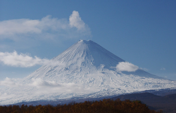
The Klyuchevskoy volcano in Russia's Far East has spewed ash twice today, the local department of Russian Academy of Sciences' Geophysical Survey said on Wednesday.

"The volcano spewed ash for the first time at 8am local time (11pm Moscow time) for eight kilometers in the air, for the second time - at 08:23am local time (11:23pm Moscow time) for 11 kilometers in the air. Volcanic plume is moving eastward, its height is unknown," a spokesman for the Geophysical Survey said.

The volcano currently continues to spew ash. Geophysicists have assigned the red danger level to the eruption. The volcano is being monitored round-the-clock with seismic stations and cameras. The Russian Emergencies Ministry said there is no threat of ash falls in local settlements.

The Klyuchevskoy volcano has been erupting since April. Four lava flows are running down its slopes, and lava is constantly fountaining in its crater. The volcano is located on the territory of the Ust-Kamchatsky district. The nearest settlement is Klyuchi, it is located in 30 kilometers from the volcano's foot.

Comment: See also: Klyuchevskoy volcano in Russia's Far East spews ash cloud up to 7.5 km

Update:

"Klyuchevskoy has erupted ash to a height of 7.5 kilometers above sea level. The ash plume has spread 734 kilometers west and northwest of the volcano," the spokesman said.

An 'orange' aviation alert code has been assigned to the volcano, second after the highest - red code, warning about the hazard eruptions may pose to aircraft flying on local and international routes.


Attention

Shallow 4.0 magnitude earthquake underneath summit of Mauna Loa volcano, Hawaii

Map Mauna Loa
© Hawaiian Volcano Observatory
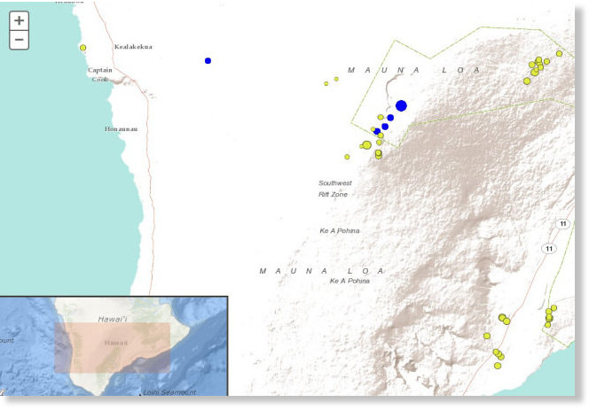
The Hawaiian Volcano Observatory recorded a magnitude-4.0 earthquake beneath Hawaii Island at 4:25 a.m. Tuesday.

The earthquake occurred underneath Moku'aweoweo, Mauna Loa's summit caldera, at a depth of 1.2 km (0.74 mi).

The USGS "Did you feel it?" website received only one felt report within an hour of the earthquake. This report described light shaking (Intensity III). The lack of felt reports is consistent with the remote location and shallow depth of the earthquake.

The earthquake appears to be isolated. As of 6:30 a.m., no aftershocks have been observed.

Magnitude-4 or greater earthquakes occurred in the summit of Mauna Loa six to seven months prior to the volcano's two most recent eruptions in 1975 and 1984. Tuesday's isolated earthquake, however, does not represent a significant departure from the seismic activity rate for the past year, so the Volcano Alert Level for Mauna Loa will remain at Advisory.

According to HVO's Scientist-in-Charge, Christina Neal, the earthquake had no apparent effect on Kilauea Volcano's ongoing eruptions.

Attention

Eruption and dome collapse at Sinabung volcano in Indonesia

Sinabung volcano
Sinabung volcano
The Sinabung volcano in Indonesia erupted and its dome collapsed on September 2, 2016.

The volcano threw a column of ash and gas to a height of 2000 meters above the crater.

As shown in the next picture, parts of the dome of the volcano collapsed during the eruption on Sept. 2nd.

Sinabung volcano
Sinabung volcano

Attention

Mexico's Popocatépetl volcano eruption triggers 3-magnitude earthquake

Popocatépetl volcano
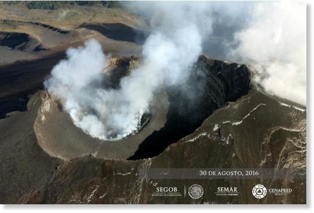
Mexico's National Center for Disaster Prevention on Wednesday said an eruption at the Popocatépetl volcano caused a 3-magnitude earthquake.

The temblor occurred at 1:11 p.m. Tuesday. The epicenter was in the southeast section of the volcano.

"These earthquakes are part of a swarm or train of volcano tectonic earthquakes that began last Monday," the disaster prevention center, or CENAPRED, said in Wednesday's statement. "At the time of this report there have been counted 366 of these earthquakes."

Popocatépetl is about 43 miles southeast of Mexico City. CENAPRED in March raised the environmental alert level to the second degree out of three, meaning nearby residents should be prepared to evacuate.

Arrow Up

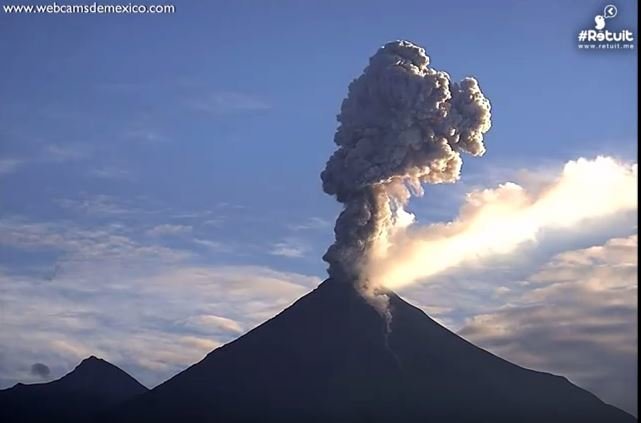
Mexico's Colima volcano erupts, filling sky with dark ash

Colima volcano eruption
© YouTube/webcamsdemexico (screen capture)
Mexico's Colima or "Fire" Volcano spewed a large column of gas and ash some 2,400 metres (7,874 feet) high into a blue sky. According to officials, the latest eruption took place on Monday at 10:19am, or 04:19pm GMT. The Fire Volcano, officially known as the Colima Volcano, is part of the Pacific's Ring of Fire.

Mexico contains over 3,000 volcanoes, but only 14 are considered active. Major eruptions in Mexican history have included the 1953 eruption of the Paricutin Volcano in Michoacan, the 1982 eruption of Tacana Volcano in Chiapas and the 1986 eruption of the Colima Volcano.